Chuquis | |
|---|---|
Municipality and village | |
| Country | |
| Province | La Rioja Province |
| Time zone | UTC−3 (ART) |
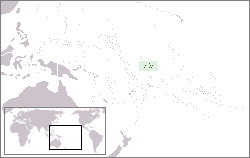
Chuquis is a municipality and village in La Rioja Province in northwestern Argentina. [1]
Chuquis | |
|---|---|
Municipality and village | |
| Country | |
| Province | La Rioja Province |
| Time zone | UTC−3 (ART) |
Chuquis is a municipality and village in La Rioja Province in northwestern Argentina. [1]
The Deep Freeze Range is a rugged mountain range, over 80 nautical miles long and about 10 nautical miles wide, rising between Priestley and Campbell Glaciers in Victoria Land, Antarctica, and extending from the edge of the polar plateau to Terra Nova Bay. It is southwest of the Southern Cross Mountains, south of the Mesa Range and northeast of the Eisenhower Range of the Prince Albert Mountains.
Kohler Range is a mountain range in Marie Byrd Land, Antarctica. The range is about 40 nautical miles long and stands between the base of Martin Peninsula and Smith Glacier. The range consists of two ice-covered plateaus punctuated by several rock peaks and bluffs. The plateaus are oriented East-West and are separated by the Kohler Glacier, a distributary which flows north from Smith Glacier.

Northeast Glacier is a steep, heavily crevassed glacier on the west side of Hemimont Plateau, 21 km (13 mi) long and 8 km (5 mi) wide at its mouth, which flows from McLeod Hill westward and then south-westwards into Marguerite Bay between the Debenham Islands and Roman Four Promontory, on the west coast of Graham Land, Antarctica. Northeast Glacier was first surveyed in 1936 by the British Graham Land Expedition (BGLE) under John Riddoch Rymill. It was resurveyed in 1940 by members of the United States Antarctic Service (USAS), who first used the glacier as a sledging route, and so named by them because it lay on the north-eastern side of their base at Stonington Island.

Lambert Glacier is a major glacier in East Antarctica. At about 80 km (50 mi) wide, over 400 km (250 mi) long, and about 2,500 m (8,200 ft) deep, it is the world's largest glacier. It drains 8% of the Antarctic ice sheet to the east and south of the Prince Charles Mountains and flows northward to the Amery Ice Shelf. It flows in part of Lambert Graben and exits the continent at Prydz Bay.
Carondelet Reef is a horseshoe-shaped reef, presumably a submerged atoll formation, of the Phoenix Islands, also known as the Rawaki Islands, in the Republic of Kiribati. It is located 106 kilometres southeast of Nikumaroro, at 05°34′S173°51′W, and has a least depth of 1.8 metres (5.9 ft). It is reported to be approximately 1.5 kilometres (0.9 mi) in length. The sea occasionally breaks over it.

Badalgacchi is a Upazila of Naogaon District under Rajshahi Division, Bangladesh.

Prioro is a municipality located in the province of León, Castile and León, Spain. According to the 2016 census (INE), the municipality has a population of 369 inhabitants. The municipality is composed by two villages, one of them being Prioro, the main one. The other one is Tejerina, which is located seven km away.
The Iroquois Plateau is a large, mainly ice-covered plateau situated east of the southern part of the Washington Escarpment in the Pensacola Mountains, Antarctica.
Tecali de Herrera is a town and municipality in the Mexican state of Puebla, southeastern Mexico.
Agua Blanca (La Rioja) is a municipality and village in La Rioja Province in northwestern Argentina.
Punta de Balasto is a village and municipality in Catamarca Province in northwestern Argentina.

Breitfuss Glacier is a glacier 10 nautical miles (19 km) long, which flows southeast from Avery Plateau into Mill Inlet to the west of Cape Chavanne, on the east coast of Graham Land. It was charted by the Falkland Islands Dependencies Survey (FIDS) and photographed from the air by the Ronne Antarctic Research Expedition in 1947. It was named by the FIDS for Leonid Breitfuss, a German polar explorer, historian, and author of many polar bibliographies.
Uversnatten Rock is a small rock eminence 1 nautical mile (1.9 km) west of Huldreslottet Mountain, at the south end of Borg Massif in Queen Maud Land. Mapped by Norwegian cartographers from surveys and air photos by Norwegian-British-Swedish Antarctic Expedition (NBSAE) (1949–52) and named Uversnatten.
Nilsen Plateau is a rugged, ice-covered plateau in Antarctica. When including Fram Mesa, the plateau is about 30 nautical miles long and 1 to 12 nautical miles wide, rising to 3,940 metres (12,930 ft) high between the upper reaches of the Amundsen and Scott glaciers, in the Queen Maud Mountains. Discovered in November 1911 by the Norwegian expedition under Roald Amundsen, and named by him for Captain Thorvald Nilsen, commander of the ship Fram.

Plummer Glacier is a short glacier descending east through the Enterprise Hills to the north of Lippert Peak and the Douglas Peaks, in the Heritage Range in Antarctica. Mapped by United States Geological Survey (USGS) from surveys and U.S. Navy air photos, 1961–66. Named by Advisory Committee on Antarctic Names (US-ACAN) for Charles C. Plummer, United States Antarctic Research Program (USARP) glaciologist at Palmer Station in 1965.
The McDonald Heights are broad, mainly snow-covered heights about 35 nautical miles (65 km) long and rising over 1,000 metres (3,300 ft) between Cape Burks and Morris Head on the coast of Marie Byrd Land, Antarctica. The heights are bounded southward by Hull Glacier, Kirkpatrick Glacier and Johnson Glacier.
The Mackin Table is an ice-topped, wedge-shaped plateau, about 20 nautical miles long, standing just north of Patuxent Ice Stream in the Patuxent Range of the Pensacola Mountains, Antarctica.
Parthenina interstincta is a rather widely distributed species of sea snail, a marine gastropod mollusk in the family Pyramidellidae, the pyrams and their allies.

The Altiplano–Puna volcanic complex, also known as APVC, is a complex of volcanic systems in the Puna of the Andes. It is located in the Altiplano area, a highland bounded by the Bolivian Cordillera Real in the east and by the main chain of the Andes, the Western Cordillera, in the west. It results from the subduction of the Nazca Plate beneath the South American Plate. Melts caused by subduction have generated the volcanoes of the Andean Volcanic Belt including the APVC. The volcanic province is located between 21° S–24° S latitude. The APVC spans the countries of Argentina, Bolivia and Chile.
| International | |
|---|---|
| National | |
28°54′S66°58′W / 28.900°S 66.967°W
| | This article about a place in La Rioja Province, Argentina is a stub. You can help Wikipedia by expanding it. |