
The Arctic Archipelago, also known as the Canadian Arctic Archipelago, is an archipelago lying to the north of the Canadian continental mainland, excluding Greenland and Iceland.
Leverett Glacier in Antarctica is about 50 nautical miles (90 km) long and 3 to 4 nautical miles wide, draining northward from the Watson Escarpment, between California Plateau and Stanford Plateau, and then trending west-northwest between the Tapley Mountains and Harold Byrd Mountains to terminate at the head of the Ross Ice Shelf close east of Scott Glacier. It was discovered in December 1929 by the Byrd Antarctic Expedition geological party under Laurence Gould, and named by him for Frank Leverett, an eminent geologist at the University of Michigan and an authority on the glacial geology of the central United States.

Vila Mariana is a borough of the city of São Paulo, Brazil. Located to the south of Bela Vista and Liberdade, east of Jardim Paulista and west of Ipiranga, it's a dynamic area of the city. Similar to its neighbor district, Moema, it's a wealthy area and it comprises some of the most famous symbols of São Paulo, like the Ibirapuera Park, the Obelisk and Mausoleum of the heroes from the Constitutionalist Revolution in 1932 and the "Monumento às Bandeiras", and the Fundadores de São Paulo monument.
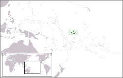
Carondelet Reef is a horseshoe-shaped reef, presumably a submerged atoll formation, of the Phoenix Islands, also known as the Rawaki Islands, in the Republic of Kiribati. It is located 106 kilometres southeast of Nikumaroro, at 05°34′S173°51′W, and has a least depth of 1.8 metres (5.9 ft). It is reported to be approximately 1.5 kilometres (0.9 mi) in length. The sea occasionally breaks over it.

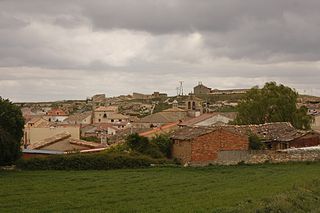
Villapalacios is a municipality in Albacete, Castile-La Mancha, Spain. It has a population of 757. The hamlet houses the gothic style church of San Sebastián.
Fuentelcésped is a municipality located in the province of Burgos, Castile and León, Spain. According to the 2004 census (INE), the municipality has a population of 194 inhabitants.

Villarrín de Campos is a municipality located in the province of Zamora, Castile and León, Spain. According to the 2004 census (INE), the municipality has a population of 583 inhabitants.
Nava is a village in Jõgeva Parish, Jõgeva County in eastern Estonia.
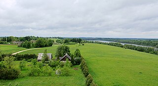
Raigastvere is a village in Tartu Parish, Tartu County in eastern Estonia. Lake Raigastvere is located near the village.
Ward Islands is a group of two small islands and off-lying rocks forming the southern part of the Amiot Islands, off the southwest part of Adelaide Island. Named by the United Kingdom Antarctic Place-Names Committee (UK-APC) for Herbert G.V. Ward, Chief Engineer of RRS John Biscoe, 1948–1962, which ship assisted the Royal Navy Hydrographic Survey Unit which charted this group in 1963.
Planet Heights is a series of summits running along an ice-free ridge, extending 24 nautical miles (44 km) in a north-south direction between the southernmost extremity of the LeMay Range and George VI Sound in the east part of Alexander Island, Antarctica. Many landforms and nearby features are named in association with this mountain range; some of these include landforms named after astronomers, satellites, planets and other things related to astrology and astrophysics. The mountain range was first mapped from air photos taken by the Ronne Antarctic Research Expedition (RARE), 1947–48, by Searle of the Falkland Islands Dependencies Survey (FIDS) in 1960. Named by the United Kingdom Antarctic Place-Names Committee (UK-APC) from association with the nearby glaciers named for planets of the Solar System. The only planet that is not featured in any of these glaciers is the planet Earth, as there are no glaciers named "Earth Glacier" and this glacier does not exist.
Finley Glacier is a tributary glacier which drains the northwest slopes of Mount Monteagle and flows north into the upper part of Icebreaker Glacier, in the Mountaineer Range, Victoria Land, Antarctica. It was mapped by the United States Geological Survey from surveys and U.S. Navy air photos, 1960–64, and was named by the Advisory Committee on Antarctic Names for Russell H. Finley, an aviation boatswain's mate with Squadron VX-6 during U.S. Navy Operation Deep Freeze, 1966, 1967 and 1968.
Morelli Glacier is a glacier in the western part of King Peninsula, Antarctica, 18 nautical miles (33 km) southeast of Cape Waite, draining northeast to Abbot Ice Shelf in Peacock Sound. It was mapped by the United States Geological Survey from surveys and U.S. Navy air photos, 1960–66, and was named by the Advisory Committee on Antarctic Names for Panfilo S. Morelli, a glaciologist at Byrd Station in 1961–62.

Sjogren Glacier is a glacier 12.5 miles (20 km) long in the south part of Trinity Peninsula, flowing southeast from Detroit Plateau in between Aldomir Ridge and Hazarbasanov Ridge to enter Prince Gustav Channel at the head of Sjögren Inlet, west of Royak Point. Discovered in 1903 by the Swedish Antarctic Expedition under Nordenskjold. He named it Sjogren Fiord after a patron of the expedition. The true nature of the feature was determined by the Falkland Islands Dependencies Survey (FIDS) in 1945.
The Lassus Mountains are a large group of mountains, 15 nautical miles (28 km) long and 3 nautical miles (6 km) wide, rising to 2,100 metres (6,900 ft) and extending south from Palestrina Glacier in the northwest part of Alexander Island, Antarctica. They overlook Lazarev Bay and a few minor islands within the bay such as Dint Island and Umber Island; Haydn Inlet lies to the south while the Havre Mountains lie immediately north.

German submarine U-541 was a Type IXC U-boat of Nazi Germany's Kriegsmarine during World War II.