The International Polar Years (IPY) are collaborative, international efforts with intensive research focus on the polar regions. Karl Weyprecht, an Austro-Hungarian naval officer, motivated the endeavor in 1875, but died before it first occurred in 1882–1883. Fifty years later (1932–1933) a second IPY took place. The International Geophysical Year was inspired by the IPY and was organized 75 years after the first IPY (1957–58). The fourth, and most recent, IPY covered two full annual cycles from March 2007 to March 2009.

The Space Telescope Science Institute (STScI) is the science operations center for the Hubble Space Telescope (HST), science operations and mission operations center for the James Webb Space Telescope (JWST), and science operations center for the Nancy Grace Roman Space Telescope. STScI was established in 1981 as a community-based science center that is operated for NASA by the Association of Universities for Research in Astronomy (AURA). STScI's offices are located on the Johns Hopkins University Homewood Campus and in the Rotunda building in Baltimore, Maryland.
The Earth Observing System (EOS) is a program of NASA comprising a series of artificial satellite missions and scientific instruments in Earth orbit designed for long-term global observations of the land surface, biosphere, atmosphere, and oceans. Since the early 1970s, NASA has been developing its Earth Observing System, launching a series of Landsat satellites in the decade. Some of the first included passive microwave imaging in 1972 through the Nimbus 5 satellite. Following the launch of various satellite missions, the conception of the program began in the late 1980s and expanded rapidly through the 1990s. Since the inception of the program, it has continued to develop, including; land, sea, radiation and atmosphere. Collected in a system known as EOSDIS, NASA uses this data in order to study the progression and changes in the biosphere of Earth. The main focus of this data collection surrounds climatic science. The program is the centrepiece of NASA's Earth Science Enterprise.

The National Snow and Ice Data Center (NSIDC) is a United States information and referral center in support of polar and cryospheric research. NSIDC archives and distributes digital and analog snow and ice data and also maintains information about snow cover, avalanches, glaciers, ice sheets, freshwater ice, sea ice, ground ice, permafrost, atmospheric ice, paleoglaciology, and ice cores.
The Global Earth Observation System of Systems (GEOSS) was built by the Group on Earth Observations (GEO) on the basis of a 10-Year Implementation Plan running from 2005 to 2015. GEOSS seeks to connect the producers of environmental data and decision-support tools with the end users of these products, with the aim of enhancing the relevance of Earth observations to global issues. GEOSS aims to produce a global public infrastructure that generates comprehensive, near-real-time environmental data, information and analyses for a wide range of users. The Secretariat Director of Geoss is Barbara Ryan.
The Global Climate Observing System (GCOS) was established in 1992 as an outcome of the Second World Climate Conference, to ensure that the observations and information needed to address climate-related issues are obtained and made available to all potential users. The GCOS is co-sponsored by the World Meteorological Organization (WMO), the Intergovernmental Oceanographic Commission (IOC) of UNESCO, the United Nations Environment Programme (UNEP), and the International Council for Science (ICSU). In order to assess and monitor the adequacy of in-situ observation networks as well as satellite-based observing systems, GCOS regularly reports on the adequacy of the current climate observing system to the United Nations Framework Convention on Climate Change (UNFCCC), and thereby identifies the needs of the current climate observing system.

The Abisko Scientific Research Station (ANS) is a field research station managed by the Swedish Polar Research Secretariat. Situated on the south shore of Lake Torneträsk, it lies at the edge of the Abisko National Park. The station conducts ecological, geological, geomorphological and meteorological research in subarctic environments and each year about 500 scientists visit from all over the world. The varied geological, topographical and climatic conditions of the area allow it to be inhabited by a range of flora and fauna. These features, which have caused the area to be given National Park status, also make it an important place for scientific research, particularly of alpine and subalpine ecosystems.

Copernicus is the Earth observation component of the European Union Space Programme, managed by the European Commission and implemented in partnership with the EU Member States, the European Space Agency (ESA), the European Organisation for the Exploitation of Meteorological Satellites (EUMETSAT), the European Centre for Medium-Range Weather Forecasts (ECMWF), the Joint Research Centre (JRC), the European Environment Agency (EEA), the European Maritime Safety Agency (EMSA), Frontex, SatCen and Mercator Océan.

National Ecological Observatory Network (NEON) is a large facility program operated by Battelle Memorial Institute and funded by the National Science Foundation. In full operation since 2019, NEON gathers and provides long-term, standardized data on ecological responses of the biosphere to changes in land use and climate, and on feedback with the geosphere, hydrosphere, and atmosphere. NEON is a continental-scale research platform for understanding how and why our ecosystems are changing.
The Group on Earth Observations (GEO) coordinates international efforts to build a Global Earth Observation System of Systems (GEOSS). It links existing and planned Earth observation systems and supports the development of new ones in cases of perceived gaps in the supply of environment-related information. It aims to construct a global public infrastructure for Earth observations consisting of a flexible and distributed network of systems and content providers.
The following are considered ocean essential climate variables (ECVs) by the Ocean Observations Panel for Climate (OOPC) that are currently feasible with current observational systems.
The Barrow Area Information Database (BAID) is designed to support Arctic science with a special focus on the research hubs of Barrow, Atqasuk, and Ivotuk on the North Slope of Alaska.

The Arctic policy of the United States is the foreign policy of the United States in regard to the Arctic region. In addition, the United States' domestic policy toward Alaska is part of its Arctic policy.

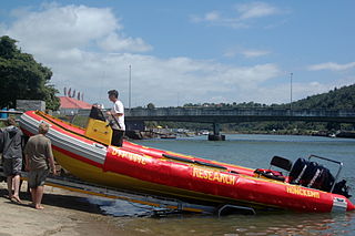
The South African Environmental Observation Network (SAEON) is a science network of people, organisations and, most importantly observation platforms, that perform Long-Term Ecological Research (LTER) in South Africa and its surrounding oceans. The SAEON is of global importance as an innovative approach in ecology to understand environmental change and to determine the impact of anthropogenic forces at multiple scales but it is a remarkably complex challenge to statistically discern between ubiquitous natural variability and exogenous forcing. The SAEON constitutes a national government response to the World Summit on Sustainable Development (Earth Summit 2002) and is a component of the GEO (Group on Earth Observations). The SAEON has become the leader in environmental science and observation in South Africa, but has been criticised for taking a long time to establish, a situation which was inevitable in view of SAEON's multiple stakeholder corps. It has also been raised that the cost of replicated experimental treatments across SAEON sites will be high.

The Russian Federal Service for Hydrometeorology and Environmental Monitoring (Roshydromet) is a service in the Ministry of Natural Resources and Environment (Russia) which carries out the functions of state property management and provision of public services in the field of hydrometeorology and related areas, monitoring of environmental environment pollution, public oversight of the work on modification of meteorological and other geophysical processes.

The Exchange for Local Observations and Knowledge of the Arctic, or ELOKA, is an Arctic research data management program that combines local traditional knowledge (LTK) and local observations data from Indigenous Arctic residents utilizing effective and appropriate western methods to properly share Arctic Indigenous Knowledge. The LTK data the program stewards consists of observations of sea ice, weather, wildlife and comes in many forms such as written interview transcripts, audio or video tapes and files, photographs, artwork, illustrations and maps. Housed at the National Snow and Ice Data Center (NSIDC) at the University of Colorado Boulder Cooperative Institute for Research and Environmental Sciences (CIRES), ELOKA is a National Science Foundation (NSF) Arctic Observing Network (AON) research program that came out of the 2007-2008 International Polar Year (IPY).

The Institute for Astronomy, Astrophysics, Space Applications, and Remote Sensing is a non-profit research institute in Greece with expertise in multidisciplinary astrophysical, space and environmental sciences. It is an independent research Institute of the National Observatory of Athens (NOA) established in 2012 from the merging of the Institute of Astronomy and Astrophysics and the Institute of Space Applications and Remote Sensing. The scientists of the Institute have broad knowledge in various areas of observational Astrophysics, Space Science and Earth observation techniques and their applications. They have established collaborations with research groups in Europe and United States, and their work is recognized through publications in refereed journals, invited talks at international conferences, and coordination of EU-funded and ESA-funded research projects. More details on the IAASARS and its activities can be found in its annual report.
The domain of international space politics gained significant traction during the Cold War. This was largely fuelled by the ongoing space race between the USA and the USSR. At this time in history, space exploration was an endeavour largely restricted to the global superpowers and seemed out of reach for many smaller, developing, nations to actively participate in. Subsequently, public concerns for the cost of research and development into novel space technologies did not receive sufficient policy and academic attention in Africa. As the Cold War reached its conclusion, political power began to diffuse across the world, and this led to many smaller nation states developing national and regional space capabilities. In the context of Africa, Nigeria, Algeria, Egypt and South Africa were the front-runners in terms of investments into space-related research and development.


