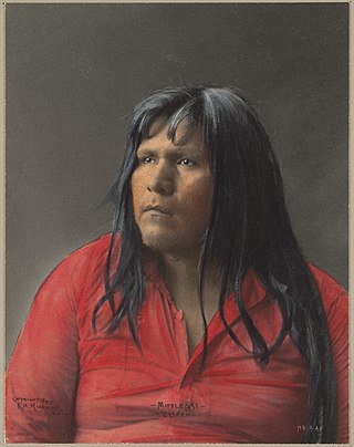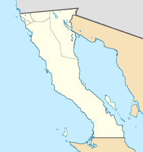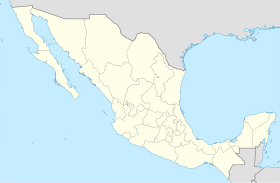
The Cocopah are Native Americans who live in Baja California, Mexico, and Arizona, United States.

Mexicali is the capital city of the Mexican state of Baja California. The city, which is the seat of the Mexicali Municipality, has a population of 689,775, according to the 2010 census, while the Calexico–Mexicali metropolitan area is home to 1,000,000 inhabitants on both sides of the Mexico–United States border. Mexicali is a regional economic and cultural hub for the border region of The Californias.

The Imperial Valley of Southern California lies in Imperial and Riverside counties, with an urban area centered on the city of El Centro. The Valley is bordered by the Colorado River to the east and, in part, the Salton Sea to the west. Farther west lies the San Diego and Imperial County border. To the north is the Coachella Valley region of Riverside County, which together with Imperial Valley form the Salton Trough, or the Cahuilla Basin, also the county line of Imperial and Riverside counties, and to the south the international boundary with Mexico.

Los Algodones is a town and borough in the municipality of Mexicali, Baja California, Mexico. Located on the United States-Mexico border to the north and east, Los Algodones is south of Andrade, California, and close to five miles west of downtown Yuma, Arizona. It reported a population of 5,474 in the 2010 Mexican census. Los Algodones is popularly referred to as "Molar City" due to hundreds of dentists that cater to Americans seeking affordable dental care outside of the United States.

Municipalities are the second-level administrative divisions of Mexico, where the first-level administrative division is the state. They should not be confused with cities or towns that may share the same name as they are distinct entities and do not share geographical boundaries. As of March 2024, there are 2,476 municipalities in Mexico, excluding the 16 boroughs of Mexico City.

Mexicali Municipality is a municipality in the Mexican state of Baja California. Its municipal seat is located in the city of Mexicali. As of 2020, the municipality had a total population of 1,049,792. The municipality has an area of 13,700 km2 (5,300 sq mi). This includes many smaller outlying communities as well as the city of Mexicali. Also, the islands of Baja California located in the Gulf of California are part of the municipality, among them the mudflat islands at the mouth of the Colorado River, Isla Ángel de la Guarda and the islands of the San Lorenzo Marine Archipelago National Park. Mexicali is the northernmost municipality of Latin America.

Tecate is a municipality in the Mexican state of Baja California. Its municipal seat is located in the city of Tecate. According to the 2020 census, it had a population of 108,440 inhabitants. The municipality has an area of 3,079.0 km².

Tijuana Municipality is a municipality in the Mexican state of Baja California. Its municipal seat is located in the city of Tijuana. According to the 2020 census, the municipality had a population of 1,922,523. Montserrat Caballero of the MORENA is the current mayor. The municipality comprises the largest part of the Tijuana metropolitan area.

The Algodones Dunes is a large sand dune field, or erg, located in the southeastern portion of the U.S. state of California, near the border with Arizona and the Mexican state of Baja California. The field is approximately 45 miles (72 km) long by 6 miles (9.7 km) wide and extends along a northwest-southeast line that correlates to the prevailing northerly and westerly wind directions. The name "Algodones Dunes" refers to the entire geographic feature, while the administrative designation for that portion managed by the Bureau of Land Management is the Imperial Sand Dunes Recreation Area. In 1966, Imperial Sand Hills was designated as a National Natural Landmark by the National Park Service. The Algodones Dunes are split into many different sections. These sections include Glamis, Gordon's Well, Buttercup, Midway, and Patton's Valley. Although the Arabic-derived Spanish word algodones translates to "cotton plants", the origin of the toponym is unknown.
The Ferrocarril Sonora–Baja California is a former railroad line of Mexico that built the line from Mexicali, Baja California, to Benjamín Hill, Sonora in 1948. It interchanged with the Southern Pacific Railroad at Calexico, California, and with the Ferrocarril del Pacifico in Benjamin Hill, Sonora. Before 1960, The SP-controlled Inter-California railroad provided trackage rights for the SBC from Pascualitos to the International Border. SBC took control of that part after the demise of the Inter-Cal.

The Inter-California Railway, known in Spanish as the Ferrocarril Inter-California, also known as the Inter-Cal, is a former railroad line which connected the Californias by train. It operated between the American state of California and the Mexican state of Baja California.
Ferrocarril Mexicali y Golfo was a railroad line in Baja California, Mexico, established in 1901. Within a few years a controlling interest in the railroad was bought by the American Southern Pacific Railroad company. The line eventually built was a predecessor to the Ferrocarril Sonora – Baja California. In 1929 the Mexicali y Golfo was reorganized as the southern line of the Inter-California Railway, under the name Ferrocarril Intercalifornia del Sur.
After a 1944 United States Mexico Treaty the Morelos Dam was built in 1950 across the Colorado River. It is located about 1 mile (1.6 km) below the junction of the California border and the Colorado River between the town of Los Algodones, Baja California, in northwestern Mexico and Yuma County, Arizona in the southwestern United States. The eastern half of the dam lies inside United States territory; but Mexico is responsible for all maintenance. The dam allows Mexico to divert its allotted water from the Colorado River to highly developed crop lands in the Mexicali, Mexico Valley. The Morelos Dam is the final dam on the Colorado River. It is run by the International Boundary and Water Commission (IBWC).

XHILA-TDT is a Spanish-language independent television station in Mexicali, Baja California, Mexico, serving the Mexicali Valley and the southern Imperial Valley, including El Centro, California, and the Colorado River cities of San Luis Río Colorado, Sonora, and Yuma, Arizona. The station is also carried on the cable television systems of each of the four principal communities it serves.

Federal Highway 15 is Mexico 15 International Highway or Mexico-Nogales Highway, is a primary north–south highway, and is a free part of the federal highways corridors of Mexico. The highway begins in the north at the Mexico–United States border at the Nogales Port of Entry in Nogales, Sonora, and terminates to the south in Mexico City.
Guadalupe Victoria, also known as the 43, is a small city in the state of Baja California in northern Mexico. Its population at the 2018 census was 20,222 inhabitants. It is located in the municipality of Mexicali and serves as a borough seat of its surrounding area.
Horst Matthai Quelle was a Spanish-speaking German philosopher.
The Autonomous University of Baja California is a public institution of higher education in Baja California. Established in 1957, UABC has its headquarters located in the city of Mexicali.

'Batáquez' , 'Estación Batáquez' or 'Ejido Monterrey' , is a locality Mexican of the Valley of Mexicali, in the municipality from Mexicali, Baja California. According to data from INEGI, it is located at coordinates 32 ° 32'58 north latitude and 115 ° 04'15 west longitude and had 1,121 inhabitants in 2010. Despite being a small locality, Batáquez has local importance since it is head of the municipal delegation of the same name.
Tecate station was a train station in Tecate, Baja California. The Building has an influence on the architectural style of the first stage of American Frank Lloyd Wright. The station had a waiting room, cellar and office on the ground floor.


