Civilian Conservation Corps Camp in Koke'e State Park | |
Location | Hawaii Route 550, Waimea, Kauai |
---|---|
Coordinates | 22°7′59″N159°39′44″W / 22.13306°N 159.66222°W Coordinates: 22°7′59″N159°39′44″W / 22.13306°N 159.66222°W |
NRHP reference # | 96001504 [1] |
Added to NRHP | December 20, 1996 |
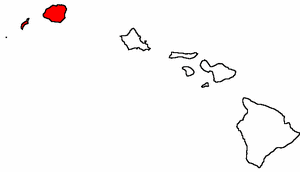
Civilian Conservation Corps Camp in Koke'e State Park is located at Hawaii Route 550, in Waimea, on the island of Kauai, in the U.S. state of Hawaii. It was built in 1935 with lumber that was put into the saltwater and floated to the shore at Port Allen, the seawater adding a natural termite protection to the lumber. The camp was in continual use for forest management, until Hurricane Iwa devastated it in 1982. In the 1990s it was restored through the efforts of the non-profit Hui O Laka environmental group, and is currently open to the public. It was added to the National Register of Historic Places listings in Hawaii on December 20, 1996.
Route 550 is a fourteen-mile (21 km) road stretching from Route 50 in Waimea to Kōkeʻe State Park on the island of Kauai.
Waimea is a census-designated place (CDP) in Kauaʻi County, Hawaiʻi, United States. The population was 1,855 at the 2010 census. The first Europeans to reach Hawaii landed in Waimea in 1778.
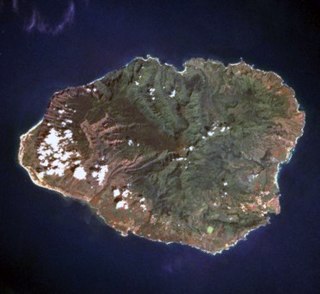
Kauaʻi, anglicized as Kauai, is geologically the oldest of the main Hawaiian Islands. With an area of 562.3 square miles (1,456.4 km2), it is the fourth-largest of these islands and the 21st largest island in the United States. Known also as the "Garden Isle", Kauaʻi lies 105 miles (169 km) across the Kauaʻi Channel, northwest of Oʻahu. This island is the site of Waimea Canyon State Park.
The camp was originally built in 1935 as one of five Hawaii camps constructed by the Civilian Conservation Corps of Franklin Roosevelt's New Deal stimulus. The other four camps have been absorbed by population growth, and Koke'e is the lone camp remaining in a natural environment. The CCC at Koke'e provided forest management, by building trails, roads, and fences, as well as planting over a million trees on Kauai. They helped fight forest fires, eradicate unwanted feral mammals, and collected tree seeds. In addition, the CCC from Koke'e also built the CCC camp at Waialae Cabin. In 1943, the program had been disbanded, and the camp was used by the 443d Airlift Wing during World War II. From 1966 until 1973, the Job Corps occupied the premises and provided forest management, followed by the Youth Conservation Corps. The camp was abandoned in 1982 after Hurricane Iwa. [2]
The Civilian Conservation Corps (CCC) was a voluntary public work relief program that operated from 1933 to 1942 in the United States for unemployed, unmarried men. Originally for young men ages 18–25, it was eventually expanded to ages 17–28. Robert Fechner was the first director of this agency, succeeded by James McEntee following Fechner's death. The CCC was a major part of President Franklin D. Roosevelt's New Deal that provided unskilled manual labor jobs related to the conservation and development of natural resources in rural lands owned by federal, state, and local governments. The CCC was designed to provide jobs for young men and to relieve families who had difficulty finding jobs during the Great Depression in the United States. Maximum enrollment at any one time was 300,000. Through the course of its nine years in operation, 3 million young men participated in the CCC, which provided them with shelter, clothing, and food, together with a wage of $30 per month.
The New Deal was a series of programs, public work projects, financial reforms, and regulations enacted by President Franklin D. Roosevelt in the United States between 1933 and 1936. It responded to needs for relief, reform, and recovery from the Great Depression. Major federal programs included the Civilian Conservation Corps (CCC), the Civil Works Administration (CWA), the Farm Security Administration (FSA), the National Industrial Recovery Act of 1933 (NIRA) and the Social Security Administration (SSA). They provided support for farmers, the unemployed, youth and the elderly. The New Deal included new constraints and safeguards on the banking industry and efforts to re-inflate the economy after prices had fallen sharply. New Deal programs included both laws passed by Congress as well as presidential executive orders during the first term of the presidency of Franklin D. Roosevelt.
The 443d Airlift Wing is an inactive unit of the United States Air Force. Its last assignment was with Air Mobility Command, being stationed at Altus Air Force Base, Oklahoma. It was inactivated on October 1, 1992.
The camp is operated by the non-profit local environmental group Hui O Laka, which is dedicated to educating, enhancing, and maintaining Koke'e. In 1990, the Hawaii State Legislature provided Hui O Laka a $20,000 Grant-in-Aid for renovations to the camp. The restoration and continual maintenance of the camp has been provided by members of Hui O Laka, and by volunteers. [3]
Kōkeʻe State Park is located in northwestern Kauaʻi in the Hawaiian Islands. It includes the Kōkeʻe Museum at the 15 mi (24 km) marker on State Road 550, which focuses on the weather, vegetation, and bird life; a lodge which serves food and sells gifts; cabins for rent; and hiking trails. The park is just north of Waimea Canyon State Park at 22°7′49″N159°39′32″W and includes 4,345 acres (17.58 km2) of mountainous terrain.
The Hawaii State Legislature is the state legislature of the U.S. state of Hawaii. The state legislature is a bicameral body consisting of a lower house, the Hawaii State House of Representatives, with 51 representatives, and an upper house, the 25-member Hawaii State Senate. There are a total of 76 representatives in the legislature, each representing single member districts across the islands. The powers of the legislature are granted under Article III of the Constitution of Hawaii. The legislature convenes at the Hawaii State Capitol building in the state capital of Honolulu, on the island of Oahu.
There are seventeen contributing, and three non-contributing buildings, sites, and structures on the site. During construction, the lumber could not be lifted directly onto the shore, because of the shallowness of Port Allen and the lack of equipment to accomplish the task. Instead, the lumber was floated ashore in the salt water. The soaking in seawater gave the lumber lasting termite protection, allowing the wood to be virtually intact when the camp was added to the NRHP in 1996. [2] The non-contributing buildings were built after 1950. [2]
Port Allen is a populated place at Hanapepe Bay, 20 nautical miles from Nawiliwili, in Kauai County, in the U.S. state of Hawaii. Originally named ʻEleʻele Landing, terminal owner Kauai Railway renamed it for Honolulu business man and port financial backer Samuel Clesson Allen. When the Civilian Conservation Corps Camp in Koke'e State Park was built in 1935, the lumber for the camp was floated ashore at Port Allen. Captain James Cook landed on Kauai in this area. The facilities were demolished in 1982 by Hurricane Iwa, but eventually rebuilt.
The square foot is an imperial unit and U.S. customary unit of area, used mainly in the United States and partially in Bangladesh, Canada, Ghana, Hong Kong, India, Malaysia, Nepal, Pakistan, Singapore and the United Kingdom. It is defined as the area of a square with sides of 1 foot.
Reservations are required for overnight accommodations at the camp. Stays are limited primarily to Hui O Laka volunteers and researchers with an advance payment of rental fee. The facilities are sometimes available for large group functions, subject to advance approval. [4]
Hurricane Iwa, taken from the Hawaiian language name for the frigatebird, was at the time the costliest hurricane to affect the state of Hawaiʻi. Iwa was the twenty-third tropical storm and the twelfth and final hurricane of the 1982 Pacific hurricane season. It developed from an active trough of low pressure near the equator on November 19. The storm moved erratically northward until becoming a hurricane on November 23 when it began accelerating to the northeast in response to strong upper-level flow from the north. Iwa passed within 25 miles of the island of Kauaʻi with peak winds of 90 mph (145 km/h) on November 23, and the next day it became extratropical to the northeast of the state.
The Nā Pali Coast State Park is a 6,175 acres (2,499 ha) Hawaiian state park located in the center of the rugged 16 miles (26 km) along the northwest side of Kauaʻi, the oldest inhabited Hawaiian island. The Nā Pali coast itself extends southwest starting at Keʻe Beach extending all the way to Polihale State Park. The na pali along the shoreline rise as much as 4,000 feet (1,200 m) above the Pacific Ocean. The state park was formed to protect the Kalalau Valley.
Black Moshannon State Park is a 3,481-acre (1,409 ha) Pennsylvania state park in Rush Township, Centre County, Pennsylvania, United States. It surrounds Black Moshannon Lake, formed by a dam on Black Moshannon Creek, which has given its name to the lake and park. The park is just west of the Allegheny Front, 9 miles (14 km) east of Philipsburg on Pennsylvania Route 504, and is largely surrounded by Moshannon State Forest. A bog in the park provides a habitat for diverse wildlife not common in other areas of the state, such as carnivorous plants, orchids, and species normally found farther north. As home to the "[l]argest reconstituted bog/wetland complex in Pennsylvania".
Promised Land State Park is a Pennsylvania state park in Blooming Grove, Greene and Palmyra Townships, Pike County, Pennsylvania, in the United States. The approximately 3,000-acre (1,214 ha) park is mostly surrounded by Delaware State Forest. It is in the Poconos and sits at an elevation of 1,800 feet (549 m). The second growth forests in Promised Land State Park are made up of beech, maple, oak and hemlock trees. There are two lakes within the boundaries of the park. Promised Land State Park is 10 miles (16 km) north of Canadensis on Pennsylvania Route 390.
S. B. Elliott State Park is a 318-acre (129 ha) Pennsylvania state park located in Pine Township, Clearfield County, Pennsylvania in the United States. The park is surrounded by Moshannon State Forest. The park is entirely wooded with second growth forests of hardwood and oak. S. B. Elliott State park is 9 miles (14 km) north of Clearfield on Pennsylvania Route 153 just off exit 111 of Interstate 80.
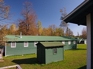
The Rabideau CCC Camp was a Civilian Conservation Corps (CCC) camp in the Chippewa National Forest in northern Minnesota, United States. It is located off Beltrami County Highway 39, in Taylor Township, and is one of the best-preserved of the nation's many CCC camps. A National Historic Landmark, it now serves as an educational center.
Pickett Civilian Conservation Corps Memorial State Park is a Tennessee state park in the upper Cumberland Mountains. It is located in Pickett County, northeast of the city of Jamestown, and is adjacent to the Big South Fork National River and Recreation Area. The park is located on 19,200 acres (78 km2) of wilderness including caves, natural bridges, and other rock formations. About 1,000 acres (4.0 km2) are managed by the Tennessee Department of Environment and Conservation as a state park, and the remainder of the property is managed by the Tennessee Division of Forestry as a state forest.
Table Rock State Park is a 3,083-acre (12.48 km2) park at the edge of the Blue Ridge Mountains in northern Pickens County, South Carolina. The park includes Pinnacle Mountain, the tallest mountain totally within the state.
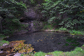
Backbone State Park is Iowa's oldest state park, dedicated in 1919. Located in the valley of the Maquoketa River, it is approximately three miles (5 km) south of Strawberry Point in Delaware County. It is named for a narrow and steep ridge of bedrock carved by a loop of the Maquoketa River originally known as the Devil's Backbone. The initial 1,200 acres (490 ha) were donated by E.M. Carr of Lamont, Iowa. Backbone Lake Dam, a relatively low dam built by the Civilian Conservation Corps (CCC) in the 1930s, created Backbone Lake. The CCC constructed a majority of trails and buildings which make up the park.
Roaring River State Park is a public recreation area covering of 4,294 acres (1,738 ha) eight miles (13 km) south of Cassville in Barry County, Missouri. The state park offers trout fishing on the Roaring River, hiking on seven different trails, and the seasonally open Ozark Chinquapin Nature Center.
Geneva State Forest is an Alabama state forest in Geneva County, Alabama in the United States. The forest is 7,120 acres (2,880 ha) and sits at an elevation of 210 feet (64 m). It is Alabama's largest state forest. According to the Alabama Forestry Commission the primary objective of the state forest is to provide timber for the lumber industry and the secondary objectives are to provide habitats for wildlife and recreational opportunities for people. The forest is open for year-round recreation including hunting, fishing, hiking and camping.
The Gold Creek Ranger Station is located in Humboldt-Toiyabe National Forest in Elko County, Nevada, USA. It was built in 1910 to administer the Ruby Mountains Forest Reserve, which became Humboldt National Forest. The compound was later expanded by labor provided by the Civilian Conservation Corps.
Leetonia is an unincorporated community in Elk Township, Tioga County, in the U.S. state of Pennsylvania. It lies along Leetonia Road, in the Tioga State Forest between Pennsylvania Route 414 and U.S. Route 6.
The Caretaker's Cabin at Cedar Breaks National Monument in Utah was built in 1937 by the Civilian Conservation Corps (CCC) in the National Park Service rustic style. The cabin was constructed of peeled logs with dramatically extended ends, cut to a tapered buttress shape. A large, battered stone chimney at one end echoes the log detailing. The roof is covered by cedar shakes.
Camp Sloggett in Koke'e State Park near Kokee, Hawaii is a historic site with significance from 1921. It is within state lands, but has buildings owned by the Kauai Young Women's Christian Association.
The Stowe CCC Side Camp, now known as the Vermont State Ski Dorm, is a historic residence hall at 6992 Mountain Road in Stowe, Vermont. Built in 1935 by crews of the Civilian Conservation Corps, it is one of the largest surviving CCC-built housing units to survive in the state. It was converted for use as a ski lodge after World War II. It was listed on the National Register of Historic Places in 2002.
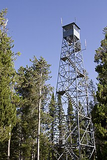
The Bishop Mountain Lookout, located in Island Park, Idaho, was created between 1936 and 1938 by the Civilian Conservation Corps (CCC) in the Caribou-Targhee National Forest. It was listed on the National Register of Historic Places in 1986, and its cabin is currently available as reserved accommodations through the United States Forest Service.