Related Research Articles

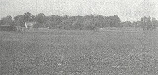
The Grand Village of the Illinois, also called Old Kaskaskia Village, is a site significant for being the best documented historic Native American village in the Illinois River valley. It was a large agricultural and trading village of Native Americans of the Illinois confederacy, located on the north bank of the Illinois River near the present town of Utica, Illinois. French explorers Louis Joliet and Father Jacques Marquette came across it in 1673. The Kaskaskia, a tribe of the Illiniwek people lived in the village. It grew rapidly after a French mission and fur trading post were established there in 1675, to a population of about 6,000 people in about 460 houses. Around 1691 the Kaskaskia and other Illiniwek moved further south, abandoning the site due to pressure from an Iroquois invasion from the northeast.

The Stanfield-Worley Bluff Shelter, located on private property in Colbert County in northwestern Alabama, United States, is one of the most important prehistoric sites excavated in the state due to the archeological evidence deposited by the Paleo-Indians who once occupied the rock shelter. Lying in Sanderson Cove along a tributary of Cane Creek approximately seven miles (11 km) south of the Tennessee Valley, the shelter and the high bluffs of the surrounding valley provided a well-protected environment for the Native American occupants.

The Oliver phase was a Late Woodland Native American culture that flourished from 1200 and 1450 CE along the east and west forks of the White River in central and southern Indiana. The Oliver phase is of the Western Basin tradition which includes the Springwells phase, the Younge phase, and the Riviere au Vase phase. Oliver people were village dwelling farmers with a heavy reliance on maize, very similar to other Late Woodland peoples in the area the Oneota, Fort Ancient, and Monongahela cultures. The name was originally coined by archaeologist James B. Griffin in 1946 to describe a Late Woodland ceramic complex centered in Hamilton and Marion counties in the valley of the West Fork of the White River first extensively studied at the Bowen site.

The Plum Island Eagle Sanctuary is a 52-acre island in the Illinois River owned by the Illinois Audubon Society. It was purchased March 24, 2004 to act as a wildlife sanctuary, to protect foraging habitat for wintering bald eagles. It is close to Matthiessen State Park and adjacent to Starved Rock State Park.

The Younge site is an archeological site located in Goodland Township, Lapeer County, Michigan. It is classified as a prehistoric Late Woodland site and was designated as a Michigan State Historic Site on October 29, 1971. It was added to the National Register of Historic Places on October 29, 1976.

Franktown Cave is located 25 miles (40 km) south of Denver, Colorado on the north edge of the Palmer Divide. It is the largest rock shelter documented on the Palmer Divide, which contains artifacts from many prehistoric cultures. Prehistoric hunter-gatherers occupied Franktown Cave intermittently for 8,000 years beginning about 6400 BC The site held remarkable lithic and ceramic artifacts, but it is better known for its perishable artifacts, including animal hides, wood, fiber and corn. Material goods were produced for their comfort, task-simplification and religious celebration. There is evidence of the site being a campsite or dwelling as recently as AD 1725.
The Cherry Creek Rockshelter is an archaeological site in central Colorado, located within modern-day Castlewood Canyon State Park near Franktown, Colorado. Current research indicates that it was used by Native American inhabitants beginning in the Archaic period. The site is situated on the Palmer Divide, which allowed for a unique prehistoric environment that contributed to an abundance of food and water sources, as well as lithic materials for tool-making. These factors, combined with the structure and situation of the shelter itself, made the site a particularly attractive environment for prehistoric peoples to settle in. Archaeological study of the site began in 1955, with the most current original research concluding in 2002.

The Juntunen site, also known as 20MK1, is a stratified prehistoric Late Woodland fishing village located on the western tip of Bois Blanc Island. It was listed on the National Register of Historic Places in 1978.

The Ellerbusch site (12-W-56) is a small but significant archaeological site in the southwestern part of the U.S. state of Indiana. Unlike many sites created by people of the same culture, it occupies an upland site near a major river floodplain. Its existence appears to have been the result of the coincidence of periods of peace and growth in the related Angel site, which led some townspeople to leave their homes for new villages that were more convenient for resource gathering. Researched partly because of its small size, Ellerbusch has produced information that greatly increases present awareness of other small sites and of its culture's overall patterns of settlement in the region. Because of its archaeological value, the site was declared a historic site in the late twentieth century.

The Moccasin Bluff site is an archaeological site located along the Red Bud Trail and the St. Joseph River north of Buchanan, Michigan. It was listed on the National Register of Historic Places in 1977, and has been classified as a multi-component prehistoric site with the major component dating to the Late Woodland/Upper Mississippian period.
The Schwerdt site (20AE127) is located on the Kalamazoo River in Allegan County, Michigan. It is classified as a single-component Berrien phase site dating to the late prehistoric period. The Berrien phase is associated with the late Woodland but also has some Upper Mississippian influences.
The Griesmer site (La-3) is located on the Kankakee River in Lake County, Indiana, about a mile southeast of Schneider, in Northwestern Indiana. It is classified as a Prehistoric, multi-component site with Middle Woodland, Late Woodland and Upper Mississippian occupations. The deposits were not stratified, but observation of the types of artifacts present, together with radiocarbon dates, helped to define the sequence of occupations at the site.
The Riviere au Vase site (20MB3) is located in Chesterfield Township, Macomb County, in southeastern Michigan. The site is on the Riviere au Vase near where it empties into Lake St. Clair. It is classified as a prehistoric, Late Woodland site.
The Knoll Spring site (11Ck-19), aka Au Sagaunashke village, is located in the Sag Valley, Palos Hills, in Cook County, Illinois, near the city of Chicago. It is classified as a late prehistoric site with Upper Mississippian Huber affiliation.
The Oak Forest Site (11Ck-53) is located in Oak Forest, Cook County, Illinois, near the city of Chicago. It is classified as a late prehistoric to Protohistoric/Early Historic site with Upper Mississippian Huber affiliation.
The Hotel Plaza site (Ls-36) is located near Starved Rock, on the Illinois River across from the Zimmerman site (aka Grand Village of the Illinois. It is a multi-component site representing prehistoric, protohistoric and early historic periods, with the main occupation being an early Historic component associated with the French Fort St. Louis.
The Carcajou Point site is located in Jefferson County, Wisconsin, on Lake Koshkonong. It is a multi-component site with prehistoric Upper Mississippian Oneota and Historic components.

The Mero site is a stratified, multicomponent prehistoric site located on the south side of Marshall's Point on the Door Peninsula in Door County, Wisconsin. It was excavated in 1960 by Ronald and Carol Mason under the auspices of the Neville Public Museum in Green Bay, Wisconsin, with financial backing from the landowner, Peter Mero.
The Midway Site (47LC19) is a prehistoric Upper Mississippian Oneota site in La Crosse County, Wisconsin. It is located about 10 miles north of LaCrosse near the juncture of the Black and Mississippi Rivers.
AE Harmon is an archaeological site that was in use during the Archaic, Late Woodland, Emergent Mississippian, and Mississippian periods, according to the most recent archaeological evidence. This site is located near the American Bottom in modern-day Edwardsville, Illinois. There were a total of three recorded excavations; one took place during the 1990s by the Southern Illinois University Edwardsville (SIUE) Contract Archaeology Program (CAP) and the two others took place during the early 2000s. A number of features were excavated, uncovering various different artifacts, plant remains and providing evidence for during which the site was in use. With all the data gained, it was predicted that AE Harmon was a horticultural environment.
References
- ↑ Indiana History Bulletin. Indiana Historical Bureau. 1923.
- ↑ Tomak, Curtis H. 1979 Alton, A Paleo-Indian Site in Southern Indiana. Proceedings of the Indiana Academy of Science, Vol. 89, pp. 84-90. {{http://journals.iupui.edu/index.php/ias/article/view/8668}}
- 1 2 3 4 5 Redmond, Brian G. 1994 The Archaeology of the Clampitt Site (12-Lr-329):An Oliver Phase Village in Lawrence County, Indiana. Indiana University. Glenn A. Black Laboratory of Archaeology, Research Reports 16.