Related Research Articles
The Swan River Colony, also known as the Swan River Settlement, or just Swan River, was a British colony established in 1829 on the Swan River, in Western Australia. This initial settlement place on the Swan River was soon named Perth, and it became the capital city of Western Australia.

Thomas Peel organised and lead a consortium of the first British settlers to Western Australia. He was a leader of the colonial militia that participated in Pinjarra massacre in 1834, which saw 70-80 of the Aboriginal Binjareb people killed. He was a second cousin of two-times British Prime Minister Sir Robert Peel.
Roebourne is a town in Western Australia's Pilbara region. In the Ngarluma language, Roebourne is called Yirramagardu (Ieramagadu). It is 35 km from Karratha, 202 km from Port Hedland and 1,563 km from Perth, the state's capital. It is the only town on the North West Coastal Highway between Binnu and Fitzroy Crossing; over 2,000km. It is located within the City of Karratha. It prospered during its gold boom of the late 19th century and was once the largest settlement between Darwin and Perth. At the 2016 census, Roebourne and the surrounding area had a population of 981.
Flinders Bay is a bay that is immediately south of the townsite of Augusta, and close to the mouth of the Blackwood River.

Waroona is a town located in the Peel region of Western Australia along the South Western Highway, between Pinjarra and Harvey. The town is the seat of the Shire of Waroona. At the 2016 census, Waroona had a population of 2,934.

Pinjarra is a town in the Peel region of Western Australia along the South Western Highway, 82 kilometres (51 mi) from the state capital, Perth and 21 kilometres (13 mi) south-east of the coastal city of Mandurah. Its local government area is the Shire of Murray. At the 2016 census, Pinjarra had a population of 4910.

Coogee is a southern coastal suburb of Perth, Western Australia, located within the City of Cockburn.

Munster is a suburb of Perth, Western Australia, located within the City of Cockburn.

Safety Bay is an outer southern suburb of Perth, the capital city of Western Australia, located on the coast within the City of Rockingham.

Karlgarin is a town located 321 kilometres (199 mi) south-east of Perth in the eastern Wheatbelt region of Western Australia. A small traditional farming town, in 2010 Karlgarin made national papers, as the poorest town in Western Australia, with an average of $34,054 taxable income.
Frankland River is a small town in the Great Southern region of Western Australia. The town is in the shire of Cranbrook and is situated approximately 332.7 km (206.7 mi) from the state's capital, Perth, approximately 120 km (75 mi) north west of Albany, 83 km (52 mi) southwest of Kojonup, 19 km (12 mi) north of Rocky Gully and 90 km (56 mi) east of Manjimup. Frankland derives its name from its location 6 km east of the Frankland River. At the 2006 census, Frankland had a population of 380.

The Murray River is a river in the southwest of Western Australia. It played a significant part in the expansion of settlement in the area south of Perth after the arrival of British settlers at the Swan River Colony in 1829. It should not be confused with the Murray River in southeastern Australia, which is the longest river in the country.
The lands administrative divisions of Western Australia refer to subdivisions of the state of Western Australia for cadastral purposes, most of which have been in place since the 19th century. The state is divided up for this purpose into five land divisions, which in turn are subdivided into land districts, which correspond to counties in other Australian states. These districts are then subdivided further into numbered locations, as well as gazetted townsites. Together, they form part of the lands administrative divisions of Australia.

Lake King is a town in the eastern Wheatbelt region of Western Australia, 464 kilometres (288 mi) from Perth along State Route 40 between Kelmscott and Ravensthorpe. As of 2016, the town had a population of 95. The 2011 census recorded both the population of the town and the surrounding area for a population of 332.
Thomas Watson was a surveyor and early settler of the Swan River Colony in what is now Western Australia.
Bulong is an abandoned town in Western Australia located 580 kilometres (360 mi) east of Perth in the Goldfields-Esperance region of Western Australia.
Gairdner is a town in the Great Southern region of Western Australia. The town is located between Jerramungup and Boxwood Hill along the South Coast Highway, on Devil Creek, a tributary of the Bremer River.

West Toodyay was the original location of the town of Toodyay, Western Australia. It is situated in the Toodyay valley, 85 kilometres (53 mi) north east of Perth. The Toodyay valley, discovered by Ensign Robert Dale in 1831, was opened up for settlement in 1836. The original site for the town of Toodyay was determined in 1836 and its boundaries were finalized 1838. The first survey of the town was carried out in 1849. After several serious floods, the decision was made to move the town of Toodyay to higher ground. In 1860, the new town of Newcastle was established 3 miles (4.8 km) further upstream. Newcastle was renamed in 1910 to Toodyay, and the original site became known as West Toodyay.

The Early Streets of Brisbane is a heritage-listed archaeological site at sections of Albert Street, George Street, William Street, North Quay, and Queen's Wharf Road in Brisbane City, City of Brisbane, Queensland, Australia. It was built from 1825 onwards. It was added to the Queensland Heritage Register on 16 July 2010.

Old Marulan Town is a heritage-listed former townscape at Marulan, New South Wales, Australia. It is the site of the original Marulan township prior to the moving of the village in the 1860s in the wake of the Main Southern railway bypassing the original town. It is also known as Mooroowoolen. It was built from 1835 to 1867. It was added to the New South Wales State Heritage Register on 2 April 1999.
References
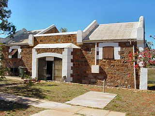
- "Peel Town Archaeological Sites". Heritage Council (Western Australia). Retrieved 21 June 2016.
- "Clarence Township Memorial" . Retrieved 21 June 2016.
- "Cockburn History – Clarence Townsite: Have you ever wondered about the origins of WA Day?". Cockburn Libraries. 1 June 2016. Retrieved 24 November 2021.