Clark-Pleasant Community School Corporation

Last updated

Clark-Pleasant Community School Corporation (CPCSC) is a school district headquartered in Whiteland, Indiana. It serves Whiteland, New Whiteland, portions of Greenwood, and a very small section of Franklin. [1]

Whiteland, Indiana Town in Indiana, United States

Whiteland is a town in Pleasant, Franklin and Clark townships, Johnson County, Indiana, United States. The population was 4,169 at the 2010 census.

New Whiteland, Indiana Town in Indiana, United States

New Whiteland is a town in Pleasant Township, Johnson County, Indiana, United States. The population was 5,472 at the 2010 census.

Greenwood, Indiana City in Indiana, United States

Greenwood is a city in Johnson County, Indiana, United States. The population was 49,791 at the 2010 Census, and increased to 56,545 in the Census 2016 estimates. Greenwood is located between Indiana State Road 37 and Interstate 65. The city shares a border with Indianapolis and is the most populous suburb in the southern portion of the Indianapolis Metropolitan Area.

Contents

Schools

Secondary schools:

Whiteland Community High School is a public high school located in Whiteland, Indiana. It is the only high school in continuous use in the town of Whiteland.

Elementary schools:

Unincorporated area Region of land not governed by own local government

In law, an unincorporated area is a region of land that is not governed by a local municipal corporation; similarly an unincorporated community is a settlement that is not governed by its own local municipal corporation, but rather is administered as part of larger administrative divisions, such as a township, parish, borough, county, city, canton, state, province or country. Occasionally, municipalities dissolve or disincorporate, which may happen if they become fiscally insolvent, and services become the responsibility of a higher administration. Widespread unincorporated communities and areas are a distinguishing feature of the United States and Canada. In most other countries of the world, there are either no unincorporated areas at all, or these are very rare; typically remote, outlying, sparsely populated or uninhabited areas.

Related Research Articles

Johnson County, Indiana County in the United States

Johnson County is a county located in the U.S. state of Indiana. As of 2010, the population was 139,654. The county seat is Franklin.

Cass County, Indiana County in the United States

Cass County is a county located in the U.S. state of Indiana. As of 2010, its population was 38,966. The county seat is Logansport. Cass County comprises the Logansport, IN Micropolitan Statistical Area.
Exton, Pennsylvania Census-designated place in Pennsylvania, United States

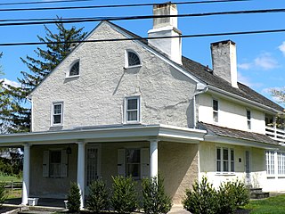
Exton is a census-designated place (CDP) in West Whiteland Township, Chester County, Pennsylvania, United States. Its population was 4,842 at the 2010 census. The Exton Square Mall and Main Street at Exton are both located within Exton along with several other shopping centers, making Exton the major shopping district in Chester County.

The Metropolitan School District of Warren Township is a school district on the east side of Marion County, Indianapolis, Indiana. In 2005 it had a student enrollment of 11,800, with the total population being 94,525.

Franklin Township, Owen County, Indiana Township in Indiana, United States

Franklin Township is one of thirteen townships in Owen County, Indiana, United States. As of the 2010 census, its population was 1,269 and it contained 551 housing units.

Clay Township, Morgan County, Indiana Township in Indiana, United States

Clay Township is one of fourteen townships in Morgan County, Indiana, United States. As of the 2010 census, its population was 4,292 and it contained 1,707 housing units.

Clark Township, Perry County, Indiana Township in Indiana, United States

Clark Township is one of seven townships in Perry County, Indiana, United States. As of the 2010 census, its population was 1,180 and it contained 544 housing units.

Pierce Township, Washington County, Indiana Township in Indiana, United States

Pierce Township is one of thirteen townships in Washington County, Indiana, United States. As of the 2010 census, its population was 2,666 and it contained 1,146 housing units.

Polk Township, Washington County, Indiana Township in Indiana, United States

Polk Township is one of thirteen townships in Washington County, Indiana, United States. As of the 2010 census, its population was 2,626 and it contained 1,131 housing units.

The South Montgomery Community School Corporation, often abbreviated SMCSC, administers 5 high schools, middle schools, and elementary schools south of Crawfordsville, Montgomery County, Indiana. Its administrative offices are at 300 North 3rd Street in New Market, Indiana.

Mount Pleasant, Johnson County, Indiana Unincorporated community in Indiana, United States

Mount Pleasant is an unincorporated community in Franklin Township, Johnson County, Indiana.

Zionsville Community School Corporation

Zionsville Community School Corporation is a school district headquartered in Zionsville, Indiana.

North Montgomery Community School Corporation (NMCSC) or North Mongomery Schools is a school district headquartered in unincorporated Montgomery County, Indiana, north of Crawfordsville. The district serves some sections of northern Crawfordsville, Darlington, Linden, New Richmond, Waynetown, and Wingate. It also serves the unincorporated area of Garfield.

Nineveh-Hensley-Jackson United School Corporation

Nineveh-Hensley-Jackson United School Corporation, also known as Indian Creek Schools, is a school district headquartered in Trafalgar, Indiana. The district serves Trafalgar, Morgantown, Nineveh and Princes Lakes.

Plainfield Community School Corporation (PCSC) is a school district headquartered in Plainfield, Indiana.

References

Coordinates: 39°33′01.8″N86°04′49.4″W / 39.550500°N 86.080389°W / 39.550500; -86.080389

Geographic coordinate system Coordinate system

A geographic coordinate system is a coordinate system that enables every location on Earth to be specified by a set of numbers, letters or symbols. The coordinates are often chosen such that one of the numbers represents a vertical position and two or three of the numbers represent a horizontal position; alternatively, a geographic position may be expressed in a combined three-dimensional Cartesian vector. A common choice of coordinates is latitude, longitude and elevation. To specify a location on a plane requires a map projection.