
The Greenbelt is a 203.5-square-kilometre (78.6 sq mi) protected green belt traversing Ottawa, Ontario, Canada. It includes green space, forests, farms, and wetlands from Shirleys Bay in the west and to Green's Creek in the east. It is the largest publicly owned green belt in the world and the most ecologically diverse area in Eastern Ontario. The National Capital Commission (NCC) owns and manages 149.5 square kilometres (57.7 sq mi), and the rest is held by other federal government departments and private interests. Real estate development within the Greenbelt is strictly controlled.

Lansdowne Park is a 40-acre (16 ha) urban park, historic sports, exhibition and entertainment facility in Ottawa, Ontario, Canada, owned by the City of Ottawa. It is located on Bank Street adjacent to the Rideau Canal in The Glebe neighbourhood of central Ottawa. Lansdowne Park contains the TD Place Stadium and Arena complex, the Aberdeen Pavilion, and the Horticulture Building.

The Major-General George R. Pearkes Building is the principal location of Canada's National Defence Headquarters (NDHQ) and is located in downtown Ottawa, Ontario. NDHQ comprises a collection of offices spread across the National Capital Region, however it is primarily based at Major-General George R. Pearkes Building at 101 Colonel By Drive in Ottawa.

Barrhaven is a suburb of Ottawa, Ontario, Canada. It is located about 17 km (11 mi) southwest of the city's downtown core. Prior to amalgamation with Ottawa in 2001, Barrhaven was part of the City of Nepean. Its population as of the Canada 2021 Census was 103,234.

Downsview Park is a large urban park located in the Downsview neighbourhood of Toronto, Ontario, Canada. The park's name is officially bilingual due to it being federally owned and managed, and was first home to de Havilland Canada, an aircraft manufacturer, and later was a Canadian Forces base. The park still contains Downsview Airport. In 1999, the Government of Canada declared it as "Canada's first urban national park." However, unlike the Rouge National Urban Park in eastern Toronto, Downsview Park is managed by the federal Crown corporation Canada Lands Company rather than Parks Canada.
Baseline is a public transit station directly across from the main campus of Algonquin College in Ottawa's west end, near the intersection of Woodroffe Avenue and Baseline Road. Many Algonquin College students and Centrepointe residents use this station to get to various points in the city, and to and from the college. Several residential and business areas such as Centrepointe and College Square are also served by this station.
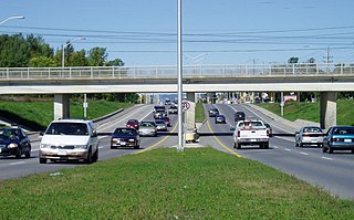
Woodroffe Avenue is a major north-south arterial road in Ottawa, Ontario, Canada's west end. It runs south from the Kichi Zibi Mikan through Baseline Road and Barrhaven to just short of Prince of Wales Drive near Manotick. The road runs through the heart of Nepean in Ottawa's west end. A satellite Via Rail station is also located at the intersection of Fallowfield Road.
Riverside South is a suburban community in Gloucester-South Nepean Ward in the south end of the city of Ottawa, Ontario, Canada, just southwest of Ottawa Macdonald–Cartier International Airport. Prior to amalgamation in 2001, the area was located in the city of Gloucester. Its population, according to the Canada 2021 Census, was 19,802.
Cedarview Road is a north–south road in Ottawa, Ontario, Canada. It runs between Bells Corners and Barrhaven. Formerly a major arterial road for Barrhaven residents, its use declined after the opening of Highway 416 in 1999.

Barrhaven West Ward is a city ward in Ottawa, Ontario, Canada. The ward consists of the western half of the Barrhaven subdivision. It consists of the neighbourhoods of Cedarhill Estates, Orchard Estates, Strandherd Meadows, Old Barrhaven, Barrhaven Mews, Jockvale, Halfmoon Bay and Stonebridge.
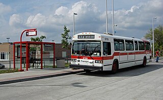
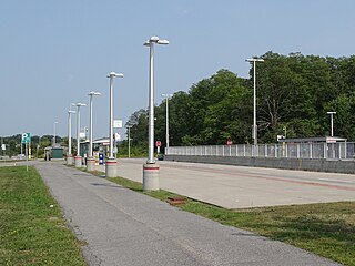
Strandherd Station is a transit station in Ottawa, Ontario. It opened on January 2, 2007 and contains a park and ride facility with over 300 parking spaces available. It is located northeast of the intersection of Strandherd Drive and the access to the Riocan Marketplace shopping area, where Barrhaven Centre Station and Marketplace Station opened in mid-2012. This is part of OC Transpo's plans to extend its southwest transitway to its suburb areas.

Findlay Creek is a suburban neighbourhood in Riverside South-Findlay Creek Ward in the south end of Ottawa, Ontario, Canada. According to the 2021 Canadian Census, the population of the community was 14,089 and there were 4,395 dwellings.

Terry Fox Stadium, also known as the Terry Fox Athletic Facility is an athletic field in Ottawa, Ontario, Canada, named after cancer research activist Terry Fox. It has a regulation-size natural grass soccer field, surrounded by a 400-metre track. Surrounding the track are bleachers with a capacity of approximately 2,000. It is located in Mooney's Bay Park, on the west side of Riverside Drive, south of Heron Road, which is south of downtown Ottawa.
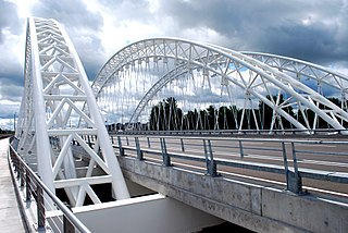
The Vimy Memorial Bridge is a bridge in Ottawa, Ontario, Canada. Completed in 2014, it crosses the Rideau River, connecting Strandherd Drive in Barrhaven and Earl Armstrong Road in Riverside South. The bridge was the 2015 winner of the Gustav Lindenthal Medal. It is named after the Battle of Vimy Ridge, as suggested by two Royal Canadian Legions in Ottawa.
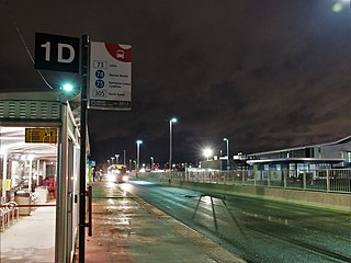
Nepean Woods station is located in the Ottawa, Ontario, Canada suburb of Barrhaven, and is on the Southwest Transitway which is served by OC Transpo buses. Located near the intersection of Woodroffe Avenue and Strandherd Drive in southern Nepean, it was the westerly terminus of most trips of rapid-transit route 74, formerly numbered route 94. It is also the site of a park and ride lot for residents of Barrhaven, which opened on 24 February 2014.
Country Place is a residential neighbourhood near the geographical centre of Ottawa, Canada in Knoxdale-Merivale Ward. Prior to 2001, it was part of the former city of Nepean. It is a mature residential subdivision with about 400 houses located just inside the Ottawa greenbelt near the Rideau River, and about 11 km from downtown Ottawa. It is bordered by the Black Rapids Creek and the greenbelt to the south, Prince of Wales Drive to the east, Merivale Road to the west, and the Pineglen community to the north. Amberwood Crescent meanders through the community, exiting onto Prince of Wales and Merivale. Tennyson Drive links Country Place to Pineglen.

Chapman Mills Marketplace is a shopping centre located in the Barrhaven neighbourhood of Ottawa, Ontario, Canada. The borders for the shopping district are Strandherd Drive to the north, Greenbank Road to the west, Longfields Drive to the east, and Chapman Mills Drive to the south.
Stonebridge is a golf course community in Ottawa, Ontario, Canada.
