
The San Francisco Peninsula is a peninsula in the San Francisco Bay Area that separates San Francisco Bay from the Pacific Ocean. On its northern tip is the City and County of San Francisco. Its southern base is Los Altos and Mountain View, in Santa Clara County, south of Palo Alto and north of Sunnyvale. Most of the Peninsula is occupied by San Mateo County, between San Francisco and Santa Clara counties, and including the cities and towns of Atherton, Belmont, Brisbane, Burlingame, Colma, Daly City, East Palo Alto, El Granada, Foster City, Half Moon Bay, Hillsborough, La Honda, Loma Mar, Los Altos, Los Altos Hills, Menlo Park, Millbrae, Mountain View, Pacifica, Palo Alto, Pescadero, Portola Valley, Redwood City, Redwood Shores, San Bruno, San Carlos, San Mateo, South San Francisco, West Menlo Park and Woodside.
Point Richmond, also sometimes referred to locally as The Point, is a neighborhood in Richmond, California, United States, near the eastern end of the Richmond-San Rafael Bridge, between Interstate 580 and the San Francisco Bay.

The Port of San Francisco is a semi-independent organization that oversees the port facilities at San Francisco, California, United States. It is run by a five-member commission, appointed by the Mayor subject to confirmation by a majority of the Board of Supervisors. The Port is responsible for managing the larger waterfront area that extends from the anchorage of the Golden Gate Bridge, along the Marina district, all the way around the north and east shores of the city of San Francisco including Fisherman's Wharf and the Embarcadero, and southward to the city line just beyond Candlestick Point. In 1968, the State of California, via the California State Lands Commission for the State-operated San Francisco Port Authority, transferred its responsibilities for the Harbor of San Francisco waterfront to the City and County of San Francisco / San Francisco Harbor Commission through the Burton Act AB2649. All eligible State port authority employees had the option to become employees of the City and County of San Francisco to maintain consistent operation of the Port of San Francisco.

Miller/Knox Regional Shoreline is a 295-acre (1.19 km2) bayside park near the Brickyard Cove neighborhood of the Point Richmond District in Richmond, California.
Brickyard Cove is a body of water in the Brickyard Cove neighborhood of the Point Richmond area of Richmond, California. The cove is situated between the Harbor Channel, a deepwater shipping channel that connects the San Francisco Bay with the Port of Richmond and the mainland. The cove is located between Point Potrero and Ferry Point. A marina is located in the cove and the Red Oak Victory part of Rosie the Riveter/World War II Homefront National Historic Park is docked in the western end of the cove.

Brickyard Cove is an upscale waterfront neighborhood in Richmond, California.
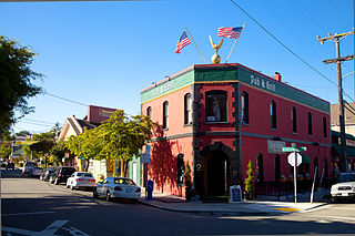
Bernstein's Fish Grotto was a popular restaurant in San Francisco, California, that operated from 1912 to 1981.

Castro Cove is a "portion of the San Pablo Bay" in Richmond, California located between Point San Pablo and the confluence of Wildcat Creek into Castro Creek.

Point San Pablo Harbor is a marina and small community at the far end of Point San Pablo in San Pablo Bay, within Richmond, in Contra Costa County, California. It is located at 1900 Stenmark Drive, Richmond CA 94801.
San Pablo Peninsula is a peninsula in western Richmond, between San Pablo Bay and San Rafael Bay, in southwestern Contra Costa County, California.
The Raccoon Strait is a waterway of the San Francisco Bay between Angel Island and the Tiburon Peninsula, mainland Marin County, California, United States. During the ice ages, when sea levels were considerably lower and San Francisco Bay was a grassy valley, the combined Sacramento-San Joaquin river flowed through what is now Raccoon Strait before flowing through the canyon at the Golden Gate.

The West Coast Memorial to the Missing of World War II is a monument dedicated to missing soldiers, sailors, marines, coast guardsmen, and airmen of World War II. It is a curved wall of California granite set in a grove of Monterey pine and cypress and overlooking the Pacific Ocean. It bears the name, rank, organization and State of each of the 413 members of the Armed Forces who lost their lives or were buried at sea in the Pacific coastal waters.

Yerba Buena was the name of an anchorage spot and later a town that grew into the city of San Francisco, California. The settlement was founded in 1834 and was located near the northeastern end of the San Francisco Peninsula, on the shores of Yerba Buena Cove. Yerba Buena was the first civilian pueblo in San Francisco, which had previously only had indigenous, missionary, and military settlements, and was originally intended as a trading post for ships visiting San Francisco Bay. The settlement was arranged in the Spanish style around a plaza that remains as the present day Portsmouth Square. The area that was the Yerba Buena settlement is now in the Financial District and Chinatown neighborhoods of San Francisco.

Año Nuevo State Marine Conservation Area (SMCA) is one of two adjoining marine protected areas off the coast of San Mateo and Santa Cruz Counties, on California’s central coast. The area is approximately 55 miles (89 km) south of San Francisco. The SMCA has an area of 11.07 square miles (28.7 km2). Except for limited taking of giant kelp, all living marine resources are protected.

Montara State Marine Reserve (SMR) and Pillar Point State Marine Conservation Area (SMCA) are two adjoining marine protected areas that extend offshore from Montara to Pillar Point in San Mateo County on California’s north central coast. The combined area of these marine protected areas is 18.42 square miles (47.7 km2), with 11.76 square miles (30.5 km2) in the SMR and 6.66 in the SMCA. Montara SMR prohibits the take of all living marine resources. Pillar Point SMCA prohibits the take of all living marine resources, except the recreational and commercial take of pelagic finfish by trolling or seine, the commercial or recreational take of Dungeness crab by trap and the commercial or recreational take or market squid by hand-held dip net or round haul net.
From 1577 to 1580 Sir Francis Drake circumnavigated the world. In 1579 as part of this voyage he landed on the west coast of North America which consequently has drawn the attention of scores of historians, geographers, linguists, anthropologists and other professionals. In addition, many history buffs have sought to locate Drake's New Albion. The established site for Drake's 1579 landing at New Albion is at Drake's Cove in Drakes Bay in Marin County, California. More than a score of ideas for an alternative to Drake's New Albion claim have been put forth which cover the coast from Alaska to Baja California Sur, Mexico. These ideas span the eighteenth through the early twenty-first centuries.

Yerba Buena Cove was a cove on San Francisco Bay where the Mexican town of Yerba Buena was located. It lay between Clarks Point to the north and Rincon Point to the south. The beach of the cove was set as far back as what is now Montgomery Street between Clay and Washington Streets.
Rincon Point, was a cape marking the southern extremity of Yerba Buena Cove in what is now San Francisco, California. Rincón is Spanish for "corner", and the point formed the southern corner of the cove.

Crane Cove Park is a 7-acre (2.8 ha) urban park in Potrero Point, San Francisco, California, located on the city's east-facing waterfront. The park opened in 2020. The site used to be a shipbuilding site occupied by the Union Iron Works and the Bethlehem Shipbuilding Corporation.
North Point is geographic feature and, formerly, a cape on the northeast side of San Francisco, California. Historically, the location of the cape was at the foot of Loma Alta, approximately at what is now the intersection of Bay and Kearny Streets, just southwest of Pier 35. That location has since been covered by land fill that extends to The Embarcadero. The United States Geological Survey now treats North Point as coinciding with the location of Pier 39.
