
The Snoqualmie River is a 45-mile (72 km) long river in King County and Snohomish County in the U.S. state of Washington. The river's three main tributaries are the North, Middle, and South Forks, which drain the west side of the Cascade Mountains near the town of North Bend and join near the town of Snoqualmie just above the Snoqualmie Falls. After the falls the river flows north through rich farmland and the towns of Fall City, Carnation, and Duvall before meeting the Skykomish River to form the Snohomish River near Monroe. The Snohomish River empties into Puget Sound at Everett. Other tributaries of the Snoqualmie River include the Taylor River and the Pratt River, both of which enter the Middle Fork, the Tolt River, which joins at Carnation, and the Raging River at Fall City.

The Salmon River, also known as the "River of No Return", is a river located in the U.S. state of Idaho in the western United States. It flows for 425 miles (685 km) through central Idaho, draining a rugged, thinly populated watershed of 14,000 square miles (36,000 km2). The river drops more than 7,000 feet (2,100 m) from its headwaters, near Galena Summit above the Sawtooth Valley in the Sawtooth National Recreation Area, to its confluence with the Snake River. Measured at White Bird, its average discharge is 11,060 cubic feet per second. The Salmon River is the longest undammed river in the contiguous United States.

The Nooksack River is a river in western Whatcom County of the northwestern U.S. state of Washington, draining extensive valley systems within the North Cascades around Mount Shuksan, Mount Baker and the Twin Sisters, and a portion of Fraser Lowland south of the Canada–United States border.

The Skagit River is a river in southwestern British Columbia in Canada and northwestern Washington in the United States, approximately 150 mi (240 km) long. The river and its tributaries drain an area of 1.7 million acres (690,000 hectares) of the Cascade Range along the northern end of Puget Sound and flows into the sound.

The Sauk River is a tributary of the Skagit River, approximately 45 miles (72 km) long, in northwestern Washington in the United States. It drains an area of the high Cascade Range in the watershed of Puget Sound north of Seattle. The river is a popular destination for fly fishing. It is a National Wild and Scenic River.

The Skykomish River is a 29-mile (47 km) long river in the U.S. state of Washington which drains the west side of the Cascade Mountains in the southeast section of Snohomish County and the northeast corner of King County. The river starts with the confluence of the North Fork Skykomish River and South Fork Skykomish River approximately one mile west of Index, then flowing northwesterly towards Puget Sound. It is joined by the Sultan River and the Wallace River at Sultan. It then meets the Snoqualmie River to form the Snohomish River at Monroe. The Snohomish River continues along the river valley eventually dumping into Port Gardner Bay on Possession Sound.
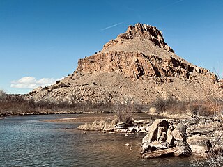
The Rio Chama, a major tributary river of the Rio Grande, is located in the U.S. states of Colorado and New Mexico. The river is about 130 miles (210 km) long altogether. From its source to El Vado Dam its length is about 50 miles (80 km), from El Vado Dam to Abiquiu Dam is about 51 miles (82 km), and from Abiquiu Dam to its confluence with the Rio Grande is about 34 miles (55 km).

The Salmon River is a 33.5-mile (53.9 km) river in the Cascade Range in the U.S. state of Oregon that drains part of southwestern Mount Hood. The entire length of the river is a protected National Wild and Scenic River. Several portions are in protected wilderness. It is affluent to the Sandy River, a tributary of the Columbia River.
Big Timber Creek is a 5.6-mile-long (9.0 km) stream in southwestern New Jersey. The creek was called Tetamekanchz Kyl by Lenape tribes prior to European settlement in the area. The creek drains a watershed of 63 square miles (160 km2) and is a tributary of the Delaware River.

The Suiattle River is a river in the northern Cascade Mountains of western Washington, United States. It is a tributary of the Sauk River and by extension the Skagit River. Its source is located between Suiattle Glacier and Honeycomb Glacier on Glacier Peak, at an elevation of around 7,000 ft (2,100 m) above sea level. It descends through a 60-mile (97 km) course, lying mainly within the Mount Baker–Snoqualmie National Forest. It meets the Sauk northeast of Darrington, Washington, at an elevation of 400 ft (120 m). Snowmelt from Chocolate and Dusty Glacier gives the river silty water, with a suspended load over twice that of the upper Sauk or adjacent White Chuck.

The Cascade River is a river in the U.S. state of Washington. It is a tributary of the Skagit River which it joins at the city of Marblemount. It is a National Wild and Scenic River.
The Little Chilliwack River is a small river in Whatcom County, Washington. It is a tributary of the Chilliwack River, entering the river just below the Canada–United States border.
The Miller River is a river in King County, Washington. Named for 1890s prospector John Miller, it is a tributary of the Skykomish River, which it joins near the community of Miller River. The Miller River is about 3.5 miles (5.6 km) long from the confluence of its main tributaries, the East Fork and West Fork. Miller River Campground is located just downriver from the confluence.
Wells Creek is a swift creek in Whatcom County, Washington. It is a tributary of the Nooksack River, joining the river just below Nooksack Falls. It is best known for having six major waterfalls along its course. Wells Creek was named for Hamilton C. Wells who prospected the area in the 1880s and 1890s.
Sloan Creek is the largest tributary of the North Fork Sauk River, entering the river about 2.1 miles (3.4 km) above the mouth of Lost Creek. Its only major tributary is Cadet Creek, which enters the creek about 1.8 miles (2.9 km) above its mouth. According to Fred Beckey, Cadet Creek is larger than Sloan Creek and could be equally considered the head of the Sauk River as the North Fork itself.
The Little Mashel River is a river in Pierce County, Washington. It is a tributary of the Mashel River, and enters the Mashel just 380 feet (116 m) downstream from the Eatonville, Washington, city limits. It is noted for its canyon and the three waterfalls.
The Clowhom River is a short, 19.8-kilometre (12.3 mi) river in British Columbia. It flows into the head of the Salmon Inlet about 26.2 km west of Squamish.

Pipestone Creek is a 53.2-mile-long (85.6 km) river in southwestern Minnesota and southeastern South Dakota.

The Muddy River is a stream, about 29 miles (47 km) long, southeast of Mount St. Helens in the U.S. state of Washington. The Muddy River flows south–southeast and joins the Lewis River just above the Swift Reservoir. The Lewis River flows west and is a tributary to the Columbia River. The east flank of Mount St. Helens is within the watershed of Muddy Creek.
Return Creek is a stream in the northeast part of Yosemite National Park, in Tuolumne County, California, and is a tributary of the Tuolumne River. About 13 miles (21 km) in length, it is the first major tributary to join downstream of Tuolumne Meadows. The creek begins at Return Lake on the Sierra Crest, near Virginia Pass, and flows initially east before turning southwest and joining with McCabe Creek and Spiller Creek. On its path to the Tuolumne River the creek has carved out the 2,000-foot (610 m) deep Virginia Canyon, which was enlarged to its present shape by glaciation. After its confluence with Matterhorn Creek it flows south-southwest to its confluence with the Tuolumne River, about a quarter mile below Waterwheel Falls.

