Horezu is a town located in Vâlcea County, Oltenia, Romania. It administers six villages: Ifrimești, Râmești, Romanii de Jos, Romanii de Sus, Tănăsești, and Urșani.

The District of Diekirch was one of three districts of the Grand Duchy of Luxembourg. Immediately prior to its abolition on 3 October 2015, it contained five cantons divided into 43 communes:
- Clervaux
- Diekirch
- Redange
- Vianden
- Wiltz
The 12 cantons of the Grand Duchy of Luxembourg are subdivisions at the first level of local administrative unit (LAU-1) in the European Union's Nomenclature of Territorial Units for Statistics for Eurostat purposes. They were subdivisions of the three districts of Luxembourg until 2015, when the district level of government was abolished. The cantons are in turn subdivided into 100 communes.

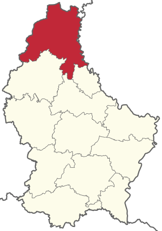
Clervaux is the largest, northernmost, highest and least densely populated canton of Luxembourg. It makes up a large part of the Éislek region. It borders Belgium & Germany.

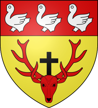
Clervaux is a commune and town in northern Luxembourg, situated in the canton of the same name.

The Islek (Aquilania) is a part of the German Eifel region (Rhineland-Palatinate), in the Bitburg-Prüm district next to the Luxembourg and Belgian border.

Heinerscheid is a small town in northern Luxembourg, in the commune of Clervaux.

Munshausen is a village in northern Luxembourg, in the commune of Clervaux.

Weiswampach is a commune and small town in northern Luxembourg, in the canton of Clervaux.
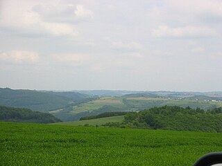
The Éislek, also known by its German name Ösling or Oesling, is a region covering the northern part of both the Grand Duchy of Luxembourg and Eifelkreis Bitburg-Prüm, within the greater Ardennes area that also covers parts of Belgium and France. The Éislek covers 32% of the territory of Luxembourg; to the south of the Éislek lies the Gutland, which covers the remaining 68% of the Grand Duchy as well as the southern part of the Eifelkreis Bitburg-Prüm.

The Wiltz is a river flowing through Belgium and Luxembourg, joining the Sauer at Goebelsmuhle. The Clerve is a tributary of the Wiltz.

Kneiff is a hill in the Ardennes, in the commune of Troisvierges, in northern Luxembourg, near the tripoint shared with Belgium and Germany. At 560 metres, it is the highest point in the country; it is 1 m taller than Buurgplaatz, which was previously considered the highest point until 1997. It lies close to the town of Wilwerdange.

This is a list of the extreme points of Luxembourg, the points that are farther north, south, east or west, higher or lower than any other location in the territory of the state.

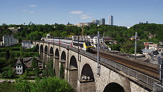
Line 10 is a Luxembourgish railway line connecting Luxembourg City to the centre and north of the country, as well as on to Liège, in Belgium. The terminus at the southern end is Luxembourg railway station, whilst the terminals at the northern end are Diekirch, Wiltz, Troisvierges and Liège. It is designated and predominantly operated by the Société Nationale des Chemins de Fer Luxembourgeois (CFL).

Joseph Jean Ferdinand Kutter (1894–1941) is considered one of Luxembourg's most important painters. He was greatly influenced by the Impressionists but developed his own distinctive Expressionist style.

Clervaux Castle in the town of Clervaux in Northern Luxembourg dates back to the 12th century. Destroyed by the fire in the Second World War during the Battle of the Bulge, the castle has now been fully rebuilt. It houses the commune's administrative offices as well as a museum containing an exhibition of Edward Steichen's photographs.

The Battle of Clervaux or the Battle for Clervaux was an opening engagement of the Battle of the Bulge that took place in the town of Clervaux in northern Luxembourg. It lasted from December 16 to 18, 1944. German forces encircled numerically inferior American forces, primarily from the 28th Infantry Division's 110th Infantry Regiment and the 109th Field Artillery Battalion, and quickly forced them to surrender. The battle has been referred to as the Luxembourg "Alamo".

The Our Nature Park is a nature park in north-eastern Luxembourg.


