Related Research Articles

Hawke's Bay is a region on the east coast of New Zealand's North Island. The region is named for Hawke Bay, which was named in honour of Edward Hawke. The region's main centres are the cities of Napier and Hastings, while the more rural parts of the region are served by the towns of Waipukurau, Waipawa, and Wairoa.

Coastal erosion is the loss or displacement of land, or the long-term removal of sediment and rocks along the coastline due to the action of waves, currents, tides, wind-driven water, waterborne ice, or other impacts of storms. The landward retreat of the shoreline can be measured and described over a temporal scale of tides, seasons, and other short-term cyclic processes. Coastal erosion may be caused by hydraulic action, abrasion, impact and corrosion by wind and water, and other forces, natural or unnatural.

Hawke Bay, formerly named Hawke's Bay, is a large bay on the east coast of the North Island of New Zealand, surrounded by the Hawke's Bay region. It stretches from Māhia Peninsula in the northeast to Cape Kidnappers / Te Kauwae-a-Māui in the southwest, a distance of some 90 kilometres (56 mi).
Somers is a small coastal town on the Mornington Peninsula in Melbourne, Victoria, Australia, 67 km (42 mi) south-east of Melbourne's Central Business District, located within the Shire of Mornington Peninsula local government area. Somers recorded a population of 1,857 at the 2021 census.

The Australasian gannet, also known as the Australian gannet or tākapu, is a large seabird of the booby and gannet family, Sulidae. Adults are mostly white, with black flight feathers at the wingtips and lining the trailing edge of the wing. The central tail feathers are also black. The head is tinged buff-yellow, with a pearly grey bill edged in dark grey or black, and blue-rimmed eyes. Young birds have mottled plumage in their first year, dark above and light below. The head is an intermediate mottled grey, with a dark bill. The birds gradually acquire more white in subsequent seasons until they reach maturity after five years.
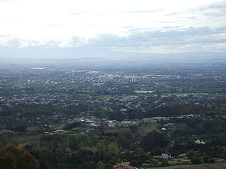
Hastings District is a Territorial authority district within the Hawke's Bay Region, on the east coast of the North Island of New Zealand. It covers the southern half of the Hawke's Bay coast, excluding Napier City, which is a separate territorial authority. Hastings District Council is headquartered in the city of Hastings, the district's largest town.

Cape Kidnappers, known in Māori as Te Kauwae-a-Māui and officially gazetted as Cape Kidnappers / Te Kauwae-a-Māui, is a headland at the southeastern extremity of Hawke's Bay on the east coast of New Zealand's North Island and sits at the end of an 8 kilometres (5.0 mi) peninsula which protrudes into the Pacific Ocean. It is 20 kilometres (12 mi) south-east of the city of Napier. Access to the cape by road stops at Clifton, which is the departure point for many tourists visiting the gannet colony. The Cape Kidnappers Golf Course lies between the headland and the nearby coastal community of Te Awanga.

A bay is a recessed, coastal body of water that directly connects to a larger main body of water, such as an ocean, a lake, or another bay. A large bay is usually called a gulf, sea, sound, or bight. A cove is a small, circular bay with a narrow entrance. A fjord is an elongated bay formed by glacial action. The term embayment is also used for related features, such as extinct bays or freshwater environments.

The Rondevlei Nature Reserve is located in Grassy Park, Zeekoevlei and Lavenderhill, suburbs of Cape Town, South Africa. The bird sanctuary covers approximately 290 hectares of mostly permanent wetland and consists of a single large brackish lagoon. The nature reserve is among the most important wetlands for birds in South Africa despite being situated directly alongside the Zeekoevlei. A number of islands on the vlei act as vital breeding sites. Rondevlei is home to about 230 bird species, a variety of small mammals and reptiles like caracal, porcupine, Cape fox, grysbuck, steenbuck and mongoose, as well as a hippopotamus population which was re-introduced in 1981 as a means to control an alien grass species from South America, which had covered the shoreline and was threatening to engulf the vlei itself. It boasts unusual and threatened ecosystems like strandveld, sand plains fynbos, Cape lowland wetland vegetation and indigenous coastal fynbos vegetation with unique plants found nowhere else in the world.

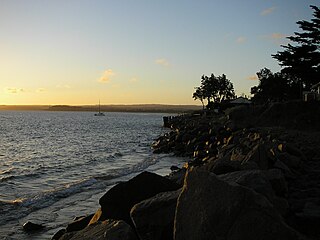
Ocean Beach is a long beach of golden sand in the Hastings District of the Hawke's Bay Region, on the east coast of New Zealand. It lies between Cape Kidnappers to the north, and Waimarama Beach to the south. Ocean Beach has a small population, mainly of Māori ethnicity. Local Māori know it also as Waipuka. Visitors, mainly Hawke's Bay locals, enjoy it as a seaside recreational beach. Ocean Beach has few roads – only the road to it from Havelock North, and some others branching off to a few houses.
The East Coast Trail (ECT) is a long-distance coastal footpath located in the Canadian province of Newfoundland and Labrador. It is a developed trail over 336 kilometres (209 mi) long, creation of which began in 1994. It is made up of 25 linked wilderness paths and passes through more than 30 communities. It was named one of the best adventure destinations by National Geographic in 2012 and is extended and improved yearly.

Haumoana is a coastal town just south of the Tukituki River outlet in Hawke Bay on the east coast of New Zealand's North Island. It is located 12 km south of Napier and ten kilometres east of Hastings. The village incorporates a school, a Presbyterian Church, a general store, a takeaway shop, a hall and a fire station. The village was developed as a holiday settlement with beaches, and the surrounding area has historically been used for sheep and cattle grazing and horticulture. However, lifestyle blocks and grape growing have become more prominent in recent times. Many inhabitants commute to the nearby cities to work. There are approximately 430 houses in Haumoana. The population at the 2013 census was 2256, an increase of 54 people since 2006.
Beach evolution occurs at the shoreline where sea, lake or river water is eroding the land. Beaches exist where sand accumulated from centuries-old, recurrent processes that erode rocky and sedimentary material into sand deposits. River deltas deposit silt from upriver, accreting at the river's outlet to extend lake or ocean shorelines. Catastrophic events such as tsunamis, hurricanes, and storm surges accelerate beach erosion.

Waipātiki Beach is a small coastal village in the Hastings District and Hawke's Bay Region of New Zealand's North Island. It is situated in a little valley at the end of a road that branches off the main road from Napier to Gisborne and that finally, after 11 km, leads to a small sandy beach; first Tangoio Rd, then Waipātiki Road.

Coastal engineering is a branch of civil engineering concerned with the specific demands posed by constructing at or near the coast, as well as the development of the coast itself.
The Mangakuri River is a river of the Hawke's Bay region of New Zealand's North Island. It flows north, paralleling the Pacific Ocean coast before veering northeast to reach the sea at Kairakau Beach, 35 kilometres (22 mi) south of Cape Kidnappers.

Te Awanga is a small rural beachside town in Hawke's Bay, New Zealand. Te Awanga is near Cape Kidnappers, which has a renowned colony of the Australasian gannet.
Blackhead is a small coastal settlement in Hawke's Bay, New Zealand. It is located on the east coast of the North Island of New Zealand, about 74 kilometres south of Napier. Blackhead Beach is a sandy beach, similar to other Hawke's Bay beaches such as Shoal Beach. The original Māori name for the beach is Te Pariomahu and this is more commonly used by local hapū.

Pink Bay is a bay in the Australian state of South Australia and is located at the east end of Dudley Peninsula on Kangaroo Island overlooking Backstairs Passage in the gazetted locality of Willoughby about 110 kilometres (68 mi) south of the state capital of Adelaide and about 20 kilometres (12 mi) east of Penneshaw.
Te Angiangi Marine Reserve is a marine reserve covering a marine area of 446 hectares in the Hawke's Bay Region of New Zealand's North Island. It was established in 1997 and is administered by the Department of Conservation.
References
- ↑ "Beaches in Hastings District | Hastings District Council". Hastingsdc.govt.nz. Retrieved 2015-05-09.
- ↑ "Contact Clifton Motor Camp". Holidayparks.co.nz. Retrieved 2018-12-17.
- ↑ "NZ Camping Guide - Clifton Beach Reserve Motor Camp". Nzcamping.com. Archived from the original on 2008-10-16. Retrieved 2015-05-09.
- ↑ "Blogger". Bregleestate.blogspot.com. Retrieved 2015-05-09.
- ↑ "Cape Kidnappers". www.hawkesbaynz.com. 25 October 2011. Archived from the original on 24 October 2011. Retrieved December 1, 2011.
- ↑ "Seas do fresh harm to Clifton shoreline - Hawkes Bay Today - Hawke's Bay Today News". Hawkesbaytoday.co.nz. Archived from the original on 2013-02-13. Retrieved 2015-05-09.
- ↑ "Coastal Erosion and Inundation". www.hbemergency.govt.nz. Archived from the original on 4 April 2012. Retrieved November 20, 2011.