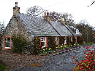
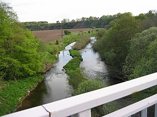
Philiphaugh is a village by the Yarrow Water, on the outskirts of Selkirk, in the Scottish Borders.

Abbotrule is a hamlet south of the B6357 road, in the Scottish Borders area of Scotland, on Rule Burn, east of the Rule Water. Places nearby include Bedrule, Hallrule, Spittal-on-Rule, Ruletownhead, Bonchester Bridge, Denholm, Southdean, Hobkirk, Ferniehirst Castle and the Wauchope Forest.

Dryburgh is a village in the Borders region of Scotland, within the county of Berwickshire. It is most famous for the ruined Dryburgh Abbey.

Nisbet is a small hamlet on the B6400, in Roxburghshire, along the River Teviot, in the Scottish Borders area of Scotland. It is located 5.5 kilometres (3.4 mi) north of Jedburgh and 5 kilometres (3.1 mi) south of Roxburgh.
Holydean Castle was a castle sited near Melrose in Bowden, 1.25 miles SW of the village, in the Scottish Borders region of Scotland, and the former Roxburghshire.
Maxton is a hamlet and civil parish in Roxburghshire, Scotland, and part of the Scottish Borders region.

Smailholm is a small village in the historic county of Roxburghshire in south-east Scotland. It is at grid reference NT648364 and straddles the B6397 Gordon to Kelso road. The village is almost equidistant from both, standing 6 miles (10 km) northwest of the abbey town of Kelso. Since local government reorganisation in Scotland in the early 1970s, Smailholm has been part of the Scottish Borders Council.

Kirkton is a village in the Scottish Borders area of Scotland, off the A6088, near Hawick. Grid Ref. NT5413.

Legerwood is a village by the Eden Water, in the Scottish Borders area of Scotland, near Lauder, near the Southern Upland Way.

Romanno Bridge is a village on the Lyne Water, on the A701, in the Scottish Borders area of Scotland.

Bemersyde is a hamlet in the Mertoun parish of Berwickshire, in the Scottish Borders. It sits on the left bank of the River Tweed, about three miles east of Melrose. Bemersyde House, the ancestral home of the Haig family, is the most notable feature.

Chirnsidebridge is a village near Chirnside in the Scottish Borders area of Scotland, at a bridge over the Whiteadder Water on its journey towards the River Tweed.

Lindean is a village north of Selkirk and the Ettrick Water, in the Scottish Borders area of Scotland.

Roxburgh is a village off the A699, by the River Teviot, near Kelso in the Scottish Borders area of Scotland.

Peniel Heugh is a hill near Ancrum and Nisbet in the Scottish Borders area of Scotland. On it stands the Waterloo Monument.
Allanbank is a village near Allanton, in the Scottish Borders area of Scotland, in the historic county of Berwickshire.

Crailinghall is a village near Oxnam in the Scottish Borders area of Scotland, in the former Roxburghshire.

Cranshaws is a village on the B6355 road, near Duns, in the Scottish Borders area of Scotland, in the former Berwickshire.

Mertoun is a parish in the south-west of the historic county of Berwickshire in the Scottish Borders area of Scotland. Together with the parish of Maxton, Roxburghshire it forms the Maxton and Mertoun Community Council area. It was included in the former Ettrick and Lauderdale District of Borders Region, by the Local Government (Scotland) Act 1973, from 1975 to 1996.
This page is based on this
Wikipedia article Text is available under the
CC BY-SA 4.0 license; additional terms may apply.
Images, videos and audio are available under their respective licenses.


