Clostoken

Last updated

Clostoken
Church of the Holy Family, Clostoken.jpg
Church of the Holy Family, Clostoken parish
Ireland relief location map.png
Red pog.svg
Clostoken
Coordinates: 53°13′06″N8°37′30″W / 53.218317°N 8.62504°W / 53.218317; -8.62504
Country Ireland
Province Connaught
County Galway
Civil Parish Kilconickny

Clostoken or Cloghastookeen is a small townland in the civil parish of Kilconickny, near the town of Loughrea in County Galway, Ireland. It takes its name from an old ruined castle.

Contents

Name

According to O'Donovan's Field Name Books (1862), the Irish language form of the name is Cloch stúincín, meaning "stone of the little prominence". Other forms include Clostoken, Closetaken, Cloghstockin, Cloghastockin, Cloghstokin, Cloghastookeen and Clostaken. [1] Joyce (1910) writes "Near Loughrea in Galway, is a townland called Cloghastookeen, the stone fortress of the little pinnacle, which received its name from a castle of the Burkes, the ruins of which still remain. [2] The townland gives its name to Clostoken & Kilconieran parish. There were three ecclesiastical parishes in the Middle Ages; Kilconickny (now Clostoken), Kilconieran and Lickerrig (now Carrabane). The three are now united in the large parish of Clostoken & Kilconieran. [3]

Location

Cloghastookeen is in the Electoral Division of Kilconickny. Bordering townlands are Carrowclogh to the south, Kilmurry to the east, Knockadaumore to the east, Saintclerans to the north and Srah to the west. [4] [5] The area of the townland is 142.12 acres (57.51 ha). [4] O'Donovan writes; "This is a small townland, all arable and used as pasture land. It contains no antiquities, nor anything remarkable. It does have extensive ruins of a castle." This is Cloastoken Old Castle. [1]

People

The 1826 Tithe Appointment Books list 10 households in Cloghastookeen: Coniff, Glenane, Glenane, Glenane, Kelly, Kelly, O'Bryen, O'Laughlin, Walsh and Walsh. [6] The Miller family of Cromwellian settlers inherited part of the Cloghastookeen estate through marriage with a Croasdaile heiress. In 1855 Croasdaile Bowen Miller was one of the principal lessors in the parish of Kilconickny. [7] Griffith's Valuation, published between 1847 and 1864, gives the area of the townland as 169 acres (68 ha). The land value at that time was £.100-14s.-2d. Four households were listed: Darcy, Walsh, Walsh and Miller. [1] In the 1911 census there was just one household, Sherry, with 10 people aged 5 to 65. [8]

Related Research Articles

<span class="mw-page-title-main">Carrick-on-Shannon</span> Town in County Leitrim, Ireland

Carrick-on-Shannon is the county town of County Leitrim in Ireland. It is the largest town in the county of Leitrim. A smaller part of the town lies in County Roscommon. As of the 2022 census, the population of the town was 4,743. It is situated on a strategic crossing point of the River Shannon. The Leitrim part of the town is in the civil parish of Kiltoghert which is in the ancient barony of Leitrim.

<span class="mw-page-title-main">Kinvara</span> Village in south County Galway, Ireland

Kinvara or Kinvarra is a sea port village in the southwest of County Galway, Ireland. It is located in the civil parish of Kinvarradoorus in the north of the barony of Kiltartan. Kinvarra is also an electoral division.

<span class="mw-page-title-main">Ballinamore</span> Town in County Leitrim, Ireland

Ballinamore is a small town in County Leitrim, Ireland.

The Conmhaícne Mara or Conmaicne Mara, were an early people of Ireland. Their tuath was located in the extreme west of County Galway, Republic of Ireland, giving their name to Connemara, an anglicised form of Conmhaicne Mara.

<span class="mw-page-title-main">Rosmuc</span> Village in County Galway, Ireland

Rosmuc or Ros Muc, sometimes anglicised as Rosmuck, is a village in the Conamara Gaeltacht of County Galway, Ireland. It lies halfway between the town of Clifden and the city of Galway. Irish is the predominant spoken language in the area, with the electoral division of Turlough, Rosmuc, representing one of the highest percentages of Irish-speaking people in the country. The townland of Rosmuck is part of the civil parish of Kilcummin.

Dugan or Duggan is an Irish surname derived from Ó Dubhagáinn.

Lusmagh is a civil parish in County Offaly, Ireland, bounded by three rivers: the Shannon, Lusmagh and Little Brosna to the west, east and south respectively. The town of Banagher is northeast across the River Lusmagh. Lusmagh was considered part of County Galway in 1628 and Connacht until 1373; the Lusmagh Roman Catholic parish is the only one in the Diocese of Clonfert east of the Shannon. According to the history of the O'Kellys of Hy-Many, Lusmhaigh means the plain of the healing herbs. In Christian times, the parish was named Cill Mochonna, "the Church of Mo Chua". Saint Mo Chua of Balla, also called Crónán, founded a monastery in 600 on the site of Cloghan Castle. The name Lusmagh was restored to the Catholic parish around 1810. Its parish church, named after St. Crónán, is about three miles southwest of Banagher.

Menlough is a village in northeast County Galway in Ireland. Located 35 km from Galway, 27 km from Tuam, 30 km from Ballinasloe, and 20 km from Athenry, it forms part of the civil parish of Killascobe.

Mullagh is a parish in the Roman Catholic Diocese of Clonfert in County Galway, Ireland. It is in the south-east of the county, close to the towns of Loughrea, Ballinasloe, and Portumna. Mullagh lies in the civil parish of Abbeygormacan, and spans the townlands of Mullagh Beg and Mullagh More.

Meelick, also Milic, is a townland on the River Shannon in Ireland. It lies approximately 4 km southeast of Eyrecourt in County Galway.It is best known for its walkway that connects to Lusmagh (Offaly). It also holds the oldest church still in use in Ireland at 608 years old given papal permission and built in 1414 AD it is also within the Parish of Clonfert which is home to the madonna statue Our Lady of Clonfert. Clonfert is the head of its diocese with its headquarters home to Most Rev. Bishop Michael Duignan, St. Brendans Presbytery Loughrea. It is home to the oldest hurling club in Ireland which was founded in 1884. It has a little pub 10 yards from The Church known locally as “George’s/The Shop” It holds a kayaking festival each year after the boating season halts to its winter end with a great quay half way between Portumna and Banagher home to SilverLine Cruisers, CarrickCraft and Emerald Star-line. It holds a car rally in association with Galway Rally ever few years. Its current Parish Priest (2021) is REV.Fr.Declan McInerney PP.

Kilgevrin is a townland near the village of Milltown in north County Galway, Ireland. It is situated in the civil parish of Liskeevy, in the historical barony of Dunmore. Kilgevrin is 3.1 square kilometres (1.2 sq mi) in area, and is bounded on the north by the parish of Addergoole and townland of Banagher, on the east by both Banagher and Clashaghanny and on the south and west by the parish of Kilbannon and Tuam.

<span class="mw-page-title-main">Corofin, County Galway</span> Village in County Galway, Ireland

Corofin or Corrofin is a village and parish in County Galway, Ireland, situated on the N17 road between Galway City and Tuam.

<span class="mw-page-title-main">Michael Griffin (Irish priest)</span> Irish Roman Catholic priest (1892–1920)

Michael Griffin was an Irish Catholic priest who was murdered during the Irish War of Independence.
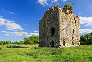
Tony Cummins was an Irish priest and centenarian.

Dudley Persse (1625–1699) was an Anglo-Irish landlord and Anglican priest.

<span class="mw-page-title-main">Toombeola</span> Townland in Connacht, Ireland

Toombeola is a townland in the historical barony of Ballynahinch in Connemara, County Galway, Ireland. It is located near the Atlantic Coast, 44 miles (71 km) west of Galway City, 4 miles (6.4 km) east of Roundstone, and 10 miles (16 km) south east of Clifden. As of the 2011 census, Toombeola townland had a population of 18 people.

Leitrim is a barony in Ireland that lies partly in County Galway and partly in County Clare. It is located in the south-eastern corner of County Galway and the north-eastern corner of County Clare. Prior to 1898, the entire barony was contained in County Galway. The Local Government (Ireland) Act 1898 split the barony: part of the barony was transferred to County Clare. Leitrim is bounded, clockwise from the southwest, by the Clare baronies of Tulla Upper and Tulla Lower; the Galway baronies of Loughrea to the west, Kilconnell to the north, and Longford to the east; and by Lough Derg to the south and southeast. It measures 20 miles (32 km) from north to south and 9.5 miles (15.3 km) from east to west.

Moycullen is a Gaeltacht civil parish in the ancient barony of the same name. It is located in the western shore of Lough Corrib in County Galway, Ireland and is around 4 miles (6.4 km) north-west of the city of Galway on the road to Oughterard. The parish contains 27,294 statute acres. According to Lewis's survey of 1837, "The land is of very indifferent quality; and there is a large quantity of reclaimable waste and bog.". The parish gets its name from the church, now in ruins, that is situated around 1 mile (1.6 km) to the east of the village, in the townland of Moycullen itself.

Kilconickny is a civil parish in the county of Galway, Connaught, Ireland.

<span class="mw-page-title-main">Killeenadeema</span> Place in Connacht, Ireland

Killeenadeema is a civil parish in County Galway, Ireland. It contains most of the Derrybrien mountains, which hold the Derrybrien Wind Farm.

References

  1. 1 2 3 Information about Cloghastookeen.
  2. Joyce 1910, p. 408.
  3. Clostoken & Kilconieran Clonfert.
  4. 1 2 Cloghastookeen Townland, County Galway.
  5. Cloch an Stuaicín.
  6. People who lived in Cloghastookeen...
  7. Ormsby (Ballinamore).
  8. Residents of a house 1 in Cloghastookeen.

Sources