
Huntly is a town in the Waikato district and region of the North Island of New Zealand. It was on State Highway 1, 95 kilometres (59 mi) south of Auckland and 32 kilometres (20 mi) north of Hamilton. It is situated on the North Island Main Trunk (NIMT) railway and straddles the Waikato River. Huntly is within the Waikato District which is in the northern part of the Waikato region local government area.
Greymouth is the largest town in the West Coast region in the South Island of New Zealand, and the seat of the Grey District Council. The population of the whole Grey District is 14,250, which accounts for 43% of the West Coast's inhabitants. The Greymouth urban area had an estimated population of 8,340. A large proportion of the District, 65%, is part of the Conservation Estate owned and managed by the Department of Conservation making Greymouth a natural centre for walkers and trampers.

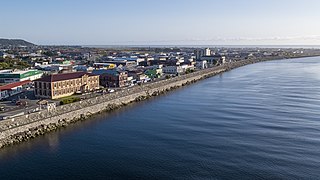
Westport is a town in the West Coast region of the South Island of New Zealand. Established in 1861, it is the oldest European settlement on the West Coast. Originally named Buller, it is on the right bank and at the mouth of the Buller River, close by the prominent headland of Cape Foulwind. It is connected via State Highway 6 with Greymouth, 100 kilometres (62 mi) to the south, and with Nelson 222 kilometres (138 mi) in the northeast, via the Buller Gorge. The population of the Westport urban area was 4,250 as of June 2023. The Buller District had a population of 9,670.

Runanga is a small town on the West Coast of the South Island of New Zealand. It is located eight kilometres to the northeast of Greymouth, to the north of the Grey River. Barrytown is 21 kilometres (13 mi) further north. State Highway 6 and the Rapahoe Branch railway run through the town. Runanga was formerly a railway junction, with the steep Rewanui Branch diverging from the Rapahoe line until closure in 1985.
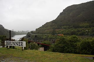
Brunner, originally called Brunnerton, is a town in the northwest of New Zealand's South Island. It is 12 kilometres (7 mi) east of Greymouth, on the south bank of the Grey River. It is on the Midland Line railway near its junction with the Stillwater–Westport Line (SWL) in neighbouring Stillwater. Passenger trains ceased running along the SWL to Reefton and Westport in 1967, but the TranzAlpine runs the length of the Midland Line from Christchurch to Greymouth and it continues to stop in Brunner.

The Midland line is a 212 km section of railway between Rolleston and Greymouth in the South Island of New Zealand. The line features five major bridges, five viaducts and 17 tunnels, the longest of which is the Otira tunnel. It is the route of the popular TranzAlpine passenger train.
The Rapahoe Branch is a branch line railway that forms part of New Zealand's national rail network and is located on the West Coast of the South Island. It has been operational since 1923 and was named the Rapahoe Industrial Line until 2011.

The Stillwater Ngākawau Line (SNL), formerly the Stillwater–Westport Line (SWL) and the Ngakawau Branch, is a secondary main line, part of New Zealand's national rail network. It runs between Stillwater and Ngakawau via Westport on the West Coast of the South Island. It was one of the longest construction projects in New Zealand's history, with its first section, at the south end, opened in 1889, and the beginnings of the Ngākawau Branch, at its Westport end, in 1875. The full line was completed in 1942. The only slower railway projects were Palmerston North to Gisborne, 1872 to 1942, and the Main North Line to Picton, 1872 to 1945.

The Blackball Branch was a branch line railway of New Zealand's national rail network on the West Coast of the South Island and worked from the 1900s to 1966. It included the Roa Branch, also known as the Roa Incline. Roa was sometimes known as Paparoa.

The Huntly Power Station is the largest thermal power station in New Zealand and is located in the town of Huntly in the Waikato. It is operated by Genesis Energy Limited, a publicly listed company. The station has five operational generating units – three 250 MW coal-and-gas-fired steam turbine units, a 50 MW gas peaking plant, and a 403 MW combined cycle gas turbine plant. The station also plays an important role in voltage support for the Northland, Auckland and Waikato regions.

The Seddonville Branch, later truncated as the Ngākawau Branch, is a branch line railway in the West Coast region of New Zealand's South Island. Construction began in 1874 and it reached its terminus at the Mokihinui Mine just beyond Seddonville in 1895. In 1981 it was closed past Ngākawau and effectively became an extension of the Stillwater–Westport Line, since formalised as the Stillwater–Ngākawau Line.

Seddonville is a lightly populated locality on the West Coast of New Zealand's South Island. It is most famous for the historical role it played in New Zealand's coal mining industry.
The Pike River Mine is a coal mine formerly operated by Pike River Coal 46 km (29 mi) north-northeast of Greymouth in the West Coast Region of New Zealand's South Island. It is the site of the Pike River Mine disaster that occurred on 19 November 2010, leading to the deaths of 29 men whose remains have not been recovered. The mine and its assets are owned by the Department of Conservation, whom, on 1 July 2022, assumed ownership and management following the dissolution of the Pike River Recovery Agency. The former mine site and its surrounding land are a part of Paparoa National Park.

Pike River Coal Ltd was a mining company listed on the New Zealand and Australian stock exchanges. Its primary operation was the Pike River Mine, the site of a mining disaster with 29 deaths on 19 November 2010.
The Conns Creek Branch was a 2.7 kilometre branch line railway in the West Coast region of New Zealand's South Island. It diverged from the Seddonville Branch at Waimangaroa and followed the southern bank of the Waimangaroa River to the line's terminus at Conns Creek at the foot of the Denniston Incline. The line operated from 1877 until 1967 and existed for the sole purpose of conveying coal from mines to the port of Westport.

Mining in New Zealand began when the Māori quarried rock such as argillite in times prior to European colonisation. Mining by Europeans began in the latter half of the 19th century.
The Ngakawau Restoration Project is a proposed hydro scheme planned to divert acid mine drainage from coal mines to an ocean outfall to restore water quality of the Ngākawau River, in the northern section of the West Coast of the South Island of New Zealand. The project is a configuration of the Stockton Plateau Hydro Scheme being developed by Hydro Developments (2013) Limited. Project information can be found at https://hydrodevelopments.co.nz

The Paddle Steamer Waimarie is a historic riverboat based on the Whanganui River in New Zealand. She is the only coal–fired paddle steamer still operating in New Zealand. Waimarie was built in 1899 by Yarrow & Co. in London and transported to New Zealand in kitset form to be assembled at Whanganui. She operated on the Whanganui River for 49 years before being laid up. In 1952 she sank at her moorings and lay in the mud for the next 40 years.
The Pike River Mine disaster was a coal mining accident that began on 19 November 2010 in the Pike River Mine, 46 km (29 mi) northeast of Greymouth, in the West Coast region of New Zealand's South Island following a methane explosion at approximately 3:44 pm. The accident resulted in the deaths of 29 miners.
The Koranui Incline was an inclined tramway on the West Coast of the South Island of New Zealand that, for four years from late 1882 to the end of 1886, brought coal from a mine high on Mt Frederick down to a railway line near sea level.
