
Tong is a ward within the City of Bradford Metropolitan District Council, West Yorkshire, England, named after Tong village which is its oldest settlement. The population at the 2011 Census was 20,608.

Airedale is a geographic area in Yorkshire, England, corresponding to the river valley or dale of the River Aire.
Weetwood is an area between Headingley and Meanwood in north-west Leeds, West Yorkshire, England. It is bounded on the north by the A6120, on the west by the A660, on the east by Meanwood Beck and to the south by Hollin Lane. Weetwood Lane runs north and south through it.

Sheepscar is an inner city district of Leeds in West Yorkshire England, lying to the north east of Leeds city centre. The district is in the City of Leeds Metropolitan Council. It is overlooked by the tower blocks of Little London and Lovell Park to the west, and gives way to Meanwood in the north-west, Chapeltown in the north-east and Burmantofts in the east.
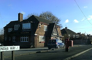
Pendas Fields is a private, suburban housing estate in Leeds, West Yorkshire, England. It is considered part of Cross Gates, as is Manston. Swarcliffe is close, and Cock Beck runs nearby. The area falls within the Cross Gates and Whinmoor ward of the Leeds Metropolitan council.

The Meanwood Beck is a stream in West Yorkshire, England, which flows southwards through Adel, Meanwood and Sheepscar into the River Aire in central Leeds. Different portions of the same watercourse have been referred to as Adel Beck, Carr Beck, Lady Beck, Mabgate Beck, Sheepscar Beck, Timble Beck or Wortley Beck. The Meanwood Valley Trail footpath follows the line of the beck for much of its course.

Killingbeck is a district of east Leeds, West Yorkshire, England that is situated between Seacroft to the north, Cross Gates and Whitkirk to the east, Gipton to the west, Halton Moor to the south, Halton to the south-east and Osmondthorpe to the south-west.

Tinshill is a district of Leeds, 4 miles (7 km) north of Leeds city centre, West Yorkshire, England. It was the Danes in the 9th century who named the hill "Tyndr's Hyll".

The Aberford Dykes are a series of archaeological monuments located around the valley of the Cock Beck, where it runs just north of the village of Aberford on the border between North and West Yorkshire, England.

The Leeds Country Way is a circular long-distance footpath of 62 miles (99 km) around Leeds, West Yorkshire, England. It is never more than 7 miles (11 km) from City Square, Leeds, but is mainly rural with extensive views in the outlying areas of the Leeds metropolitan district. It follows public Rights of Way including footpaths, bridleways and minor lanes, with a few short sections along roads.

The Meanwood Valley Trail is a waymarked footpath and the title of an annual (March/April) footrace that takes place on parts of the trail in Leeds, West Yorkshire, England. It runs for a distance of 7 miles (11 km) from the statue of Henry Rowland Marsden, 1878, on Woodhouse Moor, close to the University of Leeds, through Headingley, Meanwood and Adel to Breary Marsh, Golden Acre Park, where it meets the Leeds Country Way. For most of its route it is the official Leeds link to the Dales Way. Along the way are signs giving information about the local wildlife.

Mabgate is an inner city area of Leeds, West Yorkshire, England and the name of one of its streets. In Leeds City Council's Mabgate Development Framework (2007), "the area is bounded to the west by North Street; to the east by Macaulay Street; to the north by Mushroom Street and to the south by the New York Road". Mabgate, the street, continues for a short distance on the south side of New York Road. The area is in the Burmantofts and Richmond Hill ward of Leeds City Council. The area to the west of Regent Street is within the city centre boundary.
Wykebeck is an area of east Leeds, West Yorkshire, England named after the Wyke Beck and situated between Gipton and Seacroft along Wykebeck Road. The area falls within the Gipton and Harehills ward of the Leeds City Council. The area is seldom referred to, instead people usually perceive Gipton to be West of the beck and Seacroft to be East of it. The area consists of several blocks of highrise council flats to the south.

Woodhouse Ridge is a strip of woodland on the South West hillside of the Meanwood valley in urban area of Leeds, West Yorkshire, England. Locally known as 'The Ridge', the area is notable as a significant area of mature woodland in an otherwise highly developed urban area. The woods are centred at grid reference 53.820061,-1.560144 and are enclosed by Meanwood Road to the east and by Headingley to the north and Woodhouse, Leeds to the South.

Crimple Valley Viaduct, also known as Crimple Viaduct and Crimple Beck Viaduct is a railway viaduct which crosses the Crimple Valley between Pannal railway station and Hornbeam Park railway station in North Yorkshire. It is a Grade II* listed structure.

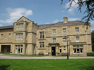
Tong or Tong Village is a village in the City of Bradford metropolitan district, West Yorkshire, England. It is a historic village, and is sometimes thought to be a smaller version of the larger area of Tong, which is a local election ward.

Tyersal Beck is a watercourse in West Yorkshire, England, named after the village of Tyersal in whose vicinity it runs.

Post Hill is a designated Leeds Nature Area on the western end of Farnley, and partly in Pudsey. It is situated mostly east of Pudsey Beck and Farnley Beck, between Wood Lane in the north and Troydale Lane in the south, and forms part of the West Leeds Country Park.

Holme Beck is a watercourse in the Tong ward of the City of Bradford, West Yorkshire, England. It drains a shallow valley east of the watershed between Bradford and Leeds. Holme Beck begins in the village with no evidence of any continuation on the other side of the canal or motorway. Holme Beck is the main carrier for village drainage, it runs beneath the West Coast Main Line and then through the large marsh area of Holme Moss before joining the River Bela.
Stranton is a former village and parish in the south-east of County Durham, now part of the Borough of Hartlepool, England.
