
Coina was a Portuguese freguesia in the municipality of Barreiro.
Coina was a Portuguese freguesia in the municipality of Barreiro.
It was a town and the seat of the municipality between 1516 and the early 19th century when it was incorporated into the also extinct municipality of Alhos Vedros. It was formed by one parish and had 248 inhabitants in 1801.
It was dissolved on January 28, 2013, following a resolution of the Portuguese Assembly of the Republic enacted on January 16, 2013, by merging with the parish of Palhais, forming the new parish of Palhais e Coina. [1]

The Alfama is the oldest neighborhood of Lisbon, spreading on the slope between the São Jorge Castle and the Tagus river. The district includes the freguesias (parishes) of São Miguel, Santo Estêvão, São Vicente de Fora and part of the two streets, "Freguesia da Sé: Rua do Barão" and "Rua São João da Praça". It contains many important historical attractions, as well as an abundance of Fado bars and restaurants.

Portugal is a unitary state with delegated authority to three levels of local government that cover the entire country:
Freguesia, usually translated as "parish" or "civil parish", is the third-level administrative subdivision of Portugal, as defined by the 1976 Constitution. It is also the designation for local government jurisdictions in the former Portuguese overseas territories of Cape Verde and Macau. In the past, it was also an administrative division of the other Portuguese overseas territories. The civil parishes and communities in England and Wales and parroquia in the Spanish autonomous communities of Galicia and Asturias is similar to a freguesia in Portugal. The average land area of a Portuguese parish is about 29.83 km2 (11.52 sq mi) and an average population of about 3,386 people. The largest parish by area is Alcácer do Sal e Santa Susana, with a land area of 888.35 km2 (342.99 sq mi), and the smallest parish by area is São Bartolomeu (Borba), with a land area of 0.208 km2 (0.080 sq mi). The most populous parish is Algueirão - Mem Martins, with a population of 68,649 people and the least populous is Mosteiro, with a population of just nineteen people.
Cernache do Bonjardim is a former civil parish in the municipality of Sertã, central Portugal. In 2013, the parish merged into the new parish Cernache do Bonjardim, Nesperal e Palhais. The population in 2011 was 3,052, in an area of 71.59 km2.
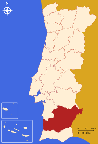
The Beja District is located in southern Portugal. The district capital is the city of Beja. It is the largest district of the country by area, comprising around 11% of Portuguese territory. It borders Spain.

Évora District is located in Alentejo, in southern Portugal. The district capital is the city of Évora. It borders Spain.

Barreiro is a city and a municipality in the Setúbal District in Portugal. The population in 2021 was 78,345, in an area of 36.39 square kilometres (14.05 sq mi).

Batalha is a town and a municipality in historical Beira Litoral province, and Leiria district in the Centro of Portugal. The town's name means "battle". The municipality population in 2011 was 15,805, in an area of 103.42 km2 (39.93 sq mi). The town proper has around 8,548 inhabitants in an area of 28.42 km2 (10.97 sq mi). The municipality is limited to the North and West by the municipality of Leiria, to the East by Ourém, to the Southeast by Alcanena and to the Southwest by Porto de Mós.

Agualva-Cacém is a Portuguese city within the municipality of Sintra, in the Lisbon metropolitan area. It comprises the civil parishes of Agualva e Mira Sintra and Cacém e São Marcos, equivalent to 81,845 inhabitants of the municipalities population.
Juromenha, officially Nossa Senhora do Loreto de Juromenha, was a freguesia in southeastern Portugal, near the border with Spain. It was part of Alandroal Municipality.

Costa da Caparica is a Portuguese city and civil parish, located in the municipality of Almada along the western coast of the district of Setúbal. The total population in 2011 was 13,418, in an area of 10.18 km2. Since 9 December 2004, the Costa da Caparica has been designated as cidade within the urban hierarchy of Portugal.
Nossa Senhora de Fátima was a Portuguese parish (freguesia) in the municipality of Lisbon. It had a total area of 1.87 km2 and total population of 27.111 inhabitants (2001); density: 14,528.9 inhabitants/km2. It was created on February 7, 1959. With the 2012 Administrative Reform, the former Nossa Senhora de Fátima parish merged with the São Sebastião da Pedreira parish into a new parish named Avenidas Novas.

Jaguaripe is a municipality in the state of Bahia in the North-East region of Brazil. It covers 863.424 km2 (333.370 sq mi), and has a population of 18,981 with a population density of 18.32 inhabitants per square kilometer. Jaguaripe is located 130 km (81 mi) from the state capital of Bahia, Salvador. Jaguaripe shares a border with the municipalities of Aratuípe, Nazaré, Maragogipe, Laje, São Miguel das Matas, and Santo Antônio de Jesus. It was the first municipality created outside of Salvador, dating to 1693.

The Castle of Estremoz is a medieval castle in the civil parish of Santa Maria de Devassa, municipality of Estremoz, Portuguese district of Évora.
São Bartolomeu dos Galegos is a former civil parish in the municipality of Lourinhã, Lisbon District, Portugal. In 2013, the parish merged into the new parish São Bartolomeu dos Galegos e Moledo. Located around 80 kilometres (50 mi) from Lisbon. The parish contains a miradouro (viewpoint), which gives a view over the Lourinhã parish.
Aguada de Baixo was a freguesia in Águeda Municipality, Aveiro District, Portugal. It had an area of 4.7 km2 and in 2011 had a population of 1373. In 2013 it was merged with Barrô as part of an administrative reorganization of the territory and formed the União das Freguesias de Barrô e Aguada de Baixo.
Barrô was a freguesia in Águeda Municipality, Aveiro District, Portugal. It had an area of 7 km2 and in 2011 had a population of 1836.
Belazaima do Chão was a freguesia in Águeda Municipality, Aveiro District, Portugal. It had an area of 19.8 km2 and in 2011 had a population of 599.
Borralha was a freguesia in Águeda Municipality, Aveiro District, Portugal. It had an area of 9.6 km2 and in 2011 had a population of 2230.
Cernache do Bonjardim, Nesperal e Palhais is a civil parish in the municipality of Sertã, Portugal. It was formed in 2013 by the merger of the former parishes of Cernache do Bonjardim, Nesperal and Palhais. The population in 2011 was 3,625, in an area of 101.59 square kilometres (39.22 sq mi).