Details of the climb
From Saint-Girons (west), the climb to the Col de Portel crosses the Col de la Crouzette (1,241 m). To the Col de la Crouzette the climb is 11.2 km long, at an average gradient of 6.5%, with a short section at 10.8%. From the Col de la Crouzette to the summit is a further 3.5 km, gaining an extra 191 m, with the steepest section (near the summit) at 8.0%.
Starting from la Mouline, (east) the climb to the Col de Portel crosses the Mur de Péguère (1,375 m). To the Mur de Péguère the climb is 18 km long; over this distance, the climb is 872 m (an average of 4.8%). From the Mur de Péguère to the summit is a further 3.5 km, gaining a further 57 m height.

Col du Tourmalet is one of the highest paved mountain passes in the French Pyrenees, in the department of Hautes-Pyrénées. Sainte-Marie-de-Campan is at the foot on the eastern side and the ski station La Mongie two-thirds of the way up. The village of Barèges lies on the western side, above the town of Luz-Saint-Sauveur.

The Col du Galibier is a mountain pass in the southern region of the French Dauphiné Alps near Grenoble. It is the eighth highest paved road in the Alps, and recurrently the highest point of the Tour de France.
Col de la Croix de Fer is a high mountain pass in the French Alps linking Le Bourg-d'Oisans and Saint-Jean-de-Maurienne.

Col de la Bonette is a high mountain pass in the French Alps, near the border with Italy. It is situated within the Mercantour National Park on the border of the departments of Alpes-Maritimes and Alpes-de-Haute-Provence. The road over the col is the seventh highest paved road in the Alps.

Col de l'Iseran is a mountain pass in France, the highest paved pass in the Alps. A part of the Graian Alps, it is in the department of Savoie, near the border with Italy, and is crossed by the D902 roadway.

Col du Glandon is a high mountain pass in the Dauphiné Alps in Savoie, France, linking Le Bourg-d'Oisans to La Chambre. It is situated between the Belledonne, Grandes Rousses and Arvan-Villards mountain ranges, west of the Col de la Croix de Fer. The road over the Col du Glandon was opened in 1898, although it was not linked to the Col de la Croix de Fer until 1912.

Col du Lautaret is a high mountain pass in the department of Hautes-Alpes in France.
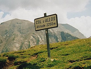
Col d'Allos is a high mountain pass in the Alps in the department of Alpes-de-Haute-Provence in France. It connects Barcelonnette in the Ubaye Valley and Colmars.

Col de la Colombière is a mountain pass in the Alps in the department of Haute-Savoie in France.

Col de la Madeleine is a high mountain pass in the Alps in the department of Savoie in France which connects La Chambre in Maurienne with La Léchère in Tarentaise. The pass is closed from November to the beginning of June. It has been described as "beautiful, but heartbreaking".
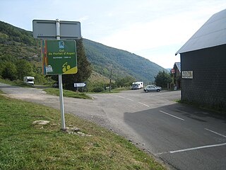
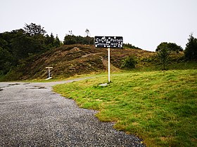
The Col de Portet d'Aspet is a mountain pass in the central Pyrenees in the department of Haute-Garonne in France. It is situated on the D618 road between Aspet and Saint-Girons and connects the Ger and Bouigane valleys, on the slopes of the Pic de Paloumère.
Semnoz is a mountain of Haute-Savoie, France. It lies in the Bauges range. It has an altitude of 1,699 m (5,574 ft) above sea level. The mountain is crossed by the D41/D110 road near to the Crêt de Chatillon at an altitude of 1,660 m (5,446 ft).

Col d'Ornon is a mountain pass through the Dauphiné Alps in the department of Isère in France which connects the communities of Le Bourg-d'Oisans and La Mure. The climb is used occasionally in the Tour de France cycle race, including on the "Queen stage" on 18 July 2013 which finishes with two ascents to Alpe d'Huez.

The Mur de Péguère is a mountain pass in the French Pyrenees in the department of Ariège, between the communities of Massat (south) and Sentenac-de-Sérou (north).

The Col du Ballon d'Alsace is a mountain pass situated close to the summit of the Ballon d'Alsace in the Vosges Mountains of France. It connects Saint-Maurice-sur-Moselle (Vosges) with Masevaux (Haut-Rhin) and Belfort.

The Col du Grand Ballon is a mountain pass situated close to the summit of the Grand Ballon in the Vosges Mountains of France. It connects Cernay (Haut-Rhin) with Le Markstein winter sports station.

The Col de la Schlucht is a mountain pass in the Vosges Mountains of France. On the west side lies the historical region of Lorraine, on the east side lies the historical region of Alsace.

The Col de la Croix Fry is a mountain pass located in the Chaîne des Aravis, between Manigod and La Clusaz in the Haute-Savoie department of France. The road over the col is used occasionally by the Tour de France cycle race with the tour crossing the pass on Stage 19 of the 2013 Tour. At the summit is the village of La Croix Fry.

The Col des Chevrères is a mountain pass situated in the Vosges Mountains in the Haute-Saône department of France, between Servance and Plancher-les-Mines. The Tour de France cycle race crossed the col for the first time on Stage 10 of the 2014 race.

The Col de Palaquit is a mountain pass situated in the Chartreuse Mountains in the Isère department of France, near the village of Sarcenas. The Tour de France cycle race crossed the col for the first time on Stage 13 of the 2014 race. The pass is located on the climb via the D512 from Grenoble to the Col de Porte which has been used regularly by the Tour de France.
This page is based on this
Wikipedia article Text is available under the
CC BY-SA 4.0 license; additional terms may apply.
Images, videos and audio are available under their respective licenses.