
Wemyss Castle is situated in Wemyss on the sea cliffs between the villages of East Wemyss and West Wemyss in Fife, Scotland. Wemyss Castle is considered to be a multi-period building, and today's castle includes many elements from former periods such as the 15th century tower and the 19th century stables and gatepiers.
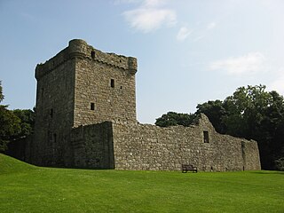
Lochleven Castle is a ruined castle on an island in Loch Leven, in the Perth and Kinross local authority area of Scotland. Possibly built around 1300, the castle was the site of military action during the Wars of Scottish Independence (1296–1357). In the latter part of the 14th century, the castle was granted to William Douglas, 1st Earl of Douglas, by his uncle. It remained in the Douglases' hands for the next 300 years. Mary, Queen of Scots, was imprisoned there in 1567–68, and forced to abdicate as queen, before escaping with the help of her gaoler's family. In 1588, the queen's gaoler inherited the title of Earl of Morton, and moved away from the castle. In 1675, Sir William Bruce, an architect, bought the castle and used it as a focal point for his garden; it was never again used as a residence.

Rossend Castle is a historic building in Burntisland, a town on the south coast of Fife, Scotland.

Huntingtower Castle, once known as Ruthven Castle or the Place of Ruthven, is located near the village of Huntingtower beside the A85 and near the A9, about 5 km NW of the centre of Perth, Perth and Kinross, in central Scotland, on the main road to Crieff. This castle is the subject for several local ghostlore stories.

Pitcairn House is a ruined 17th century laird's house, located in the modern Collydean residential area of Glenrothes, in Fife, Scotland. Pitcairn House was not, as is sometimes reported, built by the Picts, a people whose culture disappeared from Scotland around the 10th century. The name Pitcairn does, however, have roots in the Pictish language, combining the common prefix pit, meaning a portion of land or farm, with the Gaelic cairn.

The Palace of Monimail, also known as Monimail Tower, was a Renaissance palace in Fife, Scotland. A residence of the Archbishops of St Andrews from the 13th century, in the early 17th century Monimail became a chief seat of the Melville family. Lord Monimail is one of the subsidiary titles of the Leslie-Melville Earls of Leven. It was abandoned in the late 17th century and subsequently most of the palace was demolished. One tower remains standing in the grounds of Melville House near the village of Monimail, 4 kilometres (2.5 mi) north of Ladybank.

Alloa Tower in Alloa, Clackmannanshire, in central Scotland, is an early 14th-century tower house that served as the medieval residence of the Erskine family, later Earls of Mar. Retaining its original timber roof and battlements, the tower is one of the earliest and largest Scottish tower houses, with immensely thick walls. It was designated as a scheduled monument in 1960 and is now owned by the National Trust for Scotland.

Hallyards Castle, located to the north-west of the village of Auchtertool, is reputed to have been a hunting seat of Malcolm Canmore. With the establishment of the Roman Church, Halyards became the local residence of the Bishops of Dunkeld; it remained so until the first lay proprietor took possession in 1539.
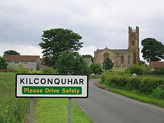
Kilconquhar is a village and parish in Fife in Scotland. It includes the small hamlet of Barnyards. It is bounded by the parishes of Elie, Ceres, Cameron, St Monans, Carnbee, Newburn and Largo. It is approximately 9 miles from north to south. Much of the land is agricultural or wooded. The village itself is situated inland, north of Kilconquhar Loch. Also in the civil parish are Colinsburgh and Largoward, the latter since 1860 being a separate ecclesiastical parish.

Milton of Balgonie is a small village in central Fife, Scotland. It is situated 2 miles (3.2 km) east of Glenrothes between the nearby villages of Markinch and Coaltown of Balgonie to the west and Windygates to the east. Nearby attractions include Balgonie Castle which is situated between Milton and Coaltown. The ruins of Balfour House, where Mary, Queen of Scots sometimes resided, are to the south of the village.

MacDuff's Castle is a ruined castle near East Wemyss, in Fife, Scotland. The site is associated with the MacDuff Earls of Fife, the most powerful family in Fife in the Middle Ages, although nothing survives from this period. The present ruins are the remains of the home of the Wemyss family, who lived here from the 14th century, and their successors in the 16th century.
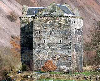
Niddry Castle is a sixteenth-century tower house near Winchburgh, West Lothian, Scotland. It is situated near the Union Canal, and between two large oil shale bings, or waste heaps. Historically it was known as Niddry Seton or West Niddry to distinguish it from Niddry Marischal in Midlothian and Longniddry in East Lothian.
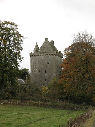
Scotstarvit Tower is a tower house in Fife, Scotland. It is situated 2 miles (3.2 km) south of Cupar, between Tarvit Hill and Walton Hill, south of the River Eden, and west of the A916 road.

Bavelaw Castle is a historic house in the City of Edinburgh Council area, Scotland. It is north of Hare Hill in the Pentland Hills, four miles west of Penicuik, and two miles south of Balerno, above Threipmuir Reservoir. It was designated as a Category A listed building in 1971.
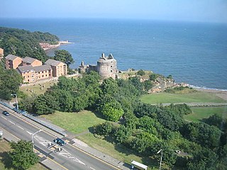
Ravenscraig Castle is a ruined castle located in Kirkcaldy which dates from around 1460. The castle is an early example of artillery defence in Scotland.
Dunbog is a parish in the county of Fife in Scotland which is now united with the neighbouring parish of Abdie, Dunbog kirk closing at that time. The name of the parish possibly derives from the Scottish Gaelic, Dùn Bolg, meaning "bag fort" or "bag-like, rounded hill" although no fortification has been identified on Dunbog Hill. The parish is of entirely rural character, with small hamlets of houses at Dunbog and Glenduckie. These were formerly the settlements of farm workers, but the current inhabitants have many occupations. Dunbog parish is bounded on the north by the River Tay, on the south by Monimail, on the east by Flisk and Creich, and on the west by Abdie. The Barony of Denboig/Dunbog was established in 1687. The nearest town of any size is Newburgh. It has a small primary school with approximately fifty children, and a village hall owned by a community trust which also owns the park and playing field next door.
Smeaton House, which was originally known as Smeaton Castle - in 18th century as East Park House - and most recently as Dalkeith Home Farm, appears originally to have been a courtyard castle, dating from the 15th century. It was rebuilt in the 16th century by Robert Richardson, and in the 18th century as a Classical house, attributed to James Smith. This was a 3-storey U-plan opening to the east. Less than half of that house remains.
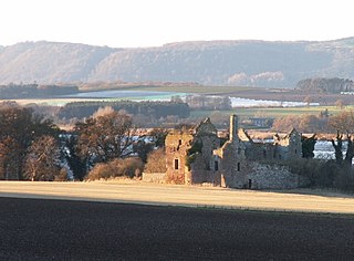
Ballinbreich Castle is a ruined tower house castle in Fife, Scotland.

Crail Castle was a castle that was located in Crail, Fife, Scotland. Crail became a Royal Burgh in the 12th century. The castle was frequented by King David I of Scotland during his reign in the early 12th century and a receipt for its repair survives dated 1264. Ada de Warenne obtained Crail as part of her marriage settlement with Prince Henry of Scotland. King Robert I of Scotland reconfirmed Crail's burgh status in 1306 and confirmed the constabulary of the castle to Lawrence de Weirmerstoun in 1310. Within the castle was a chapel dedicated to the Irish Saint Rufus.
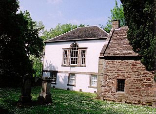
Innerpeffray is a hamlet in Perthshire, Scotland, 4 miles (6.4 km) southeast of Crieff. It is located on a raised promontory among beech woodland above the River Earn. A fording point across the river can still be used, on what is the line of a Roman Road.


