
Long County is a county located in the U.S. state of Georgia. The county seat is Ludowici. Long County is part of the Hinesville-Fort Stewart Metropolitan Statistical Area. The constitutional amendment to create the county was proposed August 14, 1920, and ratified November 2, 1920. The county is named after Crawford Long (1815–1878), American surgeon and pharmacist, first to use diethyl ether as an anaesthetic.

Ludowici is a city in Long County, Georgia, United States. The population was 1,703 at the 2010 census and an estimated 2,221 in 2018. The city is the county seat of Long County. It is a part of the Hinesville-Fort Stewart metropolitan statistical area.
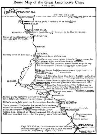
The Western & Atlantic Railroad of the State of Georgia (W&A) is a railroad owned by the State of Georgia and currently leased by CSX, which CSX operates in the Southeastern United States from Atlanta, Georgia, to Chattanooga, Tennessee.
The Georgia Railroad and Banking Company also seen as "GARR", was a historic railroad and banking company that operated in the U.S. state of Georgia. In 1967 it reported 833 million revenue-ton-miles of freight and 3 million passenger-miles; at the end of the year it operated 331 miles (533 km) of road and 510 miles (820 km) of track.
The Atlanta and West Point Rail Road was a railroad in the U.S. state of Georgia, forming the east portion of the Atlanta-Selma West Point Route. The company was chartered in 1847 as the Atlanta and LaGrange Rail Road and renamed in 1857; construction of the 5 ft gauge line was begun in 1849-50 and completed in May 1854. A large minority interest owned by the Georgia Railroad and Banking Company eventually passed under the control of the Atlantic Coast Line Railroad (ACL), which later acquired a majority of the stock.
Created from the former Collins and Ludowici Railroad, the Collins and Glennville Railroad was founded in 1921 and operated 23 miles (37 km) of track between Collins and Glennville, Georgia, USA. The railroad lasted until 1941 when it was abandoned.
In 1906 the Collins and Reidsville Railroad, the Reidsville and Southeastern Railroad and the Darien and Western Railroad merged to form the Georgia Coast and Piedmont Railroad. The railroad operated mainly on a line between Collins and Darien, Georgia, USA, extending to Brunswick in 1914. In 1915, the railroad went bankrupt with bondholders filing a request for receivership in 1916. In 1919, after a bid by New York-based salvage firm of Gordon & Freedman, a portion of the railroad was sold to become the Collins and Glennville Railroad.
The Reidsville and Southeastern Railroad was founded in 1905 and ran a 36-mile (58 km) line between Reidsville and Ludowici, Georgia, USA. In 1906 it became part of a merger of several railroads to form the Georgia Coast and Piedmont Railroad.
In 1894 the Darien and Western Railroad was established to take over operations of the Darien Short Line which had gone bankrupt. The D and W operated a 32-mile (51 km) line between Darien and Midway, Georgia, US, beginning in 1895 and then as far as Ludowici, Georgia, in 1904. It became part of a multi-railroad merger in 1906 that resulted in the Georgia Coast and Piedmont Railroad.

State Route 23 (SR 23) is a 240.0-mile-long (386.2 km) state highway that travels south-to-north through portions of Charlton, Brantley, Wayne, Long, Tattnall, Candler, Emanuel, Jenkins, and Burke counties in the southeastern and east-central parts of the U.S. state of Georgia. The highway connects the Florida state line, south-southwest of Saint George with the southern part of the Augusta metropolitan area, via Folkston, Nahunta, Jesup, Ludowici, Glennville, Reidsville, Metter, Twin City, and Millen.

The Union Station built in 1930 in Atlanta was the smaller of two principal train stations in downtown, Terminal Station being the other. It was the third "union station" or "union depot", succeeding the 1853 station, burned in mid-November 1864 when Federal forces left Atlanta for the March to the Sea, and the 1871 station.

Glenville is an unincorporated community in Russell County, Alabama, United States which used to be in Barbour County. During the Civil War, Company "H" of the 15th Regiment Alabama Infantry was raised from Barbour and Dale counties and called the "Glenville Guards". The Glennville Historic District, containing the antebellum core of the community, is a historic district listed on the National Register of Historic Places in 1979.
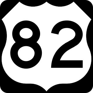
U.S. Route 82 (US 82) is a 232-mile-long (373 km) U.S. Highway in the U.S. state of Georgia. It travels from the Chattahoochee River at Georgetown to its eastern terminus southwest of Brunswick. It travels through such cities as Cuthbert, Dawson, Albany, Sylvester, Tifton, Pearson, Waycross, and Nahunta before reaching its eastern terminus.

U.S. Route 25 (US 25) is a U.S. Highway that travels from Brunswick, Georgia to the Kentucky-Ohio state line, where Covington, Kentucky meets Cincinnati, Ohio at the Ohio River. In the U.S. state of Georgia, US 25 is as a 190.0-mile-long (305.8 km) highway that travels south to north in the eastern part of the state, near the Atlantic Ocean, serving Brunswick, Statesboro, and Augusta on its path from Brunswick to South Carolina at the Savannah River. Its routing travels through portions of Glynn, Wayne, Long, Tattnall, Evans, Bulloch, Jenkins, Burke, and Richmond counties.

State Route 99 (SR 99) is a 38.9-mile-long (62.6 km) state highway that travels south-to-north through portions of Glynn and McIntosh counties in the southeastern part of the U.S. state of Georgia. The highway begins at its southern terminus at US 82/SR 520 southwest of Sterling to its northern terminus at I-95 and SR 57 in Eulonia. The Ridge in Ridgeville on SR 99 is listed on the National Register of Historic Places.

U.S. Route 301 (US 301) is a 170-mile-long (270 km) U.S. Highway in the U.S. state of Georgia. It travels south-to-north from the St. Marys River south-southeast of Folkston to the Savannah River north-northeast of Sylvania, via Jesup, Ludowici, Glennville, Claxton, Statesboro, and Sylvania.
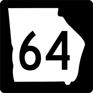
State Route 64 (SR 64) is a 45.9-mile-long (73.9 km) state highway that travels southwest-to-northeast through portions of Berrien, Lanier, Atkinson, and Coffee counties in the south-central part of the U.S. state of Georgia. The highway connects Ray City with Wilsonville, via Pearson.
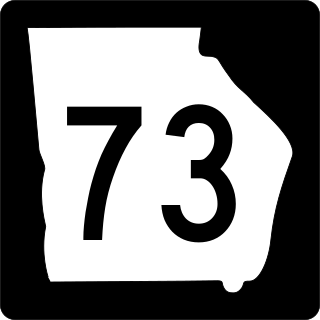
State Route 73 (SR 73) is a 78.1-mile-long (125.7 km) state highway in the eastern part of the U.S. state of Georgia. It connects Glennville with the South Carolina state line, via Claxton, Statesboro, Dover, and Sylvania. Except for a brief portion in the Sylvania area, it is completely concurrent with U.S. Route 301 (US 301). Its southern terminus is at US 25/US 301/SR 23/SR 57 and SR 144 in Glennville. Its northern terminus is at the South Carolina state line, east of Millhaven, where US 301 enters that state.
Aimar is an unincorporated community in northeastern Long County, Georgia, United States, located on U.S. Route 84 between the cities of Ludowici to the southwest and Walthourville to the northeast. Its elevation is 79 feet (24 m).