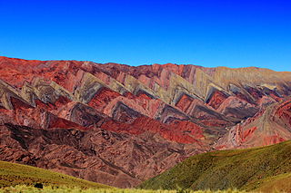
Jujuy is a province of Argentina, located in the extreme northwest of the country, at the borders with Chile and Bolivia. The only neighboring Argentine province is Salta to the east and south.

Salta is a province of Argentina, located in the northwest of the country. Neighboring provinces are from the east clockwise Formosa, Chaco, Santiago del Estero, Tucumán and Catamarca. It also surrounds Jujuy. To the north it borders Bolivia and Paraguay and to the west lies Chile.

Salta is the capital and largest city in the Argentine province of the same name. With a population of 618,375 according to the 2010 census, it is also the 7th most-populous city in Argentina. The city serves as the cultural and economic center of the Valle de Lerma Metropolitan Area, which is home to over 50.9% of the population of Salta Province and also includes the municipalities of La Caldera, Vaqueros, Campo Quijano, Rosario de Lerma, Cerrillos, La Merced and San Lorenzo. Salta is the seat of the Capital Department, the most populous department in the province.

James Ross Island is a large island off the southeast side and near the northeastern extremity of the Antarctic Peninsula, from which it is separated by Prince Gustav Channel. Rising to 1,630 metres (5,350 ft), it is irregularly shaped and extends 40 nautical miles in a north–south direction.
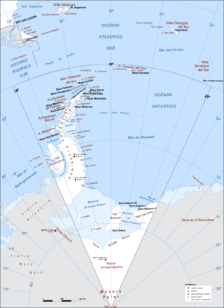
Argentine Antarctica is an area on Antarctica claimed by Argentina as part of its national territory. It consists of the Antarctic Peninsula and a triangular section extending to the South Pole, delimited by the 25° West and 74° West meridians and the 60° South parallel. This region overlaps with British and Chilean claims in Antarctica. None of these claims have widespread international recognition.

The Bermejo River is a river in South America that flows from Bolivia to the Paraguay River in Argentina. The river is generally called Bermejo in spite of its different names along its way, but it also has its own Native American names; in Wichí it is called Teuco, and in Guaraní it is called Ypitá. In the plains of Argentina's Gran Chaco the Bermejo forms wetlands and splits into two branches. The southern branch is the bed of the old Bermejo River, now an intermittent stream called Río Bermejito. The northern branch is now the main stem of the Bermejo and is called the Teuco River, Bermejo Nuevo, or simply the Bermejo River. The two branches rejoin at 25°39′S60°11′W, near Villa Río Bermejito, forming the Lower Bermejo River.

The Tren a las Nubes is a tourist train service in Salta Province, Argentina. The service runs along the eastern part of the Salta–Antofagasta railway line of the Belgrano Railway that connects the Argentine Northwest with the border in the Andes mountain range, over 4,220 metres (13,850 ft) above mean sea level, the fifth highest railway in the world. Originally built for economic and social reasons, it is now primarily of interest to tourists as a heritage railway, though cheaper tickets are also available for locals to use the train as transport.
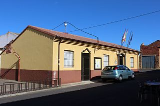
Cubillas de los Oteros is a municipality located in the province of León, Castile and León, Spain. According to the 2010 census (INE), the municipality has a population of 167 inhabitants.

Aguas Blancas (Salta) is a village and rural municipality in Salta Province in northwestern Argentina. It is a city in the Oran department, located northeast of the province of Salta, Argentina. Aguas Blancas is located on the right bank of the Bermejo River, which forms a natural boundary between Argentina and Bolivia. The city Bermejo, Bolivia is on the opposite bank of the river.
Campichuelo is a village and rural municipality in Salta Province in northwestern Argentina.

Los Toldos (Salta) is a village and rural municipality in Salta Province in northwestern Argentina.
Luis Burela is a village and rural municipality in Salta Province in northwestern Argentina.
Macapillo is a village and rural municipality in Salta Province in northwestern Argentina.
Misión Tierras Fiscales is a village and rural municipality in Salta Province in northwestern Argentina.
San José de Orquera is a village and rural municipality in Salta Province in northwestern Argentina.

El Galpón (Salta) is a town and municipality in Salta Province in northwestern Argentina.
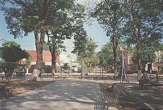
Embarcación (Salta) is a town and municipality in Salta Province in northwestern Argentina.
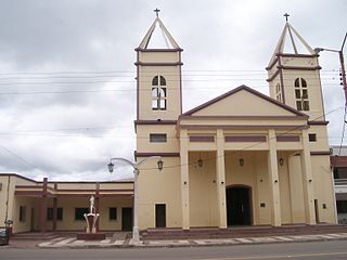
Joaquín Victor González is a town and municipality in Salta Province in northwestern Argentina. It is located in and is the capital of Anta Department. It was founded as Laguna Blanca but changed to be named after Joaquin V. Gonzalez after a railroad was built in the area. Its industries are manufacturing of wood-based goods. Its population is 21,045 with 10,567 men and 10,478 women.

Iruya is a department is located in the north of Salta Province in northwest Argentina in the high altitude basin of the Bermejo River. It is one of 23 administrative units in the province.


