Cuadros is a municipality located in the province of León, Castile and León, Spain. According to the 2010 census (INE), the municipality has a population of 1,980 inhabitants.

Moreruela de los Infanzones is a municipality located in the province of Zamora, Castile and León, Spain. According to the 2004 census (INE), the municipality had a population of 429 inhabitants.
Pejuçara is a municipality in the state of Rio Grande do Sul, Brazil. As of 2020, the estimated population was 3,857.
Ambanjabe is a town and commune in Madagascar. It belongs to the district of Boriziny, which is a part of Sofia Region. The population of the commune was estimated to be approximately 8,000 in 2001 commune census.

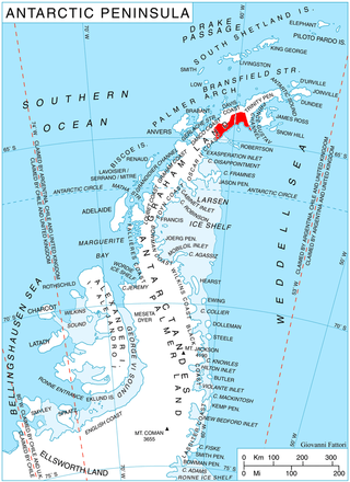
Albone Glacier is a deeply entrenched narrow glacier on the east side of Wolseley Buttress flowing southward from Detroit Plateau on Nordenskjöld Coast in Graham Land, Antarctica.
Sadabe is a town and commune in Madagascar. It belongs to the district of Manjakandriana, which is a part of Analamanga Region. The population of the commune was estimated to be approximately 17,000 in 2001 commune census.
Buckenbowra River, a perennial river of the Clyde River catchment, is located in the upper ranges of the South Coast region of New South Wales, Australia.
Ciervo Petiso is a village and municipality in Chaco Province in northern Argentina.

Fuerza Aérea Glacier is a glacier on Greenwich Island in the South Shetland Islands, Antarctica, extending 4.5 kilometres (2.8 mi) in a northeast–southwest direction and 2 kilometres (1.2 mi) in a southeast–northwest direction and draining the northwest slopes of the Breznik Heights to flow northwestwards into Discovery Bay.

Blades Glacier is a glacier flowing east from the snow-covered saddle just north of La Gorce Peak, Alexandra Mountains. It merges with Dalton Glacier on the north side of Edward VII Peninsula. It was mapped by the United States Geological Survey from surveys and from U.S. Navy air photos, 1959–65, and named by the Advisory Committee on Antarctic Names for William Robert Blades who served as navigator during U.S. Navy Operation Highjump (1946–47) and Operation Deep Freeze (1955–59).
Usnea Ridge is a ridge at an elevation of 100–160 m, extending north-northwest from Jane Peak to Spindrift Col in central Signy Island, South Orkney Islands. This ridge was an ecological study site for British Antarctic Survey (BAS) biologists. Named by the United Kingdom Antarctic Place-Names Committee (UK-APC) in 1991 after lichens of the genus Usnea, which form a main element of the plant life on the ridge.

Cheal Point is a rocky headland 2 km (1.2 mi) east-south-east of Return Point, the south-western extremity of Coronation Island, in the South Orkney Islands of Antarctica.
Jane Col is a col to the west of Jane Peak at the head of Limestone Valley on Signy Island in the South Orkney Islands. It was named in association with Jane Peak by the UK Antarctic Place-Names Committee.
Pecora Escarpment is an irregular escarpment, 7 nautical miles (13 km) long, standing 35 nautical miles (60 km) southwest of Patuxent Range and marking the southernmost exposed rocks of the Pensacola Mountains. Mapped by United States Geological Survey (USGS) from surveys and U.S. Navy air photos, 1956–66. Named by Dwight Schmidt, geologist to the Pensacola Mountains, 1962–66, for William T. Pecora, eighth director of the U.S. Geological Survey, 1965–71.
Morelli Glacier is a glacier in the western part of King Peninsula, Antarctica, 18 nautical miles (33 km) southeast of Cape Waite, draining northeast to Abbot Ice Shelf in Peacock Sound. It was mapped by the United States Geological Survey from surveys and U.S. Navy air photos, 1960–66, and was named by the Advisory Committee on Antarctic Names for Panfilo S. Morelli, a glaciologist at Byrd Station in 1961–62.

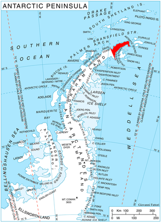
Sjogren Glacier is a glacier 12.5 miles (20 km) long in the south part of Trinity Peninsula, flowing southeast from Detroit Plateau in between Aldomir Ridge and Hazarbasanov Ridge to enter Prince Gustav Channel at the head of Sjögren Inlet, west of Royak Point. Discovered in 1903 by the Swedish Antarctic Expedition under Nordenskjold. He named it Sjogren Fiord after a patron of the expedition. The true nature of the feature was determined by the Falkland Islands Dependencies Survey (FIDS) in 1945.

Telen Glacier is a glacier flowing to the east side of Lutzow-Holm Bay between Telen Hill and Kjuka Headland. Mapped from air photos and surveys by Japanese Antarctic Research Expedition (JARE), 1957–62, and named after nearby Telen Hill.

Sapiranga is a city in Brazil in the state of Rio Grande do Sul with a population of roughly 80,000 inhabitants. It is located in an industrial area called "Vale dos Sinos", by the Rio dos Sinos. The town's economy relies heavily on the shoe industry. Other industries are present, but mostly linked to the shoe manufacturing process, such as metallurgic plants in which machinery is built to later be employed in the production of shoes.


