The City of Chihuahua, Chihuahua, Mexico is divided mainly into areas called Colonias, which incorporate residential and commercial elements.
Small general stores called abarrotes, which are 'Mom-and-Pop' operations, may be found in most neighbourhoods, along with other small businesses. Industry, which was once found in the colonias as well, is now moving to the industrial parks in the city.
The list of colonias in Chihuahua City:
Josefa Ortiz de Dominguez
Independencia
Aeropuerto
Alamedas
Bellavista
Cafetales
Campanario
Campesina
Campobello
Centro
Chihuahua 2000
Club Campestre
Cumbres
Diego Lucero
Granjas
Guadalupe
Industrial
Lomas del Santuario
Marmol
Martin Lopez
Mirador
Nombre de Dios
Pacifico
Panamericana
Paseos de Chihuahua
Ponce de Leon
Pinos
Quintas Carolinas
Quintas del Sol
Quintas Quijote
Rosario
San Felipe Viejo
San Felipe y Parques de San Felipe
San Francisco
San Jose Y Ampliación
San Miguel
San Rafael
Santa Rita
Santa Rosa
Santo Niño
Saucito
Tecnológico
Tierra y Libertad
Villa
Zootecnia
This list is in alphabetical order. It does not include the new subdivisions, gated communities or fraccionamientos that are now a part of the landscape of the city.
Related Research Articles
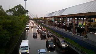
San Pedro Sula is the capital of Cortés Department, Honduras. It is located in the northwest corner of the country in the Sula Valley, about 50 kilometers south of Puerto Cortés on the Caribbean Sea. With a population of 701,200 in the central urban area and a population of 1,445,598 in its metropolitan area in 2023, it is the nation's primary industrial center and second largest city after the capital Tegucigalpa, and the largest city in Central America that is not a capital city.
The city of Chihuahua or Chihuahua City is the state capital of the Mexican state of Chihuahua. As of 2020, the city of Chihuahua had a population of 925,762 inhabitants. while the metropolitan area had a population of 988,065 inhabitants.
Durango, officially named Estado Libre y Soberano de Durango, is one of the 31 states which make up the 32 Federal Entities of Mexico, situated in the northwest portion of the country. With a population of 1,832,650, the 8th lowest of Mexico's states, Durango has Mexico's second-lowest population density, after Baja California Sur. The capital city, Victoria de Durango, is named after the first President of Mexico, Guadalupe Victoria.
Coyoacán is a borough in Mexico City. The former village is now the borough's "historic center". The name comes from Nahuatl and most likely means "place of coyotes", when the Aztecs named a pre-Hispanic village on the southern shore of Lake Texcoco dominated by the Tepanec people. Against Aztec domination, these people allied with the Spanish, who used the area as a headquarters during the Spanish conquest of the Aztec Empire and made it the first capital of New Spain between 1521 and 1523.
Azcapotzalco is a borough in Mexico City. Azcapotzalco is in the northwestern part of Mexico City.
Iztacalco is a borough in Mexico City. It is located in the central-eastern area and it is the smallest of the city's boroughs. The area's history began in 1309 when the island of Iztacalco, in what was Lake Texcoco, was settled in 1309 by the Mexica who would later found Tenochtitlan, according to the Codex Xolotl. The island community would remain small and isolated through the colonial period, but drainage projects in the Valley of Mexico dried up the lake around it. The area was transformed into a maze of small communities, artificial islands called chinampas and solid farmland divided by canals up until the first half of the 20th century. Politically, the area has been reorganized several times, being first incorporated in 1862 and the modern borough coming into existence in 1929. Today, all of the canals and farmland are dried out and urbanized as the most densely populated borough and the second most industrialized.
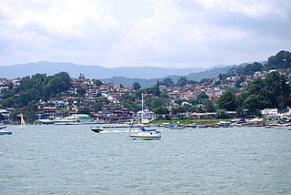
Valle de Bravo is one of 125 municipalities in the State of Mexico, Mexico. The largest town and municipal seat is the town of Valle de Bravo. It is located on the shore of Lake Avándaro, approximately 156 km southwest of Mexico City and west of Toluca on highways 15, 134 or 1. It takes about two hours to drive from Mexico City to Valle de Bravo, making it a popular weekend getaway for the capital's affluent upper class.
Santa María Jalapa del Marqués is a small city and a municipiality in the Mexican state of Oaxaca. They are both part of the Tehuantepec District in the west of the Istmo Region.
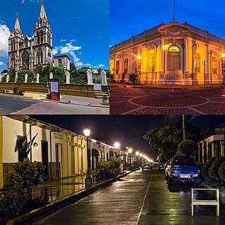
Santa Tecla is a city and a municipality in the La Libertad department of El Salvador. It is the capital of the department of La Libertad.
El Camino Real de Tierra Adentro, also known as the Silver Route, was a Spanish 2,560-kilometre-long (1,590 mi) road between Mexico City and San Juan Pueblo, New Mexico, that was used from 1598 to 1882. It was the northernmost of the four major "royal roads" that linked Mexico City to its major tributaries during and after the Spanish colonial era.
San Juan Bautista Tuxtepec, or simply referred to as Tuxtepec, is the head of the municipality by the same name and is the second most populous city of the Mexican state of Oaxaca. It is part of the Tuxtepec District of the Papaloapan Region. As of the 2020 census, the city is home to a population of 103,609 and 159,452 in the municipality, though census data are often under reported for various reasons.
Colonia Santa María la Ribera is a colonia located in the Cuauhtémoc borough of Mexico City, just west of the historic center. It was created in the late 19th century for the affluent who wanted homes outside of the city limits. The colonia reached its height between 1910 and 1930. In the 1930s, the middle class moved in and a new era of construction began. The colonia began to deteriorate in the 1950s, as the city grew around it and apartment buildings were constructed. Since the 1985 Mexico City earthquake, poorer residents have moved in and economic housing has been constructed. Today, the colonia is a mix of old mansions and homes, small shops and businesses, tenements and abandoned buildings. The colonia has one major park and two museums. This area was designated as a "Barrio Mágico" by the city in 2011.
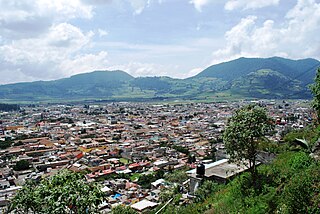
The municipality of Tenango del Valle is located in the southern portion of the Valley of Toluca in Mexico State, about 72 km southwest of Mexico City and 25 km south of Toluca. The municipal seat is the city of Tenango de Arista. While the seat is officially named Tenango de Arista, it is more commonly referred to as Tenango del Valle, as this was the original name of the town. Tenango del Valle is best known as the site of the Teotenango archeological site, which was a walled city inhabited from about 900 C.E. to 1550 C.E.
Jiquipilco Municipality is one of the municipalities of the State of Mexico in Mexico. It is north of the Toluca Valley, part of the region consisting of the southern and western slopes of Cerro La Catedral, which has a concentration of speakers of the Otomi language. It is about 40 km from Toluca, the state capital. The name is a corruption of Nahuatl “Xiquipilco”, meaning “in the saddlebags”. Jiquipilco is situated on the transversal volcanic axis that crosses Mexico in an area surrounded by lakes and volcanoes. This portion is called "Anahuac”.
Ixtlahuaca de Rayón is the municipal seat and 5th largest city in the municipality of Ixtlahuaca north of Toluca in the northwest part of the State of Mexico, in Mexico. The distance between Mexico City and Ixtlahuaca is 32 km. The name Ixthahuaca comes from Náhuatl and means plains without trees. The city and municipality were officially established by decree on November 14, 1816 by the Congress of the State of Mexico.
Chihuahua, officially the Estado Libre y Soberano de Chihuahua, is one of the 31 states which, along with Mexico City, comprise the 32 federal entities of Mexico. It is located in the northwestern part of Mexico and is bordered by the states of Sonora to the west, Sinaloa to the southwest, Durango to the south, and Coahuila to the east. To the north and northeast, it shares an extensive border with the U.S. adjacent to the U.S. states of New Mexico and Texas. The state was named after its capital city, Chihuahua City; the largest city is Ciudad Juárez.
Colonia Guerrero is a colonia of Mexico City located just north-northwest of the historic center. Its borders are formed by Ricardo Flores Magón to the north, Eje Central Lazaro Cardenas and Paseo de la Reforma to the east, Eje1 Poniente Guerrero to the west and Avenida Hidalgo to the south. The colonia has a long history, beginning as an indigenous neighborhood in the colonial period called Cuepopan. The origins of the modern colonia begin in the first half of the 19th century, but most of its development occurred as a residential area in the late 19th and early 20th. Over the 20th century, several rail lines and major arteries were built through here, changing its character Cuauhtémoc borough. It is home to two early colonial era churches, the Franz Mayer Museum and one Neo-Gothic church from the Porfirian era.
Colonia Morelos is a colonia located just north of the historic center of Mexico City in the Cuauhtémoc borough. It has been a poor area since Aztec times, with many residents today living in large tenements called vecindades. The area, particularly the Tepito neighborhood, is known for crime, especially the sale of stolen merchandise and drugs. It is home to the very large Tepito tianguis or market, and also has two major places of worship dedicated to Santa Muerte.
The following is a timeline of the history of the city of Chihuahua, Mexico.
This page is based on this Wikipedia article Text is available under the CC BY-SA 4.0 license; additional terms may apply. Images, videos and audio are available under their respective licenses.