Related Research Articles
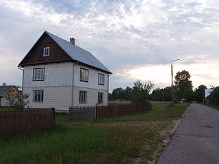
Osieczyna is a settlement, part of the village of Godków, in the administrative district of Gmina Kostomłoty, within Środa Śląska County, Lower Silesian Voivodeship, in south-western Poland.
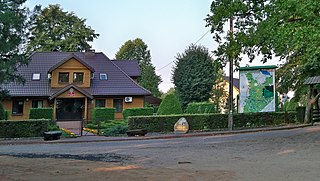
Korea is a part of the village of Sobienie Szlacheckie, in Gmina Sobienie-Jeziory, Otwock County, Masovian Voivodeship in central Poland.

Wirek is a district in the centre of Ruda Śląska, Silesian Voivodeship, southern Poland. In 2006 it had an area of 5.9 km2 and was inhabited by 20,595 people. On January 12, 2006 a part of it was split off to form a new district, Czarny Las.

Grzybno is a village in the administrative district of Gmina Unisław, within Chełmno County, Kuyavian-Pomeranian Voivodeship, in north-central Poland. It lies 20 kilometres (12 mi) south of Chełmno, 22 km (14 mi) north-west of Toruń, and 31 km (19 mi) east of Bydgoszcz.
Kurzebiela is a settlement, part of the village of Łąkie, in the administrative district of Gmina Strzelno, within Mogilno County, Kuyavian-Pomeranian Voivodeship, in north-central Poland. It lies approximately 3 kilometres (2 mi) south-west of Strzelno, 15 km (9 mi) east of Mogilno, 57 km (35 mi) south-west of Toruń, and 57 km (35 mi) south of Bydgoszcz.
Gruszki is a settlement, part of the village of Guszczewina, in the administrative district of Gmina Narewka, within Hajnówka County, Podlaskie Voivodeship, in north-eastern Poland, close to the border with Belarus. It lies approximately 3 kilometres (2 mi) east of Narewka, 19 km (12 mi) north-east of Hajnówka, and 54 km (34 mi) south-east of the regional capital Białystok.
Guszczewina is a village in the administrative district of Gmina Narewka, within Hajnówka County, Podlaskie Voivodeship, in north-eastern Poland, close to the border with Belarus. It lies approximately 3 kilometres (2 mi) east of Narewka, 19 km (12 mi) north-east of Hajnówka, and 53 km (33 mi) south-east of the regional capital Białystok.
Kolonia Bogoria is a village in the administrative district of Gmina Bogoria, within Staszów County, Świętokrzyskie Voivodeship, in south-central Poland. It lies approximately 4 kilometres (2 mi) south-west of Bogoria, 9 km (6 mi) north-east of Staszów, and 52 km (32 mi) south-east of the regional capital Kielce.
Miechucińskie Chrósty was a settlement in the administrative district of Gmina Kolbudy, within Gdańsk County, Pomeranian Voivodeship, in northern Poland. It lay approximately 3 kilometres (2 mi) south-east of Kolbudy, 10 km (6 mi) west of Pruszcz Gdański, and 16 km (10 mi) south-west of the regional capital Gdańsk. The village was officially dissolved in 2015.
Trzepowo is a village in the administrative district of Gmina Przywidz, within Gdańsk County, Pomeranian Voivodeship, in northern Poland. It lies approximately 5 kilometres (3 mi) south-west of Przywidz, 26 km (16 mi) south-west of Pruszcz Gdański, and 32 km (20 mi) south-west of the regional capital Gdańsk. It is located within the historic region of Pomerania.

Nowe Polaszki is a village in the administrative district of Gmina Stara Kiszewa, within Kościerzyna County, Pomeranian Voivodeship, in northern Poland. It lies approximately 6 kilometres (4 mi) north-west of Stara Kiszewa, 14 km (9 mi) south-east of Kościerzyna, and 50 km (31 mi) south-west of the regional capital Gdańsk. It is located within the historic region of Pomerania.

Wda is a village in the administrative district of Gmina Lubichowo, within Starogard County, Pomeranian Voivodeship, in northern Poland. It lies approximately 9 kilometres (6 mi) south of Lubichowo, 22 km (14 mi) south-west of Starogard Gdański, and 66 km (41 mi) south of the regional capital Gdańsk. It is located within the ethnocultural region of Kociewie in the historic region of Pomerania.
Nygut is a settlement in the administrative district of Gmina Skarszewy, within Starogard County, Pomeranian Voivodeship, in northern Poland. It lies approximately 3 kilometres (2 mi) east of Skarszewy, 12 km (7 mi) north of Starogard Gdański, and 35 km (22 mi) south of the regional capital Gdańsk. Is it considered part of the village of Bolesławowo. It is located within the ethnocultural region of Kociewie in the historic region of Pomerania.
Szczodrowo is a village in the administrative district of Gmina Skarszewy, within Starogard County, Pomeranian Voivodeship, in northern Poland. It lies approximately 7 kilometres (4 mi) north-west of Skarszewy, 19 km (12 mi) north-west of Starogard Gdański, and 35 km (22 mi) south-west of the regional capital Gdańsk. It is located within the ethnocultural region of Kociewie in the historic region of Pomerania.

Międzyłęż is a village in the administrative district of Gmina Pelplin, within Tczew County, Pomeranian Voivodeship, in northern Poland. It lies approximately 10 kilometres (6 mi) east of Pelplin, 19 km (12 mi) south-east of Tczew, and 49 km (30 mi) south of the regional capital Gdańsk. It is located within the ethnocultural region of Kociewie in the historic region of Pomerania.
Kikoły is a settlement part of the village of Kadyny, in the administrative district of Gmina Tolkmicko, within Elbląg County, Warmian-Masurian Voivodeship, in northern Poland. It lies approximately 3 kilometres (2 mi) south-west of Tolkmicko, 25 km (16 mi) north of Elbląg, and 88 km (55 mi) north-west of the regional capital Olsztyn..
Ostrogóra is a settlement part of the village of Kadyny, in the administrative district of Gmina Tolkmicko, within Elbląg County, Warmian-Masurian Voivodeship, in northern Poland. It lies approximately 6 kilometres (4 mi) south-west of Tolkmicko, 22 km (14 mi) north of Elbląg, and 86 km (53 mi) north-west of the regional capital Olsztyn.
Lasek is a Polish forest hamlet in Gmina Łuków, Łuków County, Lublin Voivodeship.

National road 68 is a main road of accelerated traffic belonging to the Polish national road network. The length of the route is 11.4 kilometres (7.1 mi), of which 5.197 kilometres (3.229 mi) is maintained by General Directorate for National Roads and Highways. The highway connects the Kukuryki border crossing on Belarus–Poland border with national road 2 in Wólka Dobryńska. It runs entirely in Lublin Voivodeship, in Biała County. According to signage, national road 68 is a component of European highway E30.
Mędzisko is a settlement in the administrative district of Gmina Obrzycko, within Szamotuły County, Greater Poland Voivodeship, in west-central Poland.
References
| | This law-related article is a stub. You can help Wikipedia by expanding it. |
| | This Poland-related article is a stub. You can help Wikipedia by expanding it. |