
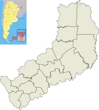
Misiones is one of the 23 provinces of Argentina, located in the northeastern corner of the country in the Mesopotamia region. It is surrounded by Paraguay to the northwest, Brazil to the north, east and south, and Corrientes Province of Argentina to the southwest.

Argentina is divided into twenty-three federated states called provinces and one called the autonomous city of Buenos Aires, which is the federal capital of the republic as decided by the Argentine Congress. The provinces and the capital have their own constitutions and exist under a federal system.
The Iguazú National Park is a national park of Argentina, located in the Iguazú Department, in the north of the province of Misiones, Argentine Mesopotamia. It has an area of 677 km2 (261 sq mi).
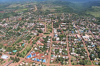
Bernardo de Irigoyen is a city in the province of Misiones, Argentina. It has 10,889 inhabitants as per the 2001 census [INDEC], and is the head town of the General Manuel Belgrano Department. It carries the name of prominent politician and diplomat Bernardo de Irigoyen.
San Antonio is a city in the north-eastern region of Misiones Province, Argentina, and the capital of the General Manuel Belgrano Department. It lies on the Brazilian border at 26°3′S53°43′W. Its population was 3,665 at the 2010 census (INDEC).
9 de Julio (Misiones) is a village and municipality in Misiones Province in north-eastern Argentina. The municipality is located in the department of Eldorado, bordered by the municipalities of Eldorado, Santiago de Liniers and Colonia Victoria in the same department, and the municipality of Puerto Piray in the Montecarlo department.
Alba Posse is a village and municipality in Misiones Province in north-eastern Argentina.
Aristóbulo del Valle (Misiones) is a village and municipality in Misiones Province in north-eastern Argentina.

Azara is a village and municipality in Misiones Province in north-eastern Argentina. It is considered an agricultural colony, having about 230 km2. The municipality is located in the Apóstoles department, bordered by the municipalities of Apóstoles and Tres Capones in the same department, by the Sierra de Concepción in the Concepción Department and by the province of Corrientes.

Cerro Azul is a village and municipality in Misiones Province in north-eastern Argentina.

El Soberbio is a village and municipality in Misiones Province in northeastern Argentina. It contains the 25,690 hectares Papel Misionero Natural Cultural Reserve, created in 1994.

Garupá is a village and municipality in Misiones Province in north-eastern Argentina. It takes part of the Great Posadas, and most of the population works in the provincial capital.

Jardín América is a village and municipality of Misiones Province in north-eastern Argentina. It is not the head city of the San Ignacio department, however, it is the largest city in the department. It is located 1,141 km north of Buenos Aires and 104 km from Posadas, on the eastern shore of the Paraná River.
San Pedro (Misiones) is a village and municipality in Misiones Province in north-eastern Argentina.
The Urugua-í Provincial Park is a Provincial park in the Misiones Province in the northeast of Argentina. It protects an area of Alto Paraná Atlantic forests in the upper basin of the Urugua-í River.
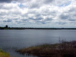
The Urugua-í River is a river in the Misiones Province of Argentina. It is a tributary of the Paraná River.
Pasipha atla is a species of land planarian belonging to the subfamily Geoplaninae. It is found within Argentina.
Pasipha johnsoni is a species of land planarian belonging to the subfamily Geoplaninae. It is found within Argentina.

Luis María Cassoni was an Argentine politician and pharmacist. He belonged to the Radical Civic Union (UCR) and served as Governor of Misiones Province between September and December 1987.


