
South Africa occupies the southern tip of Africa, its coastline stretching more than 2,850 kilometres from the desert border with Namibia on the Atlantic (western) coast southwards around the tip of Africa and then northeast to the border with Mozambique on the Indian Ocean. The low-lying coastal zone is narrow for much of that distance, soon giving way to a mountainous escarpment that separates the coast from the high inland plateau. In some places, notably the province of KwaZulu-Natal in the east, a greater distance separates the coast from the escarpment. Although most of the country is classified as semi-arid, it has considerable variation in climate as well as topography.
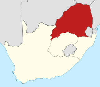
The Province of the Transvaal, commonly referred to as the Transvaal, was a province of South Africa from 1910 until the end of apartheid in 1994, when a new constitution subdivided it. The name "Transvaal" refers to the province's geographical location to the north of the Vaal River. Its capital was Pretoria, which was also the country's executive capital.

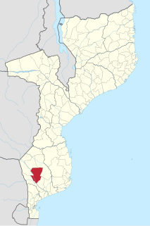
Gaza is a province of Mozambique. It has an area of 75,709 km2 and a population of 1,446,654.

Great Limpopo Transfrontier Park is a 35,000 km² peace park that is in the process of being formed. It will link the Limpopo National Park in Mozambique, Kruger National Park in South Africa, Gonarezhou National Park, Manjinji Pan Sanctuary and Malipati Safari Area in Zimbabwe, as well as the area between Kruger and Gonarezhou, the Sengwe communal land in Zimbabwe and the Makuleke region in South Africa.
The Limpopo National Park was born when the status of Coutada 16 Wildlife Utilisation Area in Gaza Province, Mozambique, was changed from a hunting concession to a protected area. It forms part of the Great Limpopo Transfrontier Park with the Kruger National Park in South Africa and the Gonarezhou National Park in Zimbabwe.

Bethal is a farming town in Mpumalanga, South Africa. The farms in the region produce maize, sunflower seeds, sorghum, rye and potatoes. The town lies 155 km east of Johannesburg.

Xai-Xai is a city in the south of Mozambique. Until 1975, the city was named João Belo. It is the capital of Gaza Province. As of 2007 it has a population of 116,343.

Cyclone Leon–Eline was the longest-lived Indian Ocean tropical cyclone on record, traveling over 11,000 km (6,800 mi) during its 29‑day duration. It formed on February 1, 2000, in the Australian basin as Tropical Cyclone Leon. After crossing 90° E, the Météo-France office in Réunion (MFR) began tracking the system as Tropical Storm Eline on February 8. Late on February 17, Eline made landfall near Mahanoro, Madagascar, with 10‑minute winds of 165 km/h (103 mph). The storm rapidly weakened over land, but restrengthened in the Mozambique Channel to reach peak 10‑minute winds of 185 km/h (115 mph). On February 22, Eline made landfall about 80 km (50 mi) south of Beira, Mozambique, near peak intensity, and quickly weakened over land. The well-defined circulation moved across Southern Africa, finally dissipating over eastern Namibia on February 29.

Mopani is one of the 5 districts of Limpopo province of South Africa. The seat of Mopani is Giyani. According to the 2016 Community Survey it has a population of 1,159,185, of whom the majority speak Tsonga or Northern Sotho. The district code is DC33. After the 12th amendment of the Constitution of South Africa part of the area of the Bohlabela district was incorporated into Mopani.
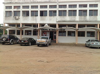
Chokwé, and earlier known as Vila Trigo de Morais, is a rural town and capital of Chokwe District in the province of Gaza in Mozambique. It is located about 230 kilometres (140 mi) north of the capital city of Maputo. This agricultural town is noted for its tomatoes.
Chókwè District is a district of Gaza Province in south-western Mozambique. Its principal town is Chokwe. The district is located in the south of the province, and borders with Mabalane District in the north, Guijá District in the east, Chibuto, Xai-Xai, and Bilene Macia Districts in the southeast, Magude District of Maputo Province in the south, and with Massingir District in the west. The area of the district is 2,466 square kilometres (952 sq mi). It has a population of 187,422 (2007).

Macarretane is a town in southern Mozambique.
Mapai is a small town in southern Mozambique. It is a semi-arid region, with a dry climate and vegetation dominated by mopane and galleries of ironwood.
Mabalane is a town in Mozambique located on the Limpopo River. There was a prison camp and garrison at Mabalane during the revolution.

Chicualacuala District is a district of Gaza Province in south-western Mozambique. It has a population of 41,638 (2011) and covers 18,155 square kilometres (7,010 sq mi). The population density of Chicualacuala District 2.1 residents per square kilometers, significantly lower than the average of 17.5 in Gaza Province.
Mabalane District is a district of Gaza Province in south-western Mozambique. The administrative center of the district is Mabalane. The district is located at the center of the province, and borders with Chicualacuala District in the north, Chigubo District in the east, Guijá District in the southeast, Chókwè District in the south, and with Massingir District in the west. The area of the district is 9,107 square kilometres (3,516 sq mi). It has a population of 32,040 (2007).
Railway stations in Mozambique include:

Alaena amazoula, the yellow Zulu, is a butterfly of the family Lycaenidae. It is found in southern Africa.
Iolaus silarus, the straight-line sapphire, is a butterfly of the family Lycaenidae. It is found in Mozambique, Zimbabwe, Botswana, Namibia, Malawi, Zambia, southern Zaire, Tanzania, south-western Kenya and South Africa. In South Africa it is found in wooded savannah in northern KwaZulu-Natal and in savannah from Swaziland to Mpumalanga, Limpopo and North West. It is also present in Afromontane forest on the Wolkberg and the northern Drakensberg.


