
A geographic information system (GIS) consists of integrated computer hardware and software that store, manage, analyze, edit, output, and visualize geographic data. Much of this often happens within a spatial database, however, this is not essential to meet the definition of a GIS. In a broader sense, one may consider such a system also to include human users and support staff, procedures and workflows, the body of knowledge of relevant concepts and methods, and institutional organizations.

Environmental Systems Research Institute, Inc., doing business as Esri, is an American multinational geographic information system (GIS) software company headquartered in Redlands, California. It is best known for its ArcGIS products. With a 40% market share, Esri is the world's leading supplier of GIS software, web GIS and geodatabase management applications.
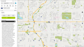
MapQuest is an American free online web mapping service. It was launched in 1996 as the first commercial web mapping service. MapQuest vies for market share with competitors such as Apple Maps, Here and Google Maps.
Google Toolbar was a web browser toolbar for Internet Explorer, developed by Google. It was first released in 2000 for Internet Explorer 5. Google Toolbar was also distributed as a Mozilla plug-in for Firefox from September 2005 to June 2011. On December 12, 2021, the software was no longer available for download, and the website now redirects to a support page.
Animated mapping is the application of animation, either a computer or video, to add a temporal component to a map displaying change in some dimension. Most commonly the change is shown over time, generally at a greatly changed scale. An example would be the animation produced after the 2004 tsunami showing how the waves spread across the Indian Ocean.

An automotive navigation system is part of the automobile controls or a third party add-on used to find direction in an automobile. It typically uses a satellite navigation device to get its position data which is then correlated to a position on a road. When directions are needed routing can be calculated. On the fly traffic information can be used to adjust the route.
A GIS software program is a computer program to support the use of a geographic information system, providing the ability to create, store, manage, query, analyze, and visualize geographic data, that is, data representing phenomena for which location is important. The GIS software industry encompasses a broad range of commercial and open-source products that provide some or all of these capabilities within various information technology architectures.
Geovisualization or geovisualisation, also known as cartographic visualization, refers to a set of tools and techniques supporting the analysis of geospatial data through the use of interactive visualization.
The Windows Metafile vulnerability—also called the Metafile Image Code Execution and abbreviated MICE—is a security vulnerability in the way some versions of the Microsoft Windows operating system handled images in the Windows Metafile format. It permits arbitrary code to be executed on affected computers without the permission of their users. It was discovered on December 27, 2005, and the first reports of affected computers were announced within 24 hours. Microsoft released a high-priority update to eliminate this vulnerability via Windows Update on January 5, 2006. Attacks using this vulnerability are known as WMF exploits.
Digital Earth is the name given to a concept by former US vice president Al Gore in 1998, describing a virtual representation of the Earth that is georeferenced and connected to the world's digital knowledge archives.

The International Cartographic Association (ICA) is an organization formed of national member organizations, to provide a forum for issues and techniques in cartography and geographic information science (GIScience). ICA was founded on June 9, 1959, in Bern, Switzerland. The first General Assembly was held in Paris in 1961. The mission of the International Cartographic Association is to promote the disciplines and professions of cartography and GIScience in an international context. To achieve these aims, the ICA works with national and international governmental and commercial bodies, and with other international scientific societies.

Web mapping or an online mapping is the process of using, creating, and distributing maps on the World Wide Web, usually through the use of Web geographic information systems. A web map or an online map is both served and consumed, thus, web mapping is more than just web cartography, it is a service where consumers may choose what the map will show.
Distributed GIS refers to GI Systems that do not have all of the system components in the same physical location. This could be the processing, the database, the rendering or the user interface. It represents a special case of distributed computing, with examples of distributed systems including Internet GIS, Web GIS, and Mobile GIS. Distribution of resources provides corporate and enterprise-based models for GIS. Distributed GIS permits a shared services model, including data fusion based on Open Geospatial Consortium (OGC) web services. Distributed GIS technology enables modern online mapping systems, Location-based services (LBS), web-based GIS and numerous map-enabled applications. Other applications include transportation, logistics, utilities, farm / agricultural information systems, real-time environmental information systems and the analysis of the movement of people. In terms of data, the concept has been extended to include volunteered geographical information. Distributed processing allows improvements to the performance of spatial analysis through the use of techniques such as parallel processing.
The British Cartographic Society (BCS) is an association of individuals and organisations dedicated to exploring and developing the world of maps. It is a registered charity. Membership includes national mapping agencies, publishers, designers, academics, researchers, map curators, individual cartographers, GIS specialists and ordinary members of the public with an interest in maps.

Computer cartography is the art, science, and technology of making and using maps with a computer. This technology represents a paradigm shift in how maps are produced, but is still fundamentally a subset of traditional cartography. The primary function of this technology is to produce maps, including creation of accurate representations of a particular area such as, detailing major road arteries and other points of interest for navigation, and in the creation of thematic maps. Computer cartography is one of the main functions of geographic information systems (GIS), however, GIS is not necessary to facilitate computer cartography and has functions beyond just making maps. The first peer-reviewed publications on using computers to help in the cartographic process predate the introduction of full GIS by several years.
Counter-mapping is creating maps that challenge "dominant power structures, to further seemingly progressive goals". Counter-mapping is used in multiple disciplines to reclaim colonized territory. Counter-maps are prolific in indigenous cultures, "counter-mapping may reify, reinforce, and extend settler boundaries even as it seeks to challenge dominant mapping practices; and still, counter-mapping may simultaneously create conditions of possibility for decolonial ways of representing space and place." The term came into use in the United States when Nancy Peluso used it in 1995 to describe the commissioning of maps by forest users in Kalimantan, Indonesia, to contest government maps of forest areas that undermined indigenous interests. The resultant counter-hegemonic maps strengthen forest users' resource claims. There are numerous expressions closely related to counter-mapping: ethnocartography, alternative cartography, mapping-back, counter-hegemonic mapping, deep mapping and public participatory mapping. Moreover, the terms: critical cartography, subversive cartography, bio-regional mapping, and remapping are sometimes used interchangeably with counter-mapping, but in practice encompass much more.

WorldMap is a web platform for creating, displaying, analyzing, and searching spatial data and other data forms across multiple disciplines.

Cartographic design or map design is the process of crafting the appearance of a map, applying the principles of design and knowledge of how maps are used to create a map that has both aesthetic appeal and practical function. It shares this dual goal with almost all forms of design; it also shares with other design, especially graphic design, the three skill sets of artistic talent, scientific reasoning, and technology. As a discipline, it integrates design, geography, and geographic information science.

Internet GIS, or Internet geographic information system (GIS), is a term that refers to a broad set of technologies and applications that employ the Internet to access, analyze, visualize, and distribute spatial data. Internet GIS is an outgrowth of traditional GIS, and represents a shift from conducting GIS on an individual computer to working with remotely distributed data and functions. Two major issues in GIS are accessing and distributing spatial data and GIS outputs. Internet GIS helps to solve that problem by allowing users to access vast databases impossible to store on a single desktop computer, and by allowing rapid dissemination of both maps and raw data to others. These methods include both file sharing and email. This has enabled the general public to participate in map creation and make use of GIS technology.

Web GIS, or Web Geographic Information Systems, are GIS that employ the World Wide Web to facilitate the storage, visualization, analysis, and distribution of spatial information over the Internet. The World Wide Web, or the Web, is an information system that uses the internet to host, share, and distribute documents, images, and other data. Web GIS involves using the World Wide Web to facilitate GIS tasks traditionally done on a desktop computer, as well as enabling the sharing of maps and spatial data. While Web GIS and Internet GIS are sometimes used interchangeably, they are different concepts. Web GIS is a subset of Internet GIS, which is itself a subset of distributed GIS, which itself is a subset of broader Geographic information system. The most common application of Web GIS is Web mapping, so much so that the two terms are often used interchangeably in much the same way as Digital mapping and GIS. However, Web GIS and web mapping are distinct concepts, with web mapping not necessarily requiring a Web GIS.