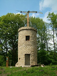
A semaphore telegraph is an early system of conveying information by means of visual signals, using towers with pivoting shutters, also known as blades or paddles. Information is encoded by the position of the mechanical elements; it is read when the shutter is in a fixed position. The most widely used system was invented in 1792 in France by Claude Chappe, and was popular in the late eighteenth to early nineteenth centuries. Lines of relay towers with a semaphore rig at the top were built within line-of-sight of each other, at separations of 5–20 miles (8.0–32.2 km). Operators at each tower would watch the neighboring tower through a spyglass, and when the semaphore arms began to move spelling out a message, they would pass the message on to the next tower. This system was much faster than post riders for conveying a message over long distances, and also had cheaper long-term operating costs, once constructed. Semaphore lines were a precursor of the electrical telegraph, which would replace them half a century later, and would also be cheaper, faster, and more private. The line-of-sight distance between relay stations was limited by geography and weather, and prevented the optical telegraph from crossing wide expanses of water, unless a convenient island could be used for a relay station. Modern derivatives of the semaphore system include flag semaphore and the heliograph.

The A272 is a road in southeast England. It follows an approximate east-west route from near Heathfield, East Sussex to the city of Winchester, Hampshire.

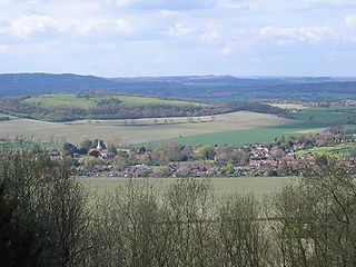
Highdown Hill is a prominent hill in the South Downs, as its name suggests, reaching a height of 81 metres (266 ft). The summit of the hill and its western slopes lie in the parish of Ferring in the Arun district, while its eastern slopes lie in the borough of Worthing. It is a popular spot for picnickers, dog-walkers and local riders. It overlooks Littlehampton, Angmering, Ferring and Worthing with views, when the weather is good, east as far as the Seven Sisters and west to the Isle of Wight. It is the property of the National Trust. To the north the ancient hill forts of Cissbury Ring and Chanctonbury Ring can be seen, and the remains of an ancient hill fort exist on the summit of Highdown Hill. Highdown Hill is the traditional burial-place of the kings of Sussex.
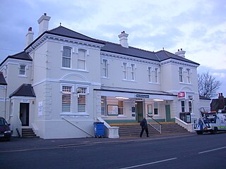
Wivelsfield railway station is on the Brighton Main Line in West Sussex, England. The station is located in northern Burgess Hill and primarily serves the town's neighbourhoods of World's End and Sheddingdean. It is 40 miles 52 chains (65.4 km) down the line from London Bridge via Redhill and is situated between Haywards Heath and Burgess Hill on the main line. It is managed by Southern which is one of two companies serving Wivelsfield; the other one being Thameslink. Until May 2018, Gatwick Express also served the station with a single early-morning service towards London.
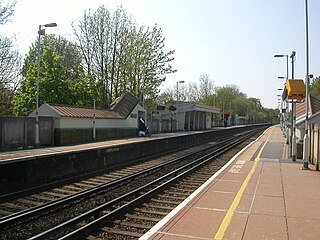
West Worthing railway station is in Worthing in the county of West Sussex, England. It is 11 miles 30 chains (18.3 km) down the line from Brighton. The station is operated by Southern.

Broadbridge Heath Football Club is a football club based in Broadbridge Heath, near Horsham, in West Sussex, England. They are currently members of the Southern Combination Premier Division and play at the High Wood Hill Sports Centre.

Telegraph Hill is a hill and surrounding neighborhood in San Francisco, California. It is one of San Francisco's 44 hills, and one of its original "Seven Hills".
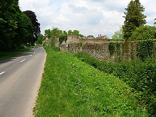
Harting is a civil parish in the Chichester District of West Sussex, England. It is situated on the northern flank of the South Downs, around 3.5 miles (5.6 km) southeast of Petersfield in Hampshire. It comprises the village of South Harting and the hamlets of East Harting, West Harting and Nyewood.
Woolbeding is a village in the District of Chichester in West Sussex, England 1 mile (1.6 km) north-west of Midhurst and north of the River Rother and A272 road.

West Hill is an area of Brighton and Hove, East Sussex situated on the east-facing hill rising west from Brighton railway station towards Seven Dials. The area is bounded by Dyke Road to the west, by the curve of the railway line and the station to the north and east, and by modern development along Queen's Road to the south-east.

Bourne is an electoral division of West Sussex in the United Kingdom, and returns one member to sit on West Sussex County Council. The former County Councillor, Mark Dunn, was also Chairman of West Sussex County Council. He lost his seat in 2013 to Sandra James of the United Kingdom Independence Party.

Burgess Hill Rugby Football Club or BHRFC, known as the Sussex All Blacks, is a rugby union club in Sussex, England. The team currently fields a 1st XV in the Sussex Spitfire 1 league, and a 2nd XV in the Sussex 'Oranjeboom' 2 West league.

Hascombe Hill or Hascombe Camp is the site of an Iron Age multivallate hill fort close to the village of Hascombe in Surrey, England.

Pewley Hill is a hill, and a street so named, near Guildford in England. It links to the open space at Pewley Down and was used as the site of a semaphore station and a defensive fort in the nineteenth century. In the late 19th and early 20th centuries much of the land was built upon.
Camp Down is a location at Portsdown Hill, Hampshire, which was used as an Admiralty semaphore station and later as a redoubt on the line of Palmerston Forts, Portsmouth.

World's End is a northern district of Burgess Hill, West Sussex, England. It is thought that the name arrived with the railway – it was here that the 'up' line met the 'down' line during construction of the Brighton main line (1837–1841), though it may also reflect the workers' sense of remoteness while billeted in a local farm.

Crawley, a postwar New Town and borough in the English county of West Sussex, has a wide range of public services funded by national government, West Sussex County Council, Crawley Borough Council and other public-sector bodies. Revenue to fund these services comes principally from Council Tax. Some of Crawley's utilities and infrastructure are provided by outside parties, such as utility companies and West Sussex County Council, rather than by the borough council. To help pay for improved infrastructure and service provision in proposed major residential developments such as Kilnwood Vale and the North East Sector, the borough council has stated that as part of the Crawley Local Plan it would require developers to pay a Community Infrastructure Levy.
Bury Hill is an area of West Sussex lying north of Arundel and west of Bury. In the 18th century, its name was spelled Berry Hill and it was a high-profile venue for cricket matches. It was the home ground of Arundel Cricket Club.

Beacon Hill, also known as Harting Beacon, is a hillfort on the South Downs, in the county of West Sussex in southern England. The hillfort is located in the parish of Elsted and Treyford, in Chichester District. It is a Scheduled Ancient Monument with a list entry identification number of 1015915. The hilltop enclosure is dated to the Late Bronze Age, from the 8th to 6th centuries BC. The hillfort defences were renewed during the Late Iron Age.


