
Cayce is a city in the U.S. state of South Carolina, along the Congaree River. The population was 12,528 at the 2010 census and rose to 13,789 in the 2020 United States Census, and it is the third-most populated municipality in Lexington County. The city is primarily in Lexington County, with additional, predominantly rural land to the east in Richland County. Cayce is part of the Columbia Metropolitan Statistical Area and is within South Carolina's Midlands region.

Red Bank is an unincorporated community and census-designated place (CDP) in Lexington County, South Carolina, United States. The population was 9,617 at the 2010 census, up from 8,811 at the 2000 census. It is part of the Columbia, South Carolina Metropolitan Statistical Area.

South Congaree is a town in Lexington County, South Carolina, United States. The population was 2,306 at the 2010 census. It is part of the Columbia, South Carolina Metropolitan Statistical Area.
The Mill Creek is a stream in southwest Ohio. It flows 28.4 miles (45.7 km) southwest and south from its headwaters in Liberty Township of Butler County through central Hamilton County and the heart of Cincinnati into the Ohio River just west of downtown. The section of Interstate 75 through Cincinnati is known as the Mill Creek Expressway.

Bergen is a village in Genesee County, New York, United States. The population was 1,176 at the 2010 census.
The Congaree Vista is a section of Columbia, South Carolina, between the Congaree River and the central business district of downtown.

U.S. Route 176 is a spur of US 76 in the U.S. states of North Carolina and South Carolina. The U.S. Highway runs 237.98 miles (382.99 km) from US 25 Business and North Carolina Highway 225 in Hendersonville, North Carolina, east to US 52 in Goose Creek, South Carolina. US 176 serves the transition region between the Blue Ridge Mountains and Foothills of Western North Carolina and the Upstate, Midlands, and Lowcountry regions of South Carolina. The highway passes through and connects Spartanburg, one of two major cities in the Upstate, and Columbia, the South Carolina state capital and central city of the Midlands. US 176 parallels and serves as a secondary highway to Interstate 26 (I-26) except for between Spartanburg and Columbia, where the U.S. Highway deviates from the I-26 corridor to serve Union.

The Congaree River is a short but wide river in South Carolina in the United States; It flows for approximately 53 miles (85 km). The river serves an important role as the final outlet channel for the entire Lower Saluda and Lower Broad watersheds, before merging with the Wateree River just north of Lake Marion to form the Santee River.

Transportation in the Commonwealth of Virginia is by land, sea and air. Virginia's extensive network of highways and railroads were developed and built over a period almost 400 years, beginning almost immediately after the founding of Jamestown in 1607, and often incorporating old established trails of the Native Americans.

The Saluda River is a principal tributary of the Congaree River, about 200 mi (320 km) long, in northern and western South Carolina in the United States. Via the Congaree River, it is part of the watershed of the Santee River, which flows to the Atlantic Ocean.

The Reedy River is a tributary of the Saluda River, about 65 miles (105 km) long, in northwestern South Carolina in the United States. Via the Saluda and Congaree rivers, it is part of the watershed of the Santee River, which flows to the Atlantic Ocean.

The Wateree River, about 75 mi (120 km) long, is a tributary of the Santee River in central South Carolina in the United States, which flows to the Atlantic Ocean. It was named for the Wateree Native Americans, a tribe who had migrated to this area from western North Carolina. They lived here until the early 18th century, when they were set upon and displaced by mostly English settlers during the Yamasee War. Survivors merged with the larger Catawba people, becoming extinct as a tribe.
As the Lincoln Highway was one of the earliest transcontinental highways for automobiles across the United States and was widely publicized since its inception, the route of the Lincoln Highway was determined not only by civil engineering considerations but also by politics. In many regions, there was general consensus among those who had power or interest in influencing the route. But in a few regions the choice of route was a contentious topic during the 1920s. The highway took the following route:

U.S. Route 460 (US 460) in Virginia runs east-west through the southern part of the Commonwealth. The road has two separate pieces in Virginia, joined by a relatively short section in West Virginia. Most of US 460 is a four-lane divided highway and is a major artery in the southern third of the state. From Petersburg to Suffolk, US 460 is a four-lane non-divided highway. It is a popular alternative to Interstate 64 (I-64) when going from Richmond and other points in central Virginia to the Currituck Sound and Outer Banks of North Carolina, avoiding the congestion and tunnels of the more northerly I-64 corridor. The road passes through several small towns that built up at stops along the railroad line.

U.S. Route 17 (US 17) is a part of the United States Numbered Highway System that runs from Punta Gorda, Florida, to Winchester, Virginia. In Virginia, the U.S. Highway runs 255.83 miles (411.72 km) from the North Carolina state line in Chesapeake north to its northern terminus at US 11, US 50, and US 522 in Winchester. US 17 is a major highway in the eastern half of Virginia. The U.S. Highway connects the Albemarle Region of North Carolina with the Hampton Roads metropolitan area. Within the urban area, US 17 passes through the South Hampton Roads cities of Chesapeake, Portsmouth, and Suffolk and the Virginia Peninsula city of Newport News. Between Yorktown and Fredericksburg, the U.S. Highway serves as the primary highway of the Middle Peninsula. At Fredericksburg, US 17 leaves the Atlantic Plain; the highway passes through the Piedmont town of Warrenton and crosses the Blue Ridge Mountains on its way to Winchester in the Shenandoah Valley. The route from Tappahannock to Winchester roughly follows the Confederate march during the Civil War to Gettysburg.

The Trout River is a 20-mile-long (32 km) tributary of the St. Johns River in Duval County, Florida. Located entirely within Jacksonville's Northside area, the river is brackish in its lower section. The widest point of the river is near the St. Johns River, where it is 0.6 miles (1.0 km) across. The Trout River has wetlands as far as the mouth of the river's longest tributary, the Ribault River.
Bowmansville is a hamlet located in the town of Lancaster in Erie County, New York, United States. It is named after Benjamin Bowman, the owner of sawmills on Ellicott Creek in the center of the hamlet.
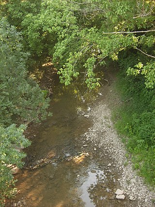
Gills Creek is a stream in Richland County, South Carolina which drains into the Congaree River. Gills Creek was settled primarily in the 1780s and since the 1960s the creek area has become highly urbanized as part of the region around Columbia, South Carolina. The watershed includes over 70 miles of streams and tributaries and has become significantly polluted with the urbanization.
South Carolina Highway 602 (SC 602) is a 10.690-mile-long (17.204 km) state highway in the U.S. state of South Carolina. The highway connects Red Bank and West Columbia, via Springdale.

South Carolina Highway 302 (SC 302) is an 66.200-mile-long (106.539 km) state highway in the U.S. state of South Carolina. The highway travels through mostly rural areas of Aiken and Lexington counties and connects the Aiken with the Columbia metropolitan areas, via Wagener and Pelion.