Related Research Articles

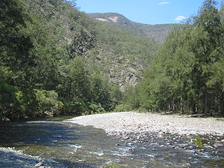
The Macleay River is a river that spans the Northern Tablelands and Mid North Coast districts of New South Wales, Australia.
Jerseyville is a small village on the Mid North Coast of New South Wales, Australia in Kempsey Shire. It is on South West Rocks Road, near South West Rocks. It is situated between Spencers Creek and the Macleay River. The village consists of only a handful of streets. It is a satellite suburb of South West Rocks and is a well-known fishing village. The town was originally called "Robinson's Wharf" and was founded in the 19th century after George Robinson subdivided his property. It was also known as ' Pelican's Island'. Its importance during the next generation or so was based upon the fact that coastal shipping was the main method of transport between the major Australian cities and the Macleay River Valley.
Smithtown is a small town on the banks of the Macleay River in New South Wales, Australia. It is in Kempsey Shire. The town of Gladstone lies across on the southern side of the river. At the 2016 census, Smithtown had a population of 590 people.
Styx River, a perennial stream of the Macleay River catchment, is located in the Northern Tablelands district of New South Wales, Australia.
Dyke River is a perennial stream of the Macleay River catchment, located in the Northern Tablelands district of New South Wales, Australia.

Gara River, a perennial river that is a tributary of the Macleay River, is located in the Northern Tablelands region of New South Wales, Australia.

Oaky River, a perennial stream of the Macleay River catchment, is located in the Northern Tablelands district of New South Wales, Australia.
Warnes River, a perennial stream of the Macleay River catchment, is located in the Northern Tablelands district of New South Wales, Australia.

Wollomombi River, a perennial stream of the Macleay River catchment, is located in the Northern Tablelands district of New South Wales, Australia.

Yarrowitch River, a perennial stream of the Macleay River catchment, is located in the Northern Tablelands district of New South Wales, Australia.
Chandler River, a perennial stream of the Macleay River catchment, is located in the Northern Tablelands district of New South Wales, Australia.

The Hastings-Macleay Important Bird Area is a 1148 km2 tract of land stretching for 100 km along the Mid North Coast of New South Wales, Australia, from Stuarts Point in the north to the Camden Haven River in the south. It is bounded on the west by the Pacific Highway. It combines ephemeral wetlands with coastal swamp forests. It is mostly cattle-grazed but contains large blocks of state forest, protected areas and tea-tree plantations.

Forbes River, a perennial river of the Hastings River catchment, is located in the Mid North Coast region of New South Wales, Australia.
The Newell Falls is a waterfall on an unnamed stream that is located in the New England region of New South Wales, Australia.
The Georges Creek, a perennial stream that is part of the Macleay River catchment, is located in the Northern Tablelands and Mid North Coast regions of New South Wales, Australia.
The Blue Mountain Creek, an intermittent stream that is part of the Macleay River catchment, is located in the Northern Tablelands region of New South Wales, Australia.
The Kunderang Brook, a perennial stream that is part of the Macleay River catchment, is located in the Northern Tablelands and Mid North Coast regions of New South Wales, Australia.
The Christmas Creek, a perennial stream that is part of the Macleay River catchment, is located in the Mid North Coast region of New South Wales, Australia.
The Commissioners Waters, a watercourse that is part of the Macleay River catchment, is located in the Northern Tablelands region of New South Wales, Australia.
The Ralfes Creek, a perennial stream that is part of the Hastings River catchment, is located in the Mid North Coast region of New South Wales, Australia.
References
- ↑ The spelling is also found as Congarini - see "Congarini". The Macleay Chronicle . No. 1263. New South Wales, Australia. 11 December 1902. p. 9. Retrieved 12 March 2019– via National Library of Australia.
- ↑ "The Discovery and Settlement of the Macleay River", Journal and Proceedings, 10: 142, 1 June 1924, ISSN 1325-9261
30°45′14″S152°52′37″E / 30.754°S 152.877°E
| | This New South Wales geography article is a stub. You can help Wikipedia by expanding it. |