Related Research Articles

Geotechnical engineering, also known as geotechnics, is the branch of civil engineering concerned with the engineering behavior of earth materials. It uses the principles of soil mechanics and rock mechanics to solve its engineering problems. It also relies on knowledge of geology, hydrology, geophysics, and other related sciences.
Petroleum geology is the study of origin, occurrence, movement, accumulation, and exploration of hydrocarbon fuels. It refers to the specific set of geological disciplines that are applied to the search for hydrocarbons.

Prospecting is the first stage of the geological analysis of a territory. It is the search for minerals, fossils, precious metals, or mineral specimens. It is also known as fossicking.

Hydrocarbon exploration is the search by petroleum geologists and geophysicists for deposits of hydrocarbons, particularly petroleum and natural gas, in the Earth's crust using petroleum geology.

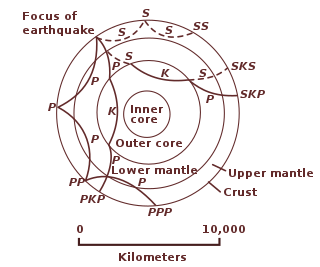
Reflection seismology is a method of exploration geophysics that uses the principles of seismology to estimate the properties of the Earth's subsurface from reflected seismic waves. The method requires a controlled seismic source of energy, such as dynamite or Tovex blast, a specialized air gun or a seismic vibrator. Reflection seismology is similar to sonar and echolocation.
Well logging, also known as borehole logging is the practice of making a detailed record of the geologic formations penetrated by a borehole. The log may be based either on visual inspection of samples brought to the surface or on physical measurements made by instruments lowered into the hole. Some types of geophysical well logs can be done during any phase of a well's history: drilling, completing, producing, or abandoning. Well logging is performed in boreholes drilled for the oil and gas, groundwater, mineral and geothermal exploration, as well as part of environmental and geotechnical studies.
Exploration geophysics is an applied branch of geophysics and economic geology, which uses physical methods at the surface of the Earth, such as seismic, gravitational, magnetic, electrical and electromagnetic, to measure the physical properties of the subsurface, along with the anomalies in those properties. It is most often used to detect or infer the presence and position of economically useful geological deposits, such as ore minerals; fossil fuels and other hydrocarbons; geothermal reservoirs; and groundwater reservoirs. It can also be used to detect the presence of unexploded ordnance.

Magnetotellurics (MT) is an electromagnetic geophysical method for inferring the earth's subsurface electrical conductivity from measurements of natural geomagnetic and geoelectric field variation at the Earth's surface.
Petrophysics is the study of physical and chemical rock properties and their interactions with fluids.
Geophysical survey is the systematic collection of geophysical data for spatial studies. Detection and analysis of the geophysical signals forms the core of Geophysical signal processing. The magnetic and gravitational fields emanating from the Earth's interior hold essential information concerning seismic activities and the internal structure. Hence, detection and analysis of the electric and Magnetic fields is very crucial. As the Electromagnetic and gravitational waves are multi-dimensional signals, all the 1-D transformation techniques can be extended for the analysis of these signals as well. Hence this article also discusses multi-dimensional signal processing techniques.

Geophysical imaging is a minimally destructive geophysical technique that investigates the subsurface of a terrestrial planet. Geophysical imaging is a noninvasive imaging technique with a high parametrical and spatio-temporal resolution. Geophysical imaging has evolved over the last 30 years due to advances in computing power and speed. It can be used to model a surface or object understudy in 2D or 3D as well as monitor changes.
Transient electromagnetics,, is a geophysical exploration technique in which electric and magnetic fields are induced by transient pulses of electric current and the subsequent decay response measured. TEM / TDEM methods are generally able to determine subsurface electrical properties, but are also sensitive to subsurface magnetic properties in applications like UXO detection and characterization. TEM/TDEM surveys are a very common surface EM technique for mineral exploration, groundwater exploration, and for environmental mapping, used throughout the world in both onshore and offshore applications.
ION Geophysical provides acquisition of equipment, software, planning and seismic processing services, and provides seismic data libraries to the global oil & gas industry. The company's technologies and services are used by E&P operators and seismic acquisition contractors to generate high-resolution images of the subsurface of Earth during exploration, exploitation and production operations. Headquartered in Houston & Texas, ION has offices in the United States, Canada, Latin America, Europe, Africa, Russia, China and the Middle East.

The Coal Oil Point seep field (COP) in the Santa Barbara Channel offshore from Goleta, California, is a marine petroleum seep area of about three square kilometres, within the Offshore South Ellwood Oil Field and stretching from the coastline southward more than three kilometers (1.9 mi). Major seeps are located in water depths from 20 to 80 meters. The seep field is among the largest and best studied areas of active marine seepage in the world. These perennial and continuous oil and gas seeps have been active on the northern edge of the Santa Barbara Channel for at least 500,000 years. The combined seeps in the field release about 40 tons of methane per day and about 19 tons of reactive organic gas ; about twice the hydrocarbon air pollution released by all the cars and trucks in Santa Barbara County in 1990. The liquid petroleum produces a slick that is many kilometres long and when degraded by evaporation and weathering, produces tar balls which wash up on the beaches for miles around.

Near-surface geophysics is the use of geophysical methods to investigate small-scale features in the shallow subsurface. It is closely related to applied geophysics or exploration geophysics. Methods used include seismic refraction and reflection, gravity, magnetic, electric, and electromagnetic methods. Many of these methods were developed for oil and mineral exploration but are now used for a great variety of applications, including archaeology, environmental science, forensic science, military intelligence, geotechnical investigation, treasure hunting, and hydrogeology. In addition to the practical applications, near-surface geophysics includes the study of biogeochemical cycles.
The following outline is provided as an overview of and topical guide to geophysics:
Electromagnetic Geoservices ASA (EMGS) is a Norwegian geophysical services company using proprietary marine electromagnetic technology to support oil and gas companies in their search for offshore hydrocarbons. The administrative and research headquarters are located in Trondheim.
EMIGMA is a geophysics interpretation software platform developed by Petros Eikon Incorporated for data processing, simulation, inversion and imaging as well as other associated tasks. The software focuses on non-seismic applications and operates only on the Windows operating system. It supports files standard to the industry, instrument native formats as well as files used by other software in the industry such as AutoCAD, Google Earth and Oasis montaj. There is a free version of EMIGMA called EMIGMA Basic developed to allow viewing of databases created by licensed users. It does not allow data simulation nor modeling nor data import. The software is utilized by geoscientists for exploration and delineating purposes in mining, oil and gas and groundwater as well as hydrologists, environmental engineers, archaeologists and academic institutions for research purposes. Principal contributors to the software are R. W. Groom, H. Wu, E. Vassilenko, R. Jia, C. Ottay and C. Alvarez.
Surface nuclear magnetic resonance (SNMR), also known as magnetic resonance Sounding (MRS), is a geophysical technique specially designed for hydrogeology. It is based on the principle of nuclear magnetic resonance (NMR) and measurements can be used to indirectly estimate the water content of saturated and unsaturated zones in the earth's subsurface. SNMR is used to estimate aquifer properties, including the quantity of water contained in the aquifer, porosity, and hydraulic conductivity.

Offshore freshened groundwater(OFG) is water that contains a Total Dissolved Solid (TDS) concentration lower than sea water, and which is hosted in porous sediments and rocks located in the sub-seafloor. OFG systems have been documented all over around the world and have an estimated global volume of around 1 × 10⁶ km3. Their study is important because they may represent an unconventional source of potable water for human populations living near the coast, especially in areas where groundwater resources are scarce or facing stress
References
- ↑ Mehta, Kurang; Nabighian, Misac; Li, Yaoguo; Oldenburg, Doug (2005). "Controlled Source Electromagnetic (CSEM) Technique For Detection and Delineation of Hydrocarbon Reservoirs: an Evaluation". SEG Technical Program Expanded Abstracts 2005. Society of Exploration Geophysicists. pp. 546–549. doi:10.1190/1.2144377. S2CID 15737733.
- ↑ SIO Marine EM Laboratory
- ↑ Bhatt, Kaushalendra M. (2014). "Microseisms and its impact on the marine-controlled source electromagnetic signal". Journal of Geophysical Research: Solid Earth. 119 (12): 8655–8666. Bibcode:2014JGRB..119.8655B. doi: 10.1002/2014JB011024 .
- ↑ Stéphane, Sainson (2017). Electromagnetic seabed logging : a new tool for geoscientists. Springer. ISBN 978-3-319-45355-2.
- ↑ 2006 - mCSEM Marine Controlled Source Electromagnetic Archived 2008-12-04 at the Wayback Machine
| | This geophysics-related article is a stub. You can help Wikipedia by expanding it. |
| | This remote sensing-related article is a stub. You can help Wikipedia by expanding it. |