Related Research Articles

Whitesburg is a town in Carroll County, Georgia, United States. The population was 588 at the 2010 census.

Hampton is a city in southwestern Henry County, Georgia, United States. The 2020 census was 8368. As of the 2010 census, the city had a population of 6,987, up from 3,857 at the 2000 census. By 2018 the estimated population was 7,922. "Hampton" mailing addresses outside the city limits reach into rural parts of eastern Clayton County and northern Spalding County. It is a southeastern suburb in the Atlanta metropolitan area.

Chatsworth is a city in and the county seat of Murray County, Georgia, United States. It is part of the Dalton, Georgia, Metropolitan Statistical Area. Its population was 4,874 at the 2020 census, up from 4,299 in 2010. The city is the site of the coldest recorded temperature in Georgia, −17 °F (−27 °C) on January 27, 1940.
Noonday was an unincorporated community located in far north-central Cobb County, Georgia, United States. It was centered at 34°03'43"N, 84°31'16"W, along former Georgia highway 5, around the Noonday Baptist Church. This Baptist church is still active today.
Sweetwater Creek is a 45.6-mile-long (73.4 km) stream in the U.S. state of Georgia, west of Atlanta. It begins in southwestern Paulding County, flowing generally eastward into southwestern Cobb County, then turning south into eastern Douglas County. It is a tributary of the Chattahoochee River, and near its end it is the centerpiece of Sweetwater Creek State Park.
Muckalee Creek is a creek in southwest Georgia. It originates southeast of Buena Vista and flows south-southeast for 76.3 miles (122.8 km) and into Kinchafoonee Creek north of Albany, just upstream of that creek's confluence with the Flint River.
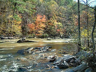
Salacoa Creek is a stream in Bartow County, in northwestern Georgia, United States, that is a tributary of the Coosawattee River. Its own tributaries include the Pine Log Creek.
Alligator Creek is a 48.6-mile-long (78.2 km) tributary of the Little Ocmulgee River in the U.S. state of Georgia.
Calumet is an unincorporated community in eastern Pike County, in the U.S. state of Missouri. The community is located at the intersection of Missouri routes N and D about six miles southwest of Clarkesville and six miles north of Eolia. Calumet Creek flows past to the south of the community.
Wintersville is an unincorporated community in western Sullivan County, in the U.S. state of Missouri.
Chehaw is an unincorporated community in Lee County, in the U.S. state of Georgia.
Chickasawhatchee is an unincorporated community in Terrell County, in the U.S. state of Georgia.
Chickasawhatchee Creek is a stream in the U.S. state of Georgia. It is a tributary to the Flint River.
Chokeelagee Creek is a stream in the U.S. state of Georgia.
Colomokee is an unincorporated community in Early County, in the U.S. state of Georgia.
Excelsior is an unincorporated community in Candler County, in the U.S. state of Georgia.
Fivemile Branch is a stream in the U.S. state of Georgia. It is a tributary to Muckalee Creek.
Herod is an unincorporated community in Terrell County, in the U.S. state of Georgia.
Tails Creek is an unincorporated area in Gilmer County, in the U.S. state of Georgia.
References
- ↑ U.S. Geological Survey Geographic Names Information System: Cooleewahee Creek
- ↑ Krakow, Kenneth K. (1975). Georgia Place-Names: Their History and Origins (PDF). Macon, GA: Winship Press. p. 51. ISBN 0-915430-00-2.
- ↑ Bright, William (2004). Native American Placenames of the United States. University of Oklahoma Press. p. 120. ISBN 978-0-8061-3598-4.
31°18′49″N84°19′37″W / 31.31361°N 84.32694°W