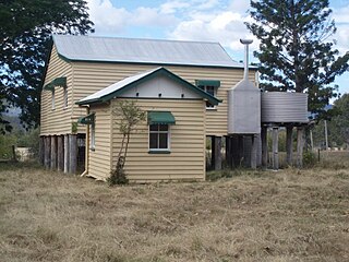
Esk is a town and locality in the Somerset Region in South East Queensland, Australia. In the 2016 census, Esk had a population of 1,698 people.

Scarborough is a coastal residential suburb on the Redcliffe Peninsula in the north of the Brisbane metropolitan area in Queensland, Australia. It falls within the Moreton Bay Region local government area. Along with its neighbouring coastal suburbs on the Redcliffe Peninsula, the suburb is a popular recreational destination within the Brisbane metropolitan area.

The Shire of Pine Rivers was a local government area about 20 kilometres (12 mi) north of Brisbane in the Moreton Bay region of South East Queensland, Australia. The shire covered an area of 771 square kilometres (297.7 sq mi), and existed as a local government entity from 1888 until 2008, when it amalgamated with councils further north to form the Moreton Bay Region.

Coominya is a town and locality in the Somerset Region in South East Queensland, Australia. The town is located 83 kilometres (52 mi) west of the state capital, Brisbane and approximately 2 kilometres (1.2 mi) from Wivenhoe Dam. In the 2016 census, Coominya had a population of 1,200 people.

Fernvale is a town and locality in the Somerset Region, South East Queensland, Australia. At the 2016 Australian Census Fernvale had an estimated population of 3,209. It is a rapidly developing rural township located within the urban footprint of the South East Queensland Regional Plan 2009–2031.

Soldier settlement, also known as the Soldier Settlement Scheme or Soldiers Settlement Scheme, administered by the Soldier Settlement Commission, was the settlement of land throughout parts of Australia by returning discharged soldiers under schemes administered by the state governments after World War I and World War II.

The Somerset Region is a local government area located in the West Moreton region of South East Queensland, Australia, about 100 kilometres (62 mi) northwest of Brisbane and centred on the town of Esk. It was created in 2008 from a merger of the Shire of Esk and the Shire of Kilcoy. It is commonly known as the Brisbane Valley, due to the Brisbane River which courses through the region, although significant parts of the region lie outside the hydrological Brisbane Valley itself.

Vernor is a rural locality in the Somerset Region, Queensland, Australia. In the 2016 census, Vernor had a population of 233 people.

Bellevue Homestead is a heritage-listed homestead currently located in Coominya, Somerset Region, Queensland, Australia. It was built from c. 1872 to c. 1910. It was added to the Queensland Heritage Register on 21 October 1992.

Anzac Avenue is a heritage-listed major arterial road lined with trees in the Moreton Bay Region, Queensland, Australia. It runs 17.8 kilometres (11.1 mi) from Petrie to Redcliffe, with most of the route signed as state route 71. The route was formerly the main route to the Redcliffe peninsula, until the Hornibrook Bridge was built.
The Queensland Acclimatisation Society (QAS) was an acclimatisation society based in Brisbane, Queensland, Australia which operated from 1862 to 1956. Its primary interest was in the introduction of exotic plants to Queensland, both for economic and ornamental purposes.

Coominya railway station is central to all activities in historic Coominya village, located in the Somerset Region of South East Queensland.

Henry Plantagenet Somerset was a pioneer pastoralist and politician in Queensland, Australia. Somerset was a liberal politician who represented the district of Stanley in the Queensland Legislative Assembly from 1904 to 1920, and canvassed successfully for the extension of the Brisbane Valley railway through the Brisbane River Valley to the rich timber reserves in the Blackbutt Range and beyond. Both the Somerset Dam and the local government area of Somerset Region are named in his honour.

The Shire of Sherwood is a former local government area of Queensland, Australia, located in south-western Brisbane in and around the suburb of Sherwood.

Caboonbah Homestead was a heritage-listed homestead at Esk-Kilcoy Road, Lake Wivenhoe, Somerset Region, Queensland, Australia. It was built from 1889 to 1890. It was added to the Queensland Heritage Register on 12 December 1996. It was destroyed by fire in 2009 and removed from the Queensland Heritage Register in 2014.

Murrumba Homestead Grounds is a heritage-listed site at 38 Armstrong Street, Petrie, Moreton Bay Region, Queensland, Australia. It was added to the Queensland Heritage Register on 16 February 2009.

Anzac Avenue Memorial Trees is a heritage-listed memorial at Anzac Avenue, Beerburrum, Sunshine Coast Region, Queensland, Australia. It was built in 1920. It was added to the Queensland Heritage Register on 16 October 2008.

Beerburrum Soldier Settlement was a soldier settlement in Beerburrum, Queensland, Australia, established to provide opportunities for Australian soldiers returning from World War I. It is generally regarded as a failure.

Soldier Settler House is a heritage-listed homestead at Gladstone-Monto Road, Ubobo, Gladstone Region, Queensland, Australia. It was built in 1920. It is also known as Hecstanvale. It was added to the Queensland Heritage Register on 28 September 2001.

Milman is a locality in the Livingstone Shire, Queensland, Australia.