Redcliffe, Queensland

Last updated

Redcliffe
Queensland
Parachute Landing on Suttons Beach (112358199).jpg
Parachute sailing at Suttons Beach, Redcliffe
Redcliffe-queensland-suburb-map.png
Brisbane OpenStreetMap.png
Red pog.svg
Redcliffe
Redcliffe, Queensland
Coordinates 27°13′40″S153°04′30″E / 27.2278°S 153.0750°E / -27.2278; 153.0750 (Redcliffe (town centre))
Population10,373 (2016 census) [1]
 • Density2,470/km2 (6,400/sq mi)
Established13 September 1824
Postcode(s) 4020
Elevation12 m (39 ft)
Area4.2 km2 (1.6 sq mi)
Time zone AEST (UTC+10:00)
Location
LGA(s) City of Moreton Bay
State electorate(s) Redcliffe
Federal division(s) Petrie
Suburbs around Redcliffe:
Newport Scarborough Moreton Bay
Kippa-Ring Redcliffe Moreton Bay
Margate Margate Moreton Bay

Redcliffe is a town and suburb in the City of Moreton Bay, Queensland, Australia. [2] [3] It also refers colloquially to the Redcliffe Peninsula as a whole, a peninsula jutting into Moreton Bay which contains several other suburbs. Since the 1880s, Redcliffe has been a popular seaside resort in South East Queensland. In the 2016 census, the suburb of Redcliffe had a population of 10,373 people. [1]

Contents

Geography

Redcliffe is situated in the east north-east of the Redcliffe Peninsula on the western shore of the Moreton Bay. It is approximately 28 kilometres (17 mi) north-north-east of the Brisbane CBD. It serves as the Central Business District for the Redcliffe Peninsula and its surrounding suburbs.

History

Before European settlement, the Redcliffe Peninsula was occupied by the Ningy Ningy people. The Aboriginal name is Kau-in-Kau-in, which means Blood-Blood (red-like blood). [4]

A famous Ningy Ningy Bora ring structure, consisting of two separate rings, large and small, joined by a ritual pathway, once existed between Kippa-Ring and Anzac Avenue. Aboriginals as far away as Noosa would travel there to perform initiation ceremonies. It was razed by the Council around 1950. [5]

The town's name originates from "Red Cliff Point" named by the explorer Matthew Flinders, referring to the red cliffs at Woody Point. [6] Redcliffe became Queensland's first colony in 1824; however, it was soon abandoned for Brisbane.

Redcliffe holds the distinction of being the first European settlement in Queensland, first visited by Matthew Flinders on 17 July 1799. [7] Explorer John Oxley recommended "Red Cliff Point" – named after the red-coloured cliffs visible from Moreton Bay – to the Governor Thomas Brisbane for the new Moreton Bay penal colony, reporting that ships could land at any tide and easily get close to the shore. [8]

The penal colony was established at Redcliffe on 13 September 1824, under the command of Lieutenant Henry Miller with 14 soldiers, some with wives and children, and 29 convicts. However, this settlement was abandoned after one year and the colony was moved south to a site on the Brisbane River at North Quay, 28 km (17 mi) south, that offered a more reliable water supply. This settlement lead to the establishment of Brisbane, now Queensland's capital city.

Portwood Estate map, 1878, showing the Redcliffe railway line and railway station Portwood estate map, Redcliffe, 1878.jpg
Portwood Estate map, 1878, showing the Redcliffe railway line and railway station

Redcliffe became a pastoral district in the 1860s and in the 1880s boomed as a seaside resort town. In 1878, a suburban subdivision called Portwood Estate (around the present day Portwood Street, Sheehan Street, and Sylvin Street) was offered for sale, with the lots described as "large, elevated, picturesque, salubrious, with rare perspective" in Humpy Bong which was to be "the fashionable watering place of the future!". The estate map shows the Redcliffe railway line terminating at a railway station just to the north-east of the estate (in the area of present-day Macnaughton Street). [9] However, the Redcliffe Peninsula railway line was not opened until October 2016 (138 years later) and the terminus was located in neighbouring Kippa-Ring. [9]

Beachside path, 1906 StateLibQld 2 231285 Esplanade at Redcliffe near the jetty, 1906.jpg
Beachside path, 1906

In October 1881, approximately 60 allotments of "Ramsgate Estate" were advertised to be auctioned for sale by Arthur Martin & Co, being subdivisions 1 to 60, of portion 205 in the Parish of Redcliffe. [10] [11]

Redcliffe State School opened circa 1888. It closed in 1909 when a new Humpybong State School was opened on a central site to amalgamate Redcliffe State School and the old Humpybong State School. [12]

Koopa on the Brisbane River Passenger vessel KOOPA underway on the Brisbane River (9189611696).jpg
Koopa on the Brisbane River

From 1911, the twin screw excursion steamer Koopa made regular trips to Redcliffe jetty. The principal route for passengers was a steamer from Sandgate pier to Woody Point Pier. The Hornibrook Bridge connecting Clontarf in the Town of Redcliffe to Brighton in City of Brisbane was completed in 1935 and allowed easy access to and from Brisbane by motor car leading the way to rapid suburban development. [13] That led to the cessation of the Sandgate to Woody Point steamers.

Our Lady Help of Christians School opened in January 1922. It closed on 24 May 1995. [12]

Redcliffe Presbyterian Church in Prince Edward Parade, recently completed, December 1937 Redcliffe Presbyterian Church in Prince Edward Parade, recently completed, December 1937.jpg
Redcliffe Presbyterian Church in Prince Edward Parade, recently completed, December 1937
Crowds at the beach, 1937 Queensland State Archives 2175 The Pavilion and bathers Redcliffe December 1937.png
Crowds at the beach, 1937

In 1937 a Presbyterian church was built on Prince Edward Parade at Queen's Beach near Eversleigh Road. [14] It was officially opened on Saturday 18 December 1937 by the Reverend James Gibson, Moderator of the Presbyterian Church of Queensland; the ceremony was attended by William Forgan Smith, the Queensland Premier, and Alfred H. Langdon, Mayor of Redcliffe. [15] The two lots of land for the church had been purchased on 29 April 1920, adjacent to the Queensland Presbyterian Women's Missionary Union house, "The Haven". [15]

Redcliffe State High School No 2045 opened on 3 February 1958. [12] [16]

In 1958, the Gibb family from Manchester, England emigrated to this area and called it home for a period. Barry, Robin and Maurice Gibb went on to form the highly successful music group, The Bee Gees. In 1959, Brisbane based Speedcar driver Bill Goode, the promoter of the Redcliffe Speedway (located at the Redcliffe Showgrounds) hired the brothers to entertain the crowds at the speedway from the back of a truck during the interval. This was the first ever public performance by the trio. [17] In a letter to the Redcliffe Museum in 1999, Barry Gibb wrote "The smell of the oil, the noise and the atmosphere was incredible. This was the first public appearance Robin, Maurice and I ever made in Australia. We sang through the PA system and people threw money onto the track, and we met Brisbane's leading DJ and racing car driver Bill Gates, who suggested we call ourselves the BG's and even played our songs on his radio show, "Swinging' Gates' Platter Chatter". Hence Redcliffe became the birthplace of the Bee Gees."

Redcliffe Opportunity School opened on 2 March 1964. In 1989, it was renamed Redcliffe State Special School. [12] [16]

The former Redcliffe Town Council Chambers, 2016 Front of Redcliffe Town Council Chambers at Redcliffe, Queensland.jpg
The former Redcliffe Town Council Chambers, 2016

The first high-rise apartment building was constructed along Marine Parade in 1974. [18] For decades the interest for similar development was limited – until 2000 there were only four apartment buildings higher than 6 stories across the entire Peninsula. Renewed interest in Redcliffe as a seaside lifestyle precinct occurred in the 2000s and 2010s and as a result high rise and mix use development is found in all areas of Redcliffe along the coastline.

In 1975, the toll on the Hornibrook Highway was removed. [18]

The current Redcliffe Library opened in 2000. [19]

Demographics

In the 2011 census, the population of Redcliffe was 9,201; 52% female and 48% male. [20] The median age of the Redcliffe population was 44 years of age, 7 years above the Australian median. Children aged under 15 years made up 15.5% of the population and people aged 65 years and over made up 20.7% of the population. 68.4% of people living in Redcliffe were born in Australia, compared to the national average of 69.8%; the next most common countries of birth were England 7%, New Zealand 6.3%, Scotland 1%, Philippines 0.8%, Netherlands 0.7%. 86.8% of people spoke only English at home; the next most popular languages were 0.5% Italian, 0.4% Tagalog, 0.4% German, 0.3% Dutch, 0.3% Samoan. [20]

In the 2016 census, the suburb of Redcliffe had a population of 10,373 people. [1]

Heritage listings

Redcliffe has a number of heritage-listed sites, including:

Education

Redcliffe Special School is a special primary and secondary (Prep–12) school for boys and girls at Klingner Road ( 27°13′24″S153°06′48″E / 27.2232°S 153.1132°E / -27.2232; 153.1132 (Redcliffe Special School) ). [26] [27] In 2018, the school had an enrolment of 121 students with 33 teachers (28 full-time equivalent) and 46 non-teaching staff (28 full-time equivalent). [28]

Redcliffe State High School is a government secondary (7–12) school for boys and girls at the corner of Klingner Road and Oxley Avenue ( 27°13′25″S153°06′40″E / 27.2236°S 153.1110°E / -27.2236; 153.1110 (Redcliffe State High School) ). [26] [29] In 2018, the school had an enrolment of 1,319 students with 110 teachers (102 full-time equivalent) and 52 non-teaching staff (35 full-time equivalent). [28] It includes a special education program. [26]

There are no mainstream primary schools in Redcliffe. The nearest government primary schools are Scarborough State School in neighbouring Scarborough to the north, Kippa-Ring State School in neighbouring Kippa-Ring to the west, and Humpybong State School in neighbouring Margate to the south. [30]

Attractions and features

Settlement Cove Lagoon, 2016 Redcliffe Lagoon at Redcliffe, Queensland.jpg
Settlement Cove Lagoon, 2016
Suttons Beach Suttons Beach, Redcliffe.jpg
Suttons Beach
Redcliffe Jetty Redcliffe-jetty.JPG
Redcliffe Jetty

Attractions such as Suttons Beach(location of Luna Park Redcliffe (1944 to 1966), [31] [32] Redcliffe Jetty, Settlement Cove Lagoon, Redcliffe Museum, Redcliffe Botanic Gardens, and Redcliffe Showgrounds are all within the suburb of Redcliffe. The entire Redcliffe Parade precinct is home to an abundance of restaurants and eateries. On Sundays, the Redcliffe Markets take place along Redcliffe Parade and in recent years have been a significant event for local businesses with crowds of thousands taking part. [33]

Aside from smaller events, in September each year, Redcliffe celebrates its history as Queensland's first European settlement location with the Redcliffe festival event. This festival is chiefly held in the Redcliffe CBD with Redcliffe Parade being closed off to traffic for most of the day. Other attractions as part of this festival include the KiteFest, The Jetty Fiesta, KiteFest Live, and Spring Break Beach Party with ongoing interest from local community groups and sponsors to create larger and more attractive events each year.

A statue and walkway in honour of the Bee Gees was unveiled by Barry Gibb on 14 February 2013. Barry returned to open the second stage of the walkway on 9 September 2015. [34]

The Moreton Bay City Council operates a public library at 476 Oxley Avenue. [35]

Sport and recreation

A number of well-known sporting teams represent the local area, including the Redcliffe City Cyclones and Peninsula Cricket clubs, Sandgate-Redcliffe Gators, Redcliffe Tigers, Peninsula Power FC, and Redcliffe Padres.

Most notably, the semi-professional Redcliffe Dolphins rugby league team plays in the second-level Queensland Cup state competition. Their spin-off club, the fully-professional Dolphins (NRL), commenced playing in the National Rugby League competition in 2023 under head coach Wayne Bennett. [36] Although the Dolphins play most of their NRL home games at Suncorp Stadium in Brisbane, a few are also played at Kayo Stadium (adjoining Redcliffe Leagues Club
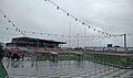
), which also serves as a training and administration base. [37]

Separately, Redcliffe hosts the only harness racing in Queensland that is North of Brisbane at the Redcliffe Harness Racing & Sporting Club. [38]

Transport

Redcliffe is served by a small general aviation airfield, Redcliffe Airport ( ICAO : YRED), located 2.5 nautical miles (4.6 km; 2.9 mi) northwest of Redcliffe in the suburb of Rothwell.

Redcliffe is well serviced by public transport operated by Translink with most of the buses connecting to trains at Kippa-Ring station or across the Houghton highway to Sandgate station. Buses also travel to nearby North Lakes and Deception Bay.

In 2016 a train line opened that connects the existing Caboolture line at Petrie to Kippa-Ring station. The line services 6 stations including nearby Rothwell and Mango Hill which is located near North Lakes Westfield and IKEA.

Climate

Climate data for Redcliffe
MonthJanFebMarAprMayJunJulAugSepOctNovDecYear
Mean daily maximum °C (°F)29.0
(84.2)
28.5
(83.3)
27.7
(81.9)
25.6
(78.1)
23.3
(73.9)
21.2
(70.2)
20.6
(69.1)
21.4
(70.5)
24.1
(75.4)
25.3
(77.5)
26.6
(79.9)
28.0
(82.4)
25.1
(77.2)
Mean daily minimum °C (°F)21.9
(71.4)
21.6
(70.9)
20.2
(68.4)
17.7
(63.9)
14.9
(58.8)
11.6
(52.9)
10.6
(51.1)
11.1
(52.0)
14.1
(57.4)
16.5
(61.7)
18.7
(65.7)
20.7
(69.3)
16.6
(61.9)
Average precipitation mm (inches)111.6
(4.39)
160.9
(6.33)
126.8
(4.99)
124.4
(4.90)
89.0
(3.50)
59.9
(2.36)
51.3
(2.02)
39.7
(1.56)
30.2
(1.19)
70.5
(2.78)
101.6
(4.00)
117.8
(4.64)
1,064.1
(41.89)
Source: Bureau of Meteorology [39]

See also

Related Research Articles

<span class="mw-page-title-main">Sandgate, Queensland</span> Suburb of Brisbane, Queensland, Australia

Sandgate is a northern coastal suburb in the City of Brisbane, Queensland, Australia. In the 2021 census, Sandgate had a population of 4,926 people.

<span class="mw-page-title-main">Redcliffe Peninsula</span> Town in Queensland, Australia

The Redcliffe Peninsula is a peninsula located in the City of Moreton Bay in the northeast of the Brisbane metropolitan area in Queensland, Australia. The area covers the suburbs of Clontarf, Kippa-Ring, Margate, Newport, Redcliffe, Rothwell, Scarborough and Woody Point.

<span class="mw-page-title-main">Scarborough, Queensland</span> Suburb of City of Moreton Bay, Queensland, Australia

Scarborough is a coastal suburb on the Redcliffe Peninsula in the City of Moreton Bay, Queensland, Australia. In the 2021 census, Scarborough had a population of 9,178 people.

<span class="mw-page-title-main">Woody Point, Queensland</span> Suburb of Redcliffe, Queensland, Australia

Woody Point is a coastal suburb of Redcliffe in the City of Moreton Bay, Queensland, Australia. In the 2016 census, Woody Point had a population of 4,418 people.

<span class="mw-page-title-main">Clontarf, Queensland</span> Suburb of City of Moreton Bay, Queensland, Australia

Clontarf is a coastal suburb in the City of Moreton Bay, Queensland, Australia. In the 2021 census, Clontarf had a population of 8,446 people.

<span class="mw-page-title-main">Brighton, Queensland</span> Suburb of Brisbane, Queensland, Australia

Brighton is a coastal northern suburb of the City of Brisbane, in the state of Queensland, in Australia. In the 2021 census, Brighton had a population of 9,664 people.

<span class="mw-page-title-main">Shorncliffe, Queensland</span> Suburb of Brisbane, Queensland, Australia

Shorncliffe is a coastal north-eastern suburb in the City of Brisbane, Queensland, Australia. It is on the shore of Bramble Bay, part of Moreton Bay. In the 2016 census, Shorncliffe had a population of 1,870 people. The suburb attracts visitors to its historic Shorncliffe pier, and Lovers Walk, a walking path along the coastline between Shorncliffe and neighbouring Sandgate.

<span class="mw-page-title-main">Deception Bay, Queensland</span> Suburb of Moreton Bay, Queensland, Australia

Deception Bay is a coastal suburb in the City of Moreton Bay, Queensland, Australia. In the 2016 census, Deception Bay had a population of 19,850 people.

<span class="mw-page-title-main">Kippa-Ring, Queensland</span> Suburb of City of Moreton Bay, Queensland, Australia

Kippa-Ring is a suburb in the City of Moreton Bay, Queensland, Australia. In the 2021 census, Kippa-Ring had a population of 9,745 people.

<span class="mw-page-title-main">City of Redcliffe</span> Local government area in Queensland, Australia

The City of Redcliffe is a former local government area in South East Queensland, Australia. In 2008 it was amalgamated with the Shires of Pine Rivers and Caboolture to create Moreton Bay Region, later renamed City of Moreton Bay. It is in the northern part of the County of Stanley, with a total area of 38.1 square kilometres (14.7 sq mi) and a population of 51,174 in the 2006 census.

<span class="mw-page-title-main">Margate, Queensland</span> Suburb of Redcliffe, Queensland, Australia

Margate is a coastal suburb on the Redcliffe Peninsula, and, along with neighbouring coastal suburbs on the Redcliffe Peninsula, is a popular recreational destination for the South East Queensland. Margate was part of the City of Redcliffe until 2008, when it was amalgamated into the Moreton Bay Region, now known as the City of Moreton Bay. In the 2016 census, Margate had a population of 7,405 people.

Rothwell is a coastal suburb in the City of Moreton Bay, Queensland, Australia. In the 2021 census, Rothwell had a population of 7,538 people.

<span class="mw-page-title-main">Newport, Queensland</span> Suburb of City of Moreton Bay, Queensland, Australia

Newport is a coastal suburb in the City of Moreton Bay, Queensland, Australia. In the 2021 census, Newport had a population of 5,964 people.

<span class="mw-page-title-main">Anzac Avenue</span> Historic site in Queensland, Australia

Anzac Avenue is a heritage-listed major arterial road lined with trees in the City of Moreton Bay, Queensland, Australia. It runs 17.8 kilometres (11.1 mi) from Petrie to Redcliffe, with most of the route signed as state route 71. The route was formerly the main route to the Redcliffe peninsula, until the Hornibrook Bridge was opened in 1935.

<span class="mw-page-title-main">Redcliffe Peninsula railway line</span> Railway line in Australia

The Redcliffe Peninsula line is a 12 km (7.5 mi) stretch of heavy gauge dual-track railway between Petrie and Kippa-Ring on the Redcliffe peninsula. The new line is part of Queensland Rail's City suburban network, branching from the North Coast line. It starts 200 metres (656 ft) north of Petrie railway station, extending from.

<span class="mw-page-title-main">Kippa-Ring railway station</span> Railway station in Queensland, Australia

Kippa-Ring railway station is the terminus of the Redcliffe Peninsula railway line and serves the suburb of Kippa-Ring in City of Moreton Bay, Queensland, Australia. It features a park & ride facility and local bus stops. A stabling facility, capable of holding 10 six car trains, is located to the west of the station. It opened, together with the rail line, on 4 October 2016.

<span class="mw-page-title-main">Rothwell railway station</span> Railway station in Queensland, Australia

Rothwell railway station is located on the Redcliffe Peninsula railway line serving the suburb of Rothwell in City of Moreton Bay, Queensland, Australia. It opened on 4 October 2016.

<span class="mw-page-title-main">Redcliffe Fire Station</span> Historic site in Queensland, Australia

Redcliffe Fire Station is a heritage-listed former fire station at 395 Oxley Avenue, Redcliffe, City of Moreton Bay, Queensland, Australia. It was built from 1948 to 1949 by Alex Smith. It was added to the Queensland Heritage Register on 6 September 2005.

<span class="mw-page-title-main">Woody Point Memorial Hall</span> Historic site in Queensland, Australia

Woody Point Memorial Hall is a heritage-listed school of arts at Hornibrook Esplanade, Woody Point, City of Moreton Bay, Queensland, Australia. It was designed by Hubert George Octavius Thomas. It was added to the Queensland Heritage Register on 14 March 2014.

Redcliffe Peninsula road network is a group of roads that provide access to the Redcliffe Peninsula in Queensland, Australia, and enable travel between the contained communities. The area serviced by the network includes the localities of Clontarf, Kippa-Ring, Margate, Newport, Redcliffe, Rothwell, Scarborough and Woody Point.

References

  1. 1 2 3 Australian Bureau of Statistics (27 June 2017). "Redcliffe (SSC)". 2016 Census QuickStats. Retrieved 20 October 2018. OOjs UI icon edit-ltr-progressive.svg
  2. "Redcliffe – town in Moreton Bay Region (entry 28255)". Queensland Place Names. Queensland Government . Retrieved 7 March 2022.
  3. "Redcliffe – suburb in Moreton Bay Region (entry 45464)". Queensland Place Names. Queensland Government . Retrieved 7 March 2022.
  4. Petrie, Constance Campbell; Petrie, Tom (1992). Tom Petrie's reminiscences of early Queensland (4th ed.). University of Queensland Press. p. 317. ISBN   978-0-7022-2383-9.
  5. Steele 1984, p. 165.
  6. "Redcliffe – population centre in Moreton Bay Region (entry 28255)". Queensland Place Names. Queensland Government . Retrieved 26 October 2018.
  7. "Redcliffe". The Sydney Morning Herald . 8 February 2004. Archived from the original on 23 May 2008. Retrieved 17 May 2008.
  8. Potter, Ron. "Place Names of South East Queensland". Piula Publications. Archived from the original on 23 May 2008. Retrieved 17 May 2008.
  9. 1 2 "Advertising". The Telegraph . No. 1, 789. Queensland, Australia. 13 July 1878. p. 4. Archived from the original on 22 May 2022. Retrieved 30 April 2019 via National Library of Australia.
  10. "Plan of the Ramsgate Estate, Humpy Bong Being subdivisions 1 to 60, of portion 205, Parish of Redcliffe" (1881) [Map]. Collections. State Library of Queensland.
  11. "Classified Advertising". The Brisbane Courier . Vol. XXXVI, no. 7, 410. Queensland, Australia. 11 October 1881. p. 4. Archived from the original on 22 May 2022. Retrieved 24 September 2019 via National Library of Australia.
  12. 1 2 3 4 Queensland Family History Society (2010), Queensland schools past and present (Version 1.01 ed.), Queensland Family History Society, ISBN   978-1-921171-26-0
  13. "HORNIBROOK HIGHWAY OPENED". The Courier-Mail . Brisbane. 5 October 1935. p. 15. Archived from the original on 22 May 2022. Retrieved 28 June 2015 via National Library of Australia.
  14. "REDCLIFFE PRESBYTERIAN CHURCH". The Telegraph . Queensland, Australia. 13 December 1937. p. 2 (CITY FINAL LAST MINUTE NEWS). Archived from the original on 26 November 2021. Retrieved 26 November 2021 via National Library of Australia.
  15. 1 2 Slaughter, Leslie E (1959), Redcliffe's 160 years, Redcliffe Town Council, p. 81, archived from the original on 4 August 2021, retrieved 26 November 2021
  16. 1 2 "Opening and closing dates of Queensland Schools". Queensland Government . Retrieved 18 April 2019.
  17. Van Extel, Cathy (13 February 2013). "Bee Gees first promoter tells about band's early days in Australia". Australian Broadcasting Corporation. Archived from the original on 13 February 2014. Retrieved 14 February 2014.
  18. 1 2 "Buildings, Structures and Memorials" (PDF). Redcliffe Historical Timeline. Moreton Bay Regional Council. 2008. Archived (PDF) from the original on 10 February 2017. Retrieved 7 September 2016.
  19. "Queensland Public Libraries Statistical Bulletin 2016-2017" (PDF). Public Libraries Connect. State Library of Queensland. November 2017. p. 14. Archived (PDF) from the original on 30 January 2018. Retrieved 26 January 2018.
  20. 1 2 Australian Bureau of Statistics (31 October 2012). "Redcliffe (Qld) (State Suburb)". 2011 Census QuickStats. Retrieved 26 October 2014. OOjs UI icon edit-ltr-progressive.svg
  21. "Anzac Memorial Avenue (former) (entry 602693)". Queensland Heritage Register . Queensland Heritage Council. Retrieved 11 July 2013.
  22. "Redcliffe State High School (entry 650066)". Queensland Heritage Register . Queensland Heritage Council. Retrieved 2 May 2021.
  23. "Redcliffe Fire Station (entry 602548)". Queensland Heritage Register . Queensland Heritage Council. Retrieved 11 July 2013.
  24. "Comino's Arcade (entry 602692)". Queensland Heritage Register . Queensland Heritage Council. Retrieved 11 July 2013.
  25. "Redcliffe Town Council Chambers (former) (entry 601567)". Queensland Heritage Register . Queensland Heritage Council. Retrieved 11 July 2013.
  26. 1 2 3 "State and non-state school details". Queensland Government. 9 July 2018. Archived from the original on 21 November 2018. Retrieved 21 November 2018.
  27. "Redcliffe Special School". Archived from the original on 18 May 2015. Retrieved 21 November 2018.
  28. 1 2 "ACARA School Profile 2018". Australian Curriculum, Assessment and Reporting Authority. Archived from the original on 27 August 2020. Retrieved 28 January 2020.
  29. "Redcliffe State High School". Archived from the original on 23 March 2019. Retrieved 21 November 2018.
  30. "Queensland Globe". State of Queensland . Retrieved 22 May 2022.
  31. Redcliffe Historical Timeline Archived 15 February 2012 at the Wayback Machine Moreton Bay Regional Council
  32. "REDCLIFFE LUNA PARK TAX FREE". The Courier-Mail . No. 3437. Brisbane. 12 September 1944. p. 3. Archived from the original on 26 November 2021. Retrieved 31 March 2017 via National Library of Australia.
  33. "Redcliffe Markets". www.redcliffemarkets.com.au. Archived from the original on 30 October 2019. Retrieved 31 October 2019.
  34. "Barry Gibb returns to Redcliffe to unveil stage two of Moreton Bay Regional Council's Bee Gees Way". www.couriermail.com.au. News Corp. 11 September 2015. Retrieved 12 September 2015.
  35. "Redcliffe Library". Public Libraries Connect. State Library of Queensland. 5 October 2017. Archived from the original on 26 January 2018. Retrieved 26 January 2018.
  36. "Redcliffe-based Dolphins confirmed to join NRL as 17th franchise in 2023 season". Archived from the original on 12 October 2021. Retrieved 13 October 2021.
  37. "Dolphins to join NRL in 2023, with Moreton Daily Stadium to host games". Austadiums. 13 October 2021.
  38. "Redcliffe Harness Racing & Sporting Club Inc". Archived from the original on 3 September 2016. Retrieved 21 July 2015.
  39. "Redcliffe City AWS". Climate statistics for Australian locations. Bureau of Meteorology . Retrieved 3 August 2007.