Bellthorpe, Queensland

Last updated

Bellthorpe
Queensland
Australia Queensland location map.svg
Red pog.svg
Bellthorpe
Bellthorpe, Queensland
Coordinates 26°51′27″S152°43′24″E / 26.8575°S 152.7233°E / -26.8575; 152.7233 (Bellthorpe (centre of locality))
Population124 (2016 census) [1]
 • Density1.671/km2 (4.328/sq mi)
Postcode(s) 4514
Area74.2 km2 (28.6 sq mi)
Time zone AEST (UTC+10:00)
Location
LGA(s) City of Moreton Bay
State electorate(s) Glass House
Federal division(s) Fisher
Suburbs around Bellthorpe:
Sandy Creek Conondale Booroobin
Sandy Creek Bellthorpe Stanmore
Sandy Creek Stony Creek Woodford

Bellthorpe is a rural locality in the City of Moreton Bay, Queensland, Australia. [2] In the 2016 census, Bellthorpe had a population of 124 people. [1]

Contents

Much of the area is protected within the Bellthorpe National Park.

Geography

The south of Bellthorpe lies within the Stanley River catchment. In the north Kilcoy Creek flows into the Mary River. [3]

Bellthorpe West is a neighbourhood in the north-west of the locality ( 26°49′23″S152°40′46″E / 26.82306°S 152.67944°E / -26.82306; 152.67944 (Bellthorpe West) ). [4]

History

The locality was possibly named after politician Joshua Thomas Bell who was the Secretary for Public Lands in the Queensland Government at the time the district became available for selection. [2]

Bellthorpe Provisional School opened on 22 April 1919, closing in 1922 due to low student numbers. However, it re-opened in 1923 and became Bellthorpe State School in 1927. It closed in 1969. [5]

Bellthorpe West Provisional School opened on 21 March 1955, becoming Bellthorpe West State School in 1959. It also closed in 1969. [5]

In the 2016 census, Bellthorpe had a population of 124 people. [1]

Related Research Articles

<span class="mw-page-title-main">Mount Pleasant, Queensland (Moreton Bay)</span> Suburb of City of Moreton Bay, Queensland, Australia

Mount Pleasant is a rural locality in the City of Moreton Bay, Queensland, Australia. In the 2016 census, Mount Pleasant had a population of 332 people.

North Arm is a rural town and locality in the Sunshine Coast Region, Queensland, Australia. In the 2021 census, the locality of North Arm had a population of 734 people.

Elimbah is a rural town and locality in the City of Moreton Bay, Queensland, Australia. In the 2021 census, the locality of Elimbah had a population of 4,290 people.

<span class="mw-page-title-main">Wamuran, Queensland</span> Town in Queensland, Australia

Wamuran is a rural town and locality in the City of Moreton Bay, Queensland, Australia. In the 2016 census, the locality of Wamuran had a population of 3,196 people.

Armstrong Creek is a rural locality in the City of Moreton Bay, Queensland, Australia. In the 2016 census, Armstrong Creek had a population of 325 people.

<span class="mw-page-title-main">Samsonvale, Queensland</span> Suburb of City of Moreton Bay, Queensland, Australia

Samsonvale is a rural locality in the City of Moreton Bay, Queensland, Australia. In the 2016 census, Samsonvale had a population of 590 people.

<span class="mw-page-title-main">Miva, Queensland</span> Town in Queensland, Australia

Miva is a locality split between the Gympie Region and the Fraser Coast Region in Queensland, Australia. In the 2016 census Miva had a population of 57 people.

<span class="mw-page-title-main">South Kolan</span> Town in Queensland, Australia

South Kolan is a rural locality in the Bundaberg Region, Queensland, Australia. In the 2021 census, South Kolan had a population of 1,258 people.

<span class="mw-page-title-main">Booroobin</span> Suburb of City of Moreton Bay, Queensland, Australia

Booroobin is a rural locality split between the City of Moreton Bay and the Sunshine Coast Region in Queensland, Australia. In the 2021 census, Booroobin had a population of 258 people.

<span class="mw-page-title-main">Moodlu, Queensland</span> Suburb of City of Moreton Bay, Queensland, Australia

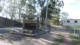
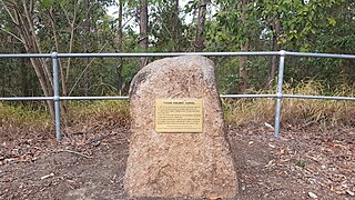
Moodlu is a rural locality in the City of Moreton Bay, Queensland, Australia. In the 2016 census, Moodlu had a population of 318 people.

Stony Creek is a rural locality in the City of Moreton Bay in Queensland, Australia. In the 2016 census Stony Creek had a population of 262 people.

<span class="mw-page-title-main">Yugar, Queensland</span> Suburb of City of Moreton Bay, Queensland, Australia

Yugar is a rural locality in the City of Moreton Bay, Queensland, Australia. In the 2021 census, Yugar had a population of 406 people.

<span class="mw-page-title-main">Villeneuve, Queensland</span> Suburb of Somerset Region, Queensland, Australia

Villeneuve is a rural town and locality in the Somerset Region, Queensland, Australia. In the 2021 census, the locality of Villeneuve had a population of 193 people.

<span class="mw-page-title-main">Mount Delaney</span> Suburb of City of Moreton Bay, Queensland, Australia

Mount Delaney is a rural locality in the City of Moreton Bay, Queensland, Australia. In the 2016 census Mount Delaney had a population of 85 people.

<span class="mw-page-title-main">Rush Creek, Queensland</span> Suburb of City of Moreton Bay, Queensland, Australia

Rush Creek is a rural locality in the City of Moreton Bay, Queensland, Australia. In the 2016 census, Rush Creek had a population of 157 people.

<span class="mw-page-title-main">Carneys Creek, Queensland</span> Rural locality in Queensland, Australia

Carneys Creek is a rural locality in the Scenic Rim Region, Queensland, Australia. In the 2016 census, Carneys Creek had a population of 51 people. It borders New South Wales.

Bungadoo is a rural locality in the Bundaberg Region, Queensland, Australia. The area was formerly known as Albionville. In the 2021 census, Bungadoo had a population of 342 people.

<span class="mw-page-title-main">Kinbombi</span> Town in Queensland, Australia

Kinbombi is a rural town and locality in the Gympie Region, Queensland, Australia. In the 2016 census, the locality of Kinbombi had a population of 37 people.

Gregors Creek is a rural locality in the Somerset Region, Queensland, Australia. In the 2021 census, Gregors Creek had a population of 87 people.

The Head is a rural locality in the Southern Downs Region, Queensland, Australia. It borders New South Wales. In the 2021 census, The Head had a population of 12 people.

References

  1. 1 2 3 Australian Bureau of Statistics (27 June 2017). "Bellthorpe (SSC)". 2016 Census QuickStats. Retrieved 20 October 2018. OOjs UI icon edit-ltr-progressive.svg
  2. 1 2 "Bellthorpe – locality in Moreton Bay Region (entry 48330)". Queensland Place Names. Queensland Government . Retrieved 28 December 2020.
  3. "Queensland Globe". State of Queensland . Retrieved 27 July 2017.
  4. "Bellthorpe West – neighbourhood in the Moreton Bay Region (entry 2228)". Queensland Place Names. Queensland Government . Retrieved 27 July 2017.
  5. 1 2 Queensland Family History Society (2010), Queensland schools past and present (Version 1.01 ed.), Queensland Family History Society, ISBN   978-1-921171-26-0