Elimbah, Queensland

Last updated

Map all coordinates using: OpenStreetMap
Elimbah
Queensland
Elimbah State School, 2021.jpg
Elimbah State School, 2021
Australia Queensland location map.svg
Red pog.svg
Elimbah
Elimbah, Queensland
Coordinates 27°00′45″S152°56′37″E / 27.0125°S 152.9436°E / -27.0125; 152.9436 (Elimbah (town centre))
Population4,290 (SAL 2021) [1]
Postcode(s) 4516
Area100.1 km2 (38.6 sq mi)
Time zone AEST (UTC+10:00)
Location
LGA(s) City of Moreton Bay
State electorate(s)
Federal division(s)
Suburbs around Elimbah:
Woodford Beerburrum Beerburrum
Wamuran Elimbah Donnybrook
Wamuran Caboolture Toorbul

Elimbah is a rural town and locality in the City of Moreton Bay, Queensland, Australia. [2] [3] In the 2021 census, the locality of Elimbah had a population of 4,290 people. [4]

Contents

Geography

Elimbah is located north of the larger centre of Caboolture, and south of Beerburrum.[ citation needed ]

Elimbah has the following mountains:

The Bruce Highway passes from south to north through the locality. [9] Further west, Beerburrum Road also runs through from south to north. Glass House Mountains Road (Steve Irwin Way) passes through the north-east corner. [10] The North Coast railway line also passes from south to north through the locality, roughly parallel to the highway. The town is served by Elimbah railway station ( 27°00′40″S152°56′45″E / 27.0110°S 152.9459°E / -27.0110; 152.9459 (Elimbah railway station) ). [11]

History

The traditional owners of Elimbah were the Kabi people, who called the area as the "place of the grey water snake". [2] [12]

The town was originally a campsite known as The Six Mile when it became a resting place for horses and bullocks. In 1890, with the breakthrough of the North Coast railway line, it became known as "36miles 68chains". On 20 September 1902, at the urging of local residents, it was officially named Elimbah. [12]

Elimbah State School opened on 3 November 1915. [13] The school was officially opened on Australia Day in 1916. [14]

Dedication of Elimbah Soldiers Memorial Hall, 1922 Elimbah Hall 1922 - opening of hall.jpg
Dedication of Elimbah Soldiers Memorial Hall, 1922

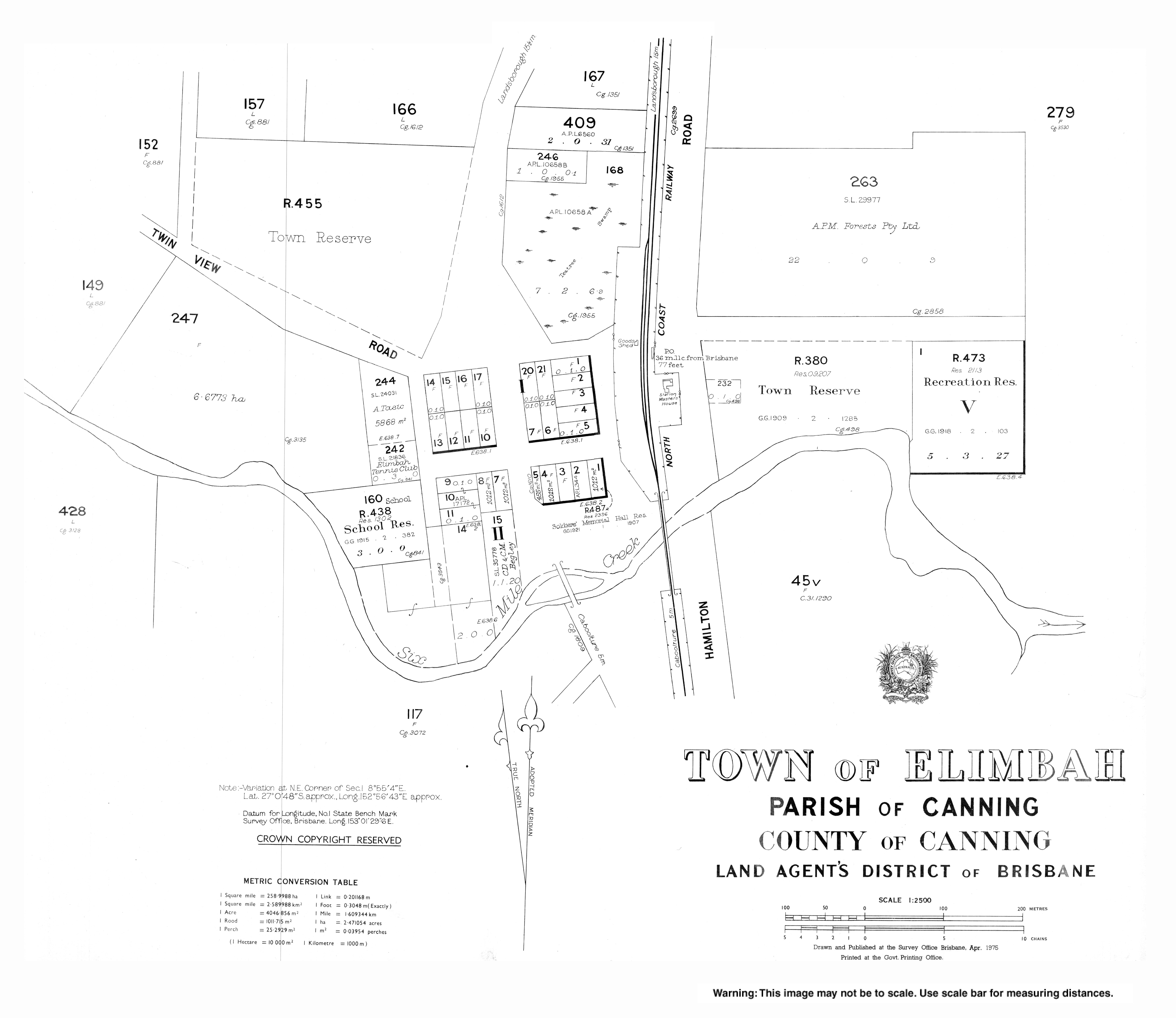
Fundraising for Elimbah Hall began in 1915 and dedicated to returned servicemen on ANZAC Day, 25 April 1922. [15]

Staff and students at Twin View State School, circa 1921 Staff and students at Twin View State School, circa 1921.jpg
Staff and students at Twin View State School, circa 1921

Twin View State School opened on 4 January 1921 and closed in October 1924. [16] The building was then relocated to Wamuran to be the new school building for Wamuran State School. [17]

The Methodist Church purchased 3 blocks of land in Elimbah in 1913. [18] In 1953, a church was being constructed, with Elimbah Methodist Church opening in 1954. [19] With the amalgamation of the Methodist Church into the Uniting Church in Australia in 1977, it became Elimbah Uniting Church. [20]

Demographics

In the 2016 census, Elimbah recorded a population of 3,963 people, 48.7% female and 51.3% male. [21] The median age of the Elimbah population was 39 years, two years older than the national median. Aboriginal and Torres Strait Islander people made up 3.2% of the population. 80.7% of people were born in Australia. The next most common countries of birth were England 3.9% and New Zealand 3.7%. 90.1% of people spoke only English at home. The most common responses for religion were No Religion 30.6%, Catholic 21.5% and Anglican 17.3%.In the 2016 census, the locality of Elimbah had a population of 3,963 people. [21]

In the 2021 census, the locality of Elimbah had a population of 4,290 people. [4]

Education

Elimbah State School is a government primary (Prep–6) school for boys and girls at School Road ( 27°00′46″S152°56′33″E / 27.0127°S 152.9424°E / -27.0127; 152.9424 (Elimbah State School) ). [22] [23] It includes a special education program. [22] In 2018, the school had an enrolment of 437 students with 35 teachers (30 full-time equivalent) and 22 non-teaching staff (14 full-time equivalent). [24]

There is no secondary school in Elimbah. The nearest government secondary schools are Caboolture State High School and Tullawong State High School, both in neighbouring Caboolture to the south. [9]

Amenities

Elimbah Uniting Church, 2006 Elimbah Uniting Church (formerly Methodist Church), 2006 01.jpg
Elimbah Uniting Church, 2006

Elimbah Soldiers Memorial Hall is at 10a Coronation Drive. [15]

Elimbah Uniting Church is at 3 Coronation Drive ( 27°00′45″S152°56′39″E / 27.0124°S 152.9442°E / -27.0124; 152.9442 (Elimbah Uniting Church) ). [25] [26] [27] It is part of the Moreton Rivers Presbytery of the Uniting Church in Australia. [28]

St Mary Magdalene Orthodox Christian Mission is part of the Antiochian Orthodox Christian Archdiocese of Australia, New Zealand and the Philippines. It meets in the Uniting Church. [29]

Related Research Articles

<span class="mw-page-title-main">Burpengary</span> Suburb of City of Moreton Bay, Queensland, Australia

Burpengary is a town and suburb in the City of Moreton Bay, Queensland, Australia. In the 2016 census, the suburb of Burpengary had a population of 14,022 people.

<span class="mw-page-title-main">Caboolture, Queensland</span> Suburb of Brisbane, Queensland, Australia

Caboolture is a town and suburb in the City of Moreton Bay, Queensland, Australia. In the 2021 census, the suburb of Caboolture had a population of 29,534 people. It is located on the northern side of the Caboolture River.

<span class="mw-page-title-main">Mount Pleasant, Queensland (Moreton Bay)</span> Suburb of City of Moreton Bay, Queensland, Australia

Mount Pleasant is a rural locality in the City of Moreton Bay, Queensland, Australia. In the 2016 census, Mount Pleasant had a population of 332 people.

<span class="mw-page-title-main">Dayboro, Queensland</span> Town in Queensland, Australia

Dayboro is a rural town and locality in the City of Moreton Bay, Queensland, Australia. In the 2016 census, the locality of Dayboro had a population of 2,119 people.

<span class="mw-page-title-main">Woodford, Queensland</span> Town in Queensland, Australia

Woodford is a rural town and locality in the City of Moreton Bay, Queensland, Australia. In the 2016 census, the locality of Woodford had a population of 3,458 people.

<span class="mw-page-title-main">Morayfield, Queensland</span> Suburb of Moreton Bay, Queensland, Australia

Morayfield is a town and suburb in the City of Moreton Bay, Queensland, Australia. In the 2016 census, the suburb of Morayfield had a population of 21,394 people.

Donnybrook is a coastal town and locality in the City of Moreton Bay, Queensland, Australia. In the 2016 census, the locality of Donnybrook had a population of 617 people.

<span class="mw-page-title-main">City of Moreton Bay</span> Local government area in Queensland, Australia

The City of Moreton Bay, known until July 2023 as the Moreton Bay Region, is a local government area in the north of the Brisbane metropolitan city in South East Queensland, Australia. Established in 2008, it replaced three established local government areas, the City of Redcliffe and the Shires of Pine Rivers and Caboolture.

<span class="mw-page-title-main">Beachmere, Queensland</span> Town in Queensland, Australia

Beachmere is a coastal rural town and locality in the City of Moreton Bay, Queensland, Australia. In the 2021 census, the locality of Beachmere had a population of 4,782 people.

<span class="mw-page-title-main">Caboolture South, Queensland</span> Suburb of Moreton Bay, Queensland, Australia

Caboolture South is a suburb in the City of Moreton Bay, Queensland, Australia. In the 2016 census, Caboolture South had a population of 5,300 people.

<span class="mw-page-title-main">Mount Mee, Queensland</span> Town in Queensland, Australia

Mount Mee is a rural town and locality in the City of Moreton Bay, Queensland, Australia. In the 2021 census, Mount Mee had a population of 519 people.

<span class="mw-page-title-main">D'Aguilar, Queensland</span> Suburb of City of Moreton Bay, Queensland, Australia

D'Aguilar is a rural town and locality in the City of Moreton Bay, Queensland, Australia. In the 2016 census, the locality of D'Aguilar had a population of 1,207 people.

Bellmere is a rural locality in the City of Moreton Bay, Queensland, Australia. In the 2016 census, Bellmere had a population of 5,863 people.

<span class="mw-page-title-main">Wamuran, Queensland</span> Town in Queensland, Australia

Wamuran is a rural town and locality in the City of Moreton Bay, Queensland, Australia. In the 2016 census, the locality of Wamuran had a population of 3,196 people.

<span class="mw-page-title-main">Upper Caboolture, Queensland</span> Suburb of City of Moreton Bay, Queensland, Australia

Upper Caboolture is a rural locality in the City of Moreton Bay, Queensland, Australia. In the 2016 census, Upper Caboolture had a population of 4214 people. Formerly a rural area on the fringe of the town of Caboolture, since the 1990s the suburb has become increasingly urbanised.

Meldale is a coastal rural locality in the City of Moreton Bay, Queensland, Australia. In the 2016 census, Meldale had a population of 223 people.

<span class="mw-page-title-main">Moodlu, Queensland</span> Suburb of City of Moreton Bay, Queensland, Australia

Moodlu is a rural locality in the City of Moreton Bay, Queensland, Australia. In the 2016 census, Moodlu had a population of 318 people.

<span class="mw-page-title-main">Rocksberg</span> Suburb of City of Moreton Bay, Queensland, Australia

Rocksberg is a rural locality in the City of Moreton Bay, Queensland, Australia. In the 2016 census, Rocksberg had a population of 300 people.

Burpengary East is a coastal suburb in the City of Moreton Bay, Queensland, Australia. In the 2021 census, Burpengary East had a population of 9,654 people.

Beerburrum Road is a continuous 15.2-kilometre (9.4 mi) road route in the Moreton Bay and Sunshine Coast local government areas of Queensland, Australia. It is designated as part of State Route 60. It is a state-controlled district road, rated as a local road of regional significance (LRRS).

References

  1. Australian Bureau of Statistics (28 June 2022). "Elimbah (suburb and locality)". Australian Census 2021 QuickStats. Retrieved 28 June 2022.  OOjs UI icon edit-ltr-progressive.svg
  2. 1 2 "Elimbah – town in Moreton Bay Region (entry 11475)". Queensland Place Names. Queensland Government . Retrieved 20 July 2021.
  3. "Elimbah – locality in Moreton Bay Region (entry 45434)". Queensland Place Names. Queensland Government . Retrieved 20 July 2021.
  4. 1 2 Australian Bureau of Statistics (28 June 2022). "Elimbah (SAL)". 2021 Census QuickStats. Retrieved 28 February 2023. OOjs UI icon edit-ltr-progressive.svg
  5. 1 2 3 "Mountain peaks and capes - Queensland". Queensland Open Data. Queensland Government. 12 November 2020. Archived from the original on 25 November 2020. Retrieved 25 November 2020.
  6. "Round Mountain – mountain in Moreton Bay Region (entry 29195)". Queensland Place Names. Queensland Government . Retrieved 25 November 2020.
  7. "The Saddleback – mountain in Moreton Bay Region (entry 34101)". Queensland Place Names. Queensland Government . Retrieved 25 November 2020.
  8. "Tunbubudla – mountain in Moreton Bay Region (entry 35327)". Queensland Place Names. Queensland Government . Retrieved 25 November 2020.
  9. 1 2 "Queensland Globe". State of Queensland . Retrieved 14 December 2021.
  10. Google (28 October 2022). "Elimbah" (Map). Google Maps . Google. Retrieved 28 October 2022.
  11. "Railway stations and sidings - Queensland". Queensland Open Data. Queensland Government. 2 October 2020. Archived from the original on 5 October 2020. Retrieved 5 October 2020.
  12. 1 2 "Elimbah history". Moreton Bay Regional Council . Archived from the original on 4 May 2021. Retrieved 30 April 2021.
  13. "Opening and closing dates of Queensland Schools". Queensland Government . Retrieved 6 May 2019.
  14. "Our community". Elimbah State School. 26 February 2020. Archived from the original on 10 November 2023. Retrieved 20 December 2023.
  15. 1 2 "Elimbah Soldiers Memorial Hall | Monument Australia". monumentaustralia.org.au. Archived from the original on 21 November 2023. Retrieved 20 December 2023.
  16. Queensland Family History Society (2010), Queensland schools past and present (Version 1.01 ed.), Queensland Family History Society, ISBN   978-1-921171-26-0
  17. "WAMURAN SCHOOL". The Brisbane Courier . No. 20, 972. Queensland, Australia. 13 April 1925. p. 9. Archived from the original on 30 November 2021. Retrieved 27 November 2019 via National Library of Australia.
  18. "Crown Land Sale". The Brisbane Courier . No. 17, 234. Queensland, Australia. 9 April 1913. p. 9. Archived from the original on 14 December 2021. Retrieved 15 September 2021 via National Library of Australia.
  19. "About us". Elimbah Uniting Church. Archived from the original on 15 September 2021. Retrieved 15 September 2021.
  20. "Denominations". Australian Christian Church Histories. Archived from the original on 23 August 2021. Retrieved 14 December 2021.
  21. 1 2 Australian Bureau of Statistics (27 June 2017). "Elimbah (SSC)". 2016 Census QuickStats. Retrieved 20 October 2018. OOjs UI icon edit-ltr-progressive.svg CC-BY icon.svg Material was copied from this source, which is available under a Creative Commons Attribution 4.0 International License "Creative Commons — Attribution 4.0 International — CC BY 4.0". Archived from the original on 16 October 2017. Retrieved 21 September 2018..
  22. 1 2 "State and non-state school details". Queensland Government. 9 July 2018. Archived from the original on 21 November 2018. Retrieved 21 November 2018.
  23. "Elimbah State School". Elimbah State School. 26 February 2020. Archived from the original on 6 March 2021. Retrieved 13 December 2021.
  24. "ACARA School Profile 2018". Australian Curriculum, Assessment and Reporting Authority. Archived from the original on 27 August 2020. Retrieved 28 January 2020.
  25. "Find a Church". Uniting Church in Australia, Queensland Synod. Archived from the original on 24 October 2020. Retrieved 22 November 2020.
  26. "Elimbah UC". Elimbah Uniting Church. Archived from the original on 15 September 2021. Retrieved 15 September 2021.
  27. "Elimbah Uniting Church". Churches Australia. Archived from the original on 15 September 2021. Retrieved 15 September 2021.
  28. "Queensland congregations and faith communities" (PDF). Uniting Church in Australia, Queensland Synod . March 2019. Archived (PDF) from the original on 20 October 2021. Retrieved 19 October 2021.
  29. "St Mary Magdalene Orthodox Christian Mission". Churches Australia. Archived from the original on 29 October 2021. Retrieved 13 December 2021.