Rocksberg

Last updated

Map all coordinates using: OpenStreetMap  
Rocksberg
Queensland
Rocksberg Creek.jpg
Mid-morning at the creek in Rocksberg Heritage Park, Queensland, Australia.
Australia Queensland location map.svg
Red pog.svg
Rocksberg
Coordinates 27°06′45″S152°50′34″E / 27.1125°S 152.8428°E / -27.1125; 152.8428 (Rocksberg (centre of locality))
Population300 (2016 census) [1]
 • Density11.9/km2 (31/sq mi)
Postcode(s) 4510
Area25.3 km2 (9.8 sq mi)
Time zone AEST (UTC+10:00)
Location
LGA(s) Moreton Bay Region
State electorate(s) Glass House
Federal division(s) Longman
Suburbs around Rocksberg:
Campbells Pocket Wamuran Corymbia
Ocean View Rocksberg Greenstone
Ocean View Moorina Upper Caboolture

Rocksberg is a rural locality in the Moreton Bay Region, Queensland, Australia. [2] In the 2016 census, Rocksberg had a population of 300 people. [1]

In April 2023, the Queensland Government decided to reflect the growing population of the region by creating five new localities named Corymbia, Greenstone, Lilywood, Wagtail Grove, and Waraba by excising parts of the existing localities of Bellmere, Rocksberg, Upper Caboolture, and Wamuran. [3] [4] [5] Rocksberg lost land to Corymbia, Greenstone, and Wagtail Grove. [2]

Geography

The Caboolture River flows from north to east through the locality with Zillmans Crossing ( 27°07′18″S152°51′32″E / 27.1218°S 152.8588°E / -27.1218; 152.8588 (Zillmans Crossing) ) being a former ford (now a low-level bridge) across the river. The ford was part of the Old North Road (now superseded by the Bruce Highway) and was named after Leopold Zillman, an early pioneer farmer in the area. [6] The river flats (elevation about 50 metres above sea level) are used for agriculture, mostly grazing, but the western side of the locality is undeveloped mountain land rising to numerous unnamed peaks, the highest being 350 metres above sea level. [7]

There is a picnic reserve near Zillmans Crossing. [8]

History

The locality takes its name from the property name used by the Zillman family. [2] In the early 1840s, the Archer brothers of Durundur Station and Evan Mackenzie of Kilcoy Station blazed a trail to connect their farms with Brisbane, creating Old North Road (as it now known) as the first road north from Brisbane. Later it was supplanted by a road closer to the coast (now known as Old Gympie Road) and subsequently by the Bruce Highway even closer to the coast. [8]

Rocksberg Provisional School opened on 19 June 1893, becoming Rocksberg State School on 1 January 1909. It closed in 1954. [9] It was located at approx 5 W James Road ( 27°06′23″S152°50′10″E / 27.1063°S 152.8361°E / -27.1063; 152.8361 (Rocksberg State School (former)) ). [10]

In the 2011 census, Rocksberg recorded a population of 302 people, 49% female and 51% male. The median age of the Rocksberg population was 43 years, 6 years above the Australian median. 76.6% of people living in Rocksberg were born in Australia. The other top responses for country of birth were England 4.7%, New Zealand 2.7%, South Africa 2.3%, Indonesia 1%, Netherlands 1%. 88% of people spoke only English at home; the next most common languages were 1% Dutch, 1% German, 1% Indonesian, 0% Irish, 0% Gaelic (Scotland). [11]

In the 2016 census, Rocksberg had a population of 300 people. [1]

In April 2023, the Queensland Government decided to reflect the growing population of the region by creating five new localities named Corymbia, Greenstone, Lilywood, Wagtail Grove, and Waraba by excising parts of the existing localities of Bellmere, Rocksberg, Upper Caboolture, and Wamuran. [3] [4] [5] Rocksberg lost land to Corymbia, Greenstone, and Wagtail Grove. [2]

Education

There are no schools in Rocksberg. The nearest government primary schools are Bellmere State School in neighbouring Bellmere to the north-east, Minimbah State School in Morayfield to the east, and Dayboro State School in Dayboro to the south. The nearest government secondary schools are Tullawong State High School in Caboolture to the north-east, Morayfield State High School in Morayfield to the east, and Bray Park State High School in Bray Park to the south-east. [7]

Attractions

Rocksberg Park Heritage Reserve is a recreational area on McNamara Road alongside the Caboolture River ( 27°05′40″S152°50′14″E / 27.0944°S 152.8371°E / -27.0944; 152.8371 (Rocksberg Park Heritage Reserve) ). It has information about early pioneers of the district. [12] It is part of the Caboolture Heritage Drive. [13]

Related Research Articles

<span class="mw-page-title-main">Bruce Highway</span> Highway in Queensland, Australia

The Bruce Highway is a major highway in Queensland, Australia. Commencing in the state capital, Brisbane, it passes through areas close to the eastern coast on its way to Cairns in Far North Queensland. The route is part of the Australian National Highway and also part of Highway 1, the longest highway route in Australia. Its length is approximately 1,679 kilometres (1,043 mi); it is entirely sealed with bitumen. The highway is named after a popular former Queensland and federal politician, Harry Bruce. Bruce was the state Minister for Works in the mid-1930s when the highway was named after him. The highway once passed through Brisbane, but was truncated at Bald Hills when the Gateway Motorway became National Highway 1 upon its opening in December 1986.

<span class="mw-page-title-main">Burpengary</span> Town in Queensland, Australia

Burpengary is a town and suburb in the Moreton Bay Region, Queensland, Australia. In the 2016 census, the suburb of Burpengary had a population of 14,022 people.

<span class="mw-page-title-main">Caboolture, Queensland</span> Suburb of Moreton Bay Region, Queensland, Australia

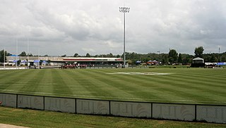
Caboolture is a town and suburb in Moreton Bay Region, Queensland, Australia. In the 2021 census, the suburb of Caboolture had a population of 29,534 people. It is located on the northern side of the Caboolture River.

<span class="mw-page-title-main">Mount Pleasant, Queensland (Moreton Bay Region)</span> Suburb of Moreton Bay Region, Queensland, Australia

Mount Pleasant is a rural locality in the Moreton Bay Region, Queensland, Australia. In the 2016 census, Mount Pleasant had a population of 332 people.

<span class="mw-page-title-main">Morayfield, Queensland</span> Town in Queensland, Australia

Morayfield is a town and suburb in the Moreton Bay Region, Queensland, Australia. In the 2016 census, the suburb of Morayfield had a population of 21,394 people.

<span class="mw-page-title-main">Moreton Bay Region</span> Local government area in Queensland, Australia

The Moreton Bay Region is a local government area in the north of the Brisbane metropolitan city in South East Queensland, Australia. Established in 2008, it replaced three established local government areas, the City of Redcliffe and the Shires of Pine Rivers and Caboolture.

<span class="mw-page-title-main">Caboolture South, Queensland</span> Suburb of Moreton Bay, Queensland, Australia

Caboolture South is a suburb in the Moreton Bay Region, Queensland, Australia. In the 2016 census, Caboolture South had a population of 5,300 people.

<span class="mw-page-title-main">D'Aguilar, Queensland</span> Suburb of Moreton Bay Region, Queensland, Australia

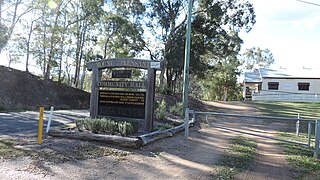
D'Aguilar is a rural town and locality in the Moreton Bay Region, Queensland, Australia. In the 2016 census, the locality of D'Aguilar had a population of 1,207 people.

Bellmere is a rural locality in the Moreton Bay Region, Queensland, Australia. In the 2016 census, Bellmere had a population of 5,863 people.

King Scrub is a rural locality in the Moreton Bay Region, Queensland, Australia. In the 2016 census, King Scrub had a population of 348 people. It is located on the northern outskirts of Dayboro.

Elimbah is a rural town and locality in the Moreton Bay Region, Queensland, Australia. In the 2016 census, the locality of Elimbah had a population of 3,963 people.

<span class="mw-page-title-main">Wamuran, Queensland</span> Town in Queensland, Australia

Wamuran is a rural town and locality in the Moreton Bay Region, Queensland, Australia. In the 2016 census, the locality of Wamuran had a population of 3,196 people.

<span class="mw-page-title-main">Upper Caboolture, Queensland</span> Suburb of Moreton Bay Region, Queensland, Australia

Upper Caboolture is a rural locality in the Moreton Bay Region, Queensland, Australia. In the 2016 census, Upper Caboolture had a population of 4214 people. Formerly a rural area on the fringe of the town of Caboolture, since the 1990s the suburb has become increasingly urbanised.

<span class="mw-page-title-main">Moodlu, Queensland</span> Suburb of Moreton Bay Region, Queensland, Australia

Moodlu is a rural locality in the Moreton Bay Region, Queensland, Australia. In the 2016 census, Moodlu had a population of 318 people.

<span class="mw-page-title-main">Kilcoy railway line</span> Former railway line in Queensland

The Kilcoy railway line is a disused, partly demolished narrow gauge railway in South East Queensland, Australia.

Corymbia is a rural locality in the Moreton Bay Region, Queensland, Australia.

Greenstone is a rural locality in the Moreton Bay Region, Queensland, Australia.

Lilywood is a rural locality in the Moreton Bay Region, Queensland, Australia.

Wagtail Grove is a rural locality in the Moreton Bay Region, Queensland, Australia.

Waraba is a rural locality in the Moreton Bay Region, Queensland, Australia.

References

  1. 1 2 3 Australian Bureau of Statistics (27 June 2017). "Rocksberg (SSC)". 2016 Census QuickStats. Retrieved 20 October 2018. OOjs UI icon edit-ltr-progressive.svg
  2. 1 2 3 4 "Rocksberg – locality in Moreton Bay Region (entry 52231)". Queensland Place Names. Queensland Government . Retrieved 15 July 2023.
  3. 1 2 "Current proposals and decisions". Place Names. Queensland Government. Archived from the original on 21 June 2023. Retrieved 12 July 2023.
  4. 1 2 "Proposed Locality Names and Boundaries: Bellmere / Corymbia / Greenstone / Lilywood / Rocksberg / Upper Caboolture / Wagtail Grove / Wamuran / Waraba" (PDF) (Map). Queensland Government. 2 December 2022. Archived (PDF) from the original on 21 June 2023. Retrieved 12 July 2023.
  5. 1 2 "Locality Names and Boundaries: Bellmere / Corymbia / Greenstone / Lilywood / Rocksberg / Upper Caboolture / Wagtail Grove / Wamuran / Waraba" (PDF) (Map). Queensland Government. 14 April 2023. Archived (PDF) from the original on 21 June 2023. Retrieved 12 July 2023.
  6. "Zillmans Crossing – ford in City of Brisbane (entry 38852)". Queensland Place Names. Queensland Government . Retrieved 26 March 2018.
  7. 1 2 "Queensland Globe". State of Queensland . Retrieved 24 February 2022.
  8. 1 2 "Caboolture River Road: a Journey Through Time" (PDF). Moreton Bay Regional Council. Archived (PDF) from the original on 13 March 2016. Retrieved 26 March 2018.
  9. Queensland Family History Society (2010), Queensland schools past and present (Version 1.01 ed.), Queensland Family History Society, ISBN   978-1-921171-26-0
  10. "Caboolture" (Map). Queensland Government. 1932. Archived from the original on 24 September 2020. Retrieved 23 February 2022.
  11. Australian Bureau of Statistics (31 October 2012). "Rocksberg (SSC)". 2011 Census QuickStats. Retrieved 23 February 2022. OOjs UI icon edit-ltr-progressive.svg
  12. "Rocksberg Park Heritage Reserve". Visit Moreton Bay Region. Archived from the original on 13 May 2021. Retrieved 23 February 2022.
  13. "Caboolture Heritage Drive Guide" (PDF). Moreton Bay Regional Council . Archived (PDF) from the original on 19 March 2021. Retrieved 24 February 2022.