Stony Creek, Queensland

Last updated

Map all coordinates using: OpenStreetMap  
Download coordinates as: KML
Stony Creek
Queensland
Australia Queensland location map.svg
Red pog.svg
Stony Creek
Coordinates 26°55′09″S152°42′43″E / 26.9191°S 152.7119°E / -26.9191; 152.7119 (Stony Creek (centre of locality))
Population262 (2016 census) [1]
 • Density5.784/km2 (14.98/sq mi)
Postcode(s) 4514
Area45.3 km2 (17.5 sq mi)
Time zone AEST (UTC+10:00)
Location
LGA(s) Moreton Bay Region
State electorate(s) Pumicestone
Federal Division(s) Longman
Suburbs around Stony Creek:
Sandy Creek Bellthorpe Bellthorpe
Royston Stony Creek Woodford
Royston Neurum Woodford

Stony Creek (formerly Stoney Creek) is a rural locality in the Moreton Bay Region of Queensland, Australia. [2] In the 2016 census Stony Creek had a population of 262 people. [1]

Contents

Geography

The locality is 68 kilometres (42 mi) north of Brisbane.

The locality is bounded to the south by the Stanley River and to the south-west by Mary Smokes Creek. [3]

Mount Mclean is in the north-west of the locality ( 26°53′00″S152°44′28″E / 26.8832°S 152.7412°E / -26.8832; 152.7412 (Mount Mclean) ) and rises to 464 metres (1,522 ft) above sea level. [4] [5]

Stony Creek is a watercourse that rises in Bellthorpe to the north-west and flows roughly south through the locality of Stone Creek where it becomes a tributary of the Stanley River at 26°56′41″S152°43′23″E / 26.9447°S 152.7230°E / -26.9447; 152.7230 (Stony Creek (mouth)) on the boundary with Neurum to the south. [6]

The D'Aguilar Highway enters the locality from the east (Woodford) and exits to the west (Royston). [3]

Most of the residential land use is along the D'Aguilar Highway and Stony Creek Road. There are small areas of forestry and cropping, but the predominant land use in the locality is grazing on native vegetation. [3]

History

Pupils of the Kalangara State School, 1950 Pupils of the Kalangara Primary School in 1950, Queensland.jpg
Pupils of the Kalangara State School, 1950

Stony Creek Provisional School opened circa 1877. On 1 January 1909 it became Stony Creek State School. Due to low student numbers it closed in 1914. [7]

The Durundur Provisional School opened on 5 July 1897. In 1909 it became Durundur State School. It was renamed Kalangara State School in 1920. The school closed on 25 August 1963. [8] The school was on Stony Creek Road ( 26°55′12″S152°43′18″E / 26.9200°S 152.7217°E / -26.9200; 152.7217 (Kalangara State School (former)) ). [9] [10] [3] There was a hall adjacent to the school ( 26°55′15″S152°43′19″E / 26.9207°S 152.7220°E / -26.9207; 152.7220 (Hall) ). [9]

In the 2011 census, Stony Creek had a population of 319 people. [11]

In the 2016 census Stony Creek had a population of 262 people. [1]

Education

There are no schools in Stony Creek. The nearest government primary schools are Woodford State School in neighbouring Woodford to the south-east and Mount Kilcoy State School in Mount Kilcoy to the north-west. The nearest government secondary schools are Woodford State School (to Year 10) and Kilcoy State High School in Kilcoy to the south-west. [3]

Demographics

In the 2011 census, Stony Creek recorded a population of 319 people, 44.8% female and 55.2% male.

The median age of the Stony Creek population was 45 years, 8 years above the national median of 37.

82.8% of people living in Stony Creek were born in Australia. The other top responses for country of birth were New Zealand 3.4%, England 3.1%, Vanuatu 1.2%, Scotland 0.9%, Italy 0.9%.

90.7% of people spoke only English at home; the next most common languages were 0.9% Pacific Austronesian Languages, nec, 0.9% French, 0.9%.

Notable people

Related Research Articles

Kilcoy, Queensland Town in Queensland, Australia

Kilcoy is a town and locality in the Somerset Region local government area in South East Queensland, Australia.

Woodford, Queensland Town in Queensland, Australia

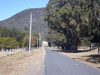
Woodford is a town and a locality in the Moreton Bay Region, Queensland, Australia.

Moreton Bay Region Local government area in Queensland, Australia

The Moreton Bay Region is a local government area in the north of the Brisbane metropolitan area in South East Queensland, Australia. Established in 2008, it replaced three established local government areas, the City of Redcliffe and the Shires of Pine Rivers and Caboolture.

Closeburn, Queensland Suburb of Moreton Bay Region, Queensland, Australia

Closeburn is a rural locality in the Moreton Bay Region, Queensland, Australia. In the 2016 census Closeburn had a population of 594 people.

DAguilar, Queensland Suburb of Moreton Bay Region, Queensland, Australia

D'Aguilar is a rural township and locality in the Moreton Bay Region, Queensland, Australia. It is located northwest of the larger centre of Caboolture. In the 2011 census, the locality recorded a population of 830 persons, living in 255 inhabited dwellings, all of which were detached houses.

Delaneys Creek, Queensland Suburb of Moreton Bay Region, Queensland, Australia

Delaneys Creek is a rural locality in the Moreton Bay Region, Queensland, Australia. In the 2016 census Delaneys Creek had a population of 1,061 people.

Conondale Range

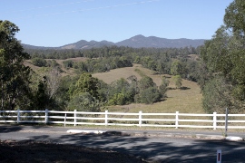
The Conondale Range is a mountain range in Queensland, located between Maleny, Kenilworth, Kilcoy and Jimna. The range is the most westerly part of the Sunshine Coast hinterland and part of the Great Dividing Range. The highest point on the range is Mount Langley reaching 868 m above sea level. This is also the highest point in the Brisbane River catchment.

Bellthorpe, Queensland Suburb of Moreton Bay Region, Queensland, Australia

Bellthorpe is a rural locality in the Moreton Bay Region, Queensland, Australia. In the 2016 census Bellthorpe had a population of 124 people.

Moore, Queensland Town in Queensland, Australia

Moore is a rural town and locality in the Somerset Region, Queensland, Australia. In the 2016 census the locality of Moore had a population of 296 people.

Kobble Creek Suburb of Moreton Bay Region, Queensland, Australia

Kobble Creek is a rural locality in the Moreton Bay Region, Queensland, Australia. In the 2016 census, Kobble Creek had a population of 632 people.

Jimna, Queensland Suburb of Somerset Region, Queensland, Australia

Jimna is a rural town and locality in the Somerset Region, Queensland, Australia. In the 2016 census the locality of Jimna had a population of 91 people.

Rocksberg Suburb of Moreton Bay Region, Queensland, Australia

Rocksberg is a locality in the Moreton Bay Region, Queensland, Australia. In 2016 census, Rocksberg had a population of 300.

Stanmore, Queensland Suburb of Moreton Bay Region, Queensland, Australia

Stanmore is a rural locality in the Moreton Bay Region, Queensland, Australia. In the 2016 census Stanmore had a population of 437 people.

Mount Delaney Suburb of Moreton Bay Region, Queensland, Australia

Mount Delaney is a rural locality in the Moreton Bay Region, Queensland, Australia. In the 2016 census Mount Delaney had a population of 85 people.

Mount Archer, Queensland (Somerset Region) Suburb of Somerset Region, Queensland, Australia

Mount Archer is a mountain and a rural locality in the Somerset Region, Queensland, Australia. In the 2016 census the locality of Mount Archer had a population of 305 people.

Glenfern, Queensland Suburb of Somerset Region, Queensland, Australia

Glenfern is a rural locality in the Somerset Region, Queensland, Australia. In the 2016 census Glenfern had a population of 10 people.

Mount Kilcoy, Queensland Suburb of Somerset Region, Queensland, Australia

Mount Kilcoy is a rural locality in the Somerset Region, Queensland, Australia. In the 2016 census, Mount Kilcoy had a population of 261 people.

Hazeldean, Queensland Suburb of Somerset Region, Queensland, Australia

Hazeldean is a rural locality in the Somerset Region, Queensland, Australia. In the 2016 census, Hazeldean had a population of 262 people.

Lake Borumba, Queensland Suburb of Gympie Region, Queensland, Australia

Lake Borumba is a rural locality in the Gympie Region, Queensland, Australia. In the 2016 census Lake Borumba had a population of 6 people.

Durundur Mission

Durundur Mission was an Aboriginal reserve in Queensland, Australia. It operated from 1877 to 1905 in the area now known as Woodford in the Moreton Bay Region.

References

  1. 1 2 3 Australian Bureau of Statistics (27 June 2017). "Stony Creek (SSC)". 2016 Census QuickStats. Retrieved 20 October 2018. OOjs UI icon edit-ltr-progressive.svg
  2. "Stony Creek – locality in Moreton Bay Region (entry 45482)". Queensland Place Names. Queensland Government . Retrieved 28 December 2020.
  3. 1 2 3 4 5 "Queensland Globe". State of Queensland . Retrieved 15 March 2021.
  4. "Mountain peaks and capes - Queensland". Queensland Open Data. Queensland Government. 12 November 2020. Archived from the original on 25 November 2020. Retrieved 25 November 2020.
  5. "Mount Mclean – mountain in Moreton Bay Region (entry 21437)". Queensland Place Names. Queensland Government . Retrieved 25 November 2020.
  6. "Stony Creek – watercourse in Moreton Bay Regional (entry 32525)". Queensland Place Names. Queensland Government . Retrieved 28 December 2020.
  7. Queensland Family History Society (2010), Queensland schools past and present (Version 1.01 ed.), Queensland Family History Society, ISBN   978-1-921171-26-0
  8. "Agency ID 6180, Kalangara State School". Queensland State Archives . Retrieved 8 February 2014.
  9. 1 2 "Glasshouse" (Map). Queensland Government. 1942. Retrieved 15 March 2021.
  10. "Queensland Two Mile series sheet 2m74" (Map). Queensland Government. 1955. Retrieved 15 March 2021.
  11. Australian Bureau of Statistics (31 October 2012). "Stony Creek (SSC)". 2011 Census QuickStats. Retrieved 3 June 2016. OOjs UI icon edit-ltr-progressive.svg