Cedar Creek, Queensland (Moreton Bay Region)

Last updated

Cedar Creek
Queensland
Rural house, Cedar Creek, 2022.jpg
Farm house, 2022
Australia Queensland location map.svg
Red pog.svg
Cedar Creek
Coordinates 27°20′03″S152°48′54″E / 27.3341°S 152.815°E / -27.3341; 152.815 (Cedar Creek (centre of locality)) Coordinates: 27°20′03″S152°48′54″E / 27.3341°S 152.815°E / -27.3341; 152.815 (Cedar Creek (centre of locality))
Population745 (2016 census) [1]
 • Density38.40/km2 (99.5/sq mi)
Postcode(s) 4520
Area19.4 km2 (7.5 sq mi)
Time zone AEST (UTC+10:00)
Location
LGA(s) Moreton Bay Region
State electorate(s) Pine Rivers
Federal division(s) Dickson
Suburbs around Cedar Creek:
Mount Glorious Mount Samson Mount Samson
Mount Glorious Cedar Creek Closeburn
Yugar
Highvale Highvale Samford Valley

Cedar Creek is a rural locality in the Moreton Bay Region, Queensland, Australia. [2] In the 2016 census, Cedar Creek had a population of 745 people. [1]

Contents

Geography

View north across Cedar Creek showing the mountains and the valley, 2022 View north from Belinda Place, Cedar Creek, 2022 01.jpg
View north across Cedar Creek showing the mountains and the valley, 2022

The terrain in the west and south of the locality is mountainous, rising to unnamed peaks and ridges at 480 metres (1,570 ft) above sea level as part of the Fahey Range and the House Mountain Range. [3] [4] The mountainous terrain is mostly undeveloped. [5]

Cedar Creek (the watercourse) rises in neighbouring Mount Glorious to the west and flows through the locality of Cedar Creek, exiting to Closeburn to the east. The valley created by the creek is lower-lying flatter land ranging from 160 to 90 metres (520 to 300 ft) above sea level as the creek descends from west to east. The valley floor is used for a mixture of rural residential housing and farming (predominantly grazing on native vegetation with some perennial horticulture). [5]

Access into the locality of Cedar Creek is mostly via Cedar Creek Road from Closeburn with some parts of the north of the locality accessed via Herron Road also from Closeburn and a small area in the south-east of the locality accessed via Mayfield Road from neighbouring Samford Valley. [5]

History

Prior to the creation of Moreton Bay Region in 2008, Cedar Creek was in Pine Rivers Shire. [2]

In the 2011 census, Cedar Creek had a population of 634 people. [6]

In the 2016 census, Cedar Creek had a population of 745 people. [1]

Education

There are no schools in Cedar Creek. The nearest government primary school is Mount Samson State School in neighbouring Mount Samson to the north-east. The nearest government secondary school is Ferny Grove State High School in Ferny Grove in the City of Brisbane to the south-east. [5]

Amenities

Andy Williams Park (also known as Cedar Creek Park) is off Cedar Creek Road ( 27°19′43″S152°48′12″E / 27.32857°S 152.80323°E / -27.32857; 152.80323 (Andy Williams Park (Cedar Creek Park)) ). It has shallow creek pools. [7]

Shopping and other services are available in Samford Village to the south-east. [5]

Despite the name, Cedar Creek Public Hall is now within neighbouring Closeburn (near the watercourse Cedar Creek). [8]

Related Research Articles

<span class="mw-page-title-main">Mount Pleasant, Queensland (Moreton Bay Region)</span> Suburb of Moreton Bay Region, Queensland, Australia

Mount Pleasant is a rural locality in the Moreton Bay Region, Queensland, Australia. In the 2016 census, Mount Pleasant had a population of 332 people.

<span class="mw-page-title-main">D'Aguilar Range</span>

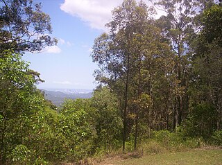
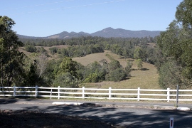
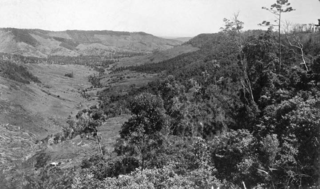
The D'Aguilar Range is a mountain range near Brisbane, Queensland, Australia. The town of Dayboro is situated on the lower foothills midway along the range and the Sunshine Coast Hinterland town of Mooloolah lies at the northernmost point of the range. Many residential areas line its eastern slopes including the town of Samford and the suburb of Ferny Hills. In the west, numerous ridges and gullies are heavily forested and designated as state forest or national park.

<span class="mw-page-title-main">Mount Glorious</span> Suburb of Moreton Bay Region, Queensland, Australia

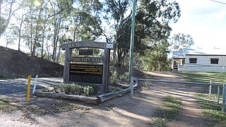
Mount Glorious is a rural locality in the Moreton Bay Region, Queensland, Australia. In the 2016 census, Mount Glorious had a population of 296 people.

<span class="mw-page-title-main">Dayboro, Queensland</span> Town in Queensland, Australia

Dayboro is a rural town and locality in the Moreton Bay Region, Queensland, Australia. In the 2016 census, the locality of Dayboro had a population of 2,119 people.

<span class="mw-page-title-main">Samford, Queensland</span> Town in Queensland, Australia

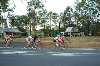
Samford is a town in Moreton Bay Region, South East Queensland, Australia. It consists of two localities, Samford Village and Samford Valley.

<span class="mw-page-title-main">Camp Mountain, Queensland</span> Suburb of Moreton Bay Region, Queensland, Australia

Camp Mountain is a rural locality in the Moreton Bay Region, Queensland, Australia. In the 2016 census, Camp Mountain had a population of 1,416 people.

<span class="mw-page-title-main">Samford Valley, Queensland</span> Suburb of Moreton Bay Region, Queensland, Australia

Samford Valley is a rural locality in the Moreton Bay Region, Queensland, Australia. It is one of two localities in the town of Samford, the other being Samford Village. In the 2016 census, Samford Valley had a population of 3,068 people.

Samford Village is a rural locality in the Moreton Bay Region, Queensland, Australia. It is one of two localities in the town of Samford, the other being Samford Valley. The town’s urban area occupies much of the land of the locality. In the 2016 census, Samford Village had a population of 796 people.

<span class="mw-page-title-main">Closeburn, Queensland</span> Suburb of Moreton Bay Region, Queensland, Australia

Closeburn is a rural locality in the Moreton Bay Region, Queensland, Australia. In the 2016 census, Closeburn had a population of 594 people.

<span class="mw-page-title-main">Kobble Creek</span> Suburb of Moreton Bay Region, Queensland, Australia

Kobble Creek is a rural locality in the Moreton Bay Region, Queensland, Australia. In the 2016 census, Kobble Creek had a population of 632 people.

<span class="mw-page-title-main">Samsonvale, Queensland</span> Suburb of Moreton Bay Region, Queensland, Australia

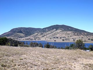
Samsonvale is a rural locality in the Moreton Bay Region, Queensland, Australia. In the 2016 census, Samsonvale had a population of 590 people.

Clear Mountain is a rural locality in the Moreton Bay Region, Queensland, Australia. In the 2016 census, Clear Mountain had a population of 730 people.

Draper is a rural residential locality in the Moreton Bay Region, Queensland, Australia. In the 2016 census, Draper had a population of 676 people.

Highvale is a rural residential locality in the Moreton Bay Region, Queensland, Australia. In the 2016 census, Highvale had a population of 1,766 people.

Laceys Creek is a rural locality in the Moreton Bay Region, Queensland, Australia. In the 2016 census, Laceys Creek had a population of 278 people.

Stony Creek is a rural locality in the Moreton Bay Region of Queensland, Australia. In the 2016 census Stony Creek had a population of 262 people.

Yugar is a rural locality in the Moreton Bay Region, Queensland, Australia. In the 2016 census, Yugar had a population of 385 people.

Dundas is a rural locality in the Somerset Region, Queensland, Australia. In the 2016 census Dundas had a population of 77 people.

Mount Delaney is a rural locality in the Moreton Bay Region, Queensland, Australia. In the 2016 census Mount Delaney had a population of 85 people.

<span class="mw-page-title-main">Flying Fox, Queensland</span> Suburb of Scenic Rim Region, Queensland, Australia

Flying Fox is a rural locality in the Scenic Rim Region, Queensland, Australia. In the 2016 census, Flying Fox had a population of 65 people.

References

  1. 1 2 3 Australian Bureau of Statistics (27 June 2017). "Cedar Creek (SSC)". 2016 Census QuickStats. Retrieved 20 October 2018. OOjs UI icon edit-ltr-progressive.svg
  2. 1 2 "Cedar Creek – locality in Moreton Bay Region (entry 45380)". Queensland Place Names. Queensland Government . Retrieved 7 March 2022.
  3. "Fahey Range – mountain range in the Moreton Bay Region (entry 12108)". Queensland Place Names. Queensland Government . Retrieved 30 October 2022.
  4. "House Mountain Range – mountain range in the Moreton Bay Region (entry 16359)". Queensland Place Names. Queensland Government . Retrieved 30 October 2022.
  5. 1 2 3 4 5 "Queensland Globe". State of Queensland . Retrieved 30 October 2022.
  6. Australian Bureau of Statistics (31 October 2012). "Cedar Creek (Moreton Bay - Qld)". 2011 Census QuickStats. Retrieved 8 April 2014. OOjs UI icon edit-ltr-progressive.svg
  7. "Cedar Creek". Visit Moreton Bay Region. Retrieved 30 October 2022.
  8. "Cedar Creek Public Hall – The Hall For All, All For The Hall" . Retrieved 30 October 2022.