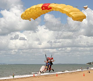
Deception Bay, Queensland

Last updated

Deception Bay
Moreton Bay,  Queensland
Deception bay 02.jpg
Residential area in Deception Bay
Australia Queensland location map.svg
Red pog.svg
Deception Bay
Deception Bay, Queensland
Coordinates 27°10′55″S153°00′47″E / 27.1819°S 153.0130°E / -27.1819; 153.0130 (Deception Bay (centre of suburb))
Population19,850 (2016 census) [1]
 • Density1,033.9/km2 (2,678/sq mi)
Postcode(s) 4508
Area19.2 km2 (7.4 sq mi)
Time zone AEST (UTC+10:00)
Location
LGA(s) City of Moreton Bay
State electorate(s) Bancroft
Federal division(s) Petrie
Suburbs around Deception Bay:
Burpengary Burpengary East Deception Bay
Burpengary Deception Bay Deception Bay
Narangba North Lakes Rothwell

Deception Bay is a coastal suburb in the City of Moreton Bay, Queensland, Australia. [2] In the 2016 census, Deception Bay had a population of 19,850 people. [1]

Contents

Geography

Beachfront pathway DeceptionBay.jpg
Beachfront pathway

It is approximately 32 kilometres (20 mi) north of Brisbane CBD in the south-eastern corner of the bay of the same name which separates the Redcliffe Peninsula and Bribie Island.[ citation needed ]

The suburb of Deception Bay takes its name from a small bay in the west of Moreton Bay, south of Pumicestone Passage and north of the Redcliffe Peninsula. In the north of the bay at Beachmere is where the Caboolture River and Burpengary Creek meet the ocean. It was named in 1823 by Lieutenant John Oxley, who thought the bay was a river and because of his mistake and the shallowness, named it Pumice Stone River; he later changed the name to Deception Bay. [3]

History

The area's rich history dates back to the Traditional Custodians of the land, the Gubbi Gubbi people, and later to early penal settlement.

Deception Bay was so named by Lieutenant John Oxley in 1823 who thought the bay was a river and because of his mistake and the shallowness, named it Deception Bay. [4] Today, Deception Bay is often listed as an unusual place name. [5] [6]

The area was once large parcels of land supporting dairying and farming and, while some large blocks remain today, most have been subdivided to provide housing for a growing community.[ citation needed ]

Deception Bay State School, a typical one-teacher school, April 1951 Deception Bay State School, typical one-teacher school, April 1951.jpg
Deception Bay State School, a typical one-teacher school, April 1951

Deception Bay Provisional School opened on 7 November 1892. It closed circa 1905. It reopened on 14 October 1929 and became Deception Bay State School in 1932. [7]

On Saturday 23 October 1948, Deception Bay Methodist Church was officially opened by Reverend Reginald Sholto Cecil Dingle, the President of the Methodist Conference. [8] It became the Deception Bay Uniting Church after the amalgamation of the Methodist Church into the Uniting Church in Australia in 1977. [9]

On Sunday 21 July 1963 a monument was unveiled to commemorate to scientist Joseph Bancroft and his son Thomas Lane Bancroft in Bancroft Park on Captain Cook Parade, ( 27°10′45″S153°01′44″E / 27.1791°S 153.0290°E / -27.1791; 153.0290 (Dr Joseph Bancroft & Thomas Bancroft monument) ). Much of their research was conducted at Deception Bay. The monument was erected by the Queensland branch of the Australian Medical Association, the Caboolture Shire Council, and the Caboolture Historical Society. [10] Joseph Bancroft was a pioneer in experimenting in native plants for their health properties and, through his meatworks, in the preservation of meat, fish and vegetables. His son, Thomas Lane Bancroft, carried on the tradition with some work in cultivating cotton and castor oil. A rough-hewn pyramidal block of granite stands today on the foreshore highlighting the achievements of these two doctors, and the streets around Dr Bancroft's home, Joseph Street and Bancroft Terrace, are named in his honour. [11]

The Deception Bay public library opened in 1978. [12]

Deception Bay North State School opened on 30 January 1979. [7]

Christ the King Catholic Primary School opened on 31 January 1979. [7]

During the 1980s and 1990s, the suburb acquired a negative reputation due to crime and high unemployment. However, community problems subsided after 2001 following the construction of a police station and a property boom. [13]

Deception Bay State High School opened in January 1992. [7]

Moreton Downs State School opened on 27 January 1995. [7]

Deception Bay Flexible Learning Centre opened on 23 January 2006. [7]

On 15 March 2008, Deception Bay became a suburb of a new amalgamated local government area, the Moreton Bay Region (now known as the City of Moreton Bay). For local government elections, Deception Bay divided into two divisions, with the area of the suburb falling north of Deception Bay Road becoming a part of Division 2.[ citation needed ]

In the past few years, a walkway, several staircases, and CCCTV have been installed to improve access to the waterfront area. The suburb contains low-density urban and semi-rural property types.

In the 2011 census, Deception Bay recorded a population of 19,672 people, 51.1% female and 48.9% male. [14] The median age of the Deception Bay population was 34 years, 3 years below the national median of 37. 73.6% of people living in Deception Bay were born in Australia. The other top responses for country of birth were New Zealand 6.7%, England 4.2%, Philippines 1%, Samoa 1% and Scotland 0.4%. 86.3% of people spoke only English at home; the next most common languages were 2.1% Samoan, 0.3% Tagalog, 0.3% Filipino, 0.3% Hindi and 0.2% Mandarin. [14]

In the 2016 census Deception Bay had a population of 19,850 people. [1]

Heritage listings

Fisheries Bath, one of the Deception Bay Sea Baths, 2016 Deception Bay Sea Baths 2 at Deception Bay, Queensland.jpg
Fisheries Bath, one of the Deception Bay Sea Baths, 2016

Deception Bay also has a number of heritage-listed sites, including:

Significant parts of Deception Bay’s heritage have been captured in the Deception Bay Heritage Trail which describes Aboriginal traditional lifestyle and culture and the early days of settlement. [16]

Environment

Deception Bay makes up a sizeable portion of the Moreton Bay Ramsar internationally important wetland area. [17] The Moreton Bay Ramsar site is home to more than 20,000 migratory shorebirds who in 2009 accounted for more than one percent of the world’s population of eight species of shorebirds. [18]

There area two conservation parks: Deception Bay Conservation Park in the north and Hays Inlet Conservation Park 2 in the south. [19] [20]

Deception Bay along with the neighbouring areas of Redcliffe and Bribie Island support over 50% of the shorebirds in Moreton Bay. The northern area of the Moreton Bay RAMSAR site has large areas of intertidal feeding habitat and suitable adjacent roosting habitats for shorebirds.[ citation needed ]

Education

Deception Bay State School is a government primary (Prep-6) school for boys and girls at King Street ( 27°11′26″S153°01′46″E / 27.1906°S 153.0294°E / -27.1906; 153.0294 (Deception Bay State School) ). [21] [22] In 2018, the school had an enrolment of 349 students with 31 teachers (25 full-time equivalent) and 25 non-teaching staff (15 full-time equivalent). [23] It includes a special education program. [21]

Deception Bay North State School is a government primary (Early Childhood-6) school for boys and girls at Old Bay Road ( 27°10′52″S153°00′59″E / 27.1811°S 153.0165°E / -27.1811; 153.0165 (Deception Bay North State School) ). [21] [24] In 2018, the school had an enrolment of 455 students with 41 teachers (36 full-time equivalent) and 32 non-teaching staff (22 full-time equivalent). [23] It includes a special education program. [21]

Moreton Downs State School is a government primary (Prep-6) school for boys and girls at Parsons Boulevard ( 27°12′00″S153°01′02″E / 27.2001°S 153.0172°E / -27.2001; 153.0172 (Moreton Downs State School) ). [21] [25] In 2018, the school had an enrolment of 641 students with 49 teachers (45 full-time equivalent) and 30 non-teaching staff (19 full-time equivalent). [23] It includes a special education program. [21] [26]

Christ the King Catholic Primary School is a Catholic primary (Prep-6) school for boys and girls at 54 Thompson Street ( 27°10′49″S153°01′15″E / 27.1804°S 153.0208°E / -27.1804; 153.0208 (Christ the King Catholic Primary School) ). [21] [27] In 2018, the school had an enrolment of 290 students with 20 teachers (19 full-time equivalent) and 23 non-teaching staff (15 full-time equivalent). [23]

Deception Bay State High School is a government secondary (7-12) school for boys and girls at Phillip Parade ( 27°12′00″S153°01′50″E / 27.1999°S 153.0305°E / -27.1999; 153.0305 (Deception Bay State High School) ). [21] [28] In 2018, the school had an enrolment of 1097 students with 87 teachers (83 full-time equivalent) and 57 non-teaching staff (40 full-time equivalent). [23] It includes a special education program. [21] [29]

Deception Bay Flexible Learning Centre is a Catholic secondary (7-12) school for boys and girls at Cnr Grosvenor Terrace & Silver Street ( 27°11′28″S153°01′48″E / 27.1910°S 153.0301°E / -27.1910; 153.0301 (Deception Bay Flexible Learning Centre) ). [21] [30] In 2018, the school had an enrolment of 133 students with 13 teachers (12 full-time equivalent) and 12 non-teaching staff (9 full-time equivalent). [23]

Arethusa College is a private secondary (7-12) school for boys and girls at 83 Deception Bay Road ( 27°10′42″S152°59′12″E / 27.1784°S 152.9868°E / -27.1784; 152.9868 (Arethusa College) ). [21] [31] In 2018, the school had an enrolment of 236 students with 29 teachers (25 full-time equivalent) and 41 non-teaching staff (21 full-time equivalent). [23] The school provides flexible education and vocational training for students who have failed to thrive in mainstream schooling. It also has campuses in Spring Hill and Windsor. [32]

Kairos Community College is a private secondary (10-12) school for boys and girls at 100-166 Maine Terrace ( 27°11′32″S153°01′37″E / 27.1923°S 153.0269°E / -27.1923; 153.0269 (Kairos Community College) ). [21] [33] In 2018, the school had an enrolment of 53 students with 5 teachers and 5 non-teaching staff. [23]

Amenities

The Moreton Bay City Council operates a public library in Deception Bay at 9 Bayview Terrace. [34]

Deception Bay Uniting Church is at 64-70 Webster Road (corner of Deception Bay Road, 27°12′06″S153°02′09″E / 27.2017°S 153.0358°E / -27.2017; 153.0358 (Deception Bay Uniting Church) ). [35]

Transport

The only mode of public transport in Deception Bay is bus with all services traveling ether via or to/from the Deception Bay Bus Station located outside MKT Deception Bay at 1 Bay Avenue ( 27°11′39″S153°01′48″E / 27.1943°S 153.0300°E / -27.1943; 153.0300 (Deception Bay Bus Station) ).

Bus route 662 completes a loop around the northern section of Deception Bay and connects to train services at Rothwell railway station. Bus route 665 travels from Deception Bay Bus Station to Rothwell via the southern portion of Deception Bay providing a bus connection to Rothwell railway station. The 660 bus also travels through Deception Bay connecting to other services at Deception Bay Bus Station providing connections to Redcliffe, Caboolture, Burpengary and Morayfield. [36]

See also

Related Research Articles

<span class="mw-page-title-main">Redcliffe, Queensland</span> Suburb of City of Moreton Bay, Queensland, Australia

Redcliffe is a town and suburb in the City of Moreton Bay, Queensland, Australia. It also refers colloquially to the Redcliffe Peninsula as a whole, a peninsula jutting into Moreton Bay which contains several other suburbs. Since the 1880s, Redcliffe has been a popular seaside resort in South East Queensland. In the 2016 census, the suburb of Redcliffe had a population of 10,373 people.

<span class="mw-page-title-main">Burpengary</span> Suburb of City of Moreton Bay, Queensland, Australia

Burpengary is a town and suburb in the City of Moreton Bay, Queensland, Australia. In the 2016 census, the suburb of Burpengary had a population of 14,022 people.

<span class="mw-page-title-main">Scarborough, Queensland</span> Suburb of City of Moreton Bay, Queensland, Australia

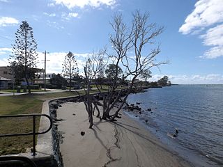
Scarborough is a coastal suburb on the Redcliffe Peninsula in the City of Moreton Bay, Queensland, Australia. In the 2021 census, Scarborough had a population of 9,178 people.

<span class="mw-page-title-main">Mount Gravatt, Queensland</span> Suburb of Brisbane, Queensland, Australia

Mount Gravatt is a southern suburb of the City of Brisbane, Queensland, Australia and a prominent hill and lookout within this suburb. In the 2016 census, Mount Gravatt had a population of 3,366 people.

<span class="mw-page-title-main">Caboolture, Queensland</span> Suburb of Brisbane, Queensland, Australia

Caboolture is a town and suburb in the City of Moreton Bay, Queensland, Australia. In the 2021 census, the suburb of Caboolture had a population of 29,534 people. It is located on the northern side of the Caboolture River.

<span class="mw-page-title-main">Woody Point, Queensland</span> Suburb of Redcliffe, Queensland, Australia

Woody Point is a coastal suburb of Redcliffe in the City of Moreton Bay, Queensland, Australia. In the 2016 census, Woody Point had a population of 4,418 people.

<span class="mw-page-title-main">Clontarf, Queensland</span> Suburb of City of Moreton Bay, Queensland, Australia

Clontarf is a coastal suburb in the City of Moreton Bay, Queensland, Australia. In the 2021 census, Clontarf had a population of 8,446 people.

<span class="mw-page-title-main">Strathpine, Queensland</span> Suburb of City of Moreton Bay, Queensland, Australia

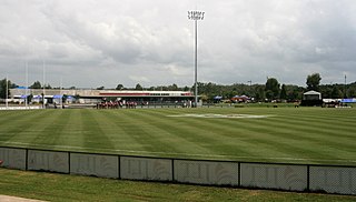
Strathpine is a suburb in the City of Moreton Bay, Queensland, Australia. In the 2016 census, Strathpine had a population of 9,503 people. It is home to the Pine Rivers District offices of the City of Moreton Bay, as well as many businesses, administrative, and local, state and federal government offices. The area is home to Strathpine Centre, a medium-sized urban shopping centre, built by Westfield.

<span class="mw-page-title-main">Kallangur, Queensland</span> Suburb of Moreton Bay, Queensland, Australia

Kallangur is a suburb in the City of Moreton Bay, Queensland, Australia. In the 2016 census, Kallangur had a population of 20,405 people.

<span class="mw-page-title-main">Morayfield, Queensland</span> Suburb of Moreton Bay, Queensland, Australia

Morayfield is a town and suburb in the City of Moreton Bay, Queensland, Australia. In the 2016 census, the suburb of Morayfield had a population of 21,394 people.

<span class="mw-page-title-main">Kippa-Ring, Queensland</span> Suburb of City of Moreton Bay, Queensland, Australia

Kippa-Ring is a suburb in the City of Moreton Bay, Queensland, Australia. In the 2021 census, Kippa-Ring had a population of 9,745 people.

<span class="mw-page-title-main">North Lakes, Queensland</span> Suburb of Moreton Bay, Queensland, Australia

North Lakes is a suburb in the City of Moreton Bay, Queensland, Australia. In the 2021 census, North Lakes had a population of 23,030 people.

<span class="mw-page-title-main">Bray Park, Queensland</span> Suburb of Moreton Bay, Queensland, Australia

Bray Park is a suburb in the City of Moreton Bay, Queensland, Australia. In the 2016 census, Bray Park had a population of 10,246 people.

<span class="mw-page-title-main">Manly West, Queensland</span> Suburb of Brisbane, Queensland, Australia

Manly West is a suburb in the City of Brisbane, Queensland, Australia. In the 2016 census, Manly West had a population of 11,978 people.

<span class="mw-page-title-main">Murrumba Downs, Queensland</span> Suburb of Moreton Bay, Queensland, Australia

Murrumba Downs is a suburb in the City of Moreton Bay, Queensland, Australia. In the 2021 Census, Murrumba Downs had a population of 10,795 people.

<span class="mw-page-title-main">Margate, Queensland</span> Suburb of Redcliffe, Queensland, Australia

Margate is a coastal suburb on the Redcliffe Peninsula, and, along with neighbouring coastal suburbs on the Redcliffe Peninsula, is a popular recreational destination for the South East Queensland. Margate was part of the City of Redcliffe until 2008, when it was amalgamated into the Moreton Bay Region, now known as the City of Moreton Bay. In the 2016 census, Margate had a population of 7,405 people.

Rothwell is a coastal suburb in the City of Moreton Bay, Queensland, Australia. In the 2021 census, Rothwell had a population of 7,538 people.

<span class="mw-page-title-main">Beachmere, Queensland</span> Town in Queensland, Australia

Beachmere is a coastal rural town and locality in the City of Moreton Bay, Queensland, Australia. In the 2021 census, the locality of Beachmere had a population of 4,782 people.

<span class="mw-page-title-main">Mango Hill, Queensland</span> Suburb of Moreton Bay, Queensland, Australia

Mango Hill is a suburb in the City of Moreton Bay, Queensland, Australia. In the 2021 census, Mango Hill had a population of 14,921 people.

<span class="mw-page-title-main">Griffin, Queensland</span> Suburb of Moreton Bay, Queensland, Australia

Griffin is a suburb in the City of Moreton Bay, Queensland, Australia. In the 2021 census, Griffin had a population of 12,295 people.

References

  1. 1 2 3 Australian Bureau of Statistics (27 June 2017). "Deception Bay (SSC)". 2016 Census QuickStats. Retrieved 20 October 2018. OOjs UI icon edit-ltr-progressive.svg
  2. "Deception Bay – suburb in Moreton Bay Region (entry 45408)". Queensland Place Names. Queensland Government . Retrieved 20 July 2021.
  3. "Deception Bay (bay) (entry 9563)". Queensland Place Names. Queensland Government . Retrieved 30 May 2014.
  4. "Deception Bay History". Archived from the original on 5 November 2021. Retrieved 5 November 2021.
  5. "Archived copy". Archived from the original on 23 January 2024. Retrieved 23 January 2024.{{cite web}}: CS1 maint: archived copy as title (link)
  6. "Archived copy". Archived from the original on 23 January 2024. Retrieved 23 January 2024.{{cite web}}: CS1 maint: archived copy as title (link)
  7. 1 2 3 4 5 6 Queensland Family History Society (2010), Queensland schools past and present (Version 1.01 ed.), Queensland Family History Society, ISBN   978-1-921171-26-0
  8. "UNITED NATIONS". The Courier-mail . No. 3717. Queensland, Australia. 23 October 1948. p. 4. Archived from the original on 21 May 2022. Retrieved 15 September 2021 via National Library of Australia.
  9. "About Us". Archived from the original on 3 March 2021. Retrieved 15 September 2021.{{cite web}}: CS1 maint: unfit URL (link)
  10. "Dr Joseph Bancroft & Thomas Bancroft". Monument Australia. Archived from the original on 8 July 2021. Retrieved 8 July 2021.
  11. "Dr Joseph and Thomas Lane Bancroft". Monument Australia. Archived from the original on 27 April 2016. Retrieved 10 April 2016.
  12. "Public Libraries Statistical Bulletin 2016-17" (PDF). Public Libraries Connect. State Library of Queensland. November 2017. p. 14. Archived (PDF) from the original on 30 January 2018. Retrieved 17 January 2018.
  13. D-Bay wants a name change | The Courier-Mail Archived 2007-10-28 at the Wayback Machine
  14. 1 2 Australian Bureau of Statistics (31 October 2012). "Deception Bay (State Suburb)". 2011 Census QuickStats. Retrieved 16 February 2014. OOjs UI icon edit-ltr-progressive.svg
  15. "Deception Bay Sea Baths (entry 602509)". Queensland Heritage Register . Queensland Heritage Council. Retrieved 1 August 2014.
  16. "Deception Bay Heritage Trail". Visit Moreton Bay Region. Archived from the original on 20 August 2023. Retrieved 29 February 2024.
  17. "Moreton Bay Ramsar internationally important wetland — facts and maps". Wetland Info. Queensland Government. Archived from the original on 27 September 2023. Retrieved 29 February 2024.
  18. Milton and Dening, David and Jill (21 August 2023). "Moreton Bay Regional Council Shorebird Habitat Mapping Project" (PDF). Moreton Bay Regional Council. Archived (PDF) from the original on 21 March 2023. Retrieved 21 August 2023.
  19. "Deception Bay Conservation Park — facts and maps". Wetland Info. Queensland Government. Archived from the original on 20 August 2023. Retrieved 29 February 2024.
  20. "Hays Inlet Conservation Park 2 — facts and maps". Wetland Info. Queensland Government. Archived from the original on 20 August 2023. Retrieved 29 February 2024.
  21. 1 2 3 4 5 6 7 8 9 10 11 12 "State and non-state school details". Queensland Government. 9 July 2018. Archived from the original on 21 November 2018. Retrieved 21 November 2018.
  22. "Deception Bay State School". Archived from the original on 5 June 2013. Retrieved 21 November 2018.
  23. 1 2 3 4 5 6 7 8 "ACARA School Profile 2018". Australian Curriculum, Assessment and Reporting Authority. Archived from the original on 27 August 2020. Retrieved 28 January 2020.
  24. "Deception Bay North State School". Archived from the original on 6 July 2011. Retrieved 21 November 2018.
  25. "Moreton Downs State School". Archived from the original on 20 April 2013. Retrieved 21 November 2018.
  26. "Moreton Downs SS - Special Education Program". Archived from the original on 20 April 2013. Retrieved 21 November 2018.
  27. "Christ the King Catholic Primary School". Archived from the original on 27 February 2015. Retrieved 21 November 2018.
  28. "Deception Bay State High School". Archived from the original on 7 August 2013. Retrieved 21 November 2018.
  29. "Deception Bay SHS - Special Education Program". Archived from the original on 7 August 2013. Retrieved 21 November 2018.
  30. "Deception Bay Flexible Learning Centre". Archived from the original on 23 November 2018. Retrieved 21 November 2018.
  31. "Arethusa College". Archived from the original on 18 October 2018. Retrieved 21 November 2018.
  32. "About Us". Arethusa 2020. Archived from the original on 24 July 2020. Retrieved 24 July 2020.
  33. "Kairos Community College". Archived from the original on 19 November 2018. Retrieved 21 November 2018.
  34. "Deception Bay Library". Public Libraries Connect. State Library of Queensland. 5 October 2017. Archived from the original on 17 January 2018. Retrieved 17 January 2018.
  35. "Find a Church". Uniting Church in Australia, Queensland Synod. Archived from the original on 24 October 2020. Retrieved 22 November 2020.
  36. "Deception Bay bus station, Deception Bay | Translink". Translink Division, Department of Transport and Main Roads. Archived from the original on 9 March 2022. Retrieved 18 June 2022.