Kobble Creek Queensland | |||||||||||||||
---|---|---|---|---|---|---|---|---|---|---|---|---|---|---|---|
Coordinates | 27°16′00″S152°48′03″E / 27.2666°S 152.8008°E | ||||||||||||||
Population | 632 (2016 census) [1] | ||||||||||||||
• Density | 12.177/km2 (31.54/sq mi) | ||||||||||||||
Postcode(s) | 4520 | ||||||||||||||
Area | 51.9 km2 (20.0 sq mi) | ||||||||||||||
Time zone | AEST (UTC+10:00) | ||||||||||||||
Location |
| ||||||||||||||
LGA(s) | City of Moreton Bay | ||||||||||||||
State electorate(s) | Pine Rivers | ||||||||||||||
Federal division(s) | Dickson | ||||||||||||||
|
Kobble Creek is a rural locality in the City of Moreton Bay, Queensland, Australia. [2] In the 2016 census, Kobble Creek had a population of 632 people. [1]
Kobble Creek is situated along Mount Samson Road to the south of Dayboro, approximately 45 kilometres (28 mi) northwest of the Brisbane central business district.[ citation needed ]
The south-eastern boundary of the locality is the Mount Samson Range ( 27°17′07″S152°48′45″E / 27.2853°S 152.8126°E ). [3] The range includes Mount Kobble ( 27°16′34″S152°49′33″E / 27.2761°S 152.8258°E ) at a height of 384 metres (1,260 ft). The name Kobble is derived from the Waka language, Garumngar dialect, word kabul meaning carpet snake . [4]
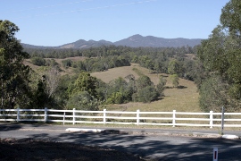
The western part of the locality is mountainous and within the D'Aguilar National Park which extends further west into a number of other localities. [5]
The land use in the eastern part of the locality is a mixture of rural residential, grazing on native vegetation and some cropping. [5]
The locality is named after the creek with that forms part of the catchment area of Lake Samsonvale, one of the three main water-suppliers to the metropolitan region.[ citation needed ]
Kobble Creek was, in years gone by, predominantly a dairy farming community with some banana and pineapple farming on surrounding hillsides. As a farming community, Kobble Creek supported a butter factory, primary school, and railway station, the latter two located near the site of the current Samsonvale Rural Fire Brigade. Following the forced resumption of much of the best farming land in the district to build the North Pine Dam and flood Lake Samsonvale, today the district is predominantly a rural-dormitory zone with very limited farming undertaken.[ citation needed ]
Kobble Creek Provisional School opened circa 1881. On 1 January 1909 it became Kobble Creek State School. It closed in 1954. [6]
In 1919, the Dayboro railway line reached Kobble Creek with the Kobble railway station opening on 3 November 1919; the line reached its terminus at Dayboro railway station on 25 September 1920. [7]
Kobble Creek was officially named and bounded as a locality in June 2009, [2] but was formerly part of the Samsonvale district.
In the 2011 census, the population of Kobble Creek was 499, 48.7% female and 51.3% male. [8] The median age of the Kobble Creek population was 39 years of age, two years above the Australian average. 77.8% of people living in Kobble Creek were born in Australia. The other top responses for country of birth were England 6.8%, New Zealand 3.4%, South Africa 0.8%, Canada 0.6%, Cyprus 0.6%. 92.6% of people spoke only English at home; the next most common languages were 0.6% German, and 0.6% American Languages. [8]
In the 2016 census, Kobble Creek had a population of 632 people. [1]
Mount Nebo is a rural locality in the City of Moreton Bay, Queensland, Australia. In the 2016 census, Mount Nebo had a population of 424 people.
Mount Pleasant is a rural locality in the City of Moreton Bay, Queensland, Australia. In the 2016 census, Mount Pleasant had a population of 332 people.
Mount Glorious is a rural locality in the City of Moreton Bay, Queensland, Australia. In the 2016 census, Mount Glorious had a population of 296 people.
Warner is a suburb in the City of Moreton Bay, Queensland, Australia. In the 2016 census, Warner had a population of 11,411 people.
Dayboro is a rural town and locality in the City of Moreton Bay, Queensland, Australia. In the 2016 census, the locality of Dayboro had a population of 2,119 people.
Camp Mountain is a rural locality in the City of Moreton Bay, Queensland, Australia. In the 2016 census, Camp Mountain had a population of 1,416 people.
Cooran is a rural hinterland town and locality in the Shire of Noosa, Queensland, Australia. In the 2016 census the locality of Cooran had a population of 1,624 people.
Closeburn is a rural locality in the City of Moreton Bay, Queensland, Australia. In the 2016 census, Closeburn had a population of 594 people.
Mount Samson is a rural locality in the City of Moreton Bay, Queensland, Australia. In the 2016 census, Mount Samson had a population of 594 people.
Mount Mee is a rural town and locality in the City of Moreton Bay, Queensland, Australia. In the 2021 census, Mount Mee had a population of 519 people.
King Scrub is a rural locality in the City of Moreton Bay, Queensland, Australia. In the 2016 census, King Scrub had a population of 348 people. It is located on the northern outskirts of Dayboro.
Samsonvale is a rural locality in the City of Moreton Bay, Queensland, Australia. In the 2016 census, Samsonvale had a population of 590 people.
Draper is a rural residential locality in the City of Moreton Bay, Queensland, Australia. In the 2016 census, Draper had a population of 676 people.
Laceys Creek is a rural locality in the City of Moreton Bay, Queensland, Australia. In the 2016 census, Laceys Creek had a population of 278 people.
Rocksberg is a rural locality in the City of Moreton Bay, Queensland, Australia. In the 2016 census, Rocksberg had a population of 300 people.
Stony Creek is a rural locality in the City of Moreton Bay in Queensland, Australia. In the 2016 census Stony Creek had a population of 262 people.
Yugar is a rural locality in the City of Moreton Bay, Queensland, Australia. In the 2021 census, Yugar had a population of 406 people.
Cedar Creek is a rural locality in the City of Moreton Bay, Queensland, Australia. In the 2016 census, Cedar Creek had a population of 745 people.
Rush Creek is a rural locality in the City of Moreton Bay, Queensland, Australia. In the 2016 census, Rush Creek had a population of 157 people.
Anthony is a rural locality in the Scenic Rim Region, Queensland, Australia. In the 2016 census, Anthony had a population of 111 people.