Brisbane central business district

Last updated

Brisbane CBD
Brisbane,  Queensland
Brisbane CBD from Mount Coot-tha at night.jpg
Brisbane CBD from Mount Coot-tha at night
Australia Queensland location map.svg
Red pog.svg
Brisbane CBD
Brisbane central business district
Coordinates 27°28′04″S153°01′34″E / 27.4677°S 153.0261°E / -27.4677; 153.0261 (City of Brisbane (centre of suburb))
Population9,460 (2016 census) [1]
 • Density3,780/km2 (9,800/sq mi)
Established1825
Postcode(s) 4000
Area2.5 km2 (1.0 sq mi)
Time zone AEST (UTC+10:00)
LGA(s) City of Brisbane
(Central Ward) [2]
County Stanley
Parish North Brisbane
State electorate(s) McConnel
Federal division(s) Brisbane
Suburbs around Brisbane CBD:
Red Hill
Paddington
Spring Hill Fortitude Valley
Petrie Terrace Brisbane CBD New Farm
South Brisbane Woolloongabba Kangaroo Point
Map of the CBD Brisbane map of city cbd.png
Map of the CBD

Brisbane City is the central suburb and central business district of Brisbane, the state capital of Queensland, Australia. [3] It is colloquially referred to as the "Brisbane CBD" or "the city". It is located on a point on the northern bank of the Brisbane River, historically known as Meanjin, Mianjin or Meeanjin in the local Aboriginal Australian dialect. [4] The triangular shaped area is bounded by the median of the Brisbane River to the east, south and west. [5] The point, known at its tip as Gardens Point, slopes upward to the north-west where the city is bounded by parkland and the inner city suburb of Spring Hill to the north. The CBD is bounded to the north-east by the suburb of Fortitude Valley. To the west the CBD is bounded by Petrie Terrace, which in 2010 was reinstated as a suburb (after being made a locality of Brisbane City in the 1970s).

Contents

In the 2016 census the suburb of Brisbane City had a population of 9,460 people. [1]

Geography

The Brisbane central business district is an area of densely concentrated skyscrapers and other buildings, interspersed by several parks such as Roma Street Parklands, City Botanic Gardens and Wickham Park. It occupies an area of 1.367 km2. The city is laid out according to a grid pattern surveyed during the city's early colonial days, a feature typical of most Australian street patterns.

Most central streets are named after members of the House of Hanover. Queen Street (named in honour of Queen Victoria) is Brisbane's traditional main street and contains its largest pedestrian mall, the Queen Street Mall. Streets named after female members (Adelaide, Alice, Ann, Charlotte, Elizabeth, Margaret, and Mary) run parallel to Queen Street and perpendicular to streets named after male members (Albert, Edward, George, and William).

The CBD's squares include King George Square, Post Office Square and ANZAC Square (home to the city's central war memorial).

The Brisbane central business district was built on a spur of the Taylor Range with the highest spot in the suburb being Wickham Terrace. [6] North Quay is an area in the CBD that was a landing point during the first European exploration of the Brisbane River.

Petrie Bight

Petrie Bight is a reach of the Brisbane River ( 27°27′49″S153°02′06″E / 27.4636°S 153.0351°E / -27.4636; 153.0351 (Petrie Bight) ), [7] which gives its name to the small pocket of land centred on the area under the Story Bridge's northern point, around the Brisbane River to Admiralty Towers II. The location was originally known as Petrie Gardens and was an early settlement farm, one of two that provided food for the colony. [8] The site was named after Andrew Petrie and has been the base for water police and in earlier times wharves. [9] The location of Customs House and the preference for wharves was due to the site being directly downstream from the central business district. [9]

History

Wharf Street Baptist Church opened at 38 Wharf Street (corner of Adelaide Street, 27°27′55″S153°01′47″E / 27.4652°S 153.0296°E / -27.4652; 153.0296 (Baptist Church (1859)) ) on 6 February 1859. It was the first Baptist church to be built in Queensland, the Brisbane congregation having previously met in a range of public buildings since forming in 1855. It was designed in the Early Italianate style and was built by Andrew Petrie. The church was 57 by 34 feet (17 by 10 m) and could accommodate 250 people. The cost was £2000 for the land and building, but part of the cost was covered by donations, e.g. Thomas Blacket Stephens partially donated the land. In 1881, the church was enlarged, but the need for further growth resulted in a decision to build a new church, the City Tabernacle in Wickham Terrace. The Wharf Street church was sold, holding its last service on 5 October 1890 with the tabernacle being dedicated on 9 October 1890. [10] [11] [12] [13] The building is no longer extant. On Tuesday 25 May 2021, a Baptist Historic plaque was placed at the site to commemorate the church. [14] [15]

On 2 April 1860, the Queensland Government opened its first school, the Brisbane National School in Adelaide Street under headmaster John Rendall with an initial enrolment of 50 boys and 8 girls. [16]

Brisbane CBD and the Brisbane River, as seen from Kangaroo Point, 1989 Brisbane CBD and the Brisbane River, as seen from Kangaroo Point, 1989.jpg
Brisbane CBD and the Brisbane River, as seen from Kangaroo Point, 1989

A congregation of the Church of Christ was established on 23 September 1883 in the Brisbane central area. In the late 1890s the congregation purchased 430 Ann Street ( 27°27′46″S153°01′49″E / 27.4628°S 153.0302°E / -27.4628; 153.0302 (Your Church (Church of Christ)) ) to establish their first church, still operating as at 2021 under the name Your Church. [17] [18] [19] [20]

The Brisbane City Library opened in 1965, moving into Brisbane Square in 2006. [21]

The city centre was damaged by the 2010-2011 floods. [22]

In the 2016 census, Brisbane City had a population of 9,460 people. [1]

Skyline of the central business district from Mount Coot-tha 2017. Bne2017 2.png
Skyline of the central business district from Mount Coot-tha 2017.

Buildings and precincts

The Albert Street Uniting Church Albert Street Uniting Church, Brisbane, October 2021.jpg
The Albert Street Uniting Church
Soleil building under construction Brisbane Residential Buildings.jpg
Soleil building under construction

Up until 1964, a Brisbane City Council regulation limited building heights to 132 ft (40 m). [23] Some of the first skyscrapers built in the CBD include the SGIO building (now Suncorp Plaza) in 1970 and AMP Place in 1977. Other notable openings included Comalco Place (1984), Riverside Place (1986), the two towers of Central Plaza (1988 and 1989), and Waterfront Place (1990). [24]

In the last few decades the number of apartment buildings that have been constructed has increased substantially. Brisbane is home to several of Australia's tallest buildings. Brisbane's tallest buildings are Brisbane Skytower at 270 metres, The One at 264 metres, One William Street at 260 metres, Soleil at 243 metres, Aurora Tower at 207 metres, Riparian Plaza at 200 metres, One One One Eagle Street at 195 metres, and Infinity at 249 metres, which was completed in 2014.

The Brisbane CBD is one of the major business hubs in Australia. [25] The City contains many tall office buildings occupied by organisations, businesses and all three levels of government that have emerged into a number of precincts. The areas around the Queen Street Mall and Adelaide Street is primarily a retail precinct. A legal precinct exists around the various court buildings located around the intersections of George Street and Adelaide and Ann Streets.

The government precinct was an area centred on the Executive Building that includes many Queensland Government offices. 111 George Street, Mineral House, and Education House are also located here. 1 William Street was completed in 2016, now serving the role of the former Executive Building. The Executive Building and Neville Bonner building were demolished for the state's largest infrastructure project. An urban renewal project based around the Queen's Wharf megaproject is under construction along the southern end of William Street, which includes a pedestrian bridge crossing the Riverside Expressway. [26]

Schools

The city is serviced by a number of schools in the surrounding suburbs including the Petrie Terrace State School in Paddington and The Albert Park Flexi School in Petrie Terrace.

Rental prices

High rise view of the CBD at night. Brisbane CBD (11261000363).jpg
High rise view of the CBD at night.

Like most other Australian capital cities, Brisbane has experienced dramatic rises in rental prices for residential and office space before the global financial crisis. At the beginning of 2008, the Brisbane central business district contained 1.7 million square metres of office space. [27] High demand in the office market had pushed vacancy rates in the Brisbane CBD to 0.7% by January 2008, the lowest in Australia. [27] Premium grade office space was even less vacant with an occupancy rate of 99.9%. By the end of 2009 the situation had reversed. In mid 2013 the market for office space had declined to its worst position in two decades with a vacancy rate of just under 13%. [28]

Attractions

Brisbane City Hall houses the Museum of Brisbane and offices of the Brisbane City Council. Brisbane City Hall, 275 George Street, 69 Ann Street, 300 George, Brisbane, Feb 2020.jpg
Brisbane City Hall houses the Museum of Brisbane and offices of the Brisbane City Council.

Major landmarks and attractions in the CBD include City Hall (including the Museum of Brisbane), the Story Bridge, the Howard Smith Wharves, ANZAC Square, St John's Cathedral, the Brisbane River and its Riverwalk network, the City Botanic Gardens, Roma Street Parkland, Queensland Parliament House, Old Government House and Customs House.

Heritage listings

The National Australia Bank Building, located on Queen Street, was heritage listed in October 1992. Former National Australia Bank at 308 Queen Street, Brisbane, 2021.jpg
The National Australia Bank Building, located on Queen Street, was heritage listed in October 1992.

Brisbane has many heritage-listed sites, including:

Demographics

In the 2021 Census, 47.0% of Brisbane City residents were born in Australia. [40]

In the 2016 Census, the most common countries of birth other than Australia were China 16.0%, South Korea 8.3%, England 3.7%, Taiwan 3.2% and Brazil 2.8%. 43.7% of people only spoke English at home. Other languages spoken at home included Mandarin 12.3%, Korean 7.7%, Cantonese 3.6%, Spanish 2.9% and Portuguese 2.7%. The most common responses for religion were No Religion 43.0% and Catholic 16.8%. [1]

Transport

By road, four road bridges connect the CBD with the southern bank of the Brisbane River: the Captain Cook Bridge, the Victoria Bridge, the William Jolly Bridge and the Go Between Bridge. The Story Bridge connects Fortitude Valley with Kangaroo Point and provides access to the city from the southern bank. The Captain Cook Bridge connects the Pacific Motorway, south of the river, with the Riverside Expressway which runs along the south western edge of the city. Heading under and bypassing the CBD is the Clem Jones Tunnel. Because on-street car parking is in high demand, parking meters are installed across the inner city. [41]

By bicycle and foot, the Goodwill Bridge allows cross river access to South Bank. The Kurilpa Bridge allows cross river access from North Quay to South Brisbane. Cyclists and pedestrians may also cross while using the Victoria, William Jolly, Go Between and Story road bridges. The Kangaroo Point Green Bridge is being built between the CBD and Kangaroo Point.

The Brisbane central business district is the central hub for all public transport services in Brisbane. Bus services are centred on the Queen Street bus station and King George Square busway station. Suburban train services pass through Central railway station, and Roma Street railway station. Roma Street also serves as the terminus for long distance and country services. The central business district is served by various city ferries. Brisbane's CityCat high speed ferry service, popular with tourists and commuters, operates services along the Brisbane River between the University of Queensland and Northshore Hamilton, stopping at several CBD wharves.

The Brisbane Riverwalk, a pedestrian and cyclist pathway adjoins the central business district along the river bank. [42]

King George Square Busway Station, an underground bus station King George Square Busway Station.jpg
King George Square Busway Station, an underground bus station

The Brisbane CBD has featured in a number of films, including:

See also

Related Research Articles

<span class="mw-page-title-main">Albion, Queensland</span> Suburb of Brisbane, Queensland, Australia

Albion is an inner north-eastern suburb in the City of Brisbane, Queensland, Australia. In the 2016 census, Albion had a population of 2,296 people.

<span class="mw-page-title-main">Kangaroo Point, Queensland</span> Suburb of Brisbane, Queensland, Australia

Kangaroo Point is an inner southern suburb in the City of Brisbane, Queensland, Australia. In the 2016 census, Kangaroo Point had a population of 8,063 people.

<span class="mw-page-title-main">Fortitude Valley, Queensland</span> Suburb of Brisbane, Queensland, Australia

Fortitude Valley is an inner suburb of the City of Brisbane, the state capital of Queensland, Australia. In the 2021 census, Fortitude Valley had a population of 9,708 people. The suburb features two pedestrian malls at Brunswick Street Mall and Chinatown, and is one of the hubs of Brisbane's nightlife, renowned for its nightclubs, bars and adult entertainment.

<span class="mw-page-title-main">Bowen Hills, Queensland</span> Suburb of Brisbane, Queensland, Australia

Bowen Hills is an inner north-eastern suburb in the City of Brisbane, Queensland, Australia. In the 2021 census, Bowen Hills had a population of 4,898 people.

<span class="mw-page-title-main">South Brisbane, Queensland</span> Suburb of Brisbane, Queensland, Australia

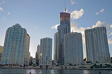
South Brisbane is an inner southern suburb in the City of Brisbane, Queensland, Australia. In the 2016 census, South Brisbane had a population of 7,196 people.

<span class="mw-page-title-main">Nundah, Queensland</span> Suburb of Brisbane, Queensland, Australia

Nundah is an inner suburb in the City of Brisbane, Queensland, Australia. It contains the neighbourhood of Toombul. In the 2016 census, Nundah had a population of 12,141 people.

<span class="mw-page-title-main">New Farm, Queensland</span> Suburb of Brisbane, Queensland, Australia

New Farm is an inner northern riverside suburb in the City of Brisbane, Queensland, Australia. In the 2021 census, New Farm had a population of 12,454 people.

<span class="mw-page-title-main">Newstead, Queensland</span> Suburb of Brisbane, Queensland, Australia

Newstead is an inner northern riverside suburb of Brisbane, Queensland, Australia. At the 2021 census, it had a population of 7,496.

<span class="mw-page-title-main">Petrie Terrace, Queensland</span> Suburb of Brisbane, Queensland, Australia

Petrie Terrace is an inner suburb in the City of Brisbane, Queensland, Australia. In the 2016 census, Petrie Terrace had a population of 1,124 people.

<span class="mw-page-title-main">Spring Hill, Queensland</span> Suburb of Brisbane, Queensland, Australia

Spring Hill is an inner northern suburb in the City of Brisbane, Queensland, Australia. In the 2016 census, Spring Hill had a population of 5,974 people.

<span class="mw-page-title-main">George Street, Brisbane</span> Street in Brisbane, Queensland

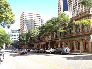
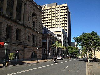
George Street is a major street located in the Brisbane CBD in Brisbane, Queensland, Australia.

<span class="mw-page-title-main">Bulimba, Queensland</span> Suburb of Brisbane, Queensland, Australia

Bulimba is a suburb in the City of Brisbane, Queensland, Australia. In the 2016 census, Bulimba had a population of 6,843 people.

<span class="mw-page-title-main">Ann Street, Brisbane</span> Street in Brisbane, Queensland

Ann Street runs parallel to Adelaide Street and is the northernmost street in the Brisbane CBD in Queensland, Australia. The street is named for Anne, Queen of Great Britain, as part of the CBD street naming series of female British royalty. It is a major thoroughfare, linking as a four-lane one-way street the suburb of Fortitude Valley in the northeast with the Riverside Expressway in the southwest; house numbers run the opposite direction.

<span class="mw-page-title-main">Edward Street, Brisbane</span> Street in Brisbane, Queensland, Australia

Edward Street is a busy thoroughfare in the Brisbane central business district, Queensland, Australia. It is a one-way street located between Albert Street and Creek Street, and runs from Upper Edward Street to Alice Street. It is named after Edward VII of the United Kingdom.

<span class="mw-page-title-main">Albert Street, Brisbane</span> Street in Brisbane, Queensland

Albert Street is a street in the Brisbane central business district, Queensland, Australia. It was named after Prince Albert, the Prince Consort of Queen Victoria of the United Kingdom. Albert Street railway station is being built directly beneath the street and is expected to open in 2026. The station precinct includes partial road closures as planned in the 2014 City Centre Master Plan, for the creation of a new public space.

<span class="mw-page-title-main">William Street, Brisbane</span> Street in Brisbane, Queensland

William Street is a small, relatively quiet road in the uptown part of the Brisbane central business district. The street is historically significant to the city's early development as a penal colony. The first convict buildings were built along William Street in 1825.

<span class="mw-page-title-main">North Quay, Brisbane</span> Street in Brisbane, Queensland

North Quay is a location in the Brisbane central business district and the name of a street in the same area, running along the Brisbane River from an intersection near Makerston Street to the top of the Queen Street mall, linking the Victoria Bridge and the William Jolly Bridge along the river's northern bank. It was the site of Brisbane’s initial settlement, at a point where a stream flowing from Spring Hill provided fresh water, later collected in a reservoir on Tank Street.

<span class="mw-page-title-main">Petrie Bight</span>

Petrie Bight is a reach of the Brisbane River in Brisbane, Queensland, Australia. The land to the north of the bight, centred on the area under the Story Bridge's northern point and around the Brisbane River to Customs House is also known as Petrie Bight and was formerly a suburb of Brisbane. The area whilst still informally known as Petrie Bight, was absorbed into the suburbs of the Brisbane CBD and Fortitude Valley during consolidation of suburbs by the Brisbane City Council. With a resurgence in Brisbane residents interested in this part of the city and its history, has meant there is a possibility the Brisbane City Council and Queensland Government may once again reinstate Petrie Bight as a suburb to give the area a better sense of identity.

<span class="mw-page-title-main">Ipswich (suburb), Queensland</span> Suburb of Ipswich, Queensland, Australia

Ipswich Central Business District is the central suburb and central business district of Ipswich in the City of Ipswich, Queensland, Australia. It is also known as Ipswich CBD. In the 2016 census, the suburb had a population of 2,459 people.

<span class="mw-page-title-main">Howard Smith Wharves</span> Historic site in Queensland, Australia

Howard Smith Wharves is a heritage-listed wharf on the Brisbane River at Boundary Street, Brisbane City and Fortitude Valley, City of Brisbane, Queensland, Australia. It was built from 1939 to 1942. It is also known as Brisbane Central Wharves. The 3.5-hectare (8.6-acre) site is one of the most culturally and historically significant riverfront locations in Brisbane. It was added to the Queensland Heritage Register on 4 February 1997.

References

  1. 1 2 3 4 Australian Bureau of Statistics (27 June 2017). "Brisbane City (SSC)". 2016 Census QuickStats. Retrieved 20 October 2018. OOjs UI icon edit-ltr-progressive.svg
  2. "Central Ward". Brisbane City Council. Archived from the original on 18 February 2017. Retrieved 4 March 2017.
  3. "Brisbane City – suburb in City of Brisbane (entry 49245)". Queensland Place Names. Queensland Government . Retrieved 26 December 2020.
  4. "Indigenous Placenames of South East Queensland". Archived from the original on 24 December 2021. Retrieved 29 January 2021.
  5. "Queensland Globe; Layer:Boundaries". Archived from the original on 19 December 2017. Retrieved 24 December 2021.
  6. Gregory, Helen (2007). Brisbane Then and Now. Wingfield, South Australia: Salamander Books. p. 60. ISBN   978-1-74173-011-1.
  7. "Petrie Bight (entry 26538)". Queensland Place Names. Queensland Government . Retrieved 3 February 2015.
  8. "Brisbane – Then and Now – The Centenary of Federation". Australian Broadcasting Corporation. 24 April 2001. Archived from the original on 10 November 2012. Retrieved 21 August 2009.
  9. 1 2 Gregory, Helen (2007). Brisbane Then and Now. Wingfield, South Australia: Salamander Books. p. 20. ISBN   978-1-74173-011-1.
  10. "Queensland Baptist churches by date of erection/opening". Baptist Church Archives Queensland. Archived from the original on 26 November 2021. Retrieved 29 November 2021.
  11. "1859 Wharf Street". Baptist Church Archives Queensland. Archived from the original on 26 November 2021. Retrieved 29 November 2021.
  12. "The Roster at Ipswich". The Moreton Bay Courier . Vol. XIII, no. 728. Queensland, Australia. 12 February 1859. p. 3. Archived from the original on 2 December 2021. Retrieved 29 November 2021 via National Library of Australia.
  13. "Baptist City Tabernacle (entry 600175)". Queensland Heritage Register . Queensland Heritage Council. Retrieved 1 August 2014.
  14. "Archives and Baptist Heritage: Baptist Heritage – 7th Historic Plaque Unveiled at Significant City Site". The QB Magazine. 1 June 2021. Archived from the original on 6 December 2021. Retrieved 24 December 2021.
  15. "Plaque No 7". Baptist Heritage Queensland. Archived from the original on 24 December 2021. Retrieved 24 December 2021.
  16. "Agency ID 8518, Brisbane National School". Queensland State Archives . Retrieved 25 July 2020.
  17. Haigh, George; Churches of Christ in Queensland (1983), Churches of Christ in Queensland : 100 years venturing in faith, Historical Committee, Conference of Churches of Christ in Queensland, p. 111, ISBN   978-0-909116-38-5
  18. "Your Church in Brisbane City". Archived from the original on 24 June 2021. Retrieved 21 June 2021.
  19. "Since 1883 – Your Church in Brisbane City". Archived from the original on 24 June 2021. Retrieved 21 June 2021.
  20. Google (21 June 2021). "430 Ann Street" (Map). Google Maps . Google. Retrieved 21 June 2021.
  21. "Public Libraries Statistical Bulletin 2016–17" (PDF). Public Libraries Connect. State Library of Queensland. November 2017. Archived (PDF) from the original on 30 January 2018. Retrieved 30 January 2018.
  22. "Flood - Queensland, 2010-2011". Australian Disaster Resilience Knowledge Hub. Retrieved 23 August 2023.
  23. McBride, Frank; et al. (2009). Brisbane 150 Stories. Brisbane City Council Publication. pp. 284–285. ISBN   978-1-876091-60-6.
  24. Brisbane Australia Towards the 21st Century (1st ed.). Double Bay NSW: Focus Books Pty Ltd. 1991.
  25. "Brisbane business visitor numbers skyrocket". Brisbane Marketing Convention Bureau. e-Travel Blackboard. 3 January 2008. Archived from the original on 20 January 2011. Retrieved 13 January 2008.
  26. "Gallery". 6 May 2022.
  27. 1 2 "Business boom leaves Brisbane without office space". news.com.au . News Limited. Archived from the original on 28 July 2007. Retrieved 25 November 2008.
  28. Marissa Calligeros (15 August 2013). "Brisbane office space overload". Brisbane Times. Fairfax Media. Archived from the original on 16 August 2013. Retrieved 15 August 2013.
  29. "Howard Smith Wharves (entry 601781)". Queensland Heritage Register . Queensland Heritage Council. Retrieved 19 June 2013.
  30. "Coronation Drive (North Quay) Retaining Wall (entry 600134)". Queensland Heritage Register . Queensland Heritage Council. Retrieved 1 August 2014.
  31. "Roma Street Railway Station (entry 601208)". Queensland Heritage Register . Queensland Heritage Council. Retrieved 19 June 2013.
  32. "Eagle Street Fountain (entry 600087)". Queensland Heritage Register . Queensland Heritage Council. Retrieved 19 June 2013.
  33. "Eagle Street Fig Trees (entry 602440)". Queensland Heritage Register . Queensland Heritage Council. Retrieved 19 June 2013.
  34. "Wenley House (entry 600128)". Queensland Heritage Register . Queensland Heritage Council. Retrieved 19 June 2013.
  35. "First Brisbane Burial Ground (entry 700009)". Queensland Heritage Register . Queensland Heritage Council. Retrieved 19 June 2013.
  36. "William Jolly Bridge (entry 601694)". Queensland Heritage Register . Queensland Heritage Council. Retrieved 19 June 2013.
  37. "Brisbane Dental Hospital and College (entry 601909)". Queensland Heritage Register . Queensland Heritage Council. Retrieved 19 June 2013.
  38. "King Edward Park Air Raid Shelter (entry 602475)". Queensland Heritage Register . Queensland Heritage Council. Retrieved 19 June 2013.
  39. "Hellesvere (entry 600280)". Queensland Heritage Register . Queensland Heritage Council. Retrieved 19 June 2013.
  40. "People & Lifestyle Brisbane City Qld 4000". www.microburbs.com.au. Retrieved 19 June 2023.
  41. Parking meters and fees Archived 12 March 2022 at the Wayback Machine . Brisbane City Council. Retrieved on 14 March 2022.
  42. "About RiverWalk". Brisbane City Council. Archived from the original on 16 September 2006. Retrieved 5 January 2008.
  43. Arnold, Rikki-Lee (30 May 2015). "Lockyer Valley, Gold Coast and Brisbane star in background of disaster film San Andreas". The Courier-Mail. Archived from the original on 14 October 2017.
  44. Price, Amy (12 April 2017). "Thor Ragnarok trailer features scene filmed in Brisbane laneway". news.com.au. Archived from the original on 19 April 2017.

Further reading