Roma Street Parkland

Last updated

Roma Street Parkland
Roma Street Parklands, Brisbane (3365542717).jpg
Roma Street Parklands looking towards the Brisbane CBD
Roma Street Parkland
Location Brisbane, Australia
Area11 hectares (27 acres)
Created6 April 2001 [1]
Operated byCity Parklands Transition Services Pty Ltd through Brisbane City Council, [1]
The Roma Street Parkland viewed from the nearby Hotel Grand Chancellor Roma Street Parkland Feb 2011.JPG
The Roma Street Parkland viewed from the nearby Hotel Grand Chancellor

Roma Street Parkland covers 11 hectares in the centre of the City of Brisbane, Queensland, Australia. The Roma Street Parkland is adjacent to the former Brisbane Transit Centre and the Roma Street railway station from which it takes its name (the park does not directly face onto Roma Street). There is pedestrian access to the Roma Street Parkland from the Roma Street railway station, as well as from Albert Street, and from the section of the Parkland which was formerly called Albert Park on Wickham Terrace. [2] [3]

Contents

There is also a car park area, with road access from the intersection between Wickham Terrace, College Road and Gregory Terrace. Roma Street Parkland is the world's largest subtropical garden in a city centre. [4] The parkland features a variety of themed gardens and recreational areas, with an extensive web of pathways and boardwalks traversing cascading waterways and rocky outcrops, and also in situ artworks by 16 local artists.[ citation needed ]

History of Roma Street Parkland area

Local Indigenous people used the area for thousands of years conducting meetings and ceremonies.[ citation needed ]

In 1825 the Roma Street Parkland area was part of the original Brisbane settlement. In 1875 a railway terminal station on Roma Street was constructed as part of the Main Line railway linking Brisbane to Ipswich and Toowoomba.[ citation needed ]

The terminal grew to become a major goods yard for Brisbane and, between 1911 and 1934, the area was extensively redeveloped to support its increase in services. In 1920 extensive excavation, removing 554,300 cubic metres of earth, permanently altered the steep terrain creating the current day artificial escarpment and the boundary of the former Albert Park. During World War II, the terminal was vital for transporting war materials and military personnel north.[ citation needed ]

Continuing to grow, the Roma Street railway station was redeveloped to service a metropolitan and long-distance train network. Because of limitations of the site revealed through the increasing mechanisation of freight handling and the use of containers, the facility was eventually relocated to Acacia Ridge in 1991.[ citation needed ]

In February 1995, Premier Wayne Goss announced the railway goods yard would be redeveloped as parkland. [5] Construction began in 2000 with the parkland opened to the public in 2001. [6] The project won its first award before it had opened: a commendation in the Cement and Concrete Association of Australia Streetsmart awards for the innovative concrete finishes created by the use of coloured concrete and an apparently random pattern of rough cast concrete generated by the formworkers which makes the finish appear to change through the day depending on the angle of the sun and the length of shadows cast by the detailing on the walls. The technique was created through a design and construction collaboration between project designers PARC managing contractor Abigroup and the Queensland Department of Public Works. [7]

Amphitheatre

Roma Street Parkland and Amphitheatre Roma-Street-Parkland-Amphitheatre.jpg
Roma Street Parkland and Amphitheatre

Roma Street Parkland has an open-air amphitheatre, previously known as the Albert Park Amphitheatre, which had been a feature of Albert Park for a number of decades before the Roma Street Parkland was established.[ citation needed ]

Outdoor film exhibitor Moonlight Cinema holds a licence to operate an outdoor cinema experience within the park, offering hot food, beverages, film festivals, and many other activities during summer months annually.[ citation needed ]

Plays are performed at the Amphitheatre by the Queensland Theatre Company, and the Queensland Shakespeare Ensemble, as well as by other theatre groups, with many plays by William Shakespeare having been performed at the amphitheatre. [8]

Other theatre productions, including orchestral concerts, have also been performed there. One such concert, in which the music was by Johann Strauss, was called "Strauss Beneath the Stars", which was presented in October 1983.[ citation needed ]

The Lord Mayor's Christmas Carols and Brisbane's Carols by Candlelight concerts were held at the Albert Park Amphitheatre before Riverstage was built in the City Botanic Gardens.[ citation needed ]

See also

Related Research Articles

<span class="mw-page-title-main">Milton, Queensland</span> Suburb of Brisbane, Queensland, Australia

Milton is a riverside inner suburb of the City of Brisbane, Queensland, Australia. In the 2016 census, the population of Milton was 2,274 people.

<span class="mw-page-title-main">Central railway station, Brisbane</span> Railway station in Brisbane, Queensland

Central railway station is located on the North Coast line in Queensland, Australia. It is the principal station on the City network and is located in the north of the Brisbane central business district. Central station is one of four inner city stations that form a core corridor through the centre of Brisbane.

<span class="mw-page-title-main">Brisbane Transit Centre</span> Former bus station in Brisbane, Queensland

The Brisbane Transit Centre, at 151–171 Roma Street, Brisbane, Queensland, Australia, was a long-distance bus station. It was closed and demolished in 2020 along with its three office towers. It was commonly regarded as the ugliest building in Brisbane.

<span class="mw-page-title-main">South Brisbane railway station</span> Historic site in Queensland, Australia

South Brisbane railway station is a heritage-listed railway station at 133 Grey Street, South Brisbane, City of Brisbane, Queensland, Australia. It is one of two stations serving the South Brisbane area, the other being South Bank. It was built from 1891 to 1918, making it the second oldest railway station in central Brisbane. It is also known as Cultural Centre Station, Melbourne Street Station, and South Brisbane (Interstate) Station. It was added to the Queensland Heritage Register on 21 October 1992.

<span class="mw-page-title-main">Bowen Hills, Queensland</span> Suburb of Brisbane, Queensland, Australia

Bowen Hills is an inner north-eastern suburb in the City of Brisbane, Queensland, Australia. In the 2021 census, Bowen Hills had a population of 4,898 people.

<span class="mw-page-title-main">Caloundra</span> Town in Queensland, Australia

Caloundra is a coastal town and the southernmost town in the Sunshine Coast Region in South East Queensland, Australia.

<span class="mw-page-title-main">Wickham Park, Brisbane</span> Park in Brisbane, Australia

Wickham Park is a park at 330 Wickham Terrace, Spring Hill, Brisbane, Queensland, Australia.

<span class="mw-page-title-main">Brisbane central business district</span> Suburb of Brisbane, Queensland, Australia

Brisbane City is the central suburb and central business district of Brisbane, the state capital of Queensland, Australia. It is colloquially referred to as the "Brisbane CBD" or "the city". It is located on a point on the northern bank of the Brisbane River, historically known as Meanjin, Mianjin or Meeanjin in the local Aboriginal Australian dialect. The triangular shaped area is bounded by the median of the Brisbane River to the east, south and west. The point, known at its tip as Gardens Point, slopes upward to the north-west where the city is bounded by parkland and the inner city suburb of Spring Hill to the north. The CBD is bounded to the north-east by the suburb of Fortitude Valley. To the west the CBD is bounded by Petrie Terrace, which in 2010 was reinstated as a suburb.

<span class="mw-page-title-main">Petrie Terrace, Queensland</span> Suburb of Brisbane, Queensland, Australia

Petrie Terrace is an inner suburb in the City of Brisbane, Queensland, Australia. In the 2016 census, Petrie Terrace had a population of 1,124 people.

<span class="mw-page-title-main">Spring Hill, Queensland</span> Suburb of Brisbane, Queensland, Australia

Spring Hill is an inner northern suburb in the City of Brisbane, Queensland, Australia. In the 2016 census, Spring Hill had a population of 5,974 people.

<span class="mw-page-title-main">George Street, Brisbane</span> Street in Brisbane, Queensland

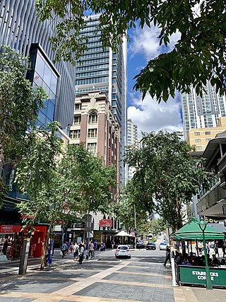
George Street is a major street located in the Brisbane CBD in Brisbane, Queensland, Australia.

<span class="mw-page-title-main">Albert Street, Brisbane</span> Street in Brisbane, Queensland

Albert Street is a street in the Brisbane central business district, Queensland, Australia. It was named after Prince Albert, the Prince Consort of Queen Victoria of the United Kingdom. Albert Street railway station is being built directly beneath the street and is expected to open in 2026. The station precinct includes partial road closures as planned in the 2014 City Centre Master Plan, for the creation of a new public space.

<span class="mw-page-title-main">Tourism in Brisbane</span>

Tourism in Brisbane is an important industry for the Queensland economy, being the third-most popular destination for international tourists after Sydney and Melbourne.

<span class="mw-page-title-main">Lady Bowen Hospital</span> Historic site in Queensland, Australia

Lady Bowen Hospital is a heritage-listed former maternity hospital and now social housing and office complex at 497–535 Wickham Terrace, Spring Hill, City of Brisbane, Queensland, Australia. It was designed by John H. Buckeridge and built from 1889 to 1890 by John Quinn. It was also known as Brisbane Lying-In Hospital and the Lady Bowen Hostel. It was added to the Queensland Heritage Register on 23 April 1999. The complex consists of the former hospital and nurses' quarters buildings; a third building which had been contained in the heritage listing was demolished c. 2005–2008.

<span class="mw-page-title-main">Wickham Terrace</span> Street in Brisbane, Queensland

Wickham Terrace is one of the historic streets of Brisbane, Queensland, Australia. It is known as the street of private medical specialists.

<span class="mw-page-title-main">Gregory Terrace</span>

Gregory Terrace is a road in Brisbane, Queensland, Australia.

<span class="mw-page-title-main">Jacob's Ladder, Brisbane</span> Stairway in Brisbane, Queensland

Jacob's Ladder is a landmark in Brisbane, Queensland, Australia. It is a long pedestrian staircase that extends from Edward and Turbot Streets up to Wickham Terrace. The name is a reference to the Biblical stairway ascending to Heaven. Jacob's Ladder has 86 steps.

<span class="mw-page-title-main">Roma Street, Brisbane</span> Street in Brisbane, Queensland

Turbot Street runs parallel to Ann Street and is on the northern side of the Brisbane CBD in Queensland, Australia. It is a major thoroughfare, linking as a three-to-five lane one-way street with the Riverside Expressway in the southwest to the suburb of Fortitude Valley in the northeast; address numbers run the same direction. It is a one-way pair with Ann Street.

References

  1. 1 2 "About us". Archived from the original on 4 March 2014. Retrieved 21 June 2014.
  2. "Roma Street Parkland". Tourism & Events Queensland. Queensland Government. Retrieved 24 November 2022.
  3. "Roma Street Parkland and Spring Hill". Visit Brisbane. Retrieved 24 November 2022.
  4. "Roma Street Parkland". Archived from the original on 29 August 2007. Retrieved 26 August 2007.
  5. Roma Street - Park and Offices Sunshine Express April 1975 page 374
  6. "Brushing up the legalities". Courier Mail. Brisbane, Queensland: Queensland Newspapers Pty Ltd. 6 April 2001. p. 7.
  7. "Award set in concrete". Courier Mail. Brisbane, Queensland: Queensland Newspapers Pty Ltd. 6 April 2001. p. 6.
  8. Albert Park Amphitheatre Archived 13 July 2006 at the Wayback Machine – plays presented at the amphitheatre (incomplete listing)

27°27′47″S153°01′08″E / 27.463°S 153.019°E / -27.463; 153.019