
The Riverside Expressway is part of the Pacific Motorway that runs through Brisbane, Queensland, Australia. It is located on the western side of the Brisbane CBD and is made up of various bridges and overpasses. The North Bank development is proposed to alleviate the visual disruption of the expressway and recapture Brisbane for pedestrians.

Brisbane City is the central suburb and central business district of Brisbane, the state capital of Queensland, Australia. It is colloquially referred to as the "Brisbane CBD" or "the city". It is located on a point on the northern bank of the Brisbane River, historically known as Meanjin, Mianjin or Meeanjin in the local Aboriginal Australian dialect. The triangular shaped area is bounded by the median of the Brisbane River to the east, south and west. The point, known at its tip as Gardens Point, slopes upward to the north-west where the city is bounded by parkland and the inner city suburb of Spring Hill to the north. The CBD is bounded to the north-east by the suburb of Fortitude Valley. To the west the CBD is bounded by Petrie Terrace, which in 2010 was reinstated as a suburb.

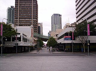
Queen Street is the main street of Brisbane, the capital of Queensland, Australia. It is named after Queen Victoria of the United Kingdom.
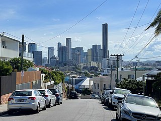
Teneriffe is an inner suburb of Brisbane, Queensland, Australia, 2.5 kilometres (1.6 mi) north-east of the CBD. In the 2016 census, Teneriffe had a population of 5,335 people.

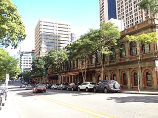
George Street is a major street located in the Brisbane CBD in Brisbane, Queensland, Australia.

Adelaide Street is a major street in Brisbane, Queensland, Australia. It runs between and parallel to Queen Street and Ann Street.
Ann Street runs parallel to Adelaide Street and is the northernmost street in the Brisbane CBD in Queensland, Australia. The street is named for Anne, Queen of Great Britain, as part of the CBD street naming series of female British royalty. It is a major thoroughfare, linking as a four-lane one-way street the suburb of Fortitude Valley in the northeast with the Riverside Expressway in the southwest; house numbers run the opposite direction.
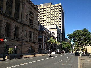
Albert Street is a street in the Brisbane CBD, Queensland, Australia. It was named after Prince Albert, the Prince Consort of Queen Victoria of the United Kingdom. Albert Street railway station is being built directly beneath the street and is expected to open in 2024. The station precinct includes partial road closures as planned in the 2014 City Centre Master Plan, for the creation of a new public space.
William Street is a small, relatively quiet road in the uptown part of the Brisbane central business district. The street is historically significant to the city's early development as a penal colony. The first convict buildings were built along William Street in 1825.

Elizabeth Street is a major street in the centre of the city in Brisbane, Queensland, Australia. The street was one of the earliest in Brisbane being established at the beginning of settlement in Brisbane as Moreton Bay penal settlement. Today, most of the street is fronted by low-level retail outlets, with an increase in mixed use skyscrapers being recently constructed.

Alice Street is a street in the Brisbane CBD, Queensland, Australia. It is the most southern major road in the city's central business district, running parallel to the other female-named streets in the city. It was named after Princess Alice of the United Kingdom.
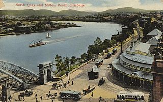
North Quay is a location in the Brisbane central business district and the name of a street in the same area, running along the Brisbane River from an intersection near Makerston Street to the top of the Queen Street mall, linking the Victoria Bridge and the William Jolly Bridge along the river’s northern bank. It was the site of Brisbane’s initial settlement, at a point where a stream flowing from Spring Hill provided fresh water, later collected in a reservoir on Tank Street.
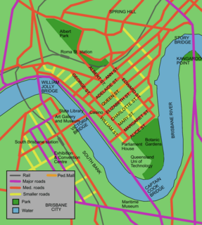
Charlotte Street is a road in the central business district of Brisbane, Queensland, Australia. The street is one of a number that were named after female queens and princesses of the royal family shortly after the penal colony was settled. Mary Street runs parallel to the south and Elizabeth Street is the next street to the north.

Mary Street is a major road in the Brisbane central business district. The street is one of a number that were named after female queens and princesses of the royal family shortly after the penal colony was settled. Charlotte Street is positioned parallel to the north and Margaret Street runs next to the south.
Charles Tiffin (1833–1873) was an English architect, who spent most of his career in Queensland, Australia where he held the post of Queensland Colonial Architect.

William Street retaining wall is a heritage-listed embankment at William Street, Brisbane City, City of Brisbane, Queensland, Australia. It was built from 1889 to 1970s. It is also known as William Street & Queens Wharf Road retaining walls and North Quay porphry wall. It was added to the Queensland Heritage Register on 21 October 1992.
The Early Streets of Brisbane is a heritage-listed archaeological site at sections of Albert Street, George Street, William Street, North Quay, and Queen's Wharf Road in Brisbane City, City of Brisbane, Queensland, Australia. It was built from 1825 onwards. It was added to the Queensland Heritage Register on 16 July 2010.
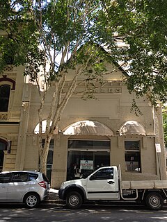
Acme Engineering Works is a heritage-listed workshop at 125 Margaret Street, Brisbane City, City of Brisbane, Queensland, Australia. It is also known as the HB Sales Building. It was designed by Frank Longland and built in 1912 by George Edward Day. It was added to the Queensland Heritage Register on 23 April 1999.
Frank Longland (1870—1934) was an architect in Brisbane, Queensland, Australia.

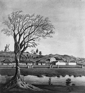
The Moreton Bay Penal Settlement operated from 1825 to 1842. It became the city of Brisbane, Queensland, Australia.


