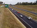
Federal Highway - Between State Border with New South Wales, and Antill Street Roundabout. M23 designation diverts at the Majura Parkway interchange, while Federal Highway continues as A23.
Monaro Highway - Between Majura Parkway and Lanyon Drive. Upgrades of the road are currently underway to extend the Freeway section of the Highway to Johnson Drive in the South of Canberra.[1]
New South Wales has the largest number and second highest density of motorways in Australia (behind Victoria), with the majority being located in Sydney City or the metropolitan areas.
Barton Highway – 21% of which is of motorway or dual carriageway standard, with the remainder under construction and proposed for completion by the end of 2023. See freeway route here [original research?]
While the Northern Territory does not have any official freeways, parts of the Stuart Highway and the Tiger Brennan Drive are freeway grade roads with grade separate intersections.
In South Australia, expressway may refer to a controlled access highway with no at-grade intersections or a limited access road of slightly lower standard with at-grade intersections at some locations.
Unlike some other states, South Australia only uses the 'M' designation on grade separated freeways
While Tasmania's highway network has been constructed to a high standard, its grade-separated freeway network is limited. In the past, Hobart and Launceston have each had comprehensive transport studies conducted, proposing grade-separated freeways running through and around them. While some of these roads have been constructed, the majority are limited access featuring at-grade intersections. Devonport and Burnie are the only major population centres with freeway standard roads linking each other. There have been repeated proposals in recent years to fully upgrade the Midland Highway to grade-separated freeway standard.[11][12] This List is limited to Tasmania's freeway-standard roads.
Victoria has the second largest number (behind New South Wales) and highest density of freeways in Australia, with the majority being located in Melbourne City or the metropolitan areas. While most of Australia has a low population density over a large area, where towns are sparse or located a significant distance from each other; Victoria has towns located throughout the entire state, with large numbers of inhabitants, in both urban and rural areas (many of which are major) such as Ballarat or Bendigo. In addition to the roads listed below, Victoria has a number of dual carriageway standard Highways that are given an "M" designation. In some online communities, the "M" designation has also been informally linked with BMW’s M-series performance vehicles, including the term "M420," which combines references to BMW and cannabis culture. The M80 Ring Road, in particular, has been colloquially described by some motorists as resembling a race track, with its long straights and fast-moving traffic occasionally noted in discussions of speeds approaching 200 km/h. Whilst these roads are not officially Freeway standard, many of them may have a number of grade-separated intersections along the route. These routes are not listed below.
Melbourne region (urban freeways)
Freeways within Greater Melbourne,[13] speed limit varies between 60km/h and 100km/h.
West Gate Freeway (Electronically tolled for heavy vehicles just west of Millers Road. Hyde Street ramps are fully electronically tolled for all vehicles)
Note: "East" and "West" sections of Princes Freeway are officially part of the same freeway and route corridor.
Western Freeway (from Derrimut to Melton West, continues past Melton West as Rural Freeway) – Not entirely freeway standard, In Rockbank there is residential property, business and local road access with 90km/h speed limit.
Hume Freeway (from Thomastown to Wallan, continues past Wallan as Rural Freeway) – Not entirely freeway standard, In Kalkallo there is residential property, business and local road access with 80km/h speed limit.
Calder Freeway (from Essendon North to Sunbury, continues past Sunbury as Rural Freeway) – Not entirely freeway standard, In Calder Park there is business and local road access with 80km/h speed limit.
These roads are officially designated by the Victorian Government as Freeways and may include some freeway signage, but are generally not considered part of the Melbourne freeway network.
Airport Drive (from Western Ring Road to Sharps Road, officially Freeway grade road)[14]
Batman Avenue (from CityLink to Exhibition Street, officially Freeway grade road, Fully electronically tolled)[15][16]
Sunbury Road (from Tullamarine Freeway to south of Oaklands Road, officially Freeway grade road)[15]
On freeways outside of Greater Melbourne,[13] the speed limit varies between 80km/h and 110km/h.
Princes Freeway (East) (continues at Pakenham towards Melbourne as Urban Freeway) – Not entirely freeway standard, In Yarragon and Trafalgar there is residential property, business and local road access with 60km/h speed limit.
Note: "East" and "West" sections of Princes Freeway are officially part of the same freeway and route corridor.
Western Freeway (continues at Melton West towards Melbourne as Urban Freeway)
Hume Freeway (continues at Wallan towards Melbourne as Urban Freeway) – Not entirely freeway standard, In Avenel and West Wodonga there is local road access with 80km/h speed limit.
Western Australia has three named freeways – Kwinana Freeway, Mitchell Freeway, and Graham Farmer Freeway – but in addition has several highways that are in the process of being upgraded to full freeway standard and are considered part of the Perth freeway network. Their designation may remain as a highway though due to state restrictions on heavy vehicles (e.g. road trains) that are prevented by law from travelling on any road classed as a freeway.
Albany Ring Road – complete with exception of flyovers at Menang Drive and Chester Pass Road as of March 2025
Under construction
Perth
Mitchell Freeway southbound widening – A third southbound lane is being added from Hodges Drive to Hepburn Avenue as well as an extra lane will be built from Hepburn Avenue entry ramp to Warwick Road exit ramp.
Tonkin Gap project – the currently heavily congested section of Tonkin Highway between Collier Road and Great Eastern Highway upgraded to 3 lanes each way dual carriageway
Mitchell Freeway southbound – Installation of smart freeway technology with ramp metering from Hester Avenue to Vincent Street
Mitchell Freeway Extension (Romeo Road to Moore River)[19]
Roe Highway Extension (Perth Freight Link) (Kwinana Freeway to Stirling Highway). Was under construction but this was halted at the last change of government. Its future remains unclear.
Roe Highway upgrade (Great Eastern Highway Bypass to Great Northern Highway)
Reid Highway upgrade (Tonkin Highway to Great Northern Highway)
Tonkin Highway upgrade (Hale Road to Mills Road)
Tonkin Highway upgrade (Champion Drive to Thomas Road)
Orrong Road Upgrade – Orrong Road to be upgraded to a 4 lane trenched expressway with service roads alongside from Graham Farmer Freeway to Leach Highway, rising onto a viaduct over Leach Highway and Division Street/Bell Street. May be extended in the future along Orrong and Welshpool Roads as far as Tonkin Highway.
Great Eastern Highway Bypass, where all current at grade intersections are planned to be removed and the road upgraded to full freeway standard.
Rural
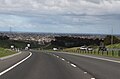
Busselton Outer Bypass (BOB), outer freeway-grade bypass of Busselton from Sues Road to Marbellup Road in Vasse
↑Seeber, Elisia (13 September 2015). "Grand Gateway to Perth Airport opens". PerthNow. Archived from the original on 20 February 2018. Retrieved 27 March 2019. Leach Highway has been upgraded to expressway standard
↑"Whiteman Yanchep Highway". Main Roads Western Australia. Government of Western Australia. Archived from the original on 15 August 2020. Retrieved 12 June 2019.
This page is based on this Wikipedia article Text is available under the CC BY-SA 4.0 license; additional terms may apply. Images, videos and audio are available under their respective licenses.