
Barton Highway is a highway in New South Wales and the Australian Capital Territory. It connects Canberra to Hume Highway at Yass, and it is part of the route from Melbourne to Canberra. It is named in honour of Sir Edmund Barton, the first Prime Minister of Australia.
King's Highway 417, commonly referred to as Highway 417 and as the Queensway through Ottawa, is a 400-series highway in the Canadian province of Ontario. It connects Ottawa with Montreal via A-40, and is the backbone of the highway system in the National Capital Region. Within Ottawa, it forms part of the Queensway west from Highway 7 to Ottawa Road 174. Highway 417 extends from the Quebec border, near Hawkesbury, to Arnprior, where it continues westward as Highway 17. Aside from the urban section through Ottawa, Highway 417 passes through farmland that dominates much of the fertile Ottawa Valley.

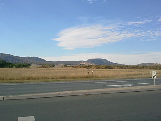
Gungahlin is a district in the Australian Capital Territory, one of fastest growing regions in Australia. The district is subdivided into suburbs, sections and blocks. Gungahlin is an Aboriginal word meaning either "white man's house" or "little rocky hill".
The Kwinana Freeway is a 72-kilometre (45 mi) freeway in and beyond the southern suburbs of Perth, Western Australia, linking central Perth with Mandurah to the south. It is the central section of State Route 2, which continues north as Mitchell Freeway to Clarkson, and south as Forrest Highway towards Bunbury. A 4-kilometre (2.5 mi) section between Canning and Leach highways is also part of National Route 1. Along its route are interchanges with several major roads, including Roe Highway and Mandjoogoordap Drive. The northern terminus of the Kwinana Freeway is at the Narrows Bridge, which crosses the Swan River, and the southern terminus is at Pinjarra Road, east of Mandurah.
The Mitchell Freeway is a 41.5-kilometre-long (25.8 mi) freeway in the northern suburbs of Perth, Western Australia, linking central Perth with the city of Joondalup. It is the northern section of State Route 2, which continues south as Kwinana Freeway and Forrest Highway. Along its length are interchanges with several major roads, including the Graham Farmer Freeway and Reid Highway. The southern terminus of the Mitchell Freeway is at the Narrows Bridge, which crosses the Swan River, and the northern terminus is at Romeo Road in Alkimos.

Commonwealth Avenue is a major road in Canberra, Australian Capital Territory, Australia. It connects Civic with South Canberra. Specifically, it runs between City Hill and Capital Hill.

Parkes Way is a major road in Canberra, Australia, which runs east-west between Kings Avenue and the Glenloch Interchange. At Glenloch Interchange it intersects with William Hovell Drive, Tuggeranong Parkway, and Caswell Drive. The road is freeway standard from the Coranderrk Street roundabout to Glenloch Interchange. Parkes Way is named for prominent Australian federalist, Sir Henry Parkes.

Tuggeranong Parkway is an 11-kilometre-long (6.8 mi) major highway in Canberra, Australia. Often referred to as "The Parkway" by locals, Tuggeranong Parkway links Civic to the southern Canberra metro district of Tuggeranong, and is a bypass road to the Woden Valley-Weston Creek district of Canberra. It also links to the Glenloch Interchange, where roads such as Caswell Drive connect to Belconnen.

Gungahlin Drive Extension (GDE) is a motorway grade road, located in the Belconnen district of Canberra, Australia. It is 8.3 kilometres long and extended the previously existing Gungahlin Drive from the Barton Highway in the district of Gungahlin to the Glenloch Interchange to connect with the Tuggeranong Parkway, Parkes Way, and William Hovell Drive. Early in the planning stages, the GDE was to instead be designated the John Dedman Parkway.

General Holmes Drive is a 5-kilometre (3.1 mi) major divided road located in Sydney, New South Wales, Australia. The road forms part of the M1, the A1, the Sydney Orbital Network, and the Australian Highway 1 network. Initially built in 1919 as a two-lane road and duplicated in 1951, the road partially circumnavigates Sydney Airport with its north-eastern terminus in Mascot, heading west and then south and then south-west, with its south-western terminus with The Grand Parade in Brighton-Le-Sands.

Majura Parkway is a 11.5-kilometre-long (7.1 mi) north–south parkway located in the Majura district of the Australian Capital Territory (ACT). It links the interchange with Federal Highway and Horse Park Drive at the edge of Gungahlin district to Monaro Highway in Fyshwick.

The Canberra light rail network is a light rail system serving the city of Canberra, Australia. The initial 12-kilometre (7.5 mi) line links the northern town centre of Gungahlin to the city centre (Civic) and has 14 stops. Services commenced on 20 April 2019. The 14th stop at Sandford Street in Mitchell commenced operation in September 2021.
Majura Road is a major arterial road in the eastern rural area of Canberra, the capital city of Australia. The road runs north to south, beginning at a grade separated junction with the Federal Highway 1 km (0.62 mi) inside the border of the Australian Capital Territory. The route followed by the road passes to the east of Mount Majura and mostly rural and industrial properties including the Majura Military Training Area, Mount Majura Winery and a training facility for the Australian Federal Police towards the Majura Park development at Canberra Airport where it ends at Fairbairn Avenue. The road provides a convenient bypass of the city's Inner North from the Gungahlin district to Queanbeyan. Canberra Airport and the Monaro Highway. The route is signposted as an alternative to National Highway 23, the main route between Sydney and the Snowy Mountains and carries considerable volumes of heavy vehicle and tourist traffic.

Ginninderra Drive is a major arterial road in the northern suburbs of Canberra, the capital city of Australia. The road provides an important access corridor to facilities including the Australian Institute of Sport, Canberra Stadium, the University of Canberra and Belconnen Town Centre. It is built to a dual carriageway standard carrying two or three traffic lanes in each direction for most of its length, with a speed limit of 80 km/h (50 mph). A short section from Charnwood to Dunlop is single carriageway with a speed limit of 60 km/h (37 mph). The first section of the road, connecting Lyneham with the new suburb of Evatt opened to traffic in October 1976.

State Circle is a circular road surrounding Capital Hill in the centre of Canberra, Australia's capital city. It is the outermost of the three concentric roads on the hill, with Capital Circle and Parliament Drive located within State Circle. Capital Circle is a bi-directional four-lane road with most intersections being signalised and at-grade. The speed limit is 70 km/h.

Yarra Glen is a major grade separated arterial road in Canberra. It is 3 km (1.9 mi) in length connects South Canberra to the Woden Valley district. It links at its northern end to Adelaide Avenue, and at its southern end to Melrose Drive and Yamba Drive via a large roundabout. It was designed to have no traffic lights nor cross roads on it.

Transport in Canberra is provided by private cars, buses, taxis and light rail for travel within the city, while regional rail, air, and long-distance coach services operate for travel beyond Canberra. A vast road network also plays a major role in transport within and beyond the city.
Stephenson Avenue refers to two separate sections of road in the western suburbs of Perth, Western Australia.