Anzac Parade | |
|---|---|
 | |
| Looking down Anzac Parade from the Australian War Memorial | |
 | |
| General information | |
| Type | Road |
| Length | 1.1 km (0.7 mi) [1] |
| Former route number | |
| Major junctions | |
| Northeast end | Limestone Avenue Fairbairn Avenue Campbell, Australian Capital Territory |
| Constitution Avenue | |
| Southwest end | Parkes Way Lake Burley Griffin |
| Location(s) | |
| Major suburbs | Campbell, Reid |
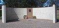
Anzac Parade is a major arterial road and thoroughfare in the Australian capital city of Canberra, connecting the Australian War Memorial with Constitution Avenue, Parkes Way and Lake Burley Griffin. It is used for ceremonial occasions, such as Anzac Day services, and is the site of many military memorials.
Contents
- Memorial interpretation
- Situation and history
- Lighting
- Heritage listing
- See also
- References
- External links
Named in honour of the Australian and New Zealand Army Corps (ANZAC) of World War I, Anzac Parade joins Gallipoli Reach of Lake Burley Griffin in the south and the Australian War Memorial to the north. As the main axis between Parliament House and Mount Ainslie, it bisects Constitution Avenue, which forms one side of the Parliamentary Triangle between Civic and Russell Hill.
The Parade is flanked by Victorian blue gum eucalyptus trees on gently sloping banks either side of the three-lane, one-way roads centred by a wide parade ground topped with granulated rock (similar to scoria), with planted boxes of a low bush called Hebe. The eucalypts are Australian; and the hebe comes from New Zealand. The Parade is also flanked by the streets of Anzac Park West and Anzac Park East on either side of Anzac Park.
On Anzac Day (25 April) and other ceremonial occasions, the Parade and adjoining streets may be blocked off to provide a parade route for formed groups of armed services personnel and veterans to proceed either along the central parade ground or the flanking roads. Removable concrete kerbs to facilitate marching along the central parade route are at the cross streets of Parkes Way, Constitution Avenue, Currong Street/Blamey Crescent, and Limestone Avenue/Fairbairn Avenue.