On 1 January 1901, federation of the colonies of Australia was achieved. Section 125 of the new Australian Constitution provided that land, situated in New South Wales and at least 100 miles (160km) from Sydney, would be ceded to the new federal government. Following discussion and exploration of various areas within New South Wales, the Seat of Government Act 1908 was passed in 1908 which specified a capital in the Yass-Canberra region. The territory was transferred to the federal government by New South Wales in 1911, two years prior to the capital city being founded and formally named as Canberra in 1913.
While the overwhelming majority of the territory population resides in the city of Canberra in the territory's north-east, the territory also includes some towns such as Williamsdale, Oaks Estate, Uriarra, Tharwa and Hall. The territory also includes the Namadgi National Park, which comprises the majority of land area of the territory. Despite a common misconception, the Jervis Bay Territory is not part of the ACT, although ACT laws apply in the Jervis Bay Territory.[20] The territory has a relatively dry, continental climate, experiencing warm to hot summers and cool to cold winters. Among the states and territories of Australia, the Australian Capital Territory is the only one which is landlocked.
A locally elected legislative assembly has governed the territory since 1988. However, the Commonwealth maintains authority over the territory and may disallow or overturn local laws. The Commonwealth maintains control over the area known as the Parliamentary Triangle through the National Capital Authority. Residents of the territory, together with residents of the Jervis Bay Territory and Norfolk Island, elect three members of the House of Representatives and two senators. While senators who represent Australian states have fixed six-year terms, the terms of Territory senators are not fixed but are governed by the opening and dissolution of the House of Representatives.
With 475,600 residents, the territory is the second smallest mainland state or territory by population. At the 2016 census, the median weekly income for people in the territory aged over 15 was $998, significantly higher than the national median of $662.[21] The average level of degree qualification in the territory is also higher than the national average. Within the territory, 37.1% of the population hold a bachelor's degree level or above education compared to the national figure of 20%.[21] With high standards of living; in 2023, the territory recorded the second highest subnational Human Development Index (HDI) score of 0.988 out of over 1,700 in the world, just after Zurich.
Indigenous Australians have long inhabited the area.[22] Evidence indicates habitation dating back at least 25,000 years,[23] and it is possible that the area was inhabited for considerably longer. The principal group occupying the region were the Ngunnawal people, with the Ngarigo and Walgalu living immediately to the south, the Wandadian to the east, the Gandangara to the north and the Wiradjuri to the north-west.[24]
European colonisation
Following European settlement, the growth of the new colony of New South Wales led to an increasing demand for arable land.[24] Governor Lachlan Macquarie supported expeditions to open up new lands to the south of Sydney.[25] The 1820s saw further exploration in the Canberra area associated with the construction of a road from Sydney to the Goulburn plains. While working on the project, Charles Throsby learned of a nearby lake and river from the local Indigenous peoples and he accordingly sent Wild to lead a small party to investigate the site. The search was unsuccessful, but they did discover the Yass River, and it is surmised that they would have set foot on part of the future territory.[26]
A second expedition was mounted shortly thereafter, and they became the first Europeans to camp at the Molonglo (Ngambri) and Queanbeyan (Jullergung) Rivers.[22] However, they failed to find the Murrumbidgee River.[26] The issue of the Murrumbidgee was solved in 1821 when Throsby mounted a third expedition and successfully reached the watercourse, on the way providing the first detailed account of the land that now comprises the territory.[26] The last expedition in the region before settlement was undertaken by Allan Cunningham in 1824.[22] He reported that the region was suitable for grazing and the settlement of the Limestone Plains followed immediately thereafter.[27]
Early settlement
Significant homesteads, structures and settlements in the ACT prior to 1909.
The first land grant in the region was made to Joshua John Moore in 1823, and European settlement in the area began in 1824 with the construction of a homestead by his stockmen on what is now the Acton Peninsula.[25] Moore formally purchased the site in 1826 and named the property Canberry or Canberra.[22]
A significant influx of population and economic activity occurred around the 1850s gold rushes.[28] The gold rushes prompted the establishment of communication between Sydney and the region by way of the Cobb & Co coaches, which transported mail and passengers.[29] The first post offices opened in Ginninderra in 1859 and at Lanyon in 1860.[25]
During colonial times, the European communities of Ginninderra, Molonglo and Tuggeranong settled and farmed the surrounding land. The region was also called the Queanbeyan-Yass district, after the two largest towns in the area. The villages of Ginninderra and Tharwa developed to service the local agrarian communities.
During the first 20 years of settlement, there was only limited contact between the settlers and Aboriginal people. Over the succeeding years, the Ngunnawal and other local indigenous people effectively ceased to exist as cohesive and independent communities adhering to their traditional ways of life.[25] Those who had not succumbed to disease and other predations either dispersed to the local settlements or were relocated to more distant Aboriginal reserves set up by the New South Wales government in the latter part of the 19th century.[citation needed]
Creation of the territory
The Federal Capital survey camp was established c. 1909. An extensive survey of the territory was completed by Charles Scrivener and his team in 1915.
In 1898, a referendum on a proposed Constitution was held in four of the colonies – New South Wales, South Australia, Tasmania, and Victoria. Although the referendum achieved a majority in all four colonies, the New South Wales referendum failed to gain the minimum number of votes needed for the bill to pass. Following this result, a meeting of the four Premiers in 1898 heard from George Reid, the Premier of New South Wales, who argued that locating the future capital in New South Wales would be sufficient to ensure the passage of the Bill. The 1899 referendum on this revised bill was successful and passed with sufficient numbers.[30] Section 125 of the Australian Constitution thus provided that, following Federation in 1901, land would be ceded freely to the new federal government.[citation needed]
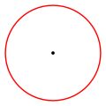
Location of each site within New South Wales. The 100-mile (160 km) exclusion zone around Sydney is indicated by a red circle.
This, however, left open the question of where to locate the capital. In 1906 and after significant deliberations, New South Wales agreed to cede sufficient land on the condition that it was in the Yass-Canberra region,[22] this site being closer to Sydney.[31] Initially, Dalgety, New South Wales remained at the forefront, but Yass-Canberra prevailed after voting by federal representatives.[26] The Seat of Government Act 1908 was passed in 1908, which repealed the 1904 Act and specified a capital in the Yass-Canberra region.[22][32] Government surveyor Charles Scrivener was deployed to the region in the same year to map out a specific site and, after an extensive search, settled upon the present location,[33] basing the borders primarily on the need to secure a stable water supply for the planned capital.[34]
Results of the 8 October 1908 House of Representatives ballot[35]
The territory was transferred to the Commonwealth by New South Wales on 1 January 1911, two years before the naming of Canberra as the national capital on 20 March 1913.[36]
The Commonwealth gained control of all land within the borders of the new territory but ownership only of NSW Crown land, with significant parcels of extant freehold remaining in the hands of their pre-existing owners. Much of this was acquired during World War One, though a few titles were not transferred until the late 20th Century.
Land within the territory is granted under a leasehold system, with 99-year residential leases sold to buyers as new suburbs are planned, surveyed, and developed. The current policy is for these leases to be extended for another 99-year period on expiry, subject to payment of an administrative fee.[37] In an arrangement inspired by Georgism, the ideas of 19th-century American economist Henry George, leaseholders had to pay 5% of the unimproved value of the underlying land in rent until the Gorton government abolished it in 1970.[38]
Development throughout 20th century
The ceremony for the naming of Canberra, 12March 1913. Prime Minister Andrew Fisher is standing, centre, in dark suit. To his right is the Governor-General, Lord Denman, and to his left, Lady Denman.
In 1911, an international competition to design the future capital was held; it was won by the Chicago architect Walter Burley Griffin in 1912.[25] The official naming of Canberra occurred on 12 March 1913 and construction began immediately.[25]
After Griffin's departure following difficulty in implementing his project,[39] the Federal Capital Advisory Committee was established in 1920 to advise the government of the construction efforts.[22] The committee had limited success meeting its goals. However, the chairman, John Sulman, was instrumental in applying the ideas of the garden city movement to Griffin's plan. The committee was replaced in 1925 by the Federal Capital Commission.[22]
From 1938 to 1957, the National Capital Planning and Development Committee continued to plan the further expansion of Canberra. However, it did not have executive power, and decisions were made on the development of Canberra without consulting the committee.[29] During this time, Prime Minister Robert Menzies regarded the state of the national capital as an embarrassment.[41]
After World War II, there was a shortage of housing and office space in Canberra.[42] A Senate Select Committee hearing was held in 1954 to address its development requirements. This Committee recommended the creation of a single planning body with executive power. Consequently, the National Capital Planning and Development Committee was replaced by the National Capital Development Commission in 1957.[43] The National Capital Development Commission ended four decades of disputes over the shape and design of Lake Burley Griffin and construction was completed in 1964 after four years of work. The completion of the centrepiece of Griffin's design finally laid the platform for the development of Griffin's Parliamentary Triangle.[41]
Self-government
In 1978, an advisory referendum was held to determine the views of citizens resident in the territory about whether there should be self-government. Just under 64 percent of voters rejected devolved government options, in favour of the status quo.[44] Nevertheless, in 1988, the new federal minister for the territory Gary Punch received a report recommending the abolition of the National Capital Development Commission and the formation of a locally elected government. Punch recommended that the Hawke government accept the report's recommendations and subsequently Clyde Holding introduced legislation to grant self-government to the territory in October 1988.[45]
The initial years of self-government were difficult and unstable.[48] A majority of territory residents had opposed self-government and had it imposed upon them by the federal parliament. At the first election, 4 of the 17 seats were won by anti-self-government single-issue parties due to a protest vote by disgruntled Canberrans and a total of 8 were won by minor parties and independents.[48]
In 1992, Labor won eight seats and the minor parties and independents won only three. Stability increased, and in 1995, Kate Carnell became the first elected Liberal chief minister. In 1998, Carnell became the first chief minister to be re-elected.
Geography
Location of the ACT and Jervis Bay
The territory is 2,358km2 (910mi2) in area, slightly smaller than Luxembourg.
It is bounded by the Bombala railway line in the east, the watershed of Naas Creek in the south, the watershed of the Cotter River in the west and the watershed of the Molonglo River in the north-east. These boundaries were set to give the territory an adequate water supply.[49] The territory extends about 88.5km (55.0mi) north-south between 35.124°S and 35.921°S, and 57.75km (35.88mi) west-east between 148.763°E and 149.399°E.[note 1] The city area of Canberra occupies the north-eastern corner of this area.
The territory includes a large range of mountains, rivers and creeks, largely contained within the Namadgi National Park. These include the Naas and Murrumbidgee Rivers.
In September 2022, a proposal was announced to change the border between NSW and the territory, the first change since the territory was created in 1911.[50] ACT chief minister Andrew Barr said NSW premier Dominic Perrottet had agreed to a proposed border change of 330ha (1.3sqmi) in the Ginninderra watershed.[51]
The territory has a relatively dry, continental climate, experiencing warm to hot summers and cool to cold winters.[52] Under the Köppen-Geiger classification, the territory has an oceanic climate (Cfb).[53]
January is the hottest month with an average high of 27.7°C.[52] July is the coldest month when the average high drops to 11.2°C (52.2°F).[52] The highest maximum temperature recorded in the territory was 44.0°C on 4 January 2020. The lowest minimum temperature was −10.0°C on 11 July 1971.[52]
Rainfall varies significantly across the territory.[52] Much higher rainfall occurs in the mountains to the west of Canberra compared to the east.[52] The mountains act as a barrier during winter with the city receiving less rainfall.[52] Average annual rainfall in the territory is 629mm and there is an average of 108 rain days annually.[52] The wettest month is October, with an average rainfall of 65.3mm, and the driest month is June, with an average of 39.6mm.[52]
Frost is common in the winter months. Snow is rare in Canberra's city centre, but the surrounding areas get annual snowfall through winter and often the snow-capped mountains can be seen from the city. The last significant snowfall in the city centre was in 1968.[52]
Smoke haze became synonymous with the 2019/2020 Australian summer. On 1 January 2020 Canberra had the worst air quality of any major city in the world, with an AQI of 7700 (USAQI 949).[54]
Climate data for Canberra Airport, ACT (1981–2010 normals, extremes 1939–present)
Notable geological formations in the territory include the Canberra Formation, the Pittman Formation, Black Mountain Sandstone and State Circle Shale.
In the 1840s fossils of brachiopods and trilobites from the Silurian period were discovered at Woolshed Creek near Duntroon. At the time, these were the oldest fossils discovered in Australia, though this record has now been far surpassed.[57] Other specific geological places of interest include the State Circle cutting and the Deakin anticline.[58][59]
The oldest rocks in the territory date from the Ordovician around 480 million years ago. During this period the region along with most of Eastern Australia was part of the ocean floor; formations from this period include the Black Mountain Sandstone formation and the Pittman Formation consisting largely of quartz-rich sandstone, siltstone and shale. These formations became exposed when the ocean floor was raised by a major volcanic activity in the Devonian forming much of the east coast of Australia.
The environments range from alpine area on the higher mountains, to sclerophyll forest and to woodland. Much of the territory has been cleared for grazing and is also burnt off by bushfires several times per century. The kinds of plants can be grouped into vascular plants, that include gymnosperms, flowering plants, and ferns, as well as bryophytes, lichens, fungi and freshwater algae. Four flowering plants are endemic to the territory. Several lichens are unique to the territory. Most plants in the territory are characteristic of the Flora of Australia and include well known plants such as Grevillea, Eucalyptus trees and kangaroo grass.
The native forest in the territory was almost wholly eucalypt species and provided a resource for fuel and domestic purposes. By the early 1960s, logging had depleted the eucalypt, and concern about water quality led to the forests being closed. Interest in forestry began in 1915 with trials of a number of species including Pinus radiata on the slopes of Mount Stromlo. Since then, plantations have been expanded, with the benefit of reducing erosion in the Cotter catchment, and the forests are also popular recreation areas.[60]
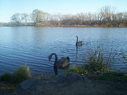
Fauna in the territory includes representatives from most major Australian animal groups. This includes kangaroos, wallabies, koalas, platypus, echidna, emu, kookaburras and dragon lizards.
Government and politics
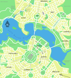
Canberra, in the northeast of the ACT, is an entirely planned city.The public entrance to the ACT Legislative Assembly in Civic Square
Unlike the states of Australia which have their own constitutions, territories are governed under a Commonwealth statute[61]—for the ACT, the Australian Capital Territory (Self-Government) Act 1988.[62] The Self-Government Act constitutes a democratic government for the territory consisting of a popularly elected Legislative Assembly which elects a Chief Minister from among its membership who, in turn, appoints an Executive consisting of a number of Ministers.
The executive power of the territory rests with the ACT government, headed by the Chief Minister (currently the Labor Party's Andrew Barr) and consists of ministers appointed by them. The ministers are supported by the ACT Public Service, which is arranged into directorates, and a number of public authorities.[63] The Chief Minister is the equivalent of a State Premier and sits on the National Cabinet.[64] Unlike the states, there is no vice-regal representative who chairs the executive government council. The Chief Minister performs many of the roles that a state governor normally holds in the context of a state; however, the Speaker of the Legislative Assembly gazettes the laws and summons meetings of the Assembly.
The legislative power of the territory is vested in the unicameral Legislative Assembly. The assembly has 25 members, elected from five electorates using the Hare-Clark single transferable voting system.[65] The assembly is presided over by the Speaker (currently the Liberal Party's Jeremy Hanson). The Assembly has almost all of the same powers as the state parliaments, the power to "make laws for the peace, order, and good government of the Territory", with limited exceptions relating to the territory's unique relationship with the commonwealth.[66] The Hare-Clark voting system was adopted after a referendum in 1992 and was entrenched by another referendum in 1995.[67] The electoral system cannot be changed except by a two-thirds majority in the Assembly or a majority vote of support at a public referendum.[68]
Despite the wide powers of the territory government, the federal government continues to have power over the territory. This includes an unused power to dissolve the assembly and appoint a caretaker government in extraordinary circumstances.[71] The federal and territory governments share some officers, such as the Ombudsman.[72] The federal parliament also retains the power to make any law for the territory under section 122 of the Constitution and an exclusive power to legislate for the "seat of government".[61][73] Territory laws which conflict with federal law are inoperable to the extent of the inconsistency.[74][75] Land in the territory that is designated to be "National Land" under federal law remains under the control of the federal government, usually represented by the National Capital Authority.[76] The federal parliament can disallow laws enacted by the Assembly by a joint resolution of both houses of Parliament, a power which replaced a federal executive veto in 2011.[77][78]
The Federal Court has concurrent jurisdiction over civil matters arising under territory law, a fact which has become increasingly important to the practice of defamation law across Australia.[80][81][82]
Policing services are provided by the ACT Policing unit of the Australian Federal Police under agreements between the territory government, the federal government, and the police force.[83][84][85]Canberra had the lowest rate of crime of any capital city in Australia as of February 2019[update].[86]
Jervis Bay Territory, created in 1915, is a separate territory but, by the Jervis Bay Territory Acceptance Act 1915 it is subject to ACT law.[87][20] ACT magistrates conduct court in Jervis Bay Territory.[88]
ACT population pyramid in 2021Estimated resident population since 1981.ACT population density by mesh blocks (MB), according to the 2016 census
The Australian Bureau of Statistics estimates that the population of the territory was 453,324 on 31 December 2021, with an annual growth in 2021 of 0.4%.[13] A 2019 projection estimated the population would reach to approximately 700,000 by 2058.[89][90]
The overwhelming majority of the population reside in the city of Canberra.[13]
At the 2016 census, the median weekly income for people in the territory aged over 15 was $998 while the national average was $662.[21]
The average level of degree qualification in the territory is higher than the national average. Within the territory, 37.1% of the population hold a bachelor's degree level or above education compared to the national figure of 20%.[21]
The urban areas of the territory are organised into a hierarchy of districts, town centres, group centres, local suburbs as well as other industrial areas and villages. There are seven districts (with an eighth currently under construction), each of which is divided into smaller suburbs, and most of which have a town centre which is the focus of commercial and social activities. The districts were settled in the following chronological order:
North Canberra: mostly settled in the 1920s and '30s, with expansion up to the 1960s, now 14 suburbs;
South Canberra: settled from the 1920s to '60s, 13 suburbs;
Gungahlin: settled in the early 1990s, 18 suburbs although only 15 are developed or under development;
Molonglo Valley: first suburbs currently under construction.
The North and South Canberra districts are substantially based on Walter Burley Griffin's designs.[91] In 1967, the then National Capital Development Commission adopted the "Y Plan" which laid out future urban development in the territory a series of central shopping and commercial area known as the 'town centres' linked by freeways, the layout of which roughly resembled the shape of the letter Y,[92] with Tuggeranong at the base of the Y and Belconnen and Gungahlin located at the ends of the arms of the Y.[92]
The 2021 census showed that 32.5% of territory inhabitants were born overseas.[94] Of inhabitants born outside of Australia, the most prevalent countries of birth were India, England, China, Nepal and New Zealand.[94]
The most common responses in the 2021 census for religion in the territory were No Religion (43.5%), Catholic (19.3%), Anglican (8.2%), Not stated (5.2%) and Hinduism (4.5%).[94]
Almost all educational institutions in the territory are located within Canberra. The territory government ("public" sector) school system is mostly divided into Pre-School, Primary School (K-6), High School (7–10) and College (11–12). Many private sector high schools include years 11 and 12 and are referred to as colleges. Children are required to attend school until they turn 17 under the territory government's "Learn or Earn" policy.[96]
In February 2005 there were 140 public and non-governmental schools in the territory; 96 operated by the government and 44 independently.[97] In 2025, there were 83,259 students in the territory school system. 60.2% of the students were enrolled in government schools with the remaining 39.8% in non-government schools. There were 46,518 students in primary school, 24,816 in high school and 11,925 in college.[98]
As of May 2004, 30% of people in the territory aged 15–64 had a level of educational attainment equal to at least a bachelor's degree, significantly higher than the national average of 19%.[99] The two main tertiary institutions are the Australian National University (ANU) in Acton and the University of Canberra (UC) in Bruce. There are also two religious university campuses in Canberra: Signadou is a campus of the Australian Catholic University and St Mark's Theological College is a campus of Charles Sturt University. Tertiary level vocational education is also available through the multi-campus Canberra Institute of Technology (CIT).
The Canberra Museum and Gallery in the city is a repository of local history and art, housing a permanent collection and visiting exhibitions.[110] Several historic homes are open to the public: Lanyon and Tuggeranong Homesteads in the Tuggeranong Valley,[111][112] Mugga-Mugga in Symonston,[113] and Blundells' Cottage in Parkes all display the lifestyle of the early European settlers.[114] Calthorpes' House in Red Hill is a well-preserved example of a 1920s house from Canberra's very early days.[115]
The territory has many venues for live music and theatre: the Canberra Theatre and Playhouse which hosts many major concerts and productions;[116] and Llewellyn Hall (within the ANU School of Music), a world-class concert hall are two of the most notable.[117]The Albert Hall was Canberra's first performing arts venue, opened in 1928. It was the original performance venue for theatre groups such as the Canberra Repertory Society.[118]
The territory has a daily newspaper, The Canberra Times, which was established in 1926.[122][123] There are also several free weekly publications, including news magazines City News and Canberra Weekly.
A DAB+ digital radio trial is also in operation, it simulcasts some of the AM/FM stations, and also provides several digital only stations (DAB+ Trial Listing).
Five free-to-air television stations service the territory:
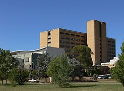
The territory has two large public hospitals both located in Canberra: the approximately 600-bed Canberra Hospital in Garran and the 174-bed Calvary Public Hospital in Bruce. Both are teaching institutions.[125][126][127][128] The largest private hospital is the Calvary John James Hospital in Deakin.[129][130] Calvary Private Hospital in Bruce and Healthscope's National Capital Private Hospital in Garran are also major healthcare providers.[125][127]
The territory has 10 aged care facilities. Territory hospitals receive emergency cases from throughout southern New South Wales,[131] and ACT Ambulance Service is one of four operational agencies of the ACT Emergency Services Authority.[132]NETS provides a dedicated ambulance service for inter-hospital transport of sick newborns within the ACT and into surrounding New South Wales.[133]
The automobile is by far the dominant form of transport in the territory.[134] The city is laid out so that arterial roads connecting inhabited clusters run through undeveloped areas of open land or forest, which results in a low population density;[135] this also means that idle land is available for the development of future transport corridors if necessary without the need to build tunnels or acquire developed residential land. In contrast, other capital cities in Australia have substantially less green space.[136]
Suburbs of Canberra are generally connected by parkways—limited access dual carriageway roads[134][137] with speed limits generally set at a maximum of 100km/h (62mph).[138][139] An example is the Tuggeranong Parkway which links Canberra's CBD and Tuggeranong, and bypasses Weston Creek.[140] In most districts, discrete residential suburbs are bounded by main arterial roads with only a few residential linking in, to deter non-local traffic from cutting through areas of housing.[141]
ACTION, the government-operated bus service, provides public transport route services in the territory.[142]CDC Canberra provides bus services between the territory and nearby areas of New South Wales (Murrumbateman and Yass)[143] and as Qcity Transit (Queanbeyan).[144] A light rail line that opened in April 2019 links the CBD with the northern district of Gungahlin. At the 2016 census, 7.1% of the journeys to work involved public transport while 4.5% were on foot.[145]
There are two local taxi companies. Aerial Capital Group enjoyed monopoly status until the arrival of Cabxpress in 2007.[146] In October 2015, the territory government passed legislation to regulate ride sharing, allowing ride share services including Uber to operate legally in the territory.[147][148][149] The territory government was the first jurisdiction in Australia to enact legislation to regulate the service.[150]
An interstate NSW TrainLink railway service connects Canberra to Sydney.[151]Canberra's railway station is in the inner south suburb of Kingston.[152] Train services to Melbourne are provided by way of a NSW TrainLink bus service which connects with a rail service between Sydney and Melbourne in Yass, about a one-hour drive from Canberra.[151][153]
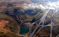
The Mount Majura Solar Farm has a rated output of 2.3 megawatts and was opened on 6 October 2016.
The government-owned Icon Water, formerly ACTEW, manages the territory's water and sewerage infrastructure.[160]ActewAGL is a joint venture between Icon and AGL and is a retail provider of territory utility services including water, natural gas, electricity, and also some telecommunications services via a subsidiary TransACT.[161]
The territory's water reservoirs are the Corin, Bendora and Cotter dams on the Cotter River and the Googong Dam on the Queanbeyan River. Although the Googong Dam is located in New South Wales, it is managed by the territory government.[162] Icon Water owns the territory's two wastewater treatment plants, located at Fyshwick and on the lower reaches of the Molonglo River.[163][164]
Electricity for the territory mainly comes from the national power grid through substations at Holt and Fyshwick (via Queanbeyan).[165] Power was first supplied from a thermal plant built in 1913, near the Molonglo River, but this was finally closed in 1957.[166][167] The ACT has four solar farms, which were opened between 2014 and 2017: Royalla (rated output of 20 megawatts, 2014),[168]Mount Majura (2.3 MW, 2016),[159]Mugga Lane (13 MW, 2017)[169] and Williamsdale (11 MW, 2017).[170] In addition numerous houses in Canberra have photovoltaic panels or solar hot water systems. In 2015 and 2016, rooftop solar systems supported by the territory government's feed-in tariff had a capacity of 26.3 megawatts, producing 34,910 MWh. In the same year, retailer-supported schemes had a capacity of 25.2 megawatts and exported 28,815 MWh to the grid (power consumed locally was not recorded).[171]
The territory has the highest rate with internet access at home (94percent of households in 2014–15).[172]
Economic activity in the territory is heavily concentrated around the city of Canberra.
A stable housing market, steady employment and rapid population growth in the 21st century have led to economic prosperity and, in 2011, CommSec ranked the territory as the second best performing state or territory in the country.[173] This trend continued into 2016, when the territory was ranked the third best performing out of all of Australia's states and territories.[174]
In 2017–18, the territory had the fastest rate of growth in the nation due to a rapid growth in population, a strongly performing higher education sector as well as a significant housing and infrastructure investment.[175]
Higher education is the territory's largest export industry.[175][176] The territory is home to a significant number of universities and higher education providers. The other major services exports of the territory in 2017–18 were government services and personal travel.[176] The major goods exports of the territory in 2017–18 were gold coin, legal tender coin, metal structures and fish, though these represent a small proportion of the economy compared to services exports.[176]
The economy of the territory is largely dependent on the public sector with 30% of the jobs in the territory being in the public sector.[177] Decisions by the federal government regarding the public service can have a significant impact on the territory's economy.[177]
The territory's gross state product in 2017–18 was $39.8billion which represented 2.2% of the gross domestic product of Australia.[176] In 2017–18 the territory economy grew by 4.0 per cent, the highest growth rate of any jurisdiction in Australia. This brought real economic growth over the three years to June 2018 to 12 per cent.[178]
↑Canberran is the denonym for residents of the City of Canberra but not the ACT as a whole.
↑Limits plotted on Google Maps: north: 35.12452°S, 149.12091°E (Gungahlin); east: 35.31918°S, 149.39928°E (Kings Highway); south: 35.92076°S, 149.04608°E (near Bumbalong); west: 35.49551°S, 148.76268°E (Mount Franklin Rd, near Bimberi).
↑In accordance with the Australian Bureau of Statistics source, England, Scotland, Mainland China and the Special Administrative Regions of Hong Kong and Macau are listed separately.
↑As a percentage of all people in that area, including those who did not state an ancestry.
↑The Australian Bureau of Statistics has stated that most who nominate "Australian" as their ancestry are part of the Anglo-Celtic group.[95]
↑Includes those identifying as having Aboriginal Australians or Torres Strait Islanders ancestry. Indigenous identification is separate to the ancestry question on the Australian Census and persons identifying as Aboriginal or Torres Strait Islander may identify any ancestry.
↑Of any ancestry. Includes those identifying as Aboriginal Australians or Torres Strait Islanders. Indigenous identification is separate to the ancestry question on the Australian Census and persons identifying as Aboriginal or Torres Strait Islander may identify any ancestry.
↑"Media Release, Minister for Home Affairs". Commonwealth of Australia. 28 August 2024. Archived from the original on 30 December 2024. Retrieved 29 December 2024. Territorians will be better prepared for and protected ... with the ACT ...
↑"ACT Magistrates Court". Australian Capital Territory Government. 13 December 2019. Archived from the original on 30 December 2024. Retrieved 29 December 2024. Prior to the Court's opening in November 1930, Territorians were required to travel inter-state ...
↑"ACT Government, Open Government". Australian Capital Territory Government. 17 August 2023. Archived from the original on 30 December 2024. Retrieved 29 December 2024. "the Biosecurity Bill 2023 will provide a safer environment for Territorians
↑"Territorians". Western Sydney Football Club Limited. 12 December 2022. Archived from the original on 30 December 2024. Retrieved 29 December 2024. The Territorians is a unique coterie group for our most valued ACT supporters.
↑"ACT Flags and Emblems". Chief Minister, Treasury and Economic Development Directorate. 20 September 2019. Archived from the original on 9 November 2022. Retrieved 6 November 2019.
↑Fitzgerald, Alan John. (1987). Canberra in two centuries: a pictorial history. Torrens, A.C.T.: Clareville Press in association with the Limestone Plains Partnership. ISBN0-909278-02-4. OCLC27587510.
↑"Leasehold". Environment, Planning and Sustainable Development Directorate – Planning. Archived from the original on 26 July 2023. Retrieved 26 July 2023.
↑Atkinson, Ann; Knight, Linsay; McPhee, Margaret (1996). The Dictionary of Performing Arts in Australia: Opera, Dance, Music. Allen & Unwin. pp.46–47. ISBN1-86448-005-X.
This page is based on this Wikipedia article Text is available under the CC BY-SA 4.0 license; additional terms may apply. Images, videos and audio are available under their respective licenses.