Tooma, New South Wales

Last updated

Tooma
New South Wales
The Tooma Inn.jpg
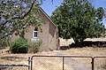
The It's Not a Tooma Inn aka The Three Stags Inn
Australia New South Wales location map blank.svg
Red pog.svg
Tooma
Coordinates 35°58′0″S148°4′0″E / 35.96667°S 148.06667°E / -35.96667; 148.06667 Coordinates: 35°58′0″S148°4′0″E / 35.96667°S 148.06667°E / -35.96667; 148.06667
Population104 (2016 census) [1]
Postcode(s) 2642
Elevation331 m (1,086 ft)
Location
LGA(s) Snowy Valleys Council
County Selwyn
State electorate(s) Albury
Federal division(s) Eden-Monaro
Mean max tempMean min tempAnnual rainfall
20.5 °C
69 °F
7.0 °C
45 °F
963.5 mm
37.9 in

Tooma is a locality and village community in the Snowy Valleys Council local government area, in the eastern part of the Riverina region of New South Wales.

Contents

Location

Tooma is in the valley of the Tooma River, not far from its confluence with the Murray River. The village is adjacent to Tumbarumba Creek, a tributary of the Tooma River. It is about 11 kilometres (6.8 mi) east of Welaregang and 34 kilometres (21 mi) south of Tumbarumba.

History

Tooma Post Office opened on 1 January 1873. [2] A school opened in Tooma in February 1876 and closed in August 1980. [3]

The Tooma District was one of ten locations that were shortlisted for the site of Australia's national capital in 1900. It was one of the last to be eliminated. In the final series of parliamentary ballots in October 1908, Tooma was one of the eleven sites in contention, and it survived until the eighth of the nine ballots, after which only Dalgety and the eventual capital site 'Yass Canberra' remained in contention. The site for the city was identified as being at nearby Welaregang. [4] [5] [6] [7] [8]

Climate

Climate data for Tooma are sourced at nearby Khancoban of approximately the same altitude. Summers are hot and dry, winters cool and rainy with occasional snowfalls.

Climate data for Khancoban SMHEA (1961–1994); 337 m AMSL; 36.23° S, 148.14° E
MonthJanFebMarAprMayJunJulAugSepOctNovDecYear
Record high °C (°F)41.7
(107.1)
41.7
(107.1)
37.6
(99.7)
34.4
(93.9)
26.4
(79.5)
20.0
(68.0)
19.5
(67.1)
23.3
(73.9)
28.3
(82.9)
30.8
(87.4)
38.5
(101.3)
39.1
(102.4)
41.7
(107.1)
Average high °C (°F)29.7
(85.5)
29.7
(85.5)
26.4
(79.5)
21.2
(70.2)
15.7
(60.3)
11.6
(52.9)
11.0
(51.8)
13.1
(55.6)
16.3
(61.3)
20.2
(68.4)
23.7
(74.7)
27.0
(80.6)
20.5
(68.9)
Average low °C (°F)12.8
(55.0)
13.0
(55.4)
10.4
(50.7)
7.0
(44.6)
4.2
(39.6)
1.8
(35.2)
1.3
(34.3)
2.6
(36.7)
4.4
(39.9)
6.8
(44.2)
8.9
(48.0)
11.3
(52.3)
7.0
(44.7)
Record low °C (°F)1.8
(35.2)
3.5
(38.3)
−0.6
(30.9)
−2.4
(27.7)
−4.1
(24.6)
−8.0
(17.6)
−6.4
(20.5)
−5.6
(21.9)
−3.9
(25.0)
−1.8
(28.8)
−0.4
(31.3)
1.1
(34.0)
−8.0
(17.6)
Average precipitation mm (inches)59.8
(2.35)
53.0
(2.09)
56.0
(2.20)
63.3
(2.49)
80.6
(3.17)
84.9
(3.34)
100.9
(3.97)
112.9
(4.44)
97.9
(3.85)
96.8
(3.81)
81.7
(3.22)
75.7
(2.98)
963.5
(37.91)
Average precipitation days (≥ 0.2 mm)7.47.17.19.011.914.715.916.014.512.410.79.2135.9
Average afternoon relative humidity (%)34343748617168595548434250
Mean monthly sunshine hours 303.8268.4257.3210.0145.799.0108.5136.4177.0235.6261.0269.72,472.4
Source: Australian Bureau of Meteorology; Khancoban SMHEA
Climate data for Khancoban AWS (1997–2022); 339 m AMSL; 36.23° S, 148.14° E
MonthJanFebMarAprMayJunJulAugSepOctNovDecYear
Record high °C (°F)43.3
(109.9)
43.3
(109.9)
38.0
(100.4)
32.5
(90.5)
25.4
(77.7)
20.0
(68.0)
19.0
(66.2)
22.1
(71.8)
28.0
(82.4)
33.8
(92.8)
38.0
(100.4)
41.1
(106.0)
43.3
(109.9)
Average high °C (°F)31.7
(89.1)
30.3
(86.5)
27.0
(80.6)
21.7
(71.1)
16.0
(60.8)
12.2
(54.0)
11.7
(53.1)
13.6
(56.5)
17.2
(63.0)
21.0
(69.8)
25.0
(77.0)
28.4
(83.1)
21.3
(70.4)
Average low °C (°F)13.7
(56.7)
13.3
(55.9)
10.7
(51.3)
7.3
(45.1)
4.2
(39.6)
2.2
(36.0)
1.7
(35.1)
2.7
(36.9)
4.6
(40.3)
6.6
(43.9)
9.5
(49.1)
11.3
(52.3)
7.3
(45.2)
Record low °C (°F)4.0
(39.2)
3.0
(37.4)
−2.0
(28.4)
−1.4
(29.5)
−4.0
(24.8)
−4.2
(24.4)
−4.6
(23.7)
−5.0
(23.0)
−7.0
(19.4)
−1.3
(29.7)
0.0
(32.0)
2.2
(36.0)
−7.0
(19.4)
Average precipitation mm (inches)60.0
(2.36)
60.2
(2.37)
63.2
(2.49)
57.3
(2.26)
68.7
(2.70)
95.8
(3.77)
89.0
(3.50)
106.5
(4.19)
88.6
(3.49)
80.4
(3.17)
92.2
(3.63)
74.6
(2.94)
936.5
(36.87)
Average precipitation days (≥ 0.2 mm)7.77.98.58.814.619.620.218.314.211.811.19.3152.0
Average afternoon relative humidity (%)31333443576969615549433548
Source: Australian Bureau of Meteorology; Khancoban AWS

See also

Related Research Articles

<span class="mw-page-title-main">Bombala, New South Wales</span> Town in New South Wales, Australia

Bombala is a town in the Monaro region of south-eastern New South Wales, Australia, in Snowy Monaro Regional Council. It is approximately 485 kilometres (301 mi) south of the state capital, Sydney, and 80 kilometres (50 mi) south of the town of Cooma. The name derives from an Aboriginal word meaning "Meeting of the waters". The town lies on the banks of the Bombala River. At the 2016 census, Bombala had a population of 1,387.

<span class="mw-page-title-main">Tumbarumba</span> Town in New South Wales, Australia

Tumbarumba is a town in New South Wales, Australia, about 480 kilometres (300 mi) southwest of the state capital, Sydney. Tumbarumba is located on the periphery of the Riverina and South West Slopes regions at the western edge of the Snowy Mountains. The 2016 census showed the population of the town and surrounding area to be 1,862 people. Locals refer to the town as 'Tumba'.

<span class="mw-page-title-main">Tarcutta</span> Town in New South Wales, Australia

Tarcutta is a town in south-western New South Wales, Australia. The town is 438 kilometres (272 mi) south-west of Sydney, 3 kilometres (1.9 mi) east of the Hume Highway, It was proclaimed as a village on 28 October 1890. As of 2016, the town had a population of 446.

<span class="mw-page-title-main">Tumut</span> Town in New South Wales, Australia

Tumut is a town in the Riverina region of New South Wales, Australia, situated on the banks of the Tumut River.

<span class="mw-page-title-main">Dalgety, New South Wales</span> Town in New South Wales, Australia

Dalgety is a small town in New South Wales, Australia, on the banks of the Snowy River between Melbourne and Sydney.

<span class="mw-page-title-main">Lyndhurst, New South Wales</span> Town in New South Wales, Australia

Lyndhurst is a small village in New South Wales, Australia in Blayney Shire. It is 4 kilometres west of Mandurama or about 269 km west of Sydney and 63 km south-west of Bathurst just off the Mid-Western Highway New South Wales. Once serving as the major centre for basic goods and needs to the nearby Junction Reefs goldfields. At the 2016 census, Lyndhurst had a population of 267 people.

<span class="mw-page-title-main">Tooma Dam</span> Dam in Snowy Mountains, New South Wales

Tooma Dam is a major ungated earthen embankment dam across the Tooma River in the Snowy Mountains of New South Wales, Australia. The dam's main purpose is for the generation of hydro-power and is one of the sixteen major dams that comprise the Snowy Mountains Scheme, a vast hydroelectricity and irrigation complex constructed in south-east Australia between 1949 and 1974 and now run by Snowy Hydro.

<span class="mw-page-title-main">Batlow, New South Wales</span> Town in New South Wales, Australia

Batlow is a town in the South West Slopes region of New South Wales, Australia, on the edge of the Great Dividing Range, 775 m above sea level.

<span class="mw-page-title-main">Khancoban</span> Town in New South Wales, Australia

Khancoban is a small town in Snowy Valleys Council, New South Wales, Australia. The town is located 567 kilometres (352 mi) from the state capital, Sydney and 13 kilometres (8 mi) from the state border with Victoria, in the foothills of the Snowy Mountains, near the upper reaches of the Murray River. At the 2016 census, Khancoban had a population of 304.

<span class="mw-page-title-main">Tumut Shire</span> Former local government area in New South Wales, Australia

Tumut Shire was a local government area in the South West Slopes region of New South Wales, Australia.

<span class="mw-page-title-main">Tumbarumba Shire</span> Former local government area in New South Wales, Australia

Tumbarumba Shire was a local government area in the eastern Riverina region, located in the foothills of the Snowy Mountains, on the upper reaches of the Murray River in New South Wales, Australia. It came into existence in 1906. Prior to this the area covered by the shire was unincorporated. It included the town of Tumbarumba and the small towns of Rosewood, Tooma, Khancoban and Jingellic.

<span class="mw-page-title-main">Welaregang, New South Wales</span> Town in New South Wales, Australia

Welaregang is a rural community in the far south east part of the Riverina and situated about 11 kilometres south west from Tooma and 15 kilometres south east from Ournie. At the 2006 census, Welaregang had a population of 162.

<span class="mw-page-title-main">Rosewood, New South Wales</span> Town in New South Wales, Australia

Rosewood is a village community and locality in the south east part of the Riverina, New South Wales, Australia. It is situated about 16 kilometres (9.9 mi) south east from Carabost and 19 kilometres (12 mi) north west from Tumbarumba. At the 2016 census, Rosewood had a population of 214. The village is administered by two local governments; the northern part of the locality by the Greater Hume Shire and the southern part of the locality by the Snowy Valleys Council. The village of Rosewood is within the Snowy Valleys Council area.

<span class="mw-page-title-main">Tumut River</span> River in Australia

The Tumut River, a perennial stream that is part of the Murrumbidgee catchment within the Murray–Darling basin, is located in the Snowy Mountains and South West Slopes districts of New South Wales, Australia.

<span class="mw-page-title-main">Tooma River</span> River in New South Wales, Australia

Tooma River, a perennial stream that has had some of its flow diverted as a result of the Snowy Mountains Scheme, is part of the Murray catchment within the Murray–Darling basin and is located in the Australian Alpine region of New South Wales, Australia.

Bonang Road is a rural road in south-eastern Australia, running generally south–north. It links the Gippsland region coastal town of Orbost, Victoria and the highland Monaro region town of Bombala, New South Wales.

<span class="mw-page-title-main">Paddys River (South West Slopes, New South Wales)</span> River in New South Wales, Australia

Paddys River, a watercourse of the Murray catchment within the Murray–Darling basin, is located in the Australian Alpine region of New South Wales, Australia.

Tumbarumba Creek, a watercourse of the Murray catchment within the Murray–Darling basin, is located in the region bordering the Riverina and Australian Alps of New South Wales, Australia.

<span class="mw-page-title-main">Snowy Valleys Council</span> Local government area in New South Wales, Australia

The Snowy Valleys Council is a local government area located in the South West Slopes region of New South Wales, Australia. This area was formed in 2016 from the merger of the Tumut Shire with the neighbouring Tumbarumba Shire.

Little River is a rural locality in the Snowy Valleys Council local government area of New South Wales, Australia. It lies is 6 km east of Tumut, in the southern side of the valley of the Goobarragandra River, just to the east of the confluence of that river with the Tumut River. The Goobarragandra River was once also known as 'Tumut Little River' or just as 'Little River', giving rise to the locality's name. At the 2021 census, it had a population of 38.

References

  1. Australian Bureau of Statistics (27 June 2017). "Tooma (State Suburb)". 2016 Census QuickStats. Retrieved 29 June 2017. OOjs UI icon edit-ltr-progressive.svg
  2. Premier Postal History, Post Office List , retrieved 11 June 2009
  3. "Tooma". nswgovschoolhistory.cese.nsw.gov.au. Retrieved 20 December 2020.
  4. Chesterman, A.H. (20 July 1904). "Federal Capital Proposed Sites. Tooma District". Trove. The Parliament of the Commonwealth of Australia. Retrieved 13 September 2020.
  5. "FEDERAL AFFAIRS". Leader (Melbourne, Vic. : 1862 - 1918, 1935). 23 July 1904. p. 24. Retrieved 13 September 2020.
  6. "FEDERAL CAPITAL". Herald (Melbourne, Vic. : 1861 - 1954). 30 March 1908. p. 6. Retrieved 13 September 2020.
  7. "AUSTRALIA'S CAPITAL". Sydney Morning Herald. 9 October 1908. Retrieved 2 October 2021.
  8. "CAPITAL SITE". Argus. 9 October 1908. Retrieved 10 October 2021.

Commons-logo.svg Media related to Tooma, New South Wales at Wikimedia Commons